Thandwe tide times
Thandwe tide forecast — heights relative to MSL.
Today's tide times for Thandwe
Tide times at Thandwe on Sunday, 21 June 2026: first low tide at 07:20am, first high tide at 01:37pm, second low tide at 08:06pm. Sunrise 05:37am, sunset 06:51pm.
Tide chart for Thandwe
24-hour cosine-interpolated curve around the present moment. Heights relative to MSL. Predictions: Predictions: Open-Meteo Marine (MeteoFrance SMOC, 0.08° grid).
Sun, moon and conditions on Sun 21 Jun
Snapshot at build time — refreshes daily. Sea state from Open-Meteo Marine.
Highs and lows next 7 days
Every predicted high and low for the next week, with the daily tidal coefficient (0–120; higher = bigger swing, > 95 means stronger currents).
Other spots nearby
The three closest curated TideTurtle locations to Thandwe, measured by great-circle distance.
Today's solunar windows
Solunar tradition: major periods are the ≈3h windows around moon transit and opposition; minor are ≈2h around moonrise and moonset. Pair with the local tide stage and wind for the best read.
Cycle dates near Thandwe
Last spring tide on Sun 21 Jun (range 1.5m). Next spring tide on Sat 27 Jun (range 1.5m). Next neap on Thu 25 Jun.
Spring tides cluster around new and full moons (biggest swings). Neap tides land on quarter moons (smallest swings). See the spring tide and neap tide glossary entries for the why.
About tides at Thandwe
A short guide to the coastline at Thandwe — geography, sea state, and what the tide is actually doing under your feet.
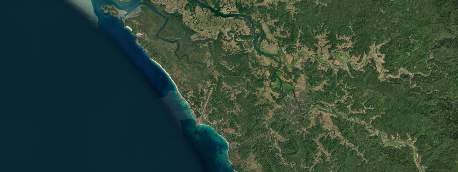
Thandwe (historically Sandoway) is the administrative and commercial hub of the Ngapali coast, sitting 8 km northeast of the beach on the Thandwe River. The town is the gateway for visitors arriving at Thandwe Airport — a small domestic airport serving flights from Yangon and Mandalay — and the market, hospital, and municipal services for the entire Ngapali resort strip are located here rather than at the beach. The Thandwe River reaches the sea through a tidal estuary, and the town's relationship to the coast is shaped by the same macrotidal Bay of Bengal regime as Ngapali Beach downstream.
The tidal regime at Thandwe is semidiurnal with diurnal inequality and a spring range of approximately 4.5 to 5.5 m, consistent with the Ngapali coast a few kilometres south. The Thandwe River bar — the shallow threshold at the river mouth where tidal estuarine water meets the Bay of Bengal — is navigable at mid-tide and above for small fishing boats and shallow-draft vessels. At spring low water the bar is exposed as a sand flat, and boats that entered the estuary on the flood must wait for the next rising tide before crossing outward. The river also carries cargo from the town's markets to coastal fishing communities and, in the dry season, serves as the water supply and transport corridor for some of the agricultural land in the river valley.
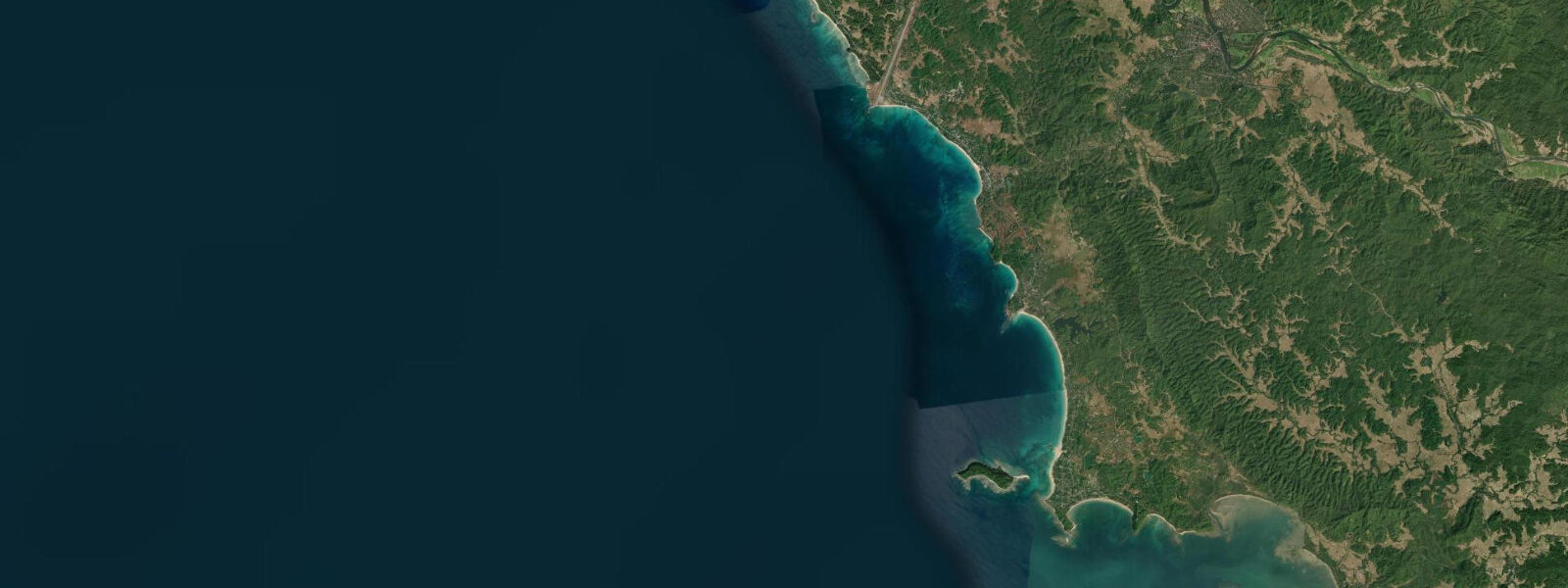
The coastline between Thandwe and Ngapali holds several smaller beaches accessible only at low water or by boat. The rocky headlands that divide these pocket beaches dry out on the larger spring ebbs, allowing a low-water coastal walk between some sections; at neap tides or above mid-tide, the headlands are wave-washed and impassable on foot. Local knowledge of the tidal timing is essential before attempting any headland traverse on foot along this coast. The same small fishing boats that work the Ngapali bay often beach at these intermediate coves at low water.
Thandwe Airport handles a volume of traffic entirely disproportionate to the town's population because of the Ngapali resort demand during the dry season. Flights are scheduled year-round but at reduced frequency in the wet season (May through October). The road connecting the airport to the beach resort strip crosses coastal lowland — rice paddy and tidal wetland — that floods during heavy monsoon rain events; the road can be impassable for short periods after significant rainfall regardless of tidal stage.
The coast between Thandwe and the northern Rakhine headlands has seen very limited tourist development. The beaches immediately north of the Thandwe district are rockier and more exposed than the sheltered Ngapali crescent. Shore fishing from the rocky northern sections at low water, when the macrotidal range drains the reef shelf, is practised by local communities who know the timing and terrain well.
Thandwe town itself has a covered market selling fish landed from the estuary and sea, produce from the Rakhine river valleys, and imported goods from the Yangon supply chain. The market is most active in the morning hours after the fishing boats return at low water. For visitors staying on the Ngapali resort strip, a tuk-tuk ride to Thandwe market in the early morning gives a grounded view of the coast's working economy alongside the beach resort character. The timing of that morning market activity shifts across the lunar month as the low-water period rotates earlier or later through the morning hours.
Predictions on this page come from Open-Meteo Marine, a gridded global ocean model; accuracy is typically within plus or minus 45 minutes on timing and 0.2 to 0.3 m on height. The Myanmar Meteorological and Hydrological Institute (MMHI) is the national authority for Myanmar tide and marine forecasts.
Tide questions about Thandwe
Quick answers to the most common questions about tide times, range, and water access at Thandwe.
When is the next high tide at Thandwe?
The hero block at the top of this page shows the next predicted high at Thandwe in local Myanmar Standard Time (MMT, UTC+6:30, no daylight saving). Spring range at Thandwe is approximately 4.5 to 5.5 m — the same macrotidal Bay of Bengal signal as Ngapali Beach to the south. Two tides per day with diurnal inequality (one higher high, one lower high each day), and the spring-neap variation across the lunar month swings the range between roughly 5.5 m at spring and 2.5 to 3.0 m at neap. The Myanmar Meteorological and Hydrological Institute (MMHI) is the national authority for Myanmar tide predictions; for the Thandwe River bar and estuary, MMHI and the local harbour authority are the contacts for operational guidance.
Is the Thandwe River navigable, and does the tide affect boat access?
The Thandwe River is navigable at mid-tide and above for small fishing boats and shallow-draft vessels. The river bar at the mouth — the shallow sand threshold where tidal estuary meets the bay — is the critical constraint: at spring low water, 4.5 to 5.5 m below the high-water mark, the bar exposes as a sand flat and is impassable for boats. Vessels entering the estuary on the flood must time their return crossing before the falling tide exposes the bar, or wait for the next flood. For small fishing boats the working window is roughly from two hours after low water to two hours after high water, giving approximately a four-to-five-hour window on each tide.
Can I walk the coast between Thandwe and Ngapali at low tide?
Some sections of the coast between Thandwe and Ngapali are accessible at low water when the intervening rocky headlands dry and can be rounded on foot. The conditions for a headland traverse are: a spring low water (range 4.0 m or more, around new and full moon), dry weather, and timing that gives at least two hours on the exposed rock before the flood returns. At neap tides the headlands do not fully expose and those sections remain impassable on foot. Local fishing communities know the specific passages and timing; asking in the villages for current conditions before attempting any coastal traverse is advisable. The distance between Thandwe town and the Ngapali resort strip is roughly 8 km by road.
What is the monsoon season like at Thandwe?
The southwest monsoon arrives at the Rakhine coast in May and typically clears by October, though the onset and withdrawal vary by year. Thandwe and the Ngapali region receive some of Myanmar's highest rainfall during the monsoon — several hundred millimetres per month in June through August. Bay of Bengal seas during this period are rough and frequently impassable for small boats; visibility is poor, and most resort and tour operations on the Ngapali coast close or significantly reduce capacity. The road from the airport to the beach can flood after heavy rain events. The dry season from November through April is the usable tourism window; November and December are transition months with some residual swell and occasional late-season rain before conditions fully stabilise.
Where do these tide predictions come from?
Open-Meteo Marine, a gridded global ocean model. Accuracy is typically within plus or minus 45 minutes on timing and 0.2 to 0.3 m on height. At Thandwe's spring range of 4.5 to 5.5 m, the proportional height uncertainty is small, but the timing uncertainty of up to 45 minutes is practically significant for planning around the Thandwe River bar crossing, which has a workable window of only a few hours around high water. For a more precise high-water time, use the Myanmar Meteorological and Hydrological Institute (MMHI) tide data — MMHI is the authoritative national source for Myanmar tide predictions and issues the marine weather forecasts for the Bay of Bengal coast.
8-day tide table — Thandwe
Heights relative to MSL. Predictions: Open-Meteo Marine (MeteoFrance SMOC, 0.08° grid) — heights relative to MSL (not chart datum / LAT). Model-derived.
| Day | Type | Time | Height |
|---|---|---|---|
| Sun 21 Jun | Low | 07:20 | 0.1m |
| High | 13:37 | 1.5m | |
| Low | 20:06 | -0.0m | |
| Mon 22 Jun | High | 02:26 | 1.3m |
| Low | 08:24 | 0.3m | |
| High | 14:31 | 1.4m | |
| Low | 20:56 | 0.1m | |
| Tue 23 Jun | High | 03:28 | 1.3m |
| Low | 09:30 | 0.4m | |
| High | 15:30 | 1.3m | |
| Low | 21:56 | 0.2m | |
| Wed 24 Jun | High | 04:30 | 1.3m |
| Low | 10:42 | 0.4m | |
| High | 16:35 | 1.2m | |
| Low | 22:52 | 0.1m | |
| Thu 25 Jun | High | 05:34 | 1.3m |
| Low | 11:50 | 0.3m | |
| High | 17:40 | 1.1m | |
| Low | 23:52 | 0.1m | |
| Fri 26 Jun | High | 06:30 | 1.4m |
| Low | 12:48 | 0.2m | |
| High | 18:36 | 1.1m | |
| Sat 27 Jun | Low | 00:41 | 0.0m |
| High | 07:12 | 1.5m | |
| Low | 13:35 | 0.1m | |
| High | 19:22 | 1.2m | |
| Sun 28 Jun | Low | 01:24 | -0.1m |
| High | 05:30 | 1.1m |