Tanna Coast at Yasur tide times
Tanna Coast at Yasur tide forecast — heights relative to MSL.
Today's tide times for Tanna Coast at Yasur
Tide times at Tanna Coast at Yasur on Saturday, 4 July 2026: first high tide at 11:00am, first low tide at 02:00pm, second high tide at 08:45pm. Sunrise 06:17am, sunset 05:15pm.
Tide chart for Tanna Coast at Yasur
24-hour cosine-interpolated curve around the present moment. Heights relative to MSL. Predictions: Predictions: Open-Meteo Marine (MeteoFrance SMOC, 0.08° grid).
Sun, moon and conditions on Sat 04 Jul
Snapshot at build time — refreshes daily. Sea state from Open-Meteo Marine.
Highs and lows next 7 days
Every predicted high and low for the next week, with the daily tidal coefficient (0–120; higher = bigger swing, > 95 means stronger currents).
Other spots nearby
The three closest curated TideTurtle locations to Tanna Coast at Yasur, measured by great-circle distance.
Today's solunar windows
Solunar tradition: major periods are the ≈3h windows around moon transit and opposition; minor are ≈2h around moonrise and moonset. Pair with the local tide stage and wind for the best read.
Cycle dates near Tanna Coast at Yasur
Last spring tide on Sat 04 Jul (range 0.9m). Next spring tide on Fri 10 Jul (range 1.2m). Next neap on Wed 08 Jul.
Spring tides cluster around new and full moons (biggest swings). Neap tides land on quarter moons (smallest swings). See the spring tide and neap tide glossary entries for the why.
About tides at Tanna Coast at Yasur
A short guide to the coastline at Tanna Coast at Yasur — geography, sea state, and what the tide is actually doing under your feet.
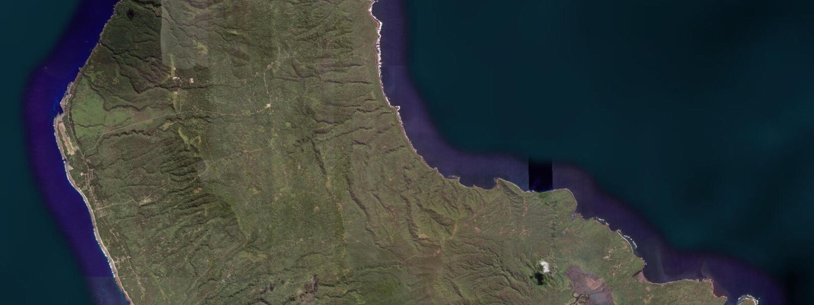
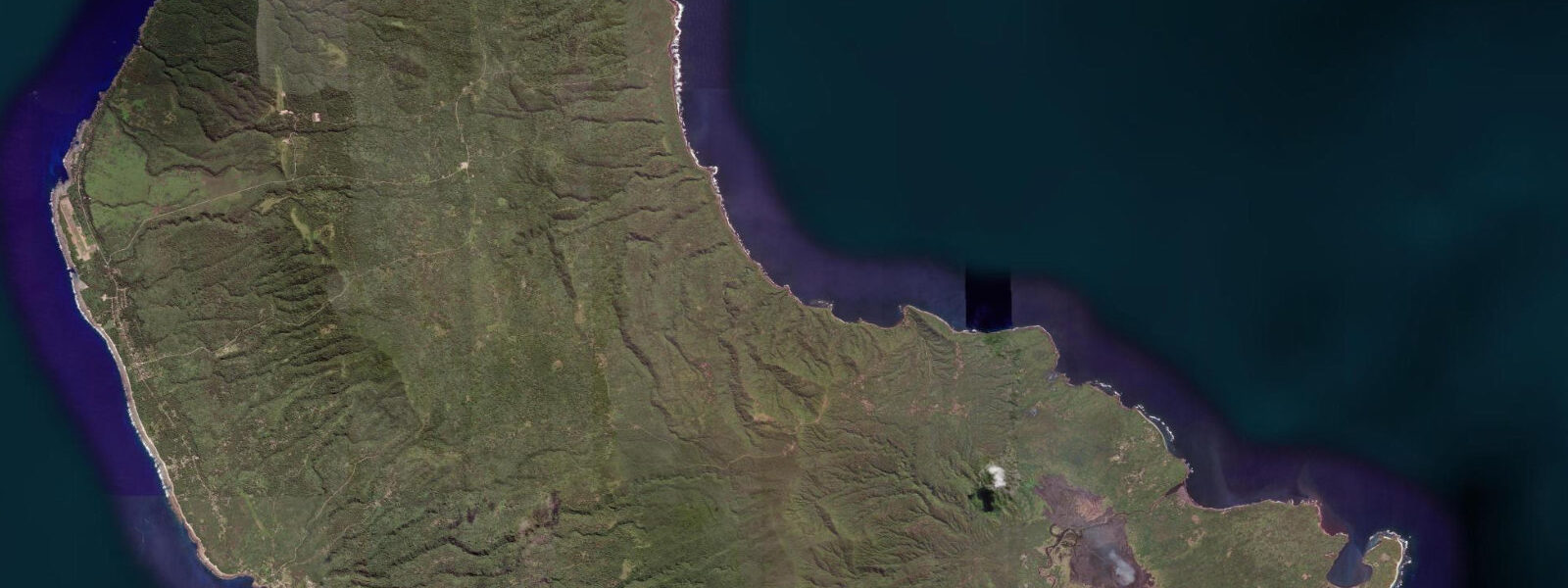
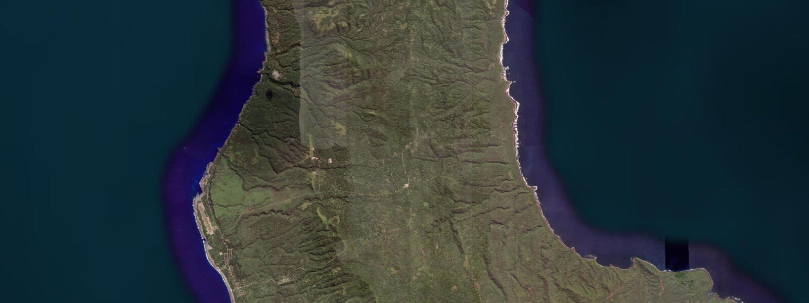
Tanna is one of the southernmost inhabited islands in Vanuatu, approximately 200 kilometres south of the capital Port Vila on Efate. The island is dominated by Mount Yasur, an active stratovolcano rising to 361 metres on the southeastern coast. Yasur has been in continuous eruption for at least 800 years — one of the longest continuously erupting volcanoes on earth — and its activity is accessible in a way that few active volcanoes are: a four-wheel-drive track runs from the coast road to within 200 metres of the crater rim, and visitors walk the last section on foot to watch lava bomb eruptions from the crater edge. The eruption cycle is rhythmic — explosions every few minutes, lava bombs arcing 50 to 100 metres above the crater rim, the ground shaking under foot with each blast.
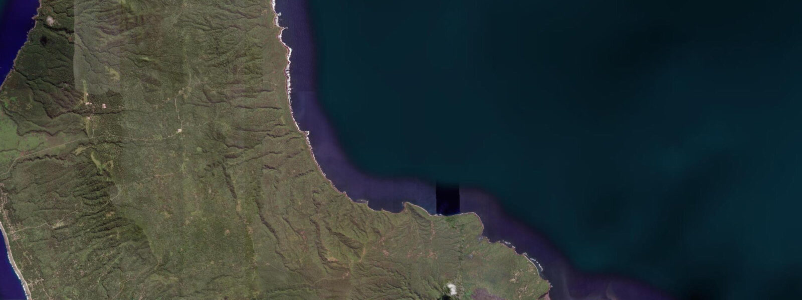
The coast nearest to Yasur, at Port Resolution on the island's eastern side, has an entirely different character from the volcanic interior. Port Resolution Bay is a drowned volcanic caldera — the same geological process that formed the volcano also created a circular bay on the coast where a secondary vent collapsed. The bay is approximately 600 metres across, ringed by black lava cliffs and volcanic black sand beaches, and connected to the open sea through a narrow northeastern passage. Captain Cook anchored here in August 1774 during his second Pacific voyage, recording it as a place of volcanic fire and remarkable hospitality from the local population.
The tidal regime at Port Resolution is mixed semidiurnal, with a spring range of approximately 1.0 to 1.2 metres. The bay is sheltered on three sides; tidal current inside the bay is gentle even at springs, rarely exceeding 0.3 knots. The black sand beach on the western side of the bay is the main recreation area. At low water springs, the volcanic rock platforms at the base of the cliff rim expose a thin band of inter-tidal zone — sparse but present, with barnacles, periwinkles, and small fish in the rock pools. The volcanic rock is sharp and uneven; footing requires care.
Thermal vents on the seabed inside Port Resolution are detectable as areas of slightly warmer water — localised temperature anomalies of 1 to 3 degrees Celsius above ambient in the vents' immediate vicinity. The vents are in 3 to 8 metres of water and are visible during snorkelling as subtle shimmer in the water column above the vent points. The bottom is dark volcanic rock and rubble, with limited coral but reasonable fish diversity.
Access to Port Resolution from the main Tanna town of Lenakel (on the western coast) takes 1.5 to 2 hours by four-wheel-drive vehicle on a rough track that crosses the island's interior. The track passes through the ash plain around Yasur — a flat grey landscape where the volcanic ash fall suppresses vegetation ��— before descending to the eastern coast. The Yasur crater visit is typically combined with the Port Resolution coast as a full-day excursion from Lenakel.
Flight connections to Tanna from Port Vila operate on Vanuatu's domestic airline network; the journey takes approximately 35 minutes. The airstrip is at Whitegrass on the western coast near Lenakel.
Predictions on this page come from Open-Meteo Marine, a gridded global ocean model. Accuracy is typically within plus or minus 45 minutes on timing and 0.2 to 0.3 metres on height — model-derived, not from a local gauge. The local tide authority is the Vanuatu Meteorology and Geo-Hazards Department (VMGD).
Tide questions about Tanna Coast at Yasur
Quick answers to the most common questions about tide times, range, and water access at Tanna Coast at Yasur.
Is it safe to visit the Yasur volcano crater?
Visitor access to the Yasur crater rim is managed by the local community under a permit system, with eruption-level alerts governing how close visitors can approach. At Alert Level 1 (lowest), visitors walk to the crater rim. At Level 2, access is restricted to a viewing area 200 metres from the rim. At Level 3 or above, visitor access is closed entirely. Alert levels change based on activity monitoring by the Vanuatu Meteorology and Geo-Hazards Department (VMGD). Check the current alert level through your accommodation or tour operator before the visit. Even at Level 1, lava bombs land occasionally outside the crater — the area around the rim is not safe for extended stationary observation during active phases.
What is Port Resolution and why did Captain Cook stop there?
Port Resolution is a sheltered bay on Tanna's eastern coast, formed by a collapsed volcanic caldera adjacent to the Yasur system. The bay is approximately 600 metres across, ringed by black lava cliffs and volcanic sand beaches, and connected to the open sea through a narrow northeastern passage. Captain James Cook anchored in the bay in August 1774 during his second Pacific voyage (aboard HMS Resolution, which gave the bay its name). Cook recorded detailed observations of Yasur's eruptions and the local Tannese population. A Cook memorial marker is at the bay's western beach. The bay is also noted for hydrothermal vents on the seabed.
What is the tidal range at Port Resolution?
Spring tidal range at Port Resolution is approximately 1.0 to 1.2 metres. The regime is mixed semidiurnal. The sheltered bay has gentle tidal currents even at springs. At low water, the volcanic rock platforms at the base of the cliff rim expose a thin inter-tidal zone. Predictions here come from Open-Meteo Marine (±45 minutes on timing, ±0.3 m on height). Not for navigation; consult the Vanuatu Meteorology and Geo-Hazards Department (VMGD) for local tide information.
How do I get to Tanna from Port Vila?
By Air Vanuatu domestic flight from Port Vila to Tanna's Whitegrass Airport, near Lenakel on the western coast — approximately 35 minutes. Flights operate several times per week. From Lenakel, Port Resolution and the Yasur volcano are reached by four-wheel-drive vehicle on rough tracks crossing the island interior; the journey takes 1.5 to 2 hours each way. Most visitors arrange guided transport through their accommodation in Lenakel. There is accommodation near Port Resolution for those who prefer to base on the eastern coast.
Are there thermal vents I can snorkel over at Port Resolution?
Yes. Hydrothermal vents on the seabed inside Port Resolution Bay create areas of slightly warmer water in 3 to 8 metres depth — localised temperature anomalies of 1 to 3 degrees Celsius above ambient are detectable by snorkellers as patches of warmer water and a subtle shimmer in the water column above each vent. The bottom is volcanic rock and rubble; coral cover is limited but the fish diversity is reasonable. The vents are not hazardous to swim over at recreational distances. Snorkel gear is not available for hire at Port Resolution — bring your own from Lenakel or Port Vila.
8-day tide table — Tanna Coast at Yasur
Heights relative to MSL. Predictions: Open-Meteo Marine (MeteoFrance SMOC, 0.08° grid) — heights relative to MSL (not chart datum / LAT). Model-derived.
| Day | Type | Time | Height |
|---|---|---|---|
| Sat 04 Jul | High | 11:00 | 0.4m |
| Low | 14:00 | 0.0m | |
| High | 20:45 | 0.9m | |
| Sun 05 Jul | Low | 02:16 | 0.4m |
| High | 08:07 | 0.9m | |
| Low | 14:37 | 0.1m | |
| High | 21:23 | 1.0m | |
| Mon 06 Jul | Low | 03:21 | 0.4m |
| High | 09:04 | 0.9m | |
| Low | 15:23 | 0.2m | |
| High | 22:06 | 1.0m | |
| Tue 07 Jul | Low | 04:22 | 0.4m |
| High | 10:04 | 0.8m | |
| Low | 16:12 | 0.2m | |
| High | 22:50 | 1.1m | |
| Wed 08 Jul | Low | 17:04 | 0.3m |
| High | 23:36 | 1.1m | |
| Thu 09 Jul | — | ||
| Fri 10 Jul | Low | 07:19 | 0.1m |
| High | 13:43 | 0.9m | |
| Low | 19:07 | 0.4m | |
| Sat 11 Jul | High | 01:24 | 1.2m |
| Low | 08:19 | 0.0m | |
| High | 10:00 | 0.2m | |