
Marmaris, Muğla tide times
Marmaris, Muğla tide forecast — heights relative to MSL.
Today's tide times for Marmaris, Muğla
Tide times at Marmaris, Muğla on Friday, 19 June 2026: first high tide at 03:00. Sunrise 05:47, sunset 20:28.
Tide chart for Marmaris, Muğla
24-hour cosine-interpolated curve around the present moment. Heights relative to MSL. Predictions: Predictions: Open-Meteo Marine (MeteoFrance SMOC, 0.08° grid).
Sun, moon and conditions on Fri 19 Jun
Snapshot at build time — refreshes daily. Sea state from Open-Meteo Marine.
Highs and lows next 7 days
Every predicted high and low for the next week, with the daily tidal coefficient (0–120; higher = bigger swing, > 95 means stronger currents).
Other spots nearby
The three closest curated TideTurtle locations to Marmaris, Muğla, measured by great-circle distance.

Today's solunar windows
Solunar tradition: major periods are the ≈3h windows around moon transit and opposition; minor are ≈2h around moonrise and moonset. Pair with the local tide stage and wind for the best read.
About tides at Marmaris, Muğla
A short guide to the coastline at Marmaris, Muğla — geography, sea state, and what the tide is actually doing under your feet.
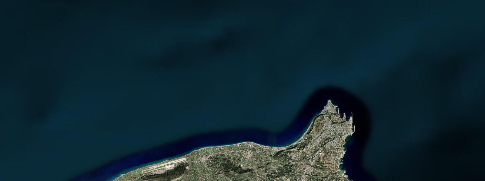
Marmaris sits at the head of an 8-kilometre fjord-like inlet on Turkey's Aegean coast, one of the most completely enclosed natural anchorages in the eastern Mediterranean. The bay reads like a lake from the town quay: tree-covered hillsides rise on three sides, the water is flat, and the narrow entrance between Nimara Point to the west and Çiftlik Bay to the south is invisible from the town waterfront. It is only when you are under way toward the exit — passing the castle hill to starboard — that the gap in the mountains reveals itself.
The tidal regime at Marmaris is microtidal. The eastern Aegean has a mean range of 0.2 to 0.4 metres, with mixed semidiurnal character and pronounced diurnal inequality: the two daily highs are not equal in height, and neither are the two lows. On some days the semidiurnal pattern becomes effectively diurnal — one high and one low — with a difference of 0.3 to 0.4 metres. The range narrows further at neaps to under 0.1 metres, at which point wind set-up and atmospheric pressure dominate water level more than the tide itself. A sustained south-westerly in the Aegean can push Marmaris bay level up by 0.15 to 0.20 metres for hours at a time, temporarily overwhelming the tidal signal.
This is the fundamental reality of Marmaris for anyone arriving from an Atlantic harbour: tides do not govern vessel operations here. Netsel Marina — one of the largest marinas in Turkey, holding over 750 berths — operates on a schedule determined by berth availability, gulet fleet rotations, and ferry timetables, not tidal windows. A vessel drawing 3.0 metres can arrive or depart at any hour of the day without concern for water depth in the approach channels. The bay depth at the narrows between Nimara Point and Çiftlik Bay is 20 to 35 metres. There is no tidal gate.
Netsel Marina is the operational hub for Turkey's Blue Voyage gulet fleet. Gulets — traditional wooden motorsailers, 15 to 40 metres in length — depart Marmaris on weekly rotation, typically Saturday morning, heading east along the Bozburun Peninsula and into Hisarönü Bay, then continuing south around the Datça Peninsula toward Knidos or north toward Göcek. The route structure is determined by anchorage availability, weather windows in the open Aegean passages, and the attractions of specific coves — not tidal planning. Passengers booking Blue Voyage charters from Marmaris need no knowledge of tidal timing, which is part of the appeal for leisure charterers arriving from tidal regions.
For anyone with a sail-training or offshore background, the absence of tide creates a different kind of planning discipline. Set and drift in the entrance channel between Nimara Point and the mainland is created by wind-driven surface current and, in summer, by the thermal gradient between the bay's warmer water and the cooler open Aegean. This surface flow runs 0.2 to 0.5 knots on summer afternoons, ebbing from the bay as the bay heats up and the surface water expands outward. It is not a tidal current and does not reverse predictably with a tidal clock; it responds to solar heating and wind.
Marmaris Castle — the 16th-century Ottoman fortification on the hill above the town — is the visual anchor of the bay from the water. Built by Suleiman the Magnificent in 1522 before the Rhodes campaign, it sits at 70 metres above sea level on the rock spur that separates the inner bay from the entrance channel. From the castle ramparts the full geography of the fjord is visible: the bay, the entrance gap, the Netsel quays below, and the mountains of the Datça Peninsula to the south-west. The castle now houses an archaeological and maritime museum.
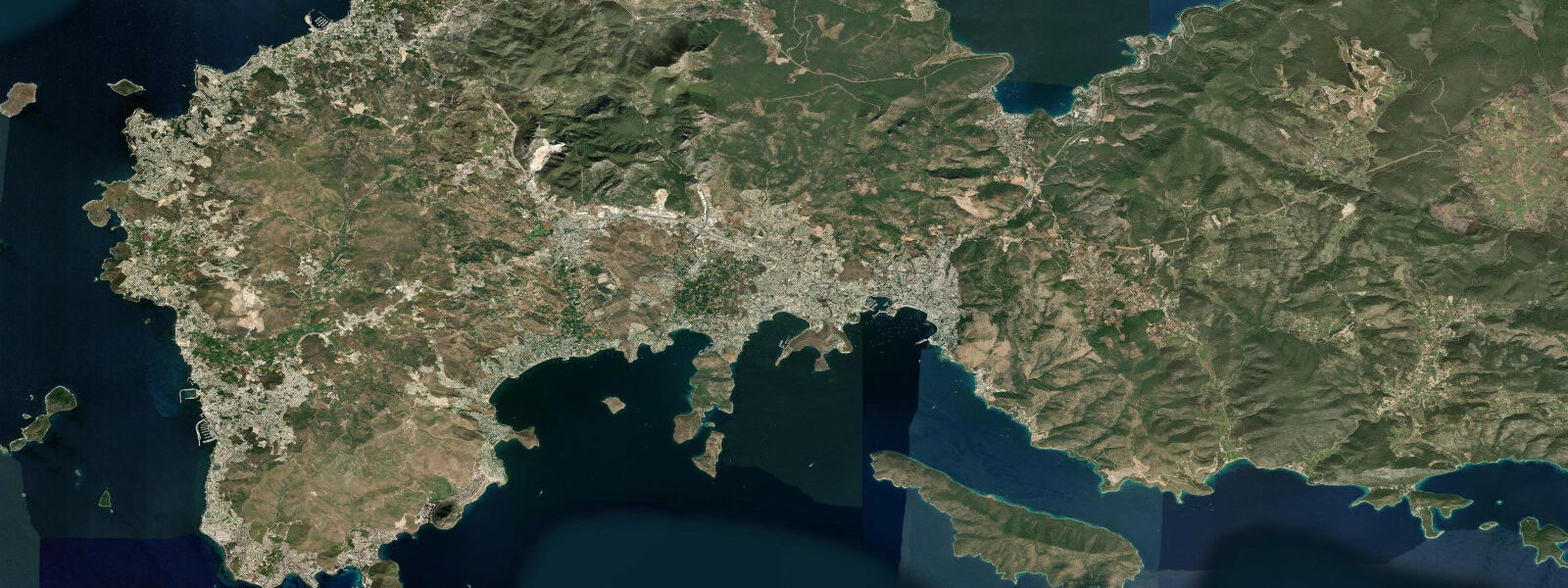
Hisarönü Bay, 15 kilometres east of the entrance channel by sea, is the most rewarding day-sail or day-trip destination from Marmaris. The bay contains a scattering of anchorages — Bozukkale (ancient Loryma), Serçe Limanı, and the Sömbeki anchorages — each with clear water, minimal boat traffic outside peak July-August, and accessible ruins of Hellenistic harbours and Byzantine structures. Water depth in the Hisarönü anchorages ranges from 3 to 12 metres with good holding sand; tidal range is the same 0.2 to 0.4 metres as Marmaris itself. Snorkellers working the ancient harbour at Bozukkale can see cut stone blocks and column sections just below the surface at all tidal states.
Anglers working Marmaris and the entrance channel target sea bass, dentex, and grouper from charter boats and the town quay. The entrance narrows between Nimara Point and Çiftlik Bay produce the most reliable current-influenced fishing; the wind-driven surface flow creates a feeding lane that concentrates predators. Early morning — before the charter fleet departs — and evening after the fleet returns are the productive windows. Tidal timing is not the primary variable; wind strength and direction matter more.
Kayakers and paddleboarders have access to sheltered water inside the bay for the full tidal cycle. The inner bay circuit — from Netsel Marina north along the town waterfront to Günlükbaşı beach, then back along the forest shore — is 8 to 10 kilometres and can be completed in three to four hours in calm conditions. Water clarity is best in the morning before boat traffic stirs the surface sediment.
Tide data for Marmaris, Muğla comes from the Open-Meteo Marine API, a gridded model product. Timing accuracy is ±45 minutes, height accuracy ±0.3 m — usable for trip planning, not for navigation.
Tide questions about Marmaris, Muğla
Quick answers to the most common questions about tide times, range, and water access at Marmaris, Muğla.
What is the tidal range at Marmaris and does it affect berthing at Netsel Marina?
The mean tidal range at Marmaris is 0.2 to 0.4 metres — microtidal. Neap tides can reduce this to under 0.1 metres, at which point wind set-up and atmospheric pressure have more influence on water level than the astronomical tide. Netsel Marina's approach channels have depths of 3 to 5 metres at the shallowest points; a vessel drawing 3.0 metres can arrive or depart at any state of tide without restriction. The bay's enclosed geography and deep entrance channel mean there is no tidal gate at Marmaris. Charter schedules, ferry timetables, and berth availability — not tidal windows — determine departure timing.
What is a Blue Voyage gulet charter and is tidal planning needed?
A Blue Voyage (Mavi Yolculuk) is a cabin or full-boat charter on a traditional Turkish gulet, departing Marmaris typically on Saturdays for one- or two-week itineraries along the Bozburun Peninsula, Hisarönü Bay, and Datça Peninsula. No tidal planning is required. The eastern Aegean and Turkish coast are microtidal; anchorages along the Blue Voyage route have 0.2 to 0.4-metre ranges. Gulet operations are planned around weather windows, berth availability at marina stops, and the itinerary of swimming bays and archaeological sites. Charterers arriving from Atlantic ports should note that departure times and anchorage entry are determined by schedule and conditions, not the tide table.
What is in Hisarönü Bay and how do I get there from Marmaris?
Hisarönü Bay lies 15 kilometres east of the Marmaris entrance channel by sea, accessible by boat in 60 to 90 minutes from Netsel Marina. Key anchorages include Bozukkale (the ancient Hellenistic harbour of Loryma, with cut stone blocks visible underwater), Serçe Limanı (a small cove with a shallow-water Byzantine amphora field, subject to dive permit requirements), and the Sömbeki anchorages with clean water and minimal development. Water depth in the main anchorages is 3 to 12 metres with sand holding ground. Tidal range is the same 0.2 to 0.4 metres as Marmaris. Day-excursion boats run from Marmaris harbour in season.
Is the Marmaris entrance channel affected by current?
The narrows between Nimara Point and Çiftlik Bay are not tidally driven — the 0.2 to 0.4-metre range produces negligible current. However, a wind-driven and thermally driven surface flow runs through the entrance channel in summer, typically 0.2 to 0.5 knots, flowing outward from the bay in the afternoon as the enclosed bay warms and surface water expands. This is relevant for kayakers and paddleboarders approaching or exiting the channel: the outward-flowing afternoon current is easier to navigate in the morning when flow direction has not yet established. The channel depth at the narrows is 20 to 35 metres; there is no navigational hazard from tidal shallowing.
What can I see from Marmaris Castle and when is the best time to visit?
Marmaris Castle sits at 70 metres above sea level on the rock spur between the town and the entrance channel, built by Suleiman the Magnificent in 1522. From the ramparts the full bay geography is visible: the 8-kilometre fjord, the entrance gap between Nimara Point and Çiftlik Bay, and the mountains of the Datça Peninsula to the south-west. The castle houses an archaeological and maritime museum with finds from the surrounding coastal region. Tidal state does not affect the visit — the approach is entirely on land. Best time: early morning before the heat builds; the light angle from the east illuminates the bay and the entrance channel at its most readable from the ramparts.
4-day tide table — Marmaris, Muğla
Heights relative to MSL. Predictions: Open-Meteo Marine (MeteoFrance SMOC, 0.08° grid) — heights relative to MSL (not chart datum / LAT). Model-derived.
| Day | Type | Time | Height |
|---|---|---|---|
| Fri 19 Jun | High | 03:00 | -0.4m |
| Sat 20 Jun | Low | 08:50 | -0.5m |
| Sun 21 Jun | — | ||
| Mon 22 Jun | High | 17:00 | -0.4m |