Chaguaramas tide times
Chaguaramas tide forecast — heights relative to MSL.
Tide chart for Chaguaramas
24-hour cosine-interpolated curve around the present moment. Heights relative to MSL. Predictions: Predictions: Open-Meteo Marine (MeteoFrance SMOC, 0.08° grid).
Sun, moon and conditions on Sat 27 Jun
Snapshot at build time — refreshes daily. Sea state from Open-Meteo Marine.
Highs and lows next 7 days
Every predicted high and low for the next week, with the daily tidal coefficient (0–120; higher = bigger swing, > 95 means stronger currents).
Other spots nearby
The three closest curated TideTurtle locations to Chaguaramas, measured by great-circle distance.

Today's solunar windows
Solunar tradition: major periods are the ≈3h windows around moon transit and opposition; minor are ≈2h around moonrise and moonset. Pair with the local tide stage and wind for the best read.
Cycle dates near Chaguaramas
Next spring tide on Mon 29 Jun (range 0.8m). Next neap on Tue 30 Jun.
Spring tides cluster around new and full moons (biggest swings). Neap tides land on quarter moons (smallest swings). See the spring tide and neap tide glossary entries for the why.
About tides at Chaguaramas
A short guide to the coastline at Chaguaramas — geography, sea state, and what the tide is actually doing under your feet.
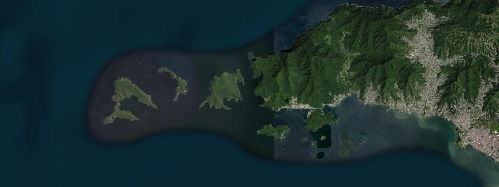
Chaguaramas sits at the western tip of Trinidad, 15 km west of Port of Spain along the Western Main Road, occupying the sheltered bay between the Chaguaramas Peninsula and the Five Islands offshore. The bay is the premier yachting and marina hub for southern Caribbean sailing: hurricane-season haul-out capacity, full boatyard services, and a position at 10°N that keeps it just south of the main hurricane track. Vessels transiting between the Lesser Antilles and the South American coast regularly call here to wait for weather windows.
The tidal regime at Chaguaramas is governed by the Gulf of Paria's restricted exchange through Dragon's Mouth, the strait running between the peninsula's north side and Venezuela's Paria coast. Spring range in the bay is 0.5–0.8 m with mixed semidiurnal character and strong diurnal inequality. The current through Dragon's Mouth itself — a series of four bocas, or passes — runs 1.5–2.5 knots on spring tides and requires attention from vessels transiting. The Boca de Monos, the northernmost and widest pass, is the main channel; the Boca de Huevos and Boca de Navios are shallower and see faster currents in proportion to their width.
For kayakers, the Chaguaramas bay system is one of the best flatwater environments in Trinidad. The government jetty area is calm year-round. The Five Islands — a cluster of five small uninhabited cays 1.5 km offshore from the TTDF (Trinidad and Tobago Defence Force) base — are reachable by paddling from the CNMG boat landing or by small charter boat. The cays have fringing reef on their seaward sides and calm-water anchorages on the leeward side. Tidal current in the channel between the Five Islands and the main shore runs 0.5–1.0 knots on spring tides; paddling with rather than against it makes the crossing notably easier. The flood runs east (into the gulf), the ebb runs west (toward Dragon's Mouth).
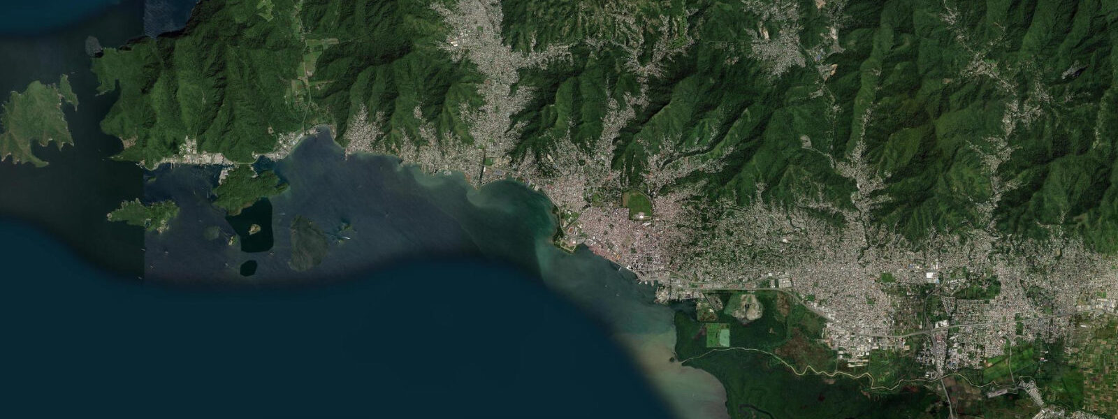
The Chaguaramas boatyards — IMS, Peake Yacht Services, and Power Boats — together haul out over 500 vessels in the peak season. The hard stands are tiered up the hillside above the bay; boats are hauled by Travelift from the water. Haul-out depth at the main slings is approximately 2.2–2.5 m at chart datum; on the lower low-water events of the day (spring neap cycles bringing lower lows), draft-sensitive vessels plan the haul for a higher tide. The boatyard operations run year-round but peak from June through November when the hurricane season drives vessels south from the more exposed Windward Islands.
Anglers work the Chaguaramas area in two ways. Shore fishing from the government jetty and the rocky headlands targets snapper, carite, and ladyfish on ebb current. Offshore, pangas and sport fishing boats run north through one of the Bocas into the Caribbean Sea for kingfish, wahoo, and mahi-mahi — the current through Dragon's Mouth and the immediate offshore drop into deep Caribbean water concentrates pelagics at the passage entrance. The flood tide through Boca de Monos brings clear Caribbean water into the upper gulf; the ebb flushes the slightly more turbid gulf water back out. Visibility on the Five Islands reef is best in the two to three hours after the flood peaks, before the ebb begins stirring bottom sediment.
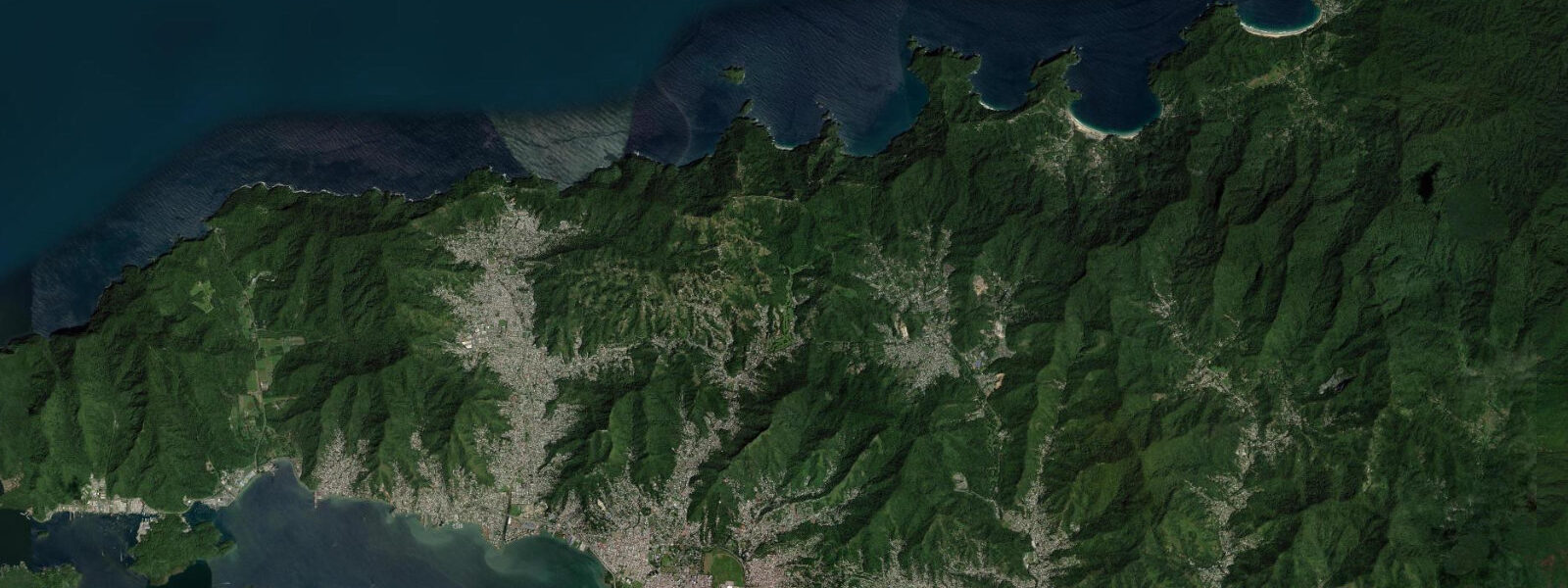
The Tucker Valley Road runs inland from Chaguaramas through a forested valley to the north coast of the peninsula, emerging at Macqueripe Bay — a small, protected beach facing the Caribbean through the Boca de Navios. The beach is calm by north coast standards because it sits inside the Bocas geography, shielded from direct northeast swell. At low tide the rocky shelf at Macqueripe's eastern end exposes, with pools holding urchins and small fish. The road through Tucker Valley is paved and accessible by car; the valley itself retains secondary forest with howler monkeys, toucans, and the nighttime chorus of frogs that characterises Trinidad's forested interior.
Photographers working the Chaguaramas waterfront find the afternoon light best: the bay faces southwest, and the Five Islands silhouetted against the late sun, with masts of hauled-out boats on the hill behind, gives the composition that defines this place.
All tide predictions for Chaguaramas come from the Open-Meteo Marine gridded model. Timing accuracy is ±45 minutes; height accuracy is ±0.3 m above Chart Datum.
Tide questions about Chaguaramas
Quick answers to the most common questions about tide times, range, and water access at Chaguaramas.
Is Chaguaramas a good kayaking destination, and how do tides affect the paddle to the Five Islands?
Chaguaramas bay is one of Trinidad's best flatwater kayaking environments — sheltered from swell year-round by the peninsula and the Five Islands. The crossing to the cays is 1.5 km over a channel with 0.5–1.0 knot spring tidal current. Paddle with the flood (running east, into the gulf) for an assisted crossing; plan the return on the ebb (running west). On neap tides the current drops to 0.2–0.4 knots and the crossing is neutral in either direction. Rentals are available from the government jetty landing. The Five Islands have fringing reef and calm leeward anchorage beaches accessible on arrival.
What is the tidal current through Dragon's Mouth (Bocas del Dragón)?
Dragon's Mouth is the northern exit from the Gulf of Paria, a series of four passes between Trinidad's northwestern peninsula and Venezuela's Paria coast. The main channel, Boca de Monos, carries 1.5–2.0 knots of tidal current on spring tides; the narrower Boca de Huevos and Boca de Navios run faster in proportion to their width. Vessels transiting north into the Caribbean Sea from Chaguaramas time the passage to take the ebb assist outbound or the flood assist inbound. The current peaks at mid-ebb and mid-flood; the slack window at turn of tide is 15–20 minutes.
What is the yachting infrastructure at Chaguaramas?
Chaguaramas has three main boatyards — IMS, Peake Yacht Services, and Power Boats — with combined hard-stand capacity for over 500 vessels. Services include Travelift haul-out, hull and antifouling work, rigging, and marine engineering. The bay is a standard hurricane-season haul-out destination for vessels sailing the eastern Caribbean circuit, as it sits south of the main hurricane track. Haul-out depth at main slings is 2.2–2.5 m at chart datum. VHF channel 16 is monitored at all three yards. Fuel, provisions, and the Creek road restaurant strip are accessible by dinghy from the anchorage.
What fishing opportunities exist around Chaguaramas?
Shore anglers fish the government jetty and rocky headlands on the ebb, targeting snapper, carite (Spanish mackerel), and ladyfish. Offshore, the current through Dragon's Mouth concentrates pelagic species at the bocas entrance — kingfish, wahoo, and mahi-mahi are the targets for boats running through into the Caribbean. The Five Islands reef holds grouper and smaller reef fish; the best visibility for reef fishing is two to three hours after the flood peaks. Local charter boats operate from the CNMG landing; half-day and full-day offshore trips are bookable.
Is Macqueripe Bay accessible from Chaguaramas, and is it good for swimming?
Macqueripe Bay is a 15-minute drive from Chaguaramas via Tucker Valley Road through forested interior. The bay faces the Caribbean through the Boca de Navios pass, sheltered enough from northeast swell by the surrounding Bocas geometry to be swimmable most days. At low tide a rocky shelf at the eastern end exposes with tidal pools containing urchins and small fish. Facilities are minimal — no beach bars or chair rentals. The Tucker Valley road through secondary forest is itself a wildlife corridor: howler monkeys and toucans are reliably heard if not always seen.
7-day tide table — Chaguaramas
Heights relative to MSL. Predictions: Open-Meteo Marine (MeteoFrance SMOC, 0.08° grid) — heights relative to MSL (not chart datum / LAT). Model-derived.
| Day | Type | Time | Height |
|---|---|---|---|
| Sat 27 Jun | — | ||
| Sun 28 Jun | High | 01:45 | 0.2m |
| Low | 09:00 | -0.5m | |
| High | 15:54 | 0.1m | |
| Mon 29 Jun | Low | 09:37 | -0.5m |
| Tue 30 Jun | High | 02:54 | 0.3m |
| Low | 10:06 | -0.5m | |
| High | 16:55 | 0.1m | |
| Low | 21:18 | -0.2m | |
| Wed 01 Jul | High | 17:18 | 0.1m |
| Low | 21:42 | -0.2m | |
| Thu 02 Jul | High | 03:55 | 0.3m |
| Low | 10:54 | -0.5m | |
| High | 17:42 | 0.1m | |
| Fri 03 Jul | Low | 11:16 | -0.4m |
| High | 18:06 | 0.2m | |