Kaohsiung tide times
Kaohsiung tide forecast — heights relative to MSL.
Today's tide times for Kaohsiung
Tide times at Kaohsiung on Sunday, 21 June 2026: first low tide at 08:00am, first high tide at 11:42am, second low tide at 07:10pm. Sunrise 05:14am, sunset 06:45pm.
Tide chart for Kaohsiung
24-hour cosine-interpolated curve around the present moment. Heights relative to MSL. Predictions: Predictions: Open-Meteo Marine (MeteoFrance SMOC, 0.08° grid).
Sun, moon and conditions on Sun 21 Jun
Snapshot at build time — refreshes daily. Sea state from Open-Meteo Marine.
Highs and lows next 7 days
Every predicted high and low for the next week, with the daily tidal coefficient (0–120; higher = bigger swing, > 95 means stronger currents).
Other spots nearby
The three closest curated TideTurtle locations to Kaohsiung, measured by great-circle distance.
Today's solunar windows
Solunar tradition: major periods are the ≈3h windows around moon transit and opposition; minor are ≈2h around moonrise and moonset. Pair with the local tide stage and wind for the best read.
Cycle dates near Kaohsiung
Next spring tide on Fri 26 Jun (range 0.8m). Next neap on Tue 23 Jun.
Spring tides cluster around new and full moons (biggest swings). Neap tides land on quarter moons (smallest swings). See the spring tide and neap tide glossary entries for the why.
About tides at Kaohsiung
A short guide to the coastline at Kaohsiung — geography, sea state, and what the tide is actually doing under your feet.
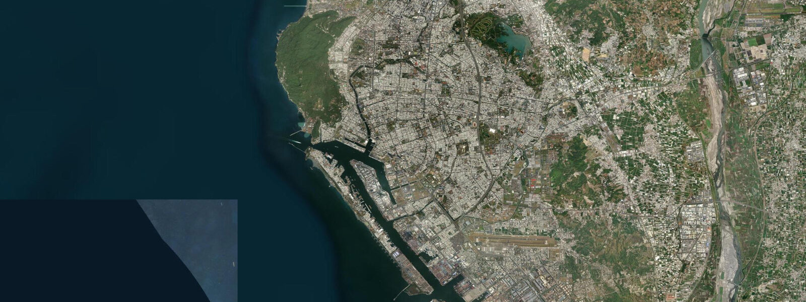
Kaohsiung is Taiwan's largest port and southern metropolis, built around a deep harbour on the South China Sea coast. 2 m relative to Chart Datum. 6 m.
The harbour entrance at Qijin Peninsula is the defining hydrographic feature of the city's coastline: the channel is narrow and both tidal current and vessel traffic run through it continuously. Qijin Island (Cijin Island) lies just inside the harbour mouth, reachable by a three-minute ferry from the Gushan terminal — the ferry crossing is tidal and vessel-traffic-dependent, running on a short-headway schedule. The Qijin Peninsula beach on the island's Pacific-facing western side is Kaohsiung's nearest ocean swimming beach, a narrow strip backed by the old lighthouse hill and the cannon-battery park above.
The Love River (Ai He) runs from Zuoying in the north through the city centre to the inner harbour basin at Yancheng — a 12 km urban waterway. At low tide, the lower reaches of the river partially expose the river bed, and the tidal backwater from the harbour raises the river level on the flood. Evening riverboat tours on the Love River are a standard Kaohsiung activity; the water level and reflections are best at high tide when the river is full.
The harbour itself handles around 10 million TEU annually; the Cijin Cross-Harbour Tunnel (bicycle and pedestrian) and the Qijin ferry are the two links between the peninsula and the main city, giving residents and visitors the option of a beach day reachable by bicycle from the urban core. 3 m on height.
Tide questions about Kaohsiung
Quick answers to the most common questions about tide times, range, and water access at Kaohsiung.
What is the tidal range at Kaohsiung?
Mean tidal range at Kaohsiung harbour is approximately 1.0 to 1.2 m relative to Chart Datum — mixed semidiurnal, with two highs and two lows per day of unequal height. Spring tides at new and full moons push toward 1.5 m; neap tides can reduce the daily range to under 0.6 m. The South China Sea location places Kaohsiung at the lower end of the regional tidal range spectrum.
How do I get to Qijin Island from central Kaohsiung?
By ferry from the Gushan terminal — a three-minute crossing that runs throughout the day on short headways (every 10 to 15 minutes in peak hours). The ferry is cheap and reliable; tidal state does not affect the service under normal conditions. Alternatively, the Cijin Cross-Harbour Tunnel is open to cyclists and pedestrians — a 5-minute ride from the Kaohsiung main harbour area to the island. The tunnel is a more direct route for cyclists wanting to reach the beach or explore the island by bike.
When is the best time for Love River boat tours?
Evening, on a high-tide day. The Love River is most photogenic when the water is at its highest — the riverbanks are fully submerged, the city's reflected lights spread across the surface, and the lower river runs full to its banks. At low tide, the exposed river bed at the inner harbour end detracts from the experience. Check the CWA tide table for the day; plan to be on the river within two hours of high water, which will also place you in the city's evening atmosphere.
What is the Qijin Peninsula beach like?
The Qijin (Cijin) beach on the western, Pacific-facing side of the island is a narrow strip of sand backed by the old lighthouse hill, running roughly 1 km between the harbour entrance to the north and the cannon-battery park to the south. Swimming is possible but the beach is narrow and the surf can be rough in northeast monsoon season (October through April). Summer is the main bathing season — calmer sea, more beach exposed at lower tide. The old Qijin lighthouse at the southern end is open to visitors and gives elevated views over the harbour entrance and the open sea.
Are tide predictions for Kaohsiung guaranteed to be accurate?
No prediction is guaranteed. Data on this page comes from Open-Meteo Marine modelling (typical accuracy ±45 minutes on timing, ±0.2–0.3 m on height) and is intended as planning guidance only. The Central Weather Administration (CWA) is the authoritative source for tidal predictions in Taiwan. Mariners and commercial vessel operators should always use CWA official tide tables for Kaohsiung harbour; the predictions on this site are not suitable for navigation. This site does not accept responsibility for decisions made based on these predictions.
7-day tide table — Kaohsiung
Heights relative to MSL. Predictions: Open-Meteo Marine (MeteoFrance SMOC, 0.08° grid) — heights relative to MSL (not chart datum / LAT). Model-derived.
| Day | Type | Time | Height |
|---|---|---|---|
| Sun 21 Jun | Low | 08:00 | 0.8m |
| High | 11:42 | 1.0m | |
| Low | 19:10 | 0.4m | |
| Mon 22 Jun | High | 01:50 | 0.8m |
| Low | 06:50 | 0.7m | |
| High | 13:00 | 0.9m | |
| Low | 19:50 | 0.5m | |
| Tue 23 Jun | High | 14:06 | 0.8m |
| Low | 20:10 | 0.6m | |
| Wed 24 Jun | — | ||
| Thu 25 Jun | — | ||
| Fri 26 Jun | High | 04:20 | 1.2m |
| Low | 12:18 | 0.4m | |
| Sat 27 Jun | High | 04:50 | 1.2m |
| Low | 12:54 | 0.4m | |
| High | 19:00 | 0.7m | |