Eforie Nord tide times
Eforie Nord tide forecast — heights relative to MSL.
Tide chart for Eforie Nord
24-hour cosine-interpolated curve around the present moment. Heights relative to MSL. Predictions: Predictions: Open-Meteo Marine (MeteoFrance SMOC, 0.08° grid).
Sun, moon and conditions on Sun 21 Jun
Snapshot at build time — refreshes daily. Sea state from Open-Meteo Marine.
Highs and lows next 7 days
Every predicted high and low for the next week, with the daily tidal coefficient (0–120; higher = bigger swing, > 95 means stronger currents).
Other spots nearby
The three closest curated TideTurtle locations to Eforie Nord, measured by great-circle distance.
Today's solunar windows
Solunar tradition: major periods are the ≈3h windows around moon transit and opposition; minor are ≈2h around moonrise and moonset. Pair with the local tide stage and wind for the best read.
About tides at Eforie Nord
A short guide to the coastline at Eforie Nord — geography, sea state, and what the tide is actually doing under your feet.
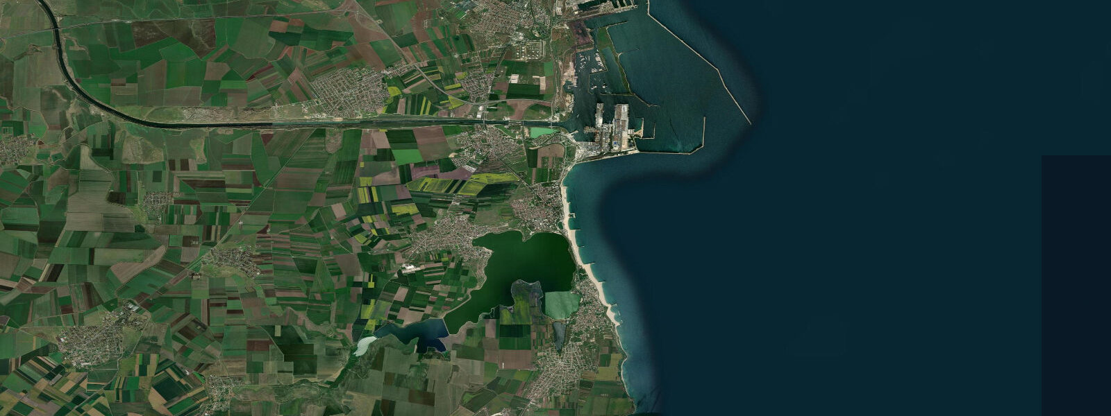
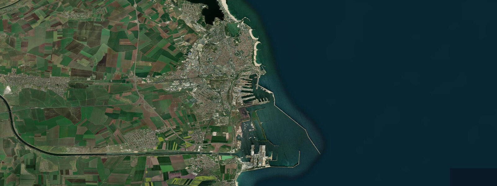
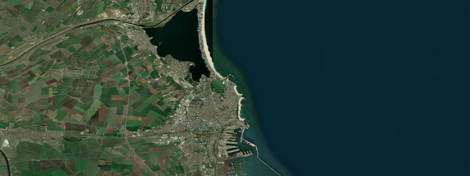
Eforie Nord sits 10 kilometres south of Constanța, the first resort below the city proper on the string of Black Sea resorts that runs down the Constanța County coast. The resort occupies a section where chalk and limestone cliffs alternate with sandy stretches — different coastal character from the flat sand bar at Mamaia to the north. The beach faces east; from the clifftop, Lake Techirghiol is visible a few hundred metres to the south.
The two water bodies could not look more different: the sea is blue-green and clear in calm weather; the lake is a dark, almost purple-grey, the colour of its dense sapropelic mud. Lake Techirghiol lost its direct connection to the Black Sea in historical times. As the connection narrowed and eventually closed, evaporation concentrated the remaining salts until the lake became significantly more saline than the sea itself — current salinity typically runs 70 to 90 parts per thousand, roughly double the Black Sea at this coast.
The bottom is covered in a thick layer of black sapropelic mud — organic sediment laid down over centuries, rich in mineral compounds, sulphur, and fine particulates. The mud's therapeutic properties have been documented since at least the late 19th century; the Eforie Nord sanatorium complex (operating since 1894, now the Europa Hotel and clinic) was among the first dedicated balneotherapy establishments in southeastern Europe to apply the Techirghiol mud systematically for musculoskeletal conditions, skin diseases, and post-injury rehabilitation. The therapeutic use is still active: patients and visitors apply the mud directly at the lake shore on the public mud-bath area, or receive clinical mud-pack treatments at the resort's medical facilities.
The lake has a slightly higher surface than the sea — water from the hillside drainage area feeds it — and from certain clifftop angles the visual contrast between the dark lake surface and the blue sea is sharp enough to make the boundary obvious. The beach at Eforie Nord between the cliffs is accessed by wooden staircases down from the cliff top; the southern end of the resort has a broader sandy section at beach level. The astronomical tide along this coast is 5 to 15 centimetres, negligible in practical terms.
8 metres; sustained southerlies lower them. The NIMR Constanța gauge, 10 kilometres north, is the reference sea-level station for this section of coast. Shore anglers fishing from the chalk-and-limestone rocky sections find the best conditions in the hour before sunset and in the early morning, targeting bream, mullet, and bluefish; the rocky ledges exposed between the sandy stretches hold more varied bottom habitat than the pure sand beach at Mamaia.
The water temperature at Eforie Nord follows the same seasonal pattern as the rest of the Romanian coast: 3 to 6°C in winter, 23 to 26°C in August. Summer swimming at the sandy stretches is safe and popular; the water clarity on calm days is noticeably better than at Constanța, where the port activity and Danube plume effects influence turbidity. The Black Sea coast south of Eforie Nord continues through a chain of resorts — Eforie Sud, Costinești, Neptun, Olimp, Venus, Saturn, Mangalia — each developed in the communist-era resort planning that assigned different demographic segments to different named resorts.
Costinești, for example, became the designated youth resort; Neptun was reserved for party officials and international guests. This planning history is visible in the architectural uniformity within each resort and the abrupt tonal shifts between them. Mangalia, at the southern end of the chain, has a harbour, a Roman and Byzantine archaeological zone (ancient Callatis), and the Turkish Esmahan Sultan Mosque (1590) in its old quarter.
The road south from Eforie Nord to Mangalia runs the length of this chain and is a straightforward day-trip by car or bus from Constanța. Predictions on this page come from Open-Meteo Marine, a gridded global ocean model. 3 metres on height — substantially exceeds the actual tidal signal.
Plan around the wind and weather forecast; the tide table here describes wind-driven and atmospheric water-level variation, not an astronomical cycle.
Tide questions about Eforie Nord
Quick answers to the most common questions about tide times, range, and water access at Eforie Nord.
What are the tide times at Eforie Nord?
The hero block at the top of this page shows the next predicted high and low at Eforie Nord in local Eastern European Time (EET/EEST, UTC+2/UTC+3). The astronomical tide on the Romanian Black Sea coast is 5 to 15 centimetres — below any practical threshold. The Black Sea has essentially no tide. Water level at Eforie Nord is governed by wind and atmospheric pressure; a Crivăț northeasterly can raise the waterline by 0.5 to 0.8 metres independent of any tidal cycle. NIMR (National Institute of Marine Research 'Grigore Antipa') operates the Constanța reference gauge 10 km north.
What is the black mud at Lake Techirghiol?
Lake Techirghiol's mud is sapropelic — an organic sediment formed by centuries of decomposing algae and microorganisms accumulating on the lake floor in the absence of oxygen. The mud is dark grey to black, finely grained, and rich in sulphur compounds and mineral salts. Its high mineral content and the lake's elevated salinity (70 to 90 parts per thousand, roughly double the Black Sea) combine to give the mud its documented anti-inflammatory and analgesic properties, which have been applied in balneotherapy treatments at Eforie Nord since the establishment of the first sanatorium in 1894. The public mud-bath area on the lake shore is accessible directly.
Why is Lake Techirghiol so much saltier than the Black Sea?
Techirghiol was once connected to the Black Sea by a tidal channel. As the channel gradually closed — through a combination of coastal sediment movement and sea-level change over the last few thousand years — the lake became isolated. With no outflow and continued freshwater input from the hillside catchment, evaporation concentrated the salts. The lake is now 70 to 90 parts per thousand salinity, while the Black Sea at the Constanța coast runs 17 to 18 parts per thousand. The visual difference is obvious: from the clifftop between the resort and the lake, the two water bodies are strikingly different in colour, the lake appearing much darker than the sea.
Where do these predictions come from?
Open-Meteo Marine, a gridded global ocean model; accuracy is typically plus or minus 45 minutes on timing and 0.2 to 0.3 metres on height. At Eforie Nord, where the astronomical tide is 5 to 15 centimetres, the model height uncertainty substantially exceeds the actual tidal signal. The values on this page reflect wind-driven and atmospheric water-level variation, not a meaningful astronomical tide. The Romanian Black Sea has essentially no tide in the astronomical sense. For authoritative sea-level data along this coast, use NIMR (National Institute of Marine Research 'Grigore Antipa'); the Constanța gauge 10 km north is the closest reference station.
Is this page safe to use for navigation?
No. For vessel operations along the Romanian Black Sea coast, use official hydrographic charts and maritime data published by the Autoritatea Navală Română. The coastal approaches south of Constanța contain shoals and reefs that are not visible from the surface at normal water levels and are not reflected in the water-level values shown on this page. The Black Sea coast south of Constanța to the Bulgarian border is a mix of sandy shoaling ground and chalk-cliff ledges; shallow-draught vessel operators should use current charts with depth soundings. Open-Meteo Marine gridded predictions are not authoritative for any vessel operation.
7-day tide table — Eforie Nord
Heights relative to MSL. Predictions: Open-Meteo Marine (MeteoFrance SMOC, 0.08° grid) — heights relative to MSL (not chart datum / LAT). Model-derived.
| Day | Type | Time | Height |
|---|---|---|---|
| Sun 21 Jun | — | ||
| Mon 22 Jun | — | ||
| Tue 23 Jun | — | ||
| Wed 24 Jun | — | ||
| Thu 25 Jun | — | ||
| Fri 26 Jun | — | ||
| Sat 27 Jun | High | 02:00 | -0.4m |