Ponce tide times
Ponce tide forecast — heights relative to MSL.
Tide chart for Ponce
24-hour cosine-interpolated curve around the present moment. Heights relative to MSL. Predictions: Predictions: Open-Meteo Marine (MeteoFrance SMOC, 0.08° grid).
Sun, moon and conditions on Sat 27 Jun
Snapshot at build time — refreshes daily. Sea state from Open-Meteo Marine.
Highs and lows next 7 days
Every predicted high and low for the next week, with the daily tidal coefficient (0–120; higher = bigger swing, > 95 means stronger currents).
Other spots nearby
The three closest curated TideTurtle locations to Ponce, measured by great-circle distance.
Today's solunar windows
Solunar tradition: major periods are the ≈3h windows around moon transit and opposition; minor are ≈2h around moonrise and moonset. Pair with the local tide stage and wind for the best read.
About tides at Ponce
A short guide to the coastline at Ponce — geography, sea state, and what the tide is actually doing under your feet.
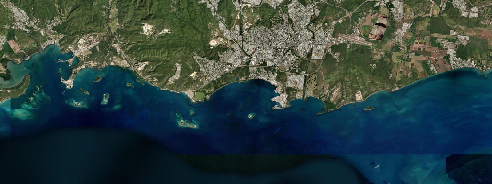
Ponce is Puerto Rico's second city and its most distinctively Puerto Rican one — the north-coast San Juan metropolitan area is cosmopolitan and US-influenced, while Ponce, facing the Caribbean from the island's south, has a different urban identity built around its Plaza Las Delicias, the red-and-black neoclassical Parque de Bombas fire station, and a civic pride centred on the city's role in island history. The port of Ponce, 3 km south of the city centre at Playa de Ponce, is one of Puerto Rico's three main commercial ports and the industrial outlet for the south-coast manufacturing corridor.
The tidal regime at Ponce on Puerto Rico's Caribbean south coast is mixed semidiurnal with a spring range of approximately 0.3–0.4 m above Chart Datum — slightly smaller than the Atlantic north coast and with more pronounced diurnal inequality. NOAA operates Maguyes Island station (9759110) 35 km west of Ponce as the primary reference for south coast tides; the pattern shows that during certain phases of the lunar cycle the two daily highs and lows merge toward a single dominant cycle, a diurnal-dominant pattern that is characteristic of the Caribbean side of islands in this latitude band. Mean high water springs at Ponce sits approximately 0.3 m above Chart Datum; mean low water springs approaches 0.0 m.
Playa de Ponce, the beach and port area 3 km south of the city centre, is a broad embayment with a narrow sand beach fronting the port facilities. At high spring water the beach is 8–12 m wide; at low spring water it extends to 18–22 m. The water offshore is shallow — depths of 2–3 m extend 200–300 m from shore before reaching the outer reef structures. The Caribbean swell on Puerto Rico's south coast is generally smaller and more attenuated than the north coast Atlantic exposure; the south-coast wave energy is dominated by southern Caribbean swell from distant storms and by local wind chop from the east-southeast trade wind. For beach swimmers, conditions are calmer and more predictable than the north coast.
The Ponce playa area has a boat ramp and small-craft harbour used by the local fishing fleet and recreational boaters. The 0.3–0.4 m tidal range is not a constraint on harbour access for any vessel drawing under 2.0 m. Navigation south from Ponce toward the offshore cay chain — Caja de Muertos Island, 12 km offshore, is the most-visited destination — uses the same shallow-water approach that applies across Puerto Rico's south-coast shelf, where depths of 2–5 m extend far offshore and chart reading matters more than tidal calculation.
Caja de Muertos (Coffin Island) is a small island reserve managed by the Puerto Rico Department of Natural Resources, accessible by ferry or private boat from Playa de Ponce. The island has a lighthouse from 1887 on its highest point and reef snorkelling in clear water on its south and east coasts. The ferry trip takes approximately 45 minutes in calm conditions; afternoon southeast trade wind can make the return trip rough. Low spring water at Caja de Muertos exposes shallow reef crests on the north side of the island, limiting passage for small craft but creating productive snorkel terrain accessible on foot from the beach.
For anglers, the south-coast shelf between Ponce and Guayanilla is known for bottom fishing on the reef and rock structure at 15–30 m depth. Red snapper, grouper, and yellowtail snapper are the target species. The ebb tide off the Ponce coast runs westward along the south coast; local boat anglers drift with the current and anchor up when they find structure. Shore fishing from the rocks at Playa de Ponce and the adjacent rocky points targets barracuda and jack on the incoming flood. The diurnal-dominant pattern during certain lunar phases means the most productive tidal transitions — the daily flood that brings baitfish onto the shallower reef — can occur only once rather than twice in a 24-hour period; checking the day's tide pattern before planning a fishing session matters here more than on the Atlantic north coast.
Ponce's city centre offers the museum of art (Museo de Arte de Ponce, Puerto Rico's most significant art collection), the Plaza Las Delicias, and the Parque de Bombas firehouse as cultural anchors independent of coastal access. For photographers, the south-coast light is different from the north — the sun tracks overhead and slightly south, meaning the south-facing coastline is backlit in the morning and side-lit in the afternoon. Best light on Playa de Ponce and the outer cays falls from 15:00 to 17:30.
All tide predictions for Ponce come from the Open-Meteo Marine gridded model. Timing accuracy is ±45 minutes; height accuracy is ±0.3 m above Chart Datum.
Tide questions about Ponce
Quick answers to the most common questions about tide times, range, and water access at Ponce.
How does the tidal character on Puerto Rico's south coast at Ponce differ from San Juan?
Ponce's Caribbean south coast has a spring range of 0.3–0.4 m versus San Juan's Atlantic north coast range of 0.4–0.6 m — slightly smaller and with more pronounced diurnal inequality. During certain lunar phases the two daily tidal cycles at Ponce merge toward a single dominant high and low, a diurnal pattern that can mean only one productive fishing flood per day rather than two. The NOAA reference station for the south coast is Maguyes Island (9759110) 35 km west of Ponce. South-coast swell is generally calmer and more attenuated than north-coast Atlantic exposure.
How do you get to Caja de Muertos Island from Ponce and does the tide affect the trip?
Caja de Muertos is accessible by scheduled ferry from Playa de Ponce (approximately 45 minutes) or private charter. The ferry operates on weekends and holidays; private charters run year-round. The south-coast shelf is shallow — 2–5 m depths extend far offshore — so navigation relies on charts and a depth sounder rather than tidal calculation, given the 0.3–0.4 m spring range. Afternoon southeast trade wind makes the return trip rougher than the morning outbound; take the early ferry. At low spring water the shallow reef crests on the island's north side are exposed, limiting approach for small boats but opening snorkel access on foot from the beach.
What is the diurnal-dominant tidal pattern at Ponce and why does it matter for fishing?
During certain phases of the lunar month, Ponce's mixed semidiurnal tide transitions toward a diurnal pattern — the two daily highs merge into one dominant high and the two daily lows into one dominant low. On those days there is effectively one flood and one ebb per 24 hours rather than two of each. For anglers who plan fishing sessions around the productive flood-tide window, a diurnal day means one bite window instead of two. Checking the day's predicted tide pattern (not just the range) is more important at Ponce than at San Juan, where the semidiurnal pattern is more consistent. The effect is most pronounced around the lunar quarter phases.
What bottom fishing is available on the south-coast shelf off Ponce?
The south-coast reef and rock structure at 15–30 m depth between Ponce and Guayanilla holds red snapper, grouper, and yellowtail snapper. Local boat anglers drift with the westward-running ebb current and anchor when they locate structure. The most productive sessions are on the ebb when current moves bait off the reef edge, concentrating predators at the down-current face of the structure. Shore fishing from the rocky points at Playa de Ponce targets barracuda and jack on the incoming flood — morning or late afternoon flooding tides are the standard windows. The small tidal range means harbour access from the Ponce playa boat ramp is unrestricted at any time.
Is the Ponce waterfront suitable for family beach visits, and how does it compare to other PR beaches?
Playa de Ponce is a calm, family-suitable beach on Puerto Rico's sheltered south coast. Caribbean swell is attenuated compared to the Atlantic north, making the water gentler and more predictable for children. The beach is 8–12 m wide at high water and expands to 18–22 m at low spring water. It lacks the resort infrastructure of Condado or Isla Verde in San Juan but offers access to the local fishing culture and the Caja de Muertos ferry. For families who want clear water and reef snorkelling without heavy tourist infrastructure, the boat trip to Caja de Muertos is the main draw. The city of Ponce's cultural attractions (Parque de Bombas, the art museum) make a full day combining beach and city worthwhile.
7-day tide table — Ponce
Heights relative to MSL. Predictions: Open-Meteo Marine (MeteoFrance SMOC, 0.08° grid) — heights relative to MSL (not chart datum / LAT). Model-derived.
| Day | Type | Time | Height |
|---|---|---|---|
| Sat 27 Jun | — | ||
| Sun 28 Jun | — | ||
| Mon 29 Jun | — | ||
| Tue 30 Jun | Low | 11:00 | 0.1m |
| Wed 01 Jul | — | ||
| Thu 02 Jul | — | ||
| Fri 03 Jul | High | 19:00 | 0.3m |