Boracay (White Beach), Western Visayas tide times
Boracay (White Beach), Western Visayas tide forecast — heights relative to MSL.
Today's tide times for Boracay (White Beach), Western Visayas
Tide times at Boracay (White Beach), Western Visayas on Sunday, 26 July 2026: first high tide at 08:00, first low tide at 16:07. Sunrise 05:38, sunset 18:19.
Tide chart for Boracay (White Beach), Western Visayas
24-hour cosine-interpolated curve around the present moment. Heights relative to MSL. Predictions: Predictions: Open-Meteo Marine (MeteoFrance SMOC, 0.08° grid).
Sun, moon and conditions on Sun 26 Jul
Snapshot at build time — refreshes daily. Sea state from Open-Meteo Marine.
Highs and lows next 7 days
Every predicted high and low for the next week, with the daily tidal coefficient (0–120; higher = bigger swing, > 95 means stronger currents).
Other spots nearby
The three closest curated TideTurtle locations to Boracay (White Beach), Western Visayas, measured by great-circle distance.
Today's solunar windows
Solunar tradition: major periods are the ≈3h windows around moon transit and opposition; minor are ≈2h around moonrise and moonset. Pair with the local tide stage and wind for the best read.
Cycle dates near Boracay (White Beach), Western Visayas
Next spring tide on Thu 30 Jul (range 1.9m). Last neap on Sun 26 Jul. Next neap on Fri 31 Jul.
Spring tides cluster around new and full moons (biggest swings). Neap tides land on quarter moons (smallest swings). See the spring tide and neap tide glossary entries for the why.
About tides at Boracay (White Beach), Western Visayas
A short guide to the coastline at Boracay (White Beach), Western Visayas — geography, sea state, and what the tide is actually doing under your feet.
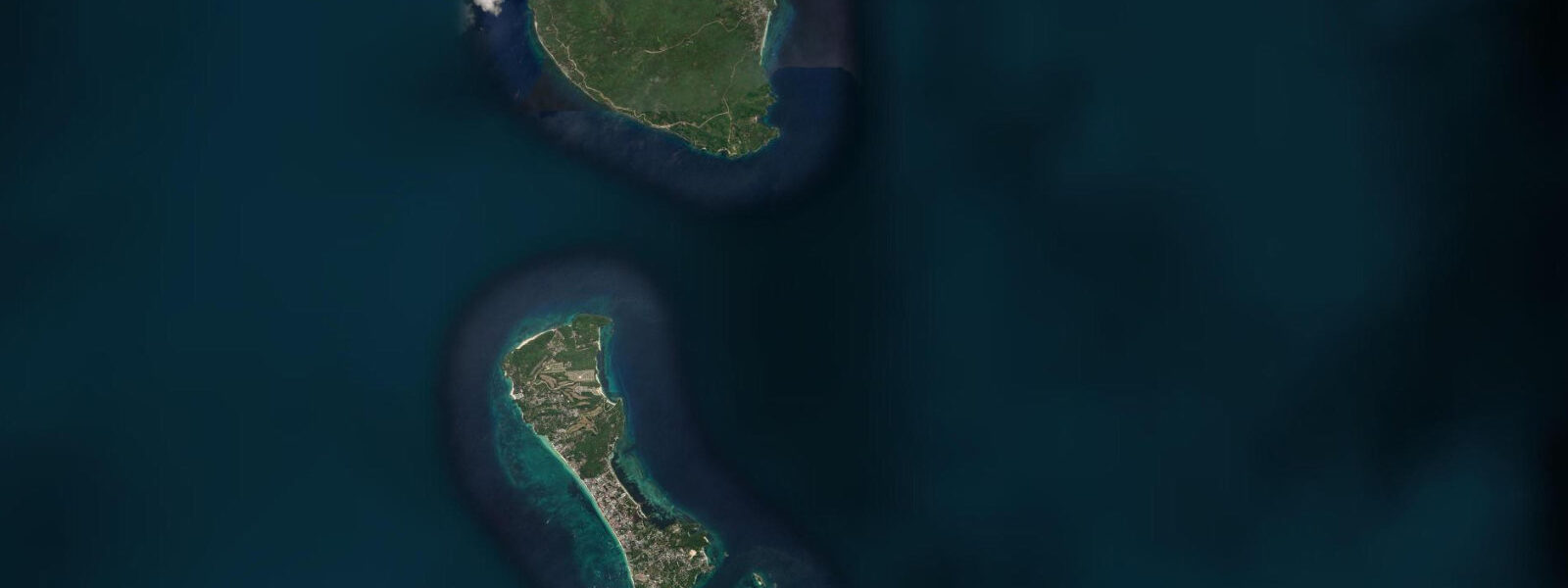
Boracay is a thin seven-kilometre-long island off the north-west tip of Panay in the Visayan archipelago of the central Philippines, separated from the larger island by the narrow Tablas Strait. White Beach runs the entire west-facing flank of the island — four kilometres of fine coral sand divided into Stations 1, 2, and 3 by the local convention, with Cagban port on the south-east coast handling the bangka pump-boat shuttle from Caticlan on the Panay side. The tide here is a moderate mixed semidiurnal signal modulated by the Tablas Strait current that runs between Boracay and Carabao Island to the west.
6 on neaps. The pattern produces two highs and two lows of unequal size each day, with the difference between the higher high and the lower low varying through the lunar month and shifting toward strongly diurnal at certain phases. The Tablas Strait current can run sharper than the height swing implies, particularly through the narrow Cagban-Caticlan channel that the bangkas cross fifty times an hour during peak tourist season.
The defining seasonal force is the monsoon split. The amihan north-east monsoon from November through May drives steady wind across the island toward White Beach, calming the west-coast swell to glass and turning Bulabog Beach on the east side into one of the great kiteboarding venues of South-East Asia. The habagat south-west monsoon from June through October reverses the wind, opens the west coast to swell, and shifts the working windsurf and kite scene to the Bulabog east side which then sits in the lee of the island.
The 5 November 2013 Typhoon Haiyan track passed about 200 kilometres south of Boracay and the surge and wind damage were severe but well below the catastrophic levels at Tacloban and Guiuan further south-east. Sailing-sunset booking offices, the dive-boat operators running to Crocodile Island and Yapak Wall, the night-market food vendors at D'Mall, the local Ati community whose ancestral lands cover the inland forest, and the resident hermit crab and monitor lizard populations all read the table for different windows. The Philippine Coast Guard NAMRIA publishes the authoritative tide tables; Open-Meteo Marine drives the gridded predictions on this page.
Tide questions about Boracay (White Beach), Western Visayas
Quick answers to the most common questions about tide times, range, and water access at Boracay (White Beach), Western Visayas.
When is the next high tide at Boracay?
The hero block shows the next high tide at the White Beach reference gauge in local Philippine time (PHT, UTC+8, no DST). The 7-day table covers all daily highs and lows. The Bulabog gauge on the east side reads at the same timing through the narrow Tablas Strait connection.
What's the typical tide range at Boracay?
Mean range at White Beach is about 1.4 metres — a moderate mixed semidiurnal signal. Spring tides push close to 2.0 metres and neaps drop near 0.6. The asymmetry between the higher high and the lower low varies through the lunar month and shifts toward strongly diurnal at certain phases. The Tablas Strait current can run sharper than the height swing implies.
Where do these tide predictions come from?
Open-Meteo Marine, a gridded global ocean model. Useful for planning White Beach swimming windows, Bulabog kiteboarding session timing in the amihan season, Crocodile Island dive-boat scheduling, and the Cagban-Caticlan bangka crossing windows. For authoritative Philippine tide data, the Philippine Coast Guard NAMRIA Hydrographic Office publishes the official tide tables.
How does the amihan / habagat monsoon split change the kite and surf scene?
The amihan north-east monsoon from November through May drives steady wind across the island toward White Beach, flattening the west-coast swell to glass and turning Bulabog Beach on the east side into one of the great kiteboarding venues of South-East Asia — that's the working kite season and the local schools at Bulabog run full bookings. The habagat south-west monsoon from June through October reverses the pattern: White Beach gets the swell and the chop, Bulabog sits in the lee of the island, and the kite operations shift their timing or close for the season. Tide windows matter for both seasons but the wind matters more for kite planning.
Is this safe to use for navigation?
No. For piloting the Cagban-Caticlan crossing, the Tablas Strait approaches, or any of the dive sites at Yapak and Crocodile use the Philippine Coast Guard NAMRIA authoritative tide tables, the local Caticlan port pilotage guidance, and the PAGASA tropical-cyclone warnings. Typhoon season runs June through November and tropical-storm surge can override the astronomical signal completely.
8-day tide table — Boracay (White Beach), Western Visayas
Heights relative to MSL. Predictions: Open-Meteo Marine (MeteoFrance SMOC, 0.08° grid) — heights relative to MSL (not chart datum / LAT). Model-derived.
| Day | Type | Time | Height |
|---|---|---|---|
| Sun 26 Jul | High | 08:00 | 1.4m |
| Low | 16:07 | 0.0m | |
| Mon 27 Jul | High | 08:13 | 1.5m |
| Low | 16:43 | -0.1m | |
| Tue 28 Jul | High | 09:08 | 1.6m |
| Low | 17:13 | -0.1m | |
| Wed 29 Jul | High | 09:47 | 1.6m |
| Low | 17:45 | -0.2m | |
| Thu 30 Jul | High | 00:12 | 0.7m |
| Low | 03:18 | 0.6m | |
| High | 10:25 | 1.7m | |
| Low | 18:08 | -0.2m | |
| Fri 31 Jul | High | 00:24 | 0.7m |
| Low | 04:04 | 0.5m | |
| High | 11:00 | 1.7m | |
| Sat 01 Aug | Low | 04:56 | 0.5m |
| High | 11:34 | 1.6m | |
| Low | 18:51 | -0.1m | |
| Sun 02 Aug | High | 01:02 | 0.9m |
| Low | 05:45 | 0.4m |