Roxas City, Western Visayas tide times
Roxas City, Western Visayas tide forecast — heights relative to MSL.
Today's tide times for Roxas City, Western Visayas
Tide times at Roxas City, Western Visayas on Friday, 19 June 2026: first low tide at 08:00, first high tide at 13:00, second low tide at 20:38. Sunrise 05:26, sunset 18:14.
Tide chart for Roxas City, Western Visayas
24-hour cosine-interpolated curve around the present moment. Heights relative to MSL. Predictions: Predictions: Open-Meteo Marine (MeteoFrance SMOC, 0.08° grid).
Sun, moon and conditions on Fri 19 Jun
Snapshot at build time — refreshes daily. Sea state from Open-Meteo Marine.
Highs and lows next 7 days
Every predicted high and low for the next week, with the daily tidal coefficient (0–120; higher = bigger swing, > 95 means stronger currents).
Other spots nearby
The three closest curated TideTurtle locations to Roxas City, Western Visayas, measured by great-circle distance.

Today's solunar windows
Solunar tradition: major periods are the ≈3h windows around moon transit and opposition; minor are ≈2h around moonrise and moonset. Pair with the local tide stage and wind for the best read.
Cycle dates near Roxas City, Western Visayas
Last spring tide on Fri 19 Jun (range 2.2m). Next spring tide on Thu 25 Jun (range 1.2m). Next neap on Tue 23 Jun.
Spring tides cluster around new and full moons (biggest swings). Neap tides land on quarter moons (smallest swings). See the spring tide and neap tide glossary entries for the why.
About tides at Roxas City, Western Visayas
A short guide to the coastline at Roxas City, Western Visayas — geography, sea state, and what the tide is actually doing under your feet.
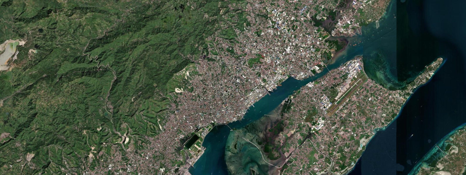
Roxas City is the capital of Capiz province, on the northern coast of Panay island facing the Sibuyan Sea. It carries the formal designation of Seafood Capital of the Philippines — an attribution that is not marketing language but a straightforward description of the economy. Capiz Bay and its tidal channels and mudflats produce shellfish in commercial quantities that supply national markets: scallops, oysters, clams, and the windowpane oyster shell product that the province has processed for centuries.
The tidal regime in the Sibuyan Sea off Roxas City is mixed semidiurnal — two unequal highs and two unequal lows daily — with mean range of 1.0–2.0 m. The range is wider than Iloilo across Panay's south coast because the Sibuyan Sea geometry amplifies the tidal signal slightly relative to the sheltered western-Visayas averages. Spring tides bring the larger lows that expose the Capiz Bay mudflats to their greatest extent; those extreme low-water events are when harvesting activity is highest.
The scallop harvested from Capiz Bay is Amusium pleuronectes, the Capiz scallop, commercially distinct from the deep-water scallops found in temperate seas. The harvest window is the 2–3 hours around low water when the mudflat is accessible on foot. Harvesters wade out across the exposed flat with nets and baskets, working specific beds that have been worked by their families across generations. The timing of that window shifts daily — roughly 50 minutes later each day as the tidal cycle advances — and the harvesters track it as precisely as a work schedule, because it is one.
On the most extreme low spring tides, the flat extends far enough that harvesters work areas rarely accessible, and yields from those events are notably higher than average. Provincial fisheries management uses tidal predictions to co-ordinate regulated harvesting periods — certain beds have rest periods tied to lunar-tidal cycles to allow recovery between major low-water harvesting events.
The windowpane oyster, Placuna placenta, is the source of Capiz shell — the translucent, pearlescent material that has been used in traditional Philippine architecture, lampshades, decorative panels, and export crafts for centuries. The shell is harvested from the shallow tidal flat and processed in factories around the city. At its peak the Capiz shell industry supplied international markets with the material for a specific category of decorative product; demand has fluctuated with global craft market trends, but the industry persists and the tidal flat continues to be the source.
The Ivisan River carries sediment from the central Panay mountains across the province to the Capiz Bay delta. The river's sediment load is the foundation of the bay mudflat ecology — the fine alluvial mud deposited at the river mouth over centuries creates the substrate that the shellfish beds require. The Ivisan River delta is an active estuarine environment where river flow, tidal exchange, and sediment dynamics interact. After heavy inland rain, the river turbidity increases and the salinity in the inner bay drops; this affects shellfish physiology and harvesters know to adjust expectations in the days following significant rainfall.
The Roxas City waterfront is a working coast first — the fishing boats and shellfish transport vessels that move through the channel are not decorative. The waterfront market at the city side of the bay is where the catch comes in, and the mix of what arrives — live scallops in wire cages, bags of oysters, Capiz shell by the sack — makes it one of the more direct fisheries markets in the Western Visayas. Timing a market visit to coincide with the end of a low-tide harvesting window — typically 09:00–11:00 when morning low water falls around 07:00–08:00 — gives the best chance of seeing fresh product arrive.
For anglers, the tidal channels cutting through the bay mudflat concentrate fish on ebb current as small baitfish are funnelled out of the shallows. Milkfish (bangus), mullet, and various flatfish species are the primary targets in the inner bay channels. Spinning lures cast across the channel current on mid-ebb produce consistent results for visiting anglers working from the channel banks.
Paddlers and kayakers in Capiz Bay face an environment where the water depth over the flat changes rapidly. At mid-tide, much of the inner bay has 0.5–1.5 m of water — navigable by kayak but requiring attentiveness to the mudflat edge. At low spring water the inner bay becomes a wide mudflat with channels; at high water the flat disappears entirely. The mid-flood period is the most straightforward paddling window — enough depth to move freely without the full flood current that runs in the channels on the strongest spring tides.
Tide data for Roxas City, Western Visayas comes from the Open-Meteo Marine API, a gridded model product. Timing accuracy is ±45 minutes, height accuracy ±0.3 m — usable for trip planning, not for navigation.
Tide questions about Roxas City, Western Visayas
Quick answers to the most common questions about tide times, range, and water access at Roxas City, Western Visayas.
When do shellfish harvesters work the Capiz Bay mudflat and how does the tide determine the schedule?
The harvesting window is the 2–3 hours around low water when the Capiz Bay mudflat is exposed and accessible on foot. The specific timing shifts by roughly 50 minutes each day as the tidal cycle advances — so a 07:00 low water on Monday becomes roughly 07:50 on Tuesday and 08:40 on Wednesday. Spring tides produce the lowest low waters and expose the widest area of flat, which is when yield is highest. Provincial fisheries management co-ordinates regulated rest periods for specific beds, timed to lunar-tidal cycles. For visitors who want to watch or photograph the harvest, identifying a spring low water between 06:00 and 09:00 and arriving 30 minutes before the predicted low gives the best positioning.
What is Capiz shell and where does it come from?
Capiz shell is the common name for the shell of Placuna placenta, the windowpane oyster — a bivalve that grows in the shallow tidal mudflat of Capiz Bay. The shell is flat, nearly circular, and translucent — historically used in traditional Philippine architecture as window panes before glass was widely available, and subsequently exported for lampshades, decorative panels, and craft products. The oysters are harvested from the tidal flat during low-water windows alongside the commercially more significant Capiz scallop. After harvest, the shells are sorted, cleaned, and processed in factories around Roxas City. The industry's output volume depends partly on how often extreme low tides allow access to the deeper reaches of the flat, giving the tidal calendar a direct role in production scheduling.
How does rainfall in central Panay affect the Capiz Bay shellfish beds?
The Ivisan River drains the central Panay mountain range and carries sediment and fresh water into Capiz Bay at the river delta. After significant rainfall, the river turbidity increases and the volume of fresh water entering the bay drops salinity in the inner bay — sometimes sharply. Shellfish are osmoregulators with tolerance ranges; sustained low salinity stresses oysters and scallops and, in extreme cases, triggers mortality events in shallow-water beds closest to the river mouth. Harvesters with beds near the delta adjust expectations for 3–7 days after heavy inland rain. The outer bay and channel beds are less affected because tidal exchange with the Sibuyan Sea dilutes the freshwater input more effectively.
What is the tidal range in Capiz Bay and is it higher than the rest of the Philippines?
Capiz Bay's mean tidal range is 1.0–2.0 m — at the higher end of the Western Visayas average, which typically sits around 1.0–1.5 m. The Sibuyan Sea geometry amplifies the tidal signal modestly compared to more sheltered enclosed channels in the region. The tidal type is mixed semidiurnal, the standard Philippine regime, with two unequal highs and two unequal lows daily. The diurnal inequality means one daily low is usually lower than the other — on days when the lower low falls in the morning, the harvest window is in the early hours and yields from the deeper flat are better. The range is not extreme by global standards but is sufficient to expose a substantial mudflat area on each spring tide.
Is the Roxas City waterfront market worth visiting and when should you go?
The waterfront fish market at Roxas City is one of the more straightforward shellfish markets in the Western Visayas — live Capiz scallops, oysters, clams, and Capiz shell by the sack arrive from the bay on a tide-driven schedule. The best time to visit is when a morning low-water harvest ends and boats and harvesters return — typically 09:00–11:00 on days when low water falls between 06:30 and 08:00. The freshest product is available in those hours; later in the day the market continues but on the previous tide's catch. The market also sells bangus (milkfish), squid, and other local catch that are not tide-schedule dependent, so the market functions throughout the day — the early-morning shellfish arrival is simply the most photogenic and freshest moment.
8-day tide table — Roxas City, Western Visayas
Heights relative to MSL. Predictions: Open-Meteo Marine (MeteoFrance SMOC, 0.08° grid) — heights relative to MSL (not chart datum / LAT). Model-derived.
| Day | Type | Time | Height |
|---|---|---|---|
| Fri 19 Jun | Low | 08:00 | 0.7m |
| High | 13:00 | 1.9m | |
| Low | 20:38 | -0.3m | |
| Sat 20 Jun | High | 03:03 | 0.8m |
| Low | 07:10 | 0.5m | |
| High | 13:50 | 1.7m | |
| Low | 21:13 | -0.1m | |
| Sun 21 Jun | High | 03:37 | 0.9m |
| Low | 08:16 | 0.5m | |
| High | 14:39 | 1.5m | |
| Low | 21:50 | 0.0m | |
| Mon 22 Jun | High | 04:23 | 1.0m |
| Low | 09:36 | 0.5m | |
| High | 15:36 | 1.2m | |
| Low | 22:19 | 0.2m | |
| Tue 23 Jun | High | 05:06 | 1.1m |
| Low | 11:07 | 0.5m | |
| High | 16:43 | 1.0m | |
| Low | 22:50 | 0.3m | |
| Wed 24 Jun | High | 05:56 | 1.3m |
| Low | 12:50 | 0.4m | |
| Thu 25 Jun | High | 06:42 | 1.4m |
| Low | 14:21 | 0.3m | |
| High | 20:06 | 0.7m | |
| Fri 26 Jun | Low | 00:06 | 0.6m |
| High | 07:00 | 1.4m |