Mughsayl Beach tide times
Mughsayl Beach tide forecast — heights relative to MSL.
Today's tide times for Mughsayl Beach
Tide times at Mughsayl Beach on Sunday, 21 June 2026: first high tide at 04:00am, first low tide at 06:37am, second high tide at 02:02pm, second low tide at 09:21pm. Sunrise 05:52am, sunset 07:00pm.
Tide chart for Mughsayl Beach
24-hour cosine-interpolated curve around the present moment. Heights relative to MSL. Predictions: Predictions: Open-Meteo Marine (MeteoFrance SMOC, 0.08° grid).
Sun, moon and conditions on Sun 21 Jun
Snapshot at build time — refreshes daily. Sea state from Open-Meteo Marine.
Highs and lows next 7 days
Every predicted high and low for the next week, with the daily tidal coefficient (0–120; higher = bigger swing, > 95 means stronger currents).
Other spots nearby
The three closest curated TideTurtle locations to Mughsayl Beach, measured by great-circle distance.
Today's solunar windows
Solunar tradition: major periods are the ≈3h windows around moon transit and opposition; minor are ≈2h around moonrise and moonset. Pair with the local tide stage and wind for the best read.
Cycle dates near Mughsayl Beach
Next spring tide on Fri 26 Jun (range 1.3m). Next neap on Mon 22 Jun.
Spring tides cluster around new and full moons (biggest swings). Neap tides land on quarter moons (smallest swings). See the spring tide and neap tide glossary entries for the why.
About tides at Mughsayl Beach
A short guide to the coastline at Mughsayl Beach — geography, sea state, and what the tide is actually doing under your feet.
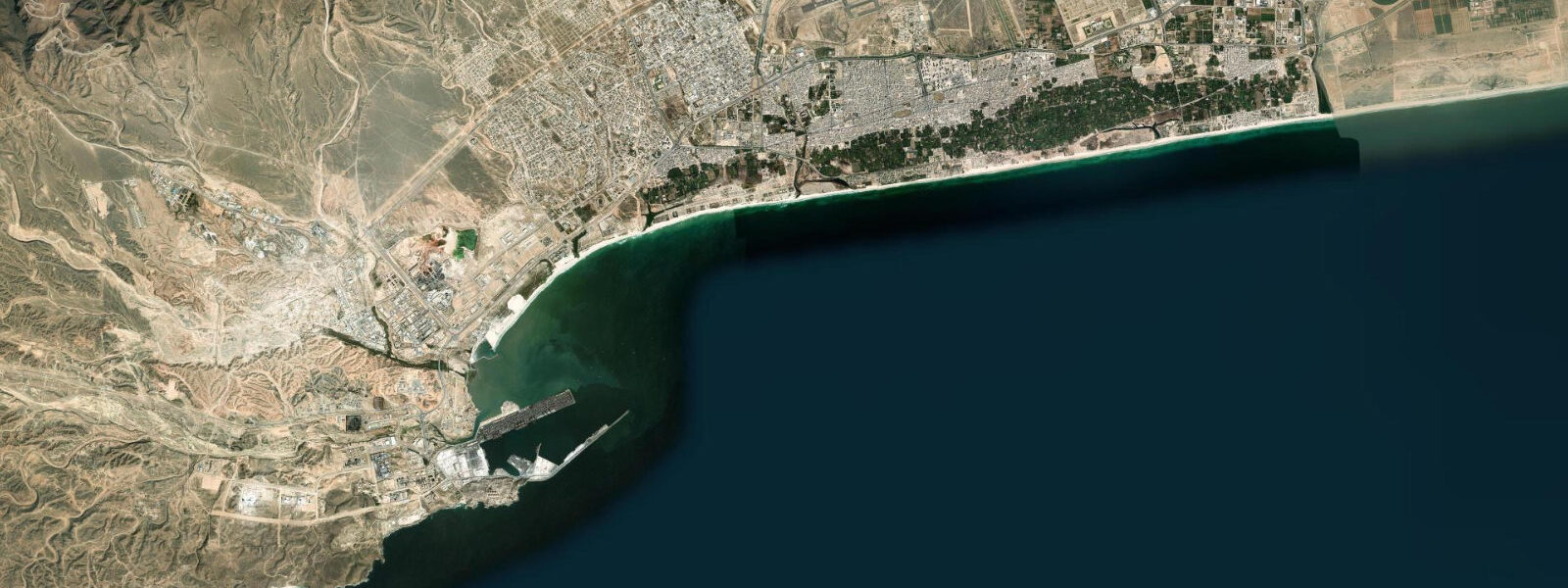
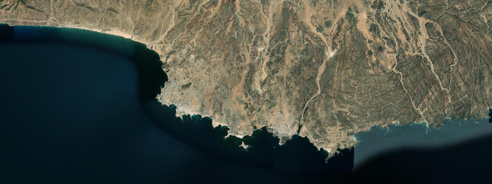
Mughsayl Beach lies 35 km west of Salalah, where the Dhofar coast makes a long, open SW-facing arc backed by limestone cliffs 20–40 m high. The beach is one of the finest on the Omani coast: a broad expanse of pale sand that extends for 4 km between rocky headlands, with the Qara Mountain foothills receding inland. The beach is synonymous in Oman with the khareef season, not because it is swimmable during the monsoon — it emphatically is not — but because the blowholes in the limestone platform west of the main beach are the dramatic natural spectacle that draws visitors from across the region.
The tidal regime is mixed semidiurnal, spring range approximately 1.5–2.0 m above Chart Datum. The beach faces directly SW into the Arabian Sea; the wide, gently sloping sand floor means the tidal change translates into 80–120 m of horizontal beach movement between the spring high-water mark and the spring low. At low water the exposed sand flat is firm, dry, and walkable for the full distance.
The limestone platform to the west of the beach access point carries a series of sinkholes and fissures — the blowholes — where the wave action forces compressed air and water up through the rock. During the khareef (June–September), SW swell arrives from the Southern Ocean fetch across the full Arabian Sea, reaching significant wave heights of 2.5–4.0 m at Mughsayl. The blowholes erupt at 30–90 second intervals, shooting water and spray 10–20 m into the air; the sound carries several hundred metres. The viewing area is a raised car park above the cliff; the limestone platform itself is fenced off during the khareef due to surge risk.
Outside the khareef (October–May) Mughsayl is a completely different place: calm, clear water, firm sand, and moderate waves that allow swimming and beach fishing. The blowholes still function on days with swell above 0.8 m but without the monsoon-season spectacle. The beach is at its widest at spring low tide in the October–May dry season; the two-to-three hour window centred on the predicted low gives the best walking conditions on the full beach expanse.
Kayaking and snorkelling are possible at Mughsayl in the dry season from the sheltered eastern end of the beach, where the headland provides some swell shadow. The rocky reef at the eastern headland base carries typical Gulf of Oman reef species at depths of 3–8 m. Tidal current at the headland tip can run 0.5–1.0 knots at springs; time snorkelling excursions to avoid the peak ebb when current is strongest.
Tide predictions here come from Open-Meteo Marine: accuracy ±45 min / ±0.2–0.3 m. The National Hydrographic Office of Oman publishes official tide tables; Salalah Port is the reference station for this section of coast.
The road from Salalah to Al Mughsayl (Highway 47) runs 35 km west along the coast, passing the smaller beach at Ayn Athum and the wadi crossings before arriving at the Mughsayl blowhole car park on the cliff above the beach. The car park is elevated 10–15 m above the beach level and gives a clear view of the blowhole platform and the beach arc. During the khareef, the car park fills with domestic tourists from across Oman and the Gulf; organised food and drink vendors operate from the roadside. Outside the khareef the car park is often empty and the beach access path to the sand is open.
The limestone coastal platform at Mughsayl is part of the Khareef Formation, a series of Cretaceous-era limestone units that dominate the Dhofar coast. The blowholes exploit weakness planes in the limestone — natural joints and fractures that the sea has enlarged over millennia of wave action. New vents form occasionally as the sea exploits fresh fracture planes; the platform is geologically active and the blowhole configuration changes on a decadal time scale. The dry-season platform, when wave action is low, gives a clear view of the fissure geometry that explains the blowhole mechanism.
Tide questions about Mughsayl Beach
Quick answers to the most common questions about tide times, range, and water access at Mughsayl Beach.
When are the Mughsayl blowholes most active?
The blowholes are most spectacular during the khareef SW monsoon (June–September) when wave heights at Mughsayl regularly reach 2.5–4.0 m and the blowholes erupt every 30–90 seconds, sending spray 10–20 m into the air. The viewing area above the cliff is open year-round; the limestone platform itself is closed during the monsoon. Outside the khareef, on any day with swell above 0.8 m, the blowholes function but with reduced intensity. Tide state affects blowhole intensity: at higher water the compressed air column in the fissures is shorter and the eruptions more forceful. The blowhole vents are most productive at high water when the rock platform above the fissures is shallowest and wave compression is highest.
Is Mughsayl Beach swimmable during the khareef?
No. Swimming at Mughsayl is prohibited from June through September when the SW monsoon generates sustained swell of 2.5–4.0 m; the beach authority posts red warning flags and beach access is restricted. Even outside the monitored swimming areas, the conditions during the khareef are dangerous for anyone in the water. The beach is accessible for viewing and walking the upper sand above the wave zone, but entry into the water is inadvisable. The dry season (October–May) is the safe swimming period. Even during the dry season, rip currents can form between the beach cusps after periods of elevated swell; assess before entering.
Where do the tide predictions on this page come from?
Open-Meteo Marine, a free gridded global ocean model. Accuracy is typically ±45 minutes on timing and ±0.2–0.3 m on height. There is no permanent gauge at Mughsayl; predictions are referenced to the nearby Salalah Port station, operated by the National Hydrographic Office of Oman, which publishes official Omani tide tables. This page is not for navigation. Salalah Port (PORT SALALAH) is a Class A NOAA reference port in the World Port Index, giving the Salalah tide tables international validation for navigation.
What is the best time to visit Mughsayl Beach for walking the full sand expanse?
The widest beach access at Mughsayl is at spring low tide during the dry season (October–May). Spring range is approximately 1.5–2.0 m; on a gently sloping sand floor this translates to 80–120 m of additional beach exposed at the predicted low. The two-to-three hour window centred on the predicted low gives the best conditions for beach walking, beach photography, and access to the outer tideline. Check the predicted low time on this page and plan to arrive 60–90 minutes beforehand. The spring low at Mughsayl typically coincides with a daytime window during the October–May season, making low-tide beach walks practical on most days.
Is the snorkelling at the eastern headland at Mughsayl suitable for beginners?
The eastern end of Mughsayl, sheltered from the dominant SW swell by the headland, is the calmest section of the beach and the most suitable entry point for snorkelling in the dry season. The reef at the headland base carries grouper, parrotfish, and various reef fish at 3–8 m depth. The tidal current at the headland tip reaches 0.5–1.0 knots at springs; snorkel within two hours of slack water (around the predicted high or low) to avoid fighting the current. This is open-water snorkelling without lifeguard cover; inexperienced swimmers should use a guide. The Gulf of Oman's eastern Dhofar coast is less affected by the NE monsoon than the northern Muscat area, giving Mughsayl more consistent calm-season conditions.
7-day tide table — Mughsayl Beach
Heights relative to MSL. Predictions: Open-Meteo Marine (MeteoFrance SMOC, 0.08° grid) — heights relative to MSL (not chart datum / LAT). Model-derived.
| Day | Type | Time | Height |
|---|---|---|---|
| Sun 21 Jun | High | 04:00 | -0.0m |
| Low | 06:37 | -0.3m | |
| High | 14:02 | 0.8m | |
| Low | 21:21 | -0.1m | |
| Mon 22 Jun | High | 14:23 | 0.8m |
| Low | 22:21 | -0.3m | |
| Tue 23 Jun | High | 14:55 | 0.7m |
| Low | 23:07 | -0.4m | |
| Wed 24 Jun | High | 15:18 | 0.7m |
| Low | 23:45 | -0.5m | |
| Thu 25 Jun | High | 15:50 | 0.6m |
| Fri 26 Jun | Low | 00:18 | -0.6m |
| High | 16:18 | 0.6m | |
| Sat 27 Jun | Low | 00:57 | -0.7m |
| High | 17:00 | 0.6m |