Duqm tide times
Duqm tide forecast — heights relative to MSL.
Today's tide times for Duqm
Tide times at Duqm on Saturday, 4 July 2026: first low tide at 05:05am, first high tide at 12:18pm, second low tide at 06:24pm, second high tide at 11:13pm. Sunrise 05:34am, sunset 06:51pm.
Tide chart for Duqm
24-hour cosine-interpolated curve around the present moment. Heights relative to MSL. Predictions: Predictions: Open-Meteo Marine (MeteoFrance SMOC, 0.08° grid).
Sun, moon and conditions on Sat 04 Jul
Snapshot at build time — refreshes daily. Sea state from Open-Meteo Marine.
Highs and lows next 7 days
Every predicted high and low for the next week, with the daily tidal coefficient (0–120; higher = bigger swing, > 95 means stronger currents).
Other spots nearby
The three closest curated TideTurtle locations to Duqm, measured by great-circle distance.
Today's solunar windows
Solunar tradition: major periods are the ≈3h windows around moon transit and opposition; minor are ≈2h around moonrise and moonset. Pair with the local tide stage and wind for the best read.
Cycle dates near Duqm
Last spring tide on Sat 04 Jul (range 1.7m). Next spring tide on Fri 10 Jul (range 1.8m). Next neap on Tue 07 Jul.
Spring tides cluster around new and full moons (biggest swings). Neap tides land on quarter moons (smallest swings). See the spring tide and neap tide glossary entries for the why.
About tides at Duqm
A short guide to the coastline at Duqm — geography, sea state, and what the tide is actually doing under your feet.
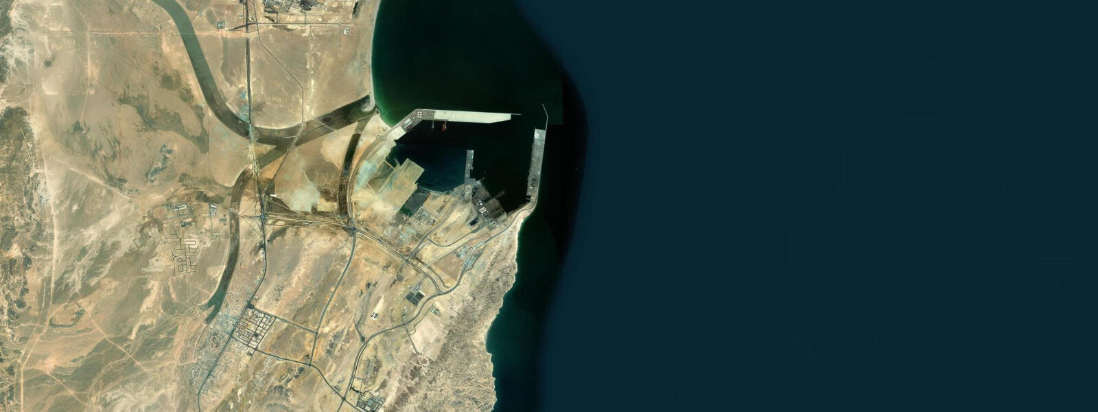
Duqm is Oman's newest large-scale development zone, a Special Economic Zone (SEZ) on the open Arabian Sea coast in Al Wusta Governorate — the most sparsely populated stretch of the Omani coast — where a deep-water port, a dry dock facility, an oil refinery, and associated industrial infrastructure have been built from near-scratch since the 2010s. The rationale for Duqm's development is strategic: the port sits outside the Strait of Hormuz, giving Oman and its trading partners an Arabian Sea export terminal unaffected by any future Hormuz closure. Chinese investment through the Oman-China Joint Investment Fund and the Al Duqm Refinery project has been a significant component of the development financing.
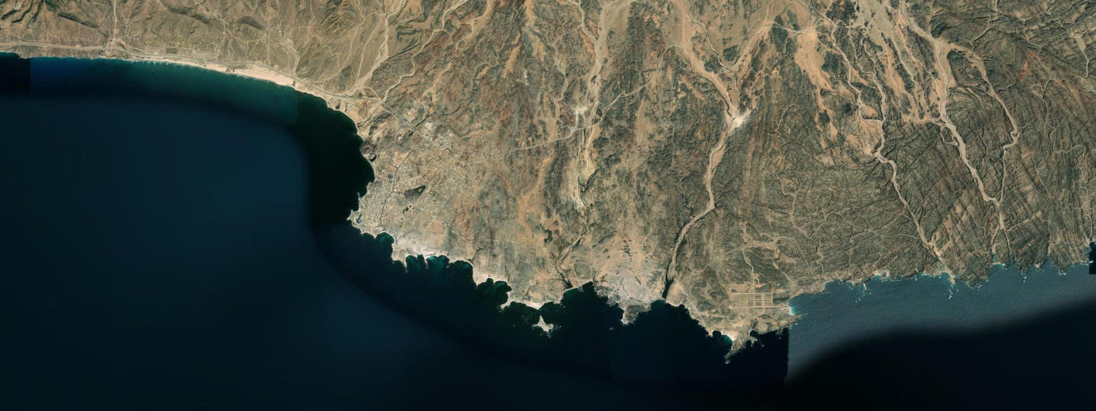
The Duqm Rock (Baat al-Hujarat) is the geological landmark of the coastline in and around Duqm: a series of granite boulders and outcrops on the coast south of the port, sculpted by tens of thousands of years of wind and wave erosion into rounded, stacked, and cantilevered forms that photographers target specifically. The coastal access to the rock formation is straightforward; the boulders are accessible on foot from the coastal road and provide foreground interest for seascape photography. The hard Precambrian granite of this stretch contrasts with the limestone that characterises most of the Omani coast.
Whale sharks (Rhincodon typus) aggregate seasonally in the offshore waters near Duqm — the upwelling system along the Omani coast driven by the southwest monsoon concentrates zooplankton, and whale sharks follow the aggregation. The offshore season broadly coincides with the southwest monsoon period (May to September) when coastal winds are strong and the sea can be rough; boat access to offshore aggregations depends on sea conditions. The Duqm port area has day-boat and dive-boat operators who run whale shark encounters in season, though this is an emerging rather than established tourism infrastructure.
Wadi Shab, one of Oman's most celebrated canyon hikes (a route through a limestone gorge ending at a pool and cave swimmable only by diving under a rock ledge), is approximately 170 km north of Duqm — accessible as a long day trip or with an overnight near Qalhat on the Gulf of Oman coast.
The Arabian Sea tidal regime at Duqm is mixed semidiurnal: mean spring range 1.5 to 2.0 m. The open coast is fully exposed to the southwest monsoon swell from May to September — wave heights of 2 to 4 m are common during this period and the port entrance current and wave action are significant for small craft. The northeast monsoon (November to March) brings calmer conditions and the primary tourist season. Predictions on this page come from Open-Meteo Marine gridded model. The DGMET in Oman publishes the authoritative tide tables for Duqm.
Tide questions about Duqm
Quick answers to the most common questions about tide times, range, and water access at Duqm.
When is the next high tide at Duqm?
The hero block at the top of this page shows the next predicted high at Duqm in local Oman Standard Time (GST, UTC+4). Duqm has an Arabian Sea mixed semidiurnal tide with a spring range of 1.5 to 2.0 m. The Directorate General of Meteorology (DGMET) in Oman publishes the authoritative tide tables for Duqm. During the southwest monsoon (May to September) wave heights of 2 to 4 m on the open coast significantly affect any coastal activity — the swell forecast is as relevant as the tide prediction.
What is the tidal range at Duqm?
Mean spring range at Duqm is 1.5 to 2.0 m — characteristic of the open Arabian Sea coast. Neap range compresses to roughly 0.5 to 1.0 m. Southwest monsoon swell (May to September) dominates coastal conditions and is a larger physical influence than the tide during this period. The northeast monsoon season (November to March) is calmer and more suitable for coastal activities on the exposed shoreline.
Where do these tide predictions come from?
Open-Meteo Marine, a free gridded global ocean model. At Duqm's 1.5 to 2.0 m spring range, the model's typical accuracy (plus or minus 45 minutes, 0.2 to 0.3 m) is 10 to 20 percent of the total signal. For authoritative Omani tide data, the DGMET publishes tide tables for Duqm port. The UKHO also publishes tide tables for the Arabian Sea coast of Oman.
Can I see whale sharks near Duqm?
Whale sharks (Rhincodon typus) aggregate in offshore Omani waters during the southwest monsoon season (May to September), when coastal upwelling concentrates zooplankton along the Omani Arabian Sea coast. The aggregation near Duqm is documented but the infrastructure for organised encounters is less developed than at other Omani whale shark sites (such as Musandam). Day-boat operators in the Duqm port area occasionally run offshore encounters during the season; sea conditions during the southwest monsoon can be rough (2 to 4 m swell), limiting access on many days. The northeast monsoon season (November to March) is calmer but the offshore aggregation is less reliable. Check with local operators on arrival for current season status.
Is this safe to use for navigation?
No. TideTurtle is a planning tool for recreational coastal activity, not a navigation resource. Duqm Port is an active commercial and naval facility; approach channels and vessel movements require standard chart navigation and coordination with port control. The open Arabian Sea coast at Duqm is exposed to significant southwest monsoon swell — small craft operations require careful weather assessment. UKHO charts and DGMET meteorological bulletins are the authoritative sources for navigation and weather planning in this area. Open-Meteo Marine gridded predictions do not replace authoritative navigation sources.
8-day tide table — Duqm
Heights relative to MSL. Predictions: Open-Meteo Marine (MeteoFrance SMOC, 0.08° grid) — heights relative to MSL (not chart datum / LAT). Model-derived.
| Day | Type | Time | Height |
|---|---|---|---|
| Sat 04 Jul | Low | 05:05 | -0.7m |
| High | 12:18 | 1.0m | |
| Low | 18:24 | 0.1m | |
| High | 23:13 | 0.5m | |
| Sun 05 Jul | Low | 05:38 | -0.5m |
| High | 12:39 | 1.0m | |
| Low | 19:10 | -0.1m | |
| Mon 06 Jul | High | 00:16 | 0.5m |
| Low | 06:11 | -0.4m | |
| High | 13:06 | 1.0m | |
| Low | 19:51 | -0.2m | |
| Tue 07 Jul | High | 01:24 | 0.4m |
| Low | 20:42 | -0.4m | |
| Wed 08 Jul | High | 02:52 | 0.4m |
| Low | 07:36 | 0.0m | |
| High | 14:06 | 1.0m | |
| Low | 21:35 | -0.6m | |
| Thu 09 Jul | High | 14:46 | 0.9m |
| Low | 22:35 | -0.8m | |
| Fri 10 Jul | High | 06:21 | 0.5m |
| Low | 10:00 | 0.3m | |
| High | 15:35 | 0.8m | |
| Low | 23:34 | -1.0m | |
| Sat 11 Jul | High | 03:00 | -0.3m |