Mirbat tide times
Mirbat tide forecast — heights relative to MSL.
Today's tide times for Mirbat
Tide times at Mirbat on Sunday, 21 June 2026: first high tide at 04:00am, first low tide at 06:43am, second high tide at 02:03pm. Sunrise 05:48am, sunset 06:57pm.
Tide chart for Mirbat
24-hour cosine-interpolated curve around the present moment. Heights relative to MSL. Predictions: Predictions: Open-Meteo Marine (MeteoFrance SMOC, 0.08° grid).
Sun, moon and conditions on Sun 21 Jun
Snapshot at build time — refreshes daily. Sea state from Open-Meteo Marine.
Highs and lows next 7 days
Every predicted high and low for the next week, with the daily tidal coefficient (0–120; higher = bigger swing, > 95 means stronger currents).
Other spots nearby
The three closest curated TideTurtle locations to Mirbat, measured by great-circle distance.
Today's solunar windows
Solunar tradition: major periods are the ≈3h windows around moon transit and opposition; minor are ≈2h around moonrise and moonset. Pair with the local tide stage and wind for the best read.
Cycle dates near Mirbat
Next spring tide on Fri 26 Jun (range 1.2m). Last neap on Sun 21 Jun.
Spring tides cluster around new and full moons (biggest swings). Neap tides land on quarter moons (smallest swings). See the spring tide and neap tide glossary entries for the why.
About tides at Mirbat
A short guide to the coastline at Mirbat — geography, sea state, and what the tide is actually doing under your feet.
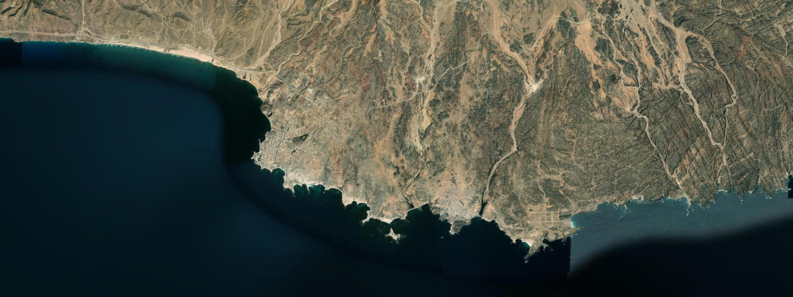
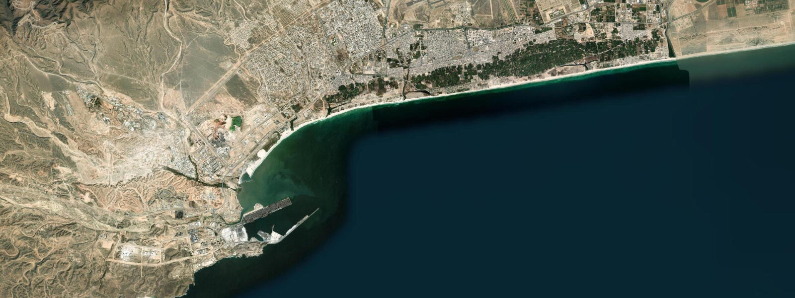
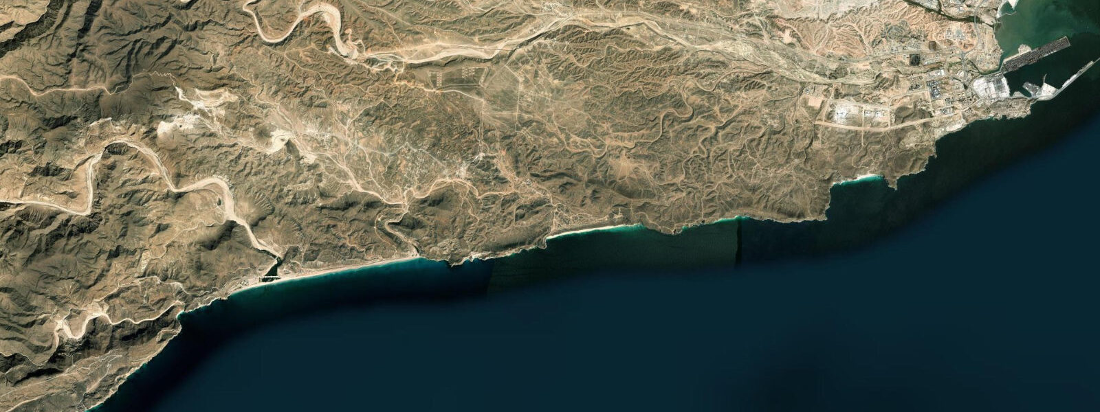
Mirbat is a small historic port 70 km east of Salalah, at the eastern end of the Dhofar coast before the coastline turns toward the arid borderlands with Yemen. The town is built around a small headland that carries a fortified watchtower (the Mirbat Fort, well-preserved and publicly accessible) and a traditional mosque. A sheltered bay forms on the western side of the headland; the fishing harbour operates here in the lee of the rock. The open beach on the eastern side of the headland faces SE into the Arabian Sea and receives swell from the SE year-round.
The tidal regime at Mirbat is mixed semidiurnal, spring range approximately 1.5–2.0 m above Chart Datum — consistent with the rest of the Dhofar coast. INOCAR-equivalent data for this location comes from the National Hydrographic Office of Oman, with Salalah Port as the regional reference station. There is no permanent gauge at Mirbat itself.
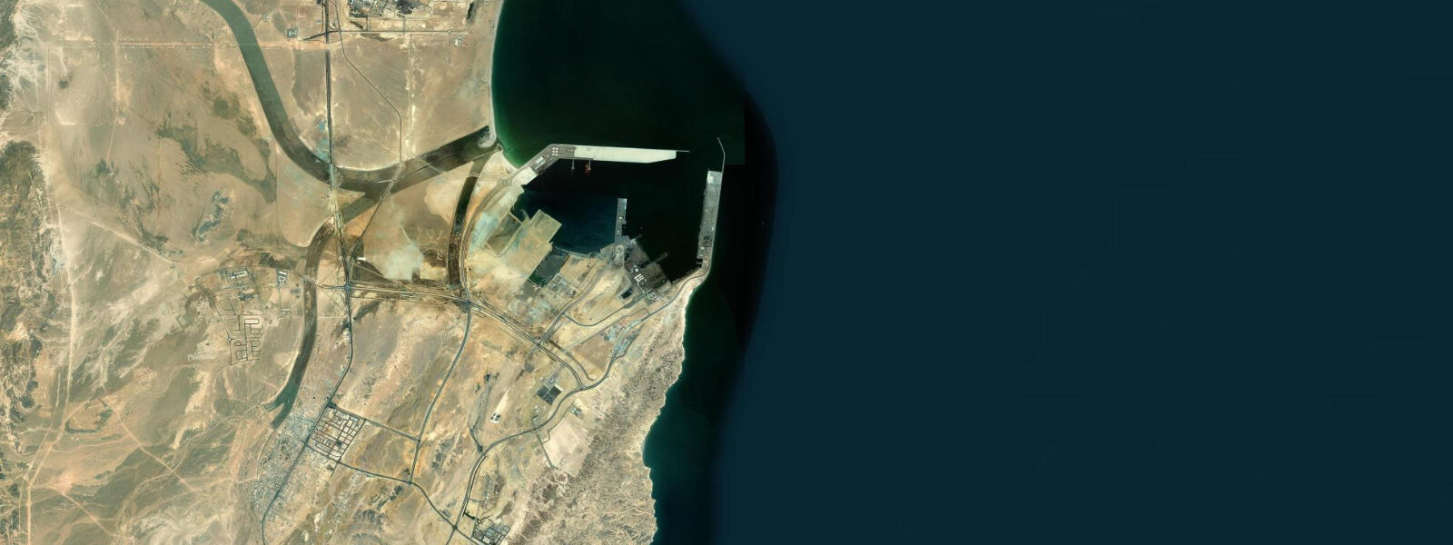
The western, sheltered bay at Mirbat is the operational harbour for the local fishing fleet. Small motorised dhows (shashas — traditional Dhofari fishing boats built from compressed palm fronds, though most modern boats are fibreglass) operate from the harbour. At low water the inner harbour shoals significantly; the 0.5–0.8 m depth over the harbour bar at spring low tide limits access to shallow-draft vessels only. Larger supply boats time their arrival within two hours of the predicted high to clear the bar.
The eastern beach, exposed to SE swell, is a consistent year-round fishing and swimming location outside the khareef months (June–September). During the khareef, east-facing beaches at Mirbat are less severely affected than the SW-facing Salalah beaches — the SE swell direction hits the eastern headland at an oblique angle that provides some mitigation — but conditions are still rough and swimming is not recommended. The dry-season beach (October–May) is wide and flat at low water; shore fishing for kingfish, trevally, and reef species from the beach and the headland rocks is productive on the incoming tide.
Mirbat has historical significance as the site of the Battle of Mirbat (1972), during the Dhofar Rebellion, in which a small SAS unit held the town against a large rebel force from the Yemeni-supported PFLOAG. The watchtower and fort compound are on the headland; entry is free. The combination of the historic fortifications and the working fishing harbour makes Mirbat one of the most authentically Dhofari coastal settlements on this coast, relatively unaffected by the resort development that has reached Salalah and Mughsayl.
Tide predictions here come from Open-Meteo Marine: accuracy ±45 min / ±0.2–0.3 m. National Hydrographic Office of Oman publishes official tide tables with Salalah as the regional reference.
The Mirbat watchtower (Mirbat Fort) sits at the headland tip overlooking the harbour; the fortified compound is one of several surviving examples of the Dhofari defensive architecture that protected coastal settlements from raids during the 17th–19th centuries. The fort is maintained but not heavily visited; access is free and the interior is open to respectful visitors. The view from the fort's upper level encompasses the harbour, the eastern beach, and the Arabian Sea arc to the horizon. In the mornings (before 09:00), the fishing boats return to the harbour from the night's fishing, and the small dock area is active with unloading.
Mirbat's traditional fishing economy is based on hand-line and net fishing from small motorised boats (the local shasha, or fibreglass equivalent) targeting the Arabian Sea reef species. The seasonal albacore and skipjack tuna migration passes offshore from Mirbat in November–January; the local fleet extends its range during these months. The tuna are caught by trolling at speed on the migration routes; the catch is sold at the Salalah fish market, a 70 km road transport away. The beach at Mirbat provides enough flat sand at low water for net-mending and boat maintenance work; the low-tide exposure is also when the fishing boats receive their maintenance season overhaul.
Tide questions about Mirbat
Quick answers to the most common questions about tide times, range, and water access at Mirbat.
Is the Mirbat fishing harbour accessible at all tide states?
No. The inner harbour bar at Mirbat shallows to approximately 0.5–0.8 m at spring low tide. This restricts access to the harbour by larger vessels; the local shallow-draft fishing boats can generally operate at all tide states, but supply or tourist boats with deeper drafts must time arrival within two hours of the predicted high water to clear the bar safely. Check the predicted high time on this page and confirm with local operators before planning a vessel arrival at the harbour. Larger supply boats time their entry at high water; the bar depth of 0.5–0.8 m at spring low is critical for vessels drawing more than 0.5 m.
Where do the tide predictions on this page come from?
Open-Meteo Marine, a free gridded global ocean model. Accuracy is typically ±45 minutes on timing and ±0.2–0.3 m on height. There is no permanent tide gauge at Mirbat; predictions are referenced to Salalah Port, the nearest NHOO (National Hydrographic Office of Oman) reference station. For navigation at Mirbat, use the official Omani tide tables with appropriate offsets. This page is not for navigation. The NHO Oman publishes both tide height tables and tidal current tables for the Dhofar coast; Salalah is the primary reference station.
Is Mirbat's eastern beach affected by the khareef monsoon?
Less severely than the SW-facing beaches at Mughsayl and Salalah. Mirbat's eastern beach faces SE; the dominant khareef swell arrives from the SW and hits the Mirbat headland obliquely, providing some mitigation. However, during August and September when the monsoon is at its peak, swell wraps around the headland and conditions on the eastern beach can still reach 1.5–2.5 m significant wave height — rough enough that swimming is not recommended. October through May is the consistent safe-swimming window at Mirbat. Mirbat's eastern beach aspect is SE-facing; the khareef swell direction is SW, so the beach receives oblique wave energy during the monsoon rather than full direct fetch.
Is shore fishing productive at Mirbat?
Yes. The rock platform at the Mirbat headland and the eastern beach are productive for kingfish (Scomberomorus commerson), trevally (Caranx species), and reef species from October through May. The most consistent window is the incoming tide from roughly one hour after the predicted low through to the high. The eastern beach flat is accessible at low water; the headland rocks require care on wet limestone. Local fishers work the surf zone at the beach edge for corbina and jacks; the headland rocks produce larger pelagic fish on long casts. The fortified watchtower at the headland tip provides an elevated view over the fishing ground; low-tide rock exposure is visible from above.
What is the best way to visit Mirbat from Salalah?
Mirbat is 70 km east of Salalah on a paved coast road, approximately 60–70 minutes by car. Taxis and car hire are available in Salalah. There is no public bus service directly to Mirbat. The drive along the Dhofar coast road passes through several smaller coastal villages and viewpoints; the full return day trip from Salalah including the fort visit and eastern beach is comfortable in a half-day. The fort is open daylight hours with no admission charge. Combine with a morning low-tide beach walk for the widest sand expanse. Car hire is available in Salalah city centre; the drive to Mirbat passes the Taqah Castle and the Khor Rori (Sumhuram) archaeological site.
7-day tide table — Mirbat
Heights relative to MSL. Predictions: Open-Meteo Marine (MeteoFrance SMOC, 0.08° grid) — heights relative to MSL (not chart datum / LAT). Model-derived.
| Day | Type | Time | Height |
|---|---|---|---|
| Sun 21 Jun | High | 04:00 | -0.0m |
| Low | 06:43 | -0.3m | |
| High | 14:03 | 0.8m | |
| Mon 22 Jun | Low | 22:21 | -0.3m |
| Tue 23 Jun | High | 14:55 | 0.7m |
| Low | 23:04 | -0.4m | |
| Wed 24 Jun | High | 15:20 | 0.7m |
| Low | 23:47 | -0.5m | |
| Thu 25 Jun | High | 09:00 | 0.4m |
| Low | 10:00 | 0.4m | |
| High | 15:50 | 0.6m | |
| Fri 26 Jun | Low | 00:23 | -0.6m |
| High | 09:10 | 0.5m | |
| High | 16:18 | 0.6m | |
| Sat 27 Jun | Low | 00:57 | -0.7m |
| High | 17:10 | 0.6m |