Salalah tide times
Salalah tide forecast — heights relative to MSL.
Today's tide times for Salalah
Tide times at Salalah on Sunday, 21 June 2026: first high tide at 04:00am, first low tide at 06:37am, second high tide at 02:02pm. Sunrise 05:50am, sunset 06:59pm.
Tide chart for Salalah
24-hour cosine-interpolated curve around the present moment. Heights relative to MSL. Predictions: Predictions: Open-Meteo Marine (MeteoFrance SMOC, 0.08° grid).
Sun, moon and conditions on Sun 21 Jun
Snapshot at build time — refreshes daily. Sea state from Open-Meteo Marine.
Highs and lows next 7 days
Every predicted high and low for the next week, with the daily tidal coefficient (0–120; higher = bigger swing, > 95 means stronger currents).
Other spots nearby
The three closest curated TideTurtle locations to Salalah, measured by great-circle distance.
Today's solunar windows
Solunar tradition: major periods are the ≈3h windows around moon transit and opposition; minor are ≈2h around moonrise and moonset. Pair with the local tide stage and wind for the best read.
Cycle dates near Salalah
Next spring tide on Fri 26 Jun (range 1.2m). Next neap on Mon 22 Jun.
Spring tides cluster around new and full moons (biggest swings). Neap tides land on quarter moons (smallest swings). See the spring tide and neap tide glossary entries for the why.
About tides at Salalah
A short guide to the coastline at Salalah — geography, sea state, and what the tide is actually doing under your feet.
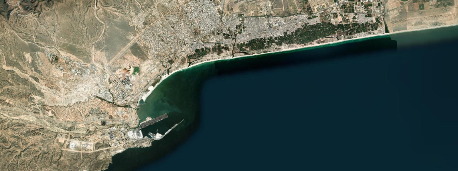
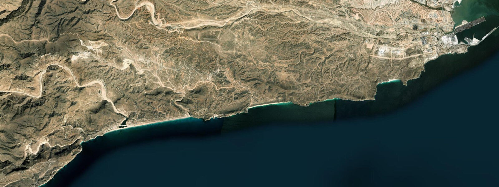
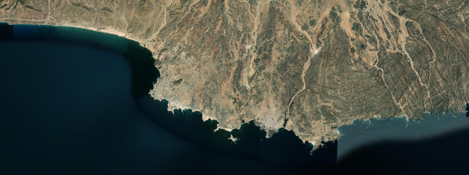
Salalah is the capital of Dhofar Governorate and the second-largest city in Oman, located on the Arabian Sea coast at 17°N. The city faces south-southwest across the open Indian Ocean; the Qara Mountains rise immediately to the north, a 1,000 m escarpment that intercepts the SW monsoon and creates the khareef climate phenomenon that defines Salalah's coastal character.
The tidal regime at Salalah is mixed semidiurnal. Spring range is approximately 1.5–2.0 m above Chart Datum; neap range 0.5–1.0 m. The diurnal inequality at this latitude is more pronounced than at Muscat — on some lunar phases, the two daily highs differ by 0.5–0.8 m, producing a noticeably asymmetric tidal day. The Arabian Sea coast here has a wide, gently sloping sandy shelf; at spring low water the beach expands seaward by 80–120 m at the main Salalah beach areas (Al Mughsayl and Ayn Athum).
The defining event on the Salalah coast is the khareef monsoon (June–September). As the SW monsoon pushes north across the Arabian Sea, it hits Dhofar's coast and mountains with enough intensity to bring consistent fog, mist, drizzle, and occasionally heavy rain. The normally arid Qara Mountain hillsides turn green — a phenomenon that draws domestic tourists from across Oman and the Gulf escaping the intense summer heat elsewhere. During the khareef the sea is rough: SW swell builds throughout June and July, reaching 2.5–4.0 m significant wave height at exposed beaches by August. Swimming is prohibited at most Salalah beaches during the khareef; the beach access points at Al Mughsayl post red flags from June through September.
Outside the khareef — October through May — Salalah's beaches are calm, clear, and warm. The main beach destinations are Al Mughsayl (25 km west of Salalah, with the famous khareef-season blowholes) and Ayn Athum (10 km west). The dry-season beaches have fine white sand, clear turquoise water, and very light wave action. Sea surface temperatures run 24–28°C from October through May.
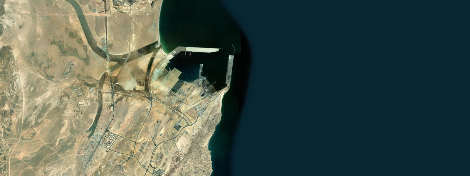
Shore fishing from the beach and the rocky points west of Salalah targets kingfish (Scomberomorus commerson), trevally (Caranx species), and various reef species on the incoming tide. The rocky platform at the base of the bluffs west of Al Mughsayl is accessible at low water and carries a productive intertidal zone; fishing from the rock edge on the incoming tide, one to two hours after the predicted low, is the most reliable window. Tide predictions here come from Open-Meteo Marine: accuracy ±45 min / ±0.2–0.3 m. The National Hydrographic Office of Oman publishes official Omani tide tables.
The Frankincense Museum (Bait Al Zubair Museum Salalah branch) in the Salalah old town area is the clearest introduction to Dhofar's identity as the historical source of most of the world's finest frankincense; the Wadi Dawkah frankincense tree nature reserve is 35 km north of Salalah on the road to the interior. The coastal road west from Salalah to Al Mughsayl passes through the Ain Hamran wadi area where freshwater springs meet the coast, creating a rare moist microclimate. The combination of the khareef moisture on the mountains, the accessible beaches, and the frankincense heritage makes Salalah the most complete coastal destination in Oman.
The Dhofar mountains visible from Salalah's beaches form a 1,000 m escarpment that intercepts moisture from the SW monsoon with remarkable efficiency. The contrast between the arid northern slopes (visible from the Salalah–Muscat highway where the khareef influence ends abruptly) and the green southern slopes facing the Arabian Sea is one of the most dramatic landscape transitions in Arabia. The archaeological site at Khor Rori (Sumhuram), 30 km east of Salalah on the coast, was an ancient frankincense trading port; the coastal lagoon (khor) at the site mouth is tidal, and the ancient port infrastructure is visible above the current lagoon water level.
Tide questions about Salalah
Quick answers to the most common questions about tide times, range, and water access at Salalah.
When is the best time to visit Salalah's beaches, and what is the khareef?
The best beach season at Salalah is October through May when the Arabian Sea is calm, the water clear, and temperatures comfortable (24–28°C sea, 25–32°C air). From June through September the khareef SW monsoon brings rough seas, fog, and heavy surf to the Dhofar coast — swimming is prohibited at most beaches during this period. The khareef transforms the arid Qara Mountains green and draws visitors for the scenery, but the beaches are not swimmable. For coastal activities in the water, visit outside the khareef window. The transition out of the khareef is rapid; the coast typically turns calm within a week of the monsoon's official end in late September.
Where do the tide predictions on this page come from?
Open-Meteo Marine, a free gridded global ocean model. Accuracy is typically ±45 minutes on timing and ±0.2–0.3 m on height. The National Hydrographic Office of Oman publishes official tide tables for Salalah Port and other Omani stations; these are the authoritative source for navigation and any safety-critical tidal timing. This page is not for navigation. NOAA's World Port Index includes Salalah as a reference port; the NHO Oman tables are the primary source for local navigation. The PORT SALALAH harbour authority maintains a daily tide board at the port operations centre.
How much does the beach at Salalah change between high and low tide?
The spring tidal range at Salalah is approximately 1.5–2.0 m above Chart Datum, and the gently sloping sandy shelf means this range translates to a large horizontal beach change: roughly 80–120 m of additional sand exposed at a spring low compared to spring high water at the main Salalah beaches (Al Mughsayl, Ayn Athum). At neap tide the change is around 30–50 m. The exposed sand at low water is firm and walkable; beach walkers get the widest expanse in the two hours centred on the predicted low. The 120 m beach change from high to low at Salalah is one of the larger horizontal tidal extents on the Arabian Sea coast, due to the very gentle sand slope.
Are the Al Mughsayl blowholes a tide-dependent feature?
The blowholes are driven by wave action forcing water and air through limestone fissures in the coastal rock platform. They are most dramatic during the khareef (June–September) when SW swell regularly reaches 2.5–4.0 m and the blowholes erupt with columns of spray 10–20 m high. Outside the khareef, on days with swell above 1.0 m, the blowholes still function but with less intensity. Tide state affects the blowholes indirectly: at high water the platform above the fissures is shallower and more wave energy reaches the holes; at low water the blowholes are less active because the rock platform partially drains between waves. The blowholes at Al Mughsayl are accessible by a short walk from the cliff-top car park and viewing area.
Is fishing from the rocky points near Salalah productive?
Shore fishing from the rocky points and the lower cliff platforms west of Salalah is productive for kingfish (Scomberomorus commerson), trevally, and grouper from October through May. The most consistent window is the incoming tide — from roughly one hour after the predicted low through to high water — when predatory fish move over the platform in pursuit of bait. The rocky shelf is accessible at low water; use care on wet limestone, which is slippery. During the khareef (June–September), the platform is hazardous and shore fishing is inadvisable due to rough seas. The rocky platform ledges at the base of the coastal bluffs west of Salalah are accessible for two to three hours centred on the spring low; confirm the low time on this page.
7-day tide table — Salalah
Heights relative to MSL. Predictions: Open-Meteo Marine (MeteoFrance SMOC, 0.08° grid) — heights relative to MSL (not chart datum / LAT). Model-derived.
| Day | Type | Time | Height |
|---|---|---|---|
| Sun 21 Jun | High | 04:00 | -0.0m |
| Low | 06:37 | -0.3m | |
| High | 14:02 | 0.8m | |
| Mon 22 Jun | Low | 07:06 | -0.0m |
| High | 14:24 | 0.8m | |
| Low | 22:21 | -0.3m | |
| Tue 23 Jun | High | 05:10 | 0.2m |
| Low | 07:00 | 0.2m | |
| High | 14:55 | 0.7m | |
| Low | 23:04 | -0.4m | |
| Wed 24 Jun | High | 15:20 | 0.7m |
| Low | 23:45 | -0.5m | |
| Thu 25 Jun | High | 15:47 | 0.6m |
| Fri 26 Jun | Low | 00:23 | -0.6m |
| High | 16:15 | 0.6m | |
| Sat 27 Jun | Low | 00:54 | -0.7m |
| High | 17:00 | 0.6m |