Senja tide times
Senja tide forecast — heights relative to MSL.
Today's tide times for Senja
Tide times at Senja on Sunday, 21 June 2026: first low tide at 02:00, first high tide at 06:26, second low tide at 12:58, second high tide at 19:16.
Tide chart for Senja
24-hour cosine-interpolated curve around the present moment. Heights relative to MSL. Predictions: Predictions: Open-Meteo Marine (MeteoFrance SMOC, 0.08° grid).
Sun, moon and conditions on Sun 21 Jun
Snapshot at build time — refreshes daily. Sea state from Open-Meteo Marine.
Highs and lows next 7 days
Every predicted high and low for the next week, with the daily tidal coefficient (0–120; higher = bigger swing, > 95 means stronger currents).
Other spots nearby
The three closest curated TideTurtle locations to Senja, measured by great-circle distance.
Today's solunar windows
Solunar tradition: major periods are the ≈3h windows around moon transit and opposition; minor are ≈2h around moonrise and moonset. Pair with the local tide stage and wind for the best read.
Cycle dates near Senja
Last spring tide on Sun 21 Jun (range 1.8m). Next spring tide on Sat 27 Jun (range 1.4m). Next neap on Thu 25 Jun.
Spring tides cluster around new and full moons (biggest swings). Neap tides land on quarter moons (smallest swings). See the spring tide and neap tide glossary entries for the why.
About tides at Senja
A short guide to the coastline at Senja — geography, sea state, and what the tide is actually doing under your feet.
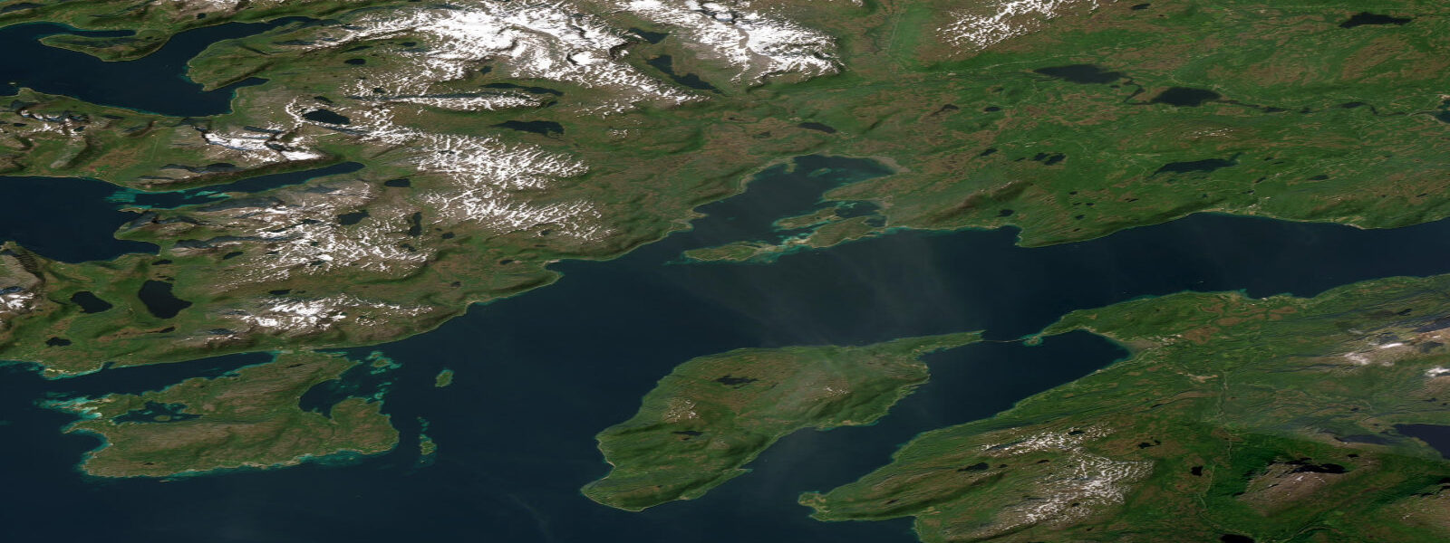
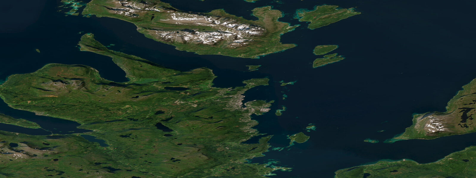
Senja is Norway's second-largest island at approximately 1,580 square kilometres, positioned between Tromsø (80 km north by road) and the inner Troms fjord system. The island's western coast faces the open Norwegian Sea with a wall of mountains — summits to 1,000 metres — rising almost directly from the waterline in a manner that has earned the island a reputation as one of Norway's most dramatic coastal landscapes. Mean spring tidal range is approximately 2.0 metres above Chart Datum. The tidal current in Gisund — the main strait between Senja and the mainland to the east — runs consistently on each tide cycle and is the primary navigational variable for small boats approaching from the mainland ferry crossing.
The Senjatrollet landscape area on the western coast encompasses the most dramatic section — the peaks above Mefjordvær, Husøy, and Berg rise steeply from narrow fjord inlets, with the Segla peak (639 m) standing directly above Mefjordvær village in a profile that photographs as a near-perfect pyramid from the water. These peaks are accessible as day hikes from the coastal villages and look entirely different from the fjord than from the summit. The viewpoint from the water — from a kayak or a small fishing boat approaching along the inner coastline — gives the only scale reference that makes the vertical relief comprehensible.
Senja is still a working fishing island. Husøy is a small island village connected to Senja by bridge, with an active fishing fleet landing predominantly cod and saithe from the winter and spring Norwegian Sea fisheries. The Senja winter cod season (January through March) brings larger boats into the outer passages, and the village harbours fill with vessels working the coastal banks. The island's processing facilities handle catch through the season. Shore fishing from the rocky foreshore on the outer coast targets saithe and cod on the current lines at the fjord mouths.
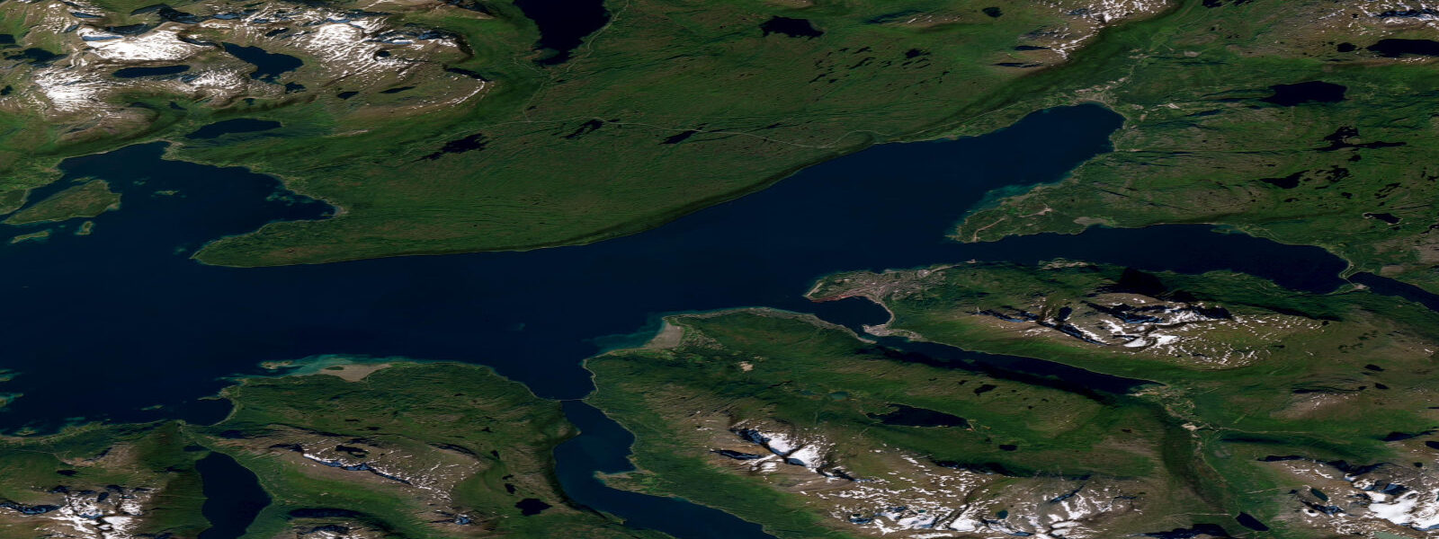
For sea kayakers, Senja's inner fjord system — Bergsfjord, Gisund, and the sheltered passages between the inner skerries — offers a protected route with strong tidal current that can be used or managed depending on the passage. The outer coast is fully exposed to Norwegian Sea swell and is for experienced paddlers only; the fjord walls are steep-to and landing options on the outer coast are limited. Water temperature in summer runs 9 to 13 degrees Celsius; a drysuit is the appropriate choice for multi-day touring at this latitude.
The midnight sun over the Senja western peaks runs from approximately late May to mid-July. The combination of near-vertical mountain faces, the reflective fjord water in the inlets below them, and continuous summer daylight creates one of the highest-contrast photographic environments in Arctic Norway. Photographers specifically target the ridge light on Segla and the adjacent Hesten (614 m) from the fjord at midnight.
Sea eagles nest on the Senja fjord cliffs throughout the island. The inner fjord margins — particularly in Bergsfjord and the smaller inlets on the eastern shore — have resident pairs whose territories have been stable for decades. Encounters from a low-profile kayak in the inner fjord are essentially guaranteed on a multi-day circuit.
Tide predictions on this page come from Open-Meteo Marine, a global gridded ocean model — typically within plus or minus 45 minutes on timing and 0.2 to 0.3 metres on height. For authoritative Norwegian tide predictions, consult Kartverket (Norwegian Mapping Authority) at kartverket.no/sehavniva.
Tide questions about Senja
Quick answers to the most common questions about tide times, range, and water access at Senja.
What is the tidal range at Senja?
Mean spring tidal range at Senja is approximately 2.0 metres above Chart Datum. The tide is semidiurnal. Tidal current in Gisund — the strait separating Senja from the mainland — is the primary navigational variable for small boats and sea kayakers approaching from the mainland ferry terminals at Botnhamn or from Lenvik. The outer coast facing the Norwegian Sea experiences the full macrotidal range without fjord attenuation. Kartverket (Norwegian Mapping Authority) publishes authoritative tidal predictions for this coast at kartverket.no/sehavniva.
What is the Senjatrollet landscape, and can I see it from the water?
Senjatrollet is the protected landscape designation covering the western coastal strip of Senja — a sequence of steep fjord inlets beneath peaks to 1,000 metres, most recognisably Segla (639 m) above Mefjordvær and Hesten (614 m) nearby. Both peaks are accessible as day hikes from the fjord-side villages (2 to 3 hours return, demanding gradient). From the water — approaching by kayak or boat along the inner coast — the vertical relief is more apparent than from any land viewpoint, because the base of the cliff starts at the waterline and the summit is directly above. The inner fjord approach from Gisund southward gives the clearest perspective on the Segla profile.
Is sea kayaking around Senja accessible for intermediate paddlers?
The inner fjord system on Senja's eastern and southern coast — Gisund, Bergsfjord, and the sheltered mainland-side passages — is manageable for competent intermediate sea kayakers in settled conditions. Tidal current in Gisund requires timing; at spring tides the stream runs consistently and paddling against it in a loaded touring kayak is slow and tiring. The outer western coast — facing the Norwegian Sea below the Senjatrollet peaks — is for experienced sea kayakers with self-rescue capability and open-water Atlantic experience. Landing options on the outer coast are limited: the fjord walls are steep-to and many sections have no accessible beach below the cliff base. Water is 9 to 13 degrees Celsius in summer; a drysuit or 5mm wetsuit minimum.
When is the best time to visit Senja for photography?
Two distinct windows. In summer (late May to mid-July), midnight sun gives continuous directional light on the Segla and Hesten peaks from the fjord below — the most intense period is 22:00 to 02:00 when the sun catches the western rock faces at near-horizontal angle and the fjord inlets below are often calm. In autumn (late September to late October), the peaks get early snow while the fjord water is still relatively warm, creating contrast, and the days are short enough for golden-hour light across a large portion of the day. The northern lights become visible again from late September through polar night. Winter access to the outer coast is complicated by weather and road conditions; local knowledge about the Senja Coastal Route (Senja Scenic Route, National Tourist Route) conditions is essential.
Is this tide data suitable for planning passages through Gisund?
Tide predictions on this page come from Open-Meteo Marine, a global gridded ocean model — model-derived, not from a local gauge. Accuracy is typically within plus or minus 45 minutes on timing and 0.2 to 0.3 metres on height. For orientation and general recreational planning, this is a useful reference. For tidal current timing in Gisund and the island passages around Senja — where stream timing and rate are operationally relevant for kayak and small-boat passages — Kartverket (Norwegian Mapping Authority) publishes authoritative tidal predictions and current tables at kartverket.no/sehavniva. This site does not provide navigational guidance; verify independently before any marine passage.
8-day tide table — Senja
Heights relative to MSL. Predictions: Open-Meteo Marine (MeteoFrance SMOC, 0.08° grid) — heights relative to MSL (not chart datum / LAT). Model-derived.
| Day | Type | Time | Height |
|---|---|---|---|
| Sun 21 Jun | Low | 02:00 | -0.7m |
| High | 06:26 | 0.6m | |
| Low | 12:58 | -1.3m | |
| High | 19:16 | 0.4m | |
| Mon 22 Jun | Low | 13:55 | -1.1m |
| High | 20:12 | 0.3m | |
| Tue 23 Jun | Low | 02:12 | -0.9m |
| High | 08:35 | 0.2m | |
| Low | 14:41 | -1.1m | |
| High | 21:15 | 0.2m | |
| Wed 24 Jun | Low | 03:08 | -0.9m |
| High | 09:39 | 0.3m | |
| Low | 15:36 | -0.9m | |
| High | 22:12 | 0.4m | |
| Thu 25 Jun | Low | 04:12 | -0.8m |
| High | 10:35 | 0.2m | |
| Low | 16:33 | -0.9m | |
| High | 23:07 | 0.3m | |
| Fri 26 Jun | Low | 05:04 | -0.9m |
| High | 11:27 | 0.2m | |
| Low | 17:21 | -1.0m | |
| High | 23:55 | 0.2m | |
| Sat 27 Jun | Low | 05:55 | -1.1m |
| High | 12:15 | 0.2m | |
| Low | 18:12 | -1.1m | |
| Sun 28 Jun | High | 01:00 | 0.3m |