
Stavanger tide times
Stavanger tide forecast — heights relative to MSL.
Today's tide times for Stavanger
Tide times at Stavanger on Friday, 31 July 2026: first high tide at 02:40, first low tide at 05:49, second high tide at 08:25, second low tide at 08:42, third high tide at 12:01, third low tide at 18:04, fourth high tide at 21:18, fourth low tide at 21:34. Sunrise 05:19, sunset 22:05.
Tide chart for Stavanger
24-hour cosine-interpolated curve around the present moment. Heights relative to MSL. Predictions: Predictions: Open-Meteo Marine (MeteoFrance SMOC, 0.08° grid).
Sun, moon and conditions on Fri 31 Jul
Snapshot at build time — refreshes daily. Sea state from Open-Meteo Marine.
Highs and lows next 7 days
Every predicted high and low for the next week, with the daily tidal coefficient (0–120; higher = bigger swing, > 95 means stronger currents).
Other spots nearby
The three closest curated TideTurtle locations to Stavanger, measured by great-circle distance.
Today's solunar windows
Solunar tradition: major periods are the ≈3h windows around moon transit and opposition; minor are ≈2h around moonrise and moonset. Pair with the local tide stage and wind for the best read.
Cycle dates near Stavanger
Last spring tide on Fri 31 Jul (range 0.7m). Next neap on Thu 06 Aug.
Spring tides cluster around new and full moons (biggest swings). Neap tides land on quarter moons (smallest swings). See the spring tide and neap tide glossary entries for the why.
About tides at Stavanger
A short guide to the coastline at Stavanger — geography, sea state, and what the tide is actually doing under your feet.
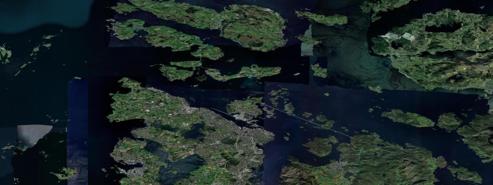
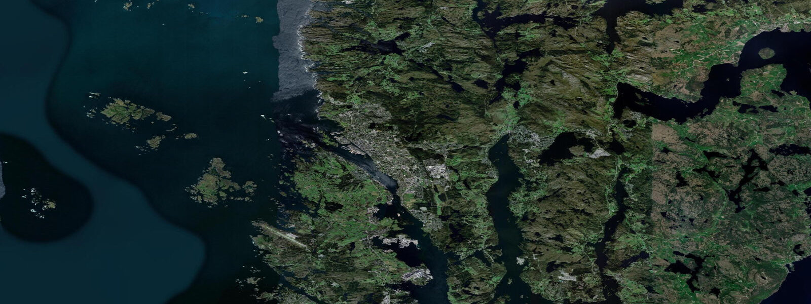
Stavanger occupies a peninsula at the edge of the Boknafjord, surrounded by an archipelago so fragmented it is easier to count the passages between islands than the islands themselves. The city's double identity — old wooden town of painted merchants' houses on one side, global oil capital on the other — has shaped the waterfront in ways visible from any boat passing the harbour mouth. Offshore supply vessels, crew-transfer boats, and the occasional seismic survey ship share the approaches with recreational fishing boats and the archipelago ferries that thread between the islands toward Tau and Jelsa. Lysefjord, the fjord that draws the tourists, starts about 25 kilometres from Stavanger by water, cutting east through increasingly steep walls until the cliffs at Preikestolen rise straight from the surface.
The tide in Stavanger is semidiurnal — two highs and two lows per day — with a mean spring range of approximately 0.6 to 0.8 metres. That modest range is unremarkable in isolation, but Rogaland's geography means it matters in context. In open water across the Boknafjord, the 0.7-metre spring tide produces tidal streams of 0.3 to 0.5 knots — calm water, generally. In the narrows between islands, where the same volume of water moves through a gap a fraction of the width, streams run 1.5 to 3 knots on springs. The Mastrafjord, the passage east of Stavanger toward the fjord system, concentrates tidal flow noticeably. Kayakers crossing between islands plan crossings with the stream rather than across it. Small fishing boats run timed departures through the island gaps at slack or with the flood, depending on direction.
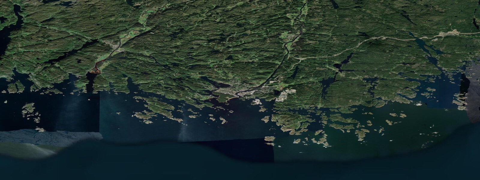
In Lysefjord itself, the tidal influence is present but quiet through most of the fjord's 42-kilometre length. The walls are close enough in several places that shade falls across the water for hours mid-day in winter, and the waterfalls — Hengjanefossen and several unnamed seasonal falls — drop freshwater directly into the fjord year-round. That freshwater stays on the surface, less dense than the salt water below, creating a halocline at depth that divers encounter as a blurred visibility layer. Boat tour operators running from Stavanger out to Preikestolen base departures on weather windows more than tidal state, but passage through the outer skerry narrows does get timed around stream conditions.
Fishing in Rogaland covers the full range: jigging for saithe and cod in the island channels from mid-summer through autumn, mackerel shoals in the outer Boknafjord from June onward, and pollock working the current lines behind the skerry edges. The fish follow the tidal current at the pinch points. Shore fishing from island rocks at the mouth of active narrows — the locals call it merking, marking a spot — works best on the ebb when current acceleration concentrates prey. Kayak fishing has grown significantly over the past decade, and the inner archipelago with its numerous protected coves and accessible passages is well-suited to it. The water temperature runs 12 to 17 degrees Celsius through summer, cold enough that a wetsuit is appropriate for extended immersion even on a warm August afternoon.
Swimmers use the sheltered coves within the archipelago rather than open water — Solastranden south of Stavanger airport is the main swimming beach, a kilometre of sand facing southwest, open to any south or southwest swell but sheltered from northwest by the peninsula. The tidal change is 0.6 metres spring range, which shifts the beach width meaningfully at a flat beach: 50 metres of dry sand at high water becomes 80 metres at low, with a sandbar exposed in the gentler conditions. Photographers working the coastline come for the evening light on the granite skerries near Sola and Tananger, and for the winter conditions when the Boknafjord surface goes flat in calm freezing air and the light quality around the winter solstice is unlike anything on a lower-latitude coast.
The Norwegian Meteorological Institute's Yr.no service provides combined tide and weather forecasts for this coast, and the Norwegian Mapping Authority (Kartverket) publishes the authoritative tidal current tables for the island narrows and fjord passages. Tide predictions on this page come from Open-Meteo Marine, a global gridded ocean model — typically accurate within plus or minus 45 minutes on timing and 0.2 to 0.3 metres on height, model-derived, not a local gauge. For the outer Boknafjord and Stavanger harbour area, that accuracy is generally sufficient for recreational planning. For the inner narrows and fjord passages where tidal current timing matters, Kartverket's local tables are the authoritative reference.
Tide questions about Stavanger
Quick answers to the most common questions about tide times, range, and water access at Stavanger.
What is the tidal range at Stavanger?
Mean spring tidal range at Stavanger is approximately 0.6 to 0.8 metres — modest by Atlantic and North Sea standards. The tide is semidiurnal: two high waters and two low waters per day, separated by roughly six-hour intervals. Neap ranges are smaller still, typically 0.3 to 0.5 metres. The small range does not mean tidal currents are irrelevant across the region: the Rogaland archipelago forces the same tidal volume through numerous narrow passages between islands, and those pinch points can produce streams of 1.5 to 3 knots on springs. For open water in the Boknafjord, the tide produces gentle currents. For island-crossing by kayak or small boat, current timing at the narrows is the relevant variable. Open-Meteo Marine predictions on this page are model-derived, typically within plus or minus 45 minutes on timing and 0.2 to 0.3 metres on height.
When is the best time to take a boat trip to Lysefjord and Preikestolen?
Lysefjord boat tours from Stavanger are primarily governed by weather and daylight, not tidal state — the fjord itself has gentle tidal currents through most of its length. The outer passage through the Rogaland archipelago involves some island narrows where tidal stream timing matters for small boats. Most commercial operators run departures in the morning to arrive at Preikestolen viewpoint and Kjeragbolten vicinity in mid-morning light, returning on afternoon departures. The fjord walls are so high that direct light reaches the water surface only for a few hours mid-day in winter, making summer visits more productive for photography. July and August bring the flattest water and longest light. Spring and autumn offer emptier fjords and better low-angle light at cost of shorter windows and less predictable conditions.
Is kayaking safe around the Stavanger archipelago?
Kayaking in the Rogaland archipelago is well-established and the sheltered passages between islands make it accessible for intermediate paddlers in settled weather. The primary variables to manage are tidal current in the narrows and exposure to swell and wind in the outer passages. In the inner archipelago between Stavanger and the island chain to the west and south, passages are short and currents generally manageable. The outer skerries toward Tungenes and Sola face open water and can develop significant chop quickly when southwest wind builds against an Atlantic swell. The Norwegian Mapping Authority (Kartverket) publishes tidal current tables for the main island passages; checking stream timing before crossing a busy narrows is standard practice among local paddlers. Water temperature runs 12 to 17 degrees Celsius in summer — cold enough that immersion without a wetsuit carries hypothermia risk.
What fish are found in the waters around Stavanger?
Saithe, cod, and pollock dominate the deepwater jigging in the island channels from mid-summer through autumn. Mackerel arrive in the outer Boknafjord from June and can be caught from kayak, small boat, or the ferry quays during feeding runs close to the surface. Coalfish (sei) run with the mackerel. Shore fishing from rocky points at island narrows works on the ebb current for pollock and saithe. The tidal current concentration at island gaps creates feeding ambush points that fish have used for as long as the fjords have existed. Lobster fishing (within legal seasons and permit rules) occupies many local boats in early autumn. Halibut are taken in deeper water channels in the outer fjord, typically boat-fished with larger baits on the bottom.
Where does the Stavanger tide data come from?
Tide predictions on this page are generated by Open-Meteo Marine, a free global ocean model — model-derived, not measured at a local gauge. Accuracy is typically within plus or minus 45 minutes on timing and 0.2 to 0.3 metres on height. For the outer Boknafjord and Stavanger harbour approaches, that resolution is adequate for most recreational planning. For tidal current timing in the island narrows and inner fjord passages — which is the operationally relevant variable in Rogaland rather than water height — the Norwegian Mapping Authority (Kartverket) publishes tidal stream atlases and current tables for the main passages. The Norwegian Meteorological Institute's Yr.no service combines tide and weather for this coastline in a single forecast interface used widely by Norwegian coastal users.
8-day tide table — Stavanger
Heights relative to MSL. Predictions: Open-Meteo Marine (MeteoFrance SMOC, 0.08° grid) — heights relative to MSL (not chart datum / LAT). Model-derived.
| Day | Type | Time | Height |
|---|---|---|---|
| Fri 31 Jul | High | 02:40 | -0.3m |
| Low | 05:49 | -0.7m | |
| High | 08:25 | -0.4m | |
| Low | 08:42 | -0.5m | |
| High | 12:01 | -0.1m | |
| Low | 18:04 | -0.7m | |
| High | 21:18 | -0.3m | |
| Low | 21:34 | -0.4m | |
| Sat 01 Aug | High | 00:21 | -0.0m |
| Low | 06:33 | -0.7m | |
| High | 09:17 | -0.4m | |
| Low | 09:52 | -0.4m | |
| High | 12:49 | -0.1m | |
| Low | 18:51 | -0.7m | |
| High | 22:10 | -0.3m | |
| Low | 22:34 | -0.3m | |
| Sun 02 Aug | High | 01:09 | -0.0m |
| Low | 07:16 | -0.7m | |
| High | 10:13 | -0.4m | |
| Low | 10:48 | -0.4m | |
| High | 13:38 | -0.1m | |
| Low | 16:25 | -0.4m | |
| High | 16:40 | -0.4m | |
| Low | 19:38 | -0.7m | |
| High | 22:26 | -0.3m | |
| Low | 23:33 | -0.3m | |
| Mon 03 Aug | High | 01:56 | -0.1m |
| Low | 08:03 | -0.8m | |
| High | 11:03 | -0.4m | |
| Low | 11:48 | -0.4m | |
| High | 14:23 | -0.2m | |
| Low | 17:20 | -0.5m | |
| High | 17:43 | -0.5m | |
| Low | 20:22 | -0.7m | |
| High | 23:15 | -0.3m | |
| Tue 04 Aug | Low | 00:18 | -0.4m |
| High | 02:48 | -0.1m | |
| Low | 08:49 | -0.7m | |
| High | 11:47 | -0.3m | |
| Low | 12:50 | -0.4m | |
| High | 15:12 | -0.1m | |
| Low | 18:06 | -0.5m | |
| High | 18:51 | -0.4m | |
| Low | 21:07 | -0.6m | |
| Wed 05 Aug | High | 00:03 | -0.2m |
| Low | 01:16 | -0.3m | |
| High | 03:35 | -0.1m | |
| Low | 06:26 | -0.5m | |
| High | 07:00 | -0.4m | |
| Low | 09:43 | -0.6m | |
| High | 12:20 | -0.3m | |
| Low | 13:48 | -0.4m | |
| High | 16:00 | -0.2m | |
| Low | 18:56 | -0.5m | |
| High | 19:53 | -0.5m | |
| Low | 22:00 | -0.6m | |
| Thu 06 Aug | High | 00:50 | -0.3m |
| Low | 02:13 | -0.4m | |
| High | 04:22 | -0.2m | |
| Low | 07:15 | -0.6m | |
| High | 08:18 | -0.5m | |
| Low | 10:33 | -0.7m | |
| High | 13:11 | -0.3m | |
| Low | 14:41 | -0.4m | |
| High | 16:52 | -0.2m | |
| Low | 19:23 | -0.5m | |
| High | 20:50 | -0.4m | |
| Low | 22:54 | -0.6m | |
| Fri 07 Aug | High | 01:00 | -0.3m |