Napier tide times
Napier tide forecast — heights relative to MSL.
Tide chart for Napier
24-hour cosine-interpolated curve around the present moment. Heights relative to MSL. Predictions: Predictions: Open-Meteo Marine (MeteoFrance SMOC, 0.08° grid).
Sun, moon and conditions on Tue 23 Jun
Snapshot at build time — refreshes daily. Sea state from Open-Meteo Marine.
Highs and lows next 7 days
Every predicted high and low for the next week, with the daily tidal coefficient (0–120; higher = bigger swing, > 95 means stronger currents).
Other spots nearby
The three closest curated TideTurtle locations to Napier, measured by great-circle distance.
Today's solunar windows
Solunar tradition: major periods are the ≈3h windows around moon transit and opposition; minor are ≈2h around moonrise and moonset. Pair with the local tide stage and wind for the best read.
Cycle dates near Napier
Last spring tide on Sun 21 Jun (range 1.4m). Next neap on Sat 27 Jun.
Spring tides cluster around new and full moons (biggest swings). Neap tides land on quarter moons (smallest swings). See the spring tide and neap tide glossary entries for the why.
About tides at Napier
A short guide to the coastline at Napier — geography, sea state, and what the tide is actually doing under your feet.
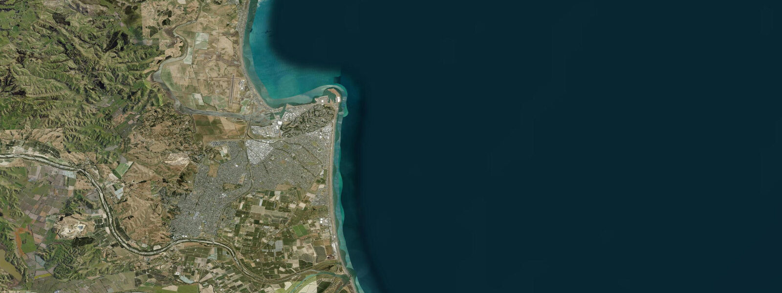
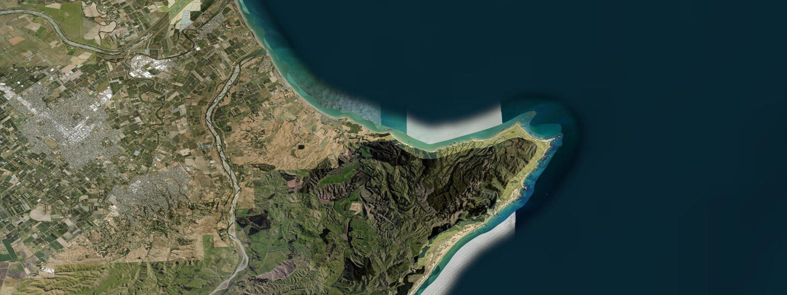
Napier stands on a peninsula on the Hawke's Bay coast, the result of one of the most dramatic geological events in New Zealand's modern history. The 1931 Hawke's Bay earthquake — magnitude 7.8, centred beneath the bay on 3 February — raised the land surface by 1.5 to 2.0 metres over a single day. The seafloor beneath the tidal lagoon of Ahuriri was lifted clear of the water, draining 37 km² of tidal flat and shallow harbour overnight. The lagoon became land; that land is now Napier's city centre, its airport, and the industrial port. The remnant of the lagoon — Ahuriri Estuary — survives as a 500-hectare wildlife reserve at the northwest end of the city, one of the best coastal bird habitats in the North Island.
The earthquake killed 256 people and destroyed virtually every building in Napier. The reconstruction between 1931 and 1933 produced a city built almost entirely in the Art Deco style then at its peak of popularity — one of the world's most coherent and intact Art Deco streetscapes. Emerson Street, Tennyson Street, and the Marine Parade waterfront form the core of an urban landscape that now draws architectural tourism from across the world.
The tidal pattern at Napier is semidiurnal with a mean range of approximately 1.3 m above LAT (Lowest Astronomical Tide). Two roughly equal highs and lows each day. The Marine Parade seafront faces east into Hawke Bay — a broad, open bay exposed to east and northeast Pacific swells. The beach is a mix of shingle and sand, not a surf beach, but the Napier Aquatic Centre and harbour area are used for flatwater kayaking and open-water swimming.
Ahuriri Estuary is the coastal feature with the most tidal sensitivity. The estuary channel and margins shift significantly between low and high water — low tide reveals extensive mud and sand flats on which bar-tailed godwits (trans-Pacific migrants from Alaska), banded dotterels, and white-faced herons feed. The estuary walking track runs from the Ahuriri village near the boat harbour around the northern estuary margin; the birdlife is richest in the two hours either side of low water.
The Napier Port (Port of Napier) handles the export of Hawke's Bay's wine and horticultural produce — the Hawke's Bay region produces roughly a third of New Zealand's wine output. The port breakwaters create sheltered water at the north end of the beach that is used for flatwater paddling.
Predictions on this page come from Open-Meteo Marine, a gridded global ocean model. Accuracy is typically within ±45 minutes on timing and ±0.2–0.3 m on height — model-derived, not from a local gauge. For authoritative New Zealand tide data, consult Land Information New Zealand (LINZ) at linz.govt.nz.
Tide questions about Napier
Quick answers to the most common questions about tide times, range, and water access at Napier.
How did the 1931 earthquake change Napier's coastline?
The 3 February 1931 earthquake (magnitude 7.8) raised the ground beneath Napier and the surrounding Hawke's Bay coast by 1.5 to 2.0 metres in a single event. The tidal lagoon of Ahuriri — a wide, shallow harbour used by the port — was lifted clear of sea level, draining overnight and exposing 37 km² of new land. That land now contains Napier's inner city, its airport, and the port industrial area. Ahuriri Estuary, the remaining tidal water body, is a protected wildlife reserve. The earthquake also triggered fires that destroyed the central city — the Art Deco rebuild followed immediately.
What is the tidal range at Napier?
Napier has a semidiurnal tidal pattern — two highs and two lows each day — with a mean range of approximately 1.3 m above LAT. Spring tides reach somewhat higher and neap tides somewhat lower than this average. The tidal range is large enough to be meaningful for estuary access and beach character, but not large enough to create significant tidal currents on the open Hawke's Bay coast. Ahuriri Estuary transforms markedly between high and low water — the birdlife is most accessible at low tide when the flats are exposed.
What is Art Deco Napier?
After the 1931 earthquake destroyed the city, Napier was rebuilt almost entirely between 1931 and 1933 in the Art Deco architectural style then in its prime. Emerson Street, Tennyson Street, and the Marine Parade form the core of an unusually intact Art Deco urban precinct — the buildings retain their original facades, shop-front detailing, and neon signage. The Art Deco Trust runs guided walking tours daily and organises the annual Art Deco Festival in February, which draws 50,000+ visitors. Napier is listed by UNESCO as a city of Art Deco heritage and is one of the two finest Art Deco cities in the world alongside Miami Beach.
What birds can I see at Ahuriri Estuary?
Ahuriri Estuary is one of the most important coastal bird habitats in the North Island. Bar-tailed godwits (kuaka) overwinter here from Alaska — up to 1,000 individuals at peak season (September through March). Resident species include banded dotterel, white-faced heron, royal spoonbill, pied stilt, and South Island pied oystercatcher. The estuary also attracts vagrant and rare waders during migration. The best viewing is from the Ahuriri Estuary walkway on the northern margin — arrive within two hours of low tide for the highest bird density on the exposed flats.
Are tide predictions on this page accurate for planning Hawke's Bay coastal activities?
Predictions here come from Open-Meteo Marine, a global ocean model, and are typically accurate to within ±45 minutes on timing and ±0.2–0.3 m on height. For activities where the tide window is critical — particularly vehicle and foot access to Cape Kidnappers, estuary walking, or any activity near the Ahuriri Estuary margins — consult the authoritative LINZ tide tables at linz.govt.nz for Napier. LINZ predictions are derived from the local tide gauge and are significantly more accurate. These predictions on TideTurtle are a planning guide; LINZ is the navigation reference.
7-day tide table — Napier
Heights relative to MSL. Predictions: Open-Meteo Marine (MeteoFrance SMOC, 0.08° grid) — heights relative to MSL (not chart datum / LAT). Model-derived.
| Day | Type | Time | Height |
|---|---|---|---|
| Tue 23 Jun | Low | 04:58 | -0.5m |
| High | 11:08 | 0.9m | |
| Wed 24 Jun | Low | 05:52 | -0.5m |
| High | 12:05 | 0.8m | |
| Low | 18:11 | -0.4m | |
| Thu 25 Jun | High | 00:22 | 0.9m |
| Low | 06:40 | -0.4m | |
| High | 13:00 | 0.9m | |
| Low | 19:02 | -0.2m | |
| Fri 26 Jun | High | 01:17 | 1.0m |
| Low | 07:38 | -0.2m | |
| High | 13:45 | 1.0m | |
| Low | 20:00 | -0.1m | |
| Sat 27 Jun | High | 02:04 | 0.9m |
| Low | 08:17 | -0.2m | |
| High | 14:38 | 1.0m | |
| Low | 20:51 | -0.1m | |
| Sun 28 Jun | High | 02:53 | 0.9m |
| Low | 09:08 | -0.2m | |
| High | 15:25 | 0.9m | |
| Low | 21:38 | -0.2m | |
| Mon 29 Jun | High | 03:45 | 0.8m |
| Low | 09:55 | -0.2m |