Katwijk, South Holland tide times
Katwijk, South Holland tide forecast — heights relative to MSL.
Today's tide times for Katwijk, South Holland
Tide times at Katwijk, South Holland on Friday, 19 June 2026: first low tide at 02:42, first high tide at 06:46, second low tide at 11:16, second high tide at 12:12, third low tide at 15:19, third high tide at 18:53, fourth low tide at 23:42. Sunrise 05:20, sunset 22:06.
Tide chart for Katwijk, South Holland
24-hour cosine-interpolated curve around the present moment. Heights relative to MSL. Predictions: Predictions: Open-Meteo Marine (MeteoFrance SMOC, 0.08° grid).
Sun, moon and conditions on Fri 19 Jun
Snapshot at build time — refreshes daily. Sea state from Open-Meteo Marine.
Highs and lows next 7 days
Every predicted high and low for the next week, with the daily tidal coefficient (0–120; higher = bigger swing, > 95 means stronger currents).
Other spots nearby
The three closest curated TideTurtle locations to Katwijk, South Holland, measured by great-circle distance.
Today's solunar windows
Solunar tradition: major periods are the ≈3h windows around moon transit and opposition; minor are ≈2h around moonrise and moonset. Pair with the local tide stage and wind for the best read.
Cycle dates near Katwijk, South Holland
Last spring tide on Fri 19 Jun (range 2.3m). Next neap on Sat 20 Jun.
Spring tides cluster around new and full moons (biggest swings). Neap tides land on quarter moons (smallest swings). See the spring tide and neap tide glossary entries for the why.
About tides at Katwijk, South Holland
A short guide to the coastline at Katwijk, South Holland — geography, sea state, and what the tide is actually doing under your feet.
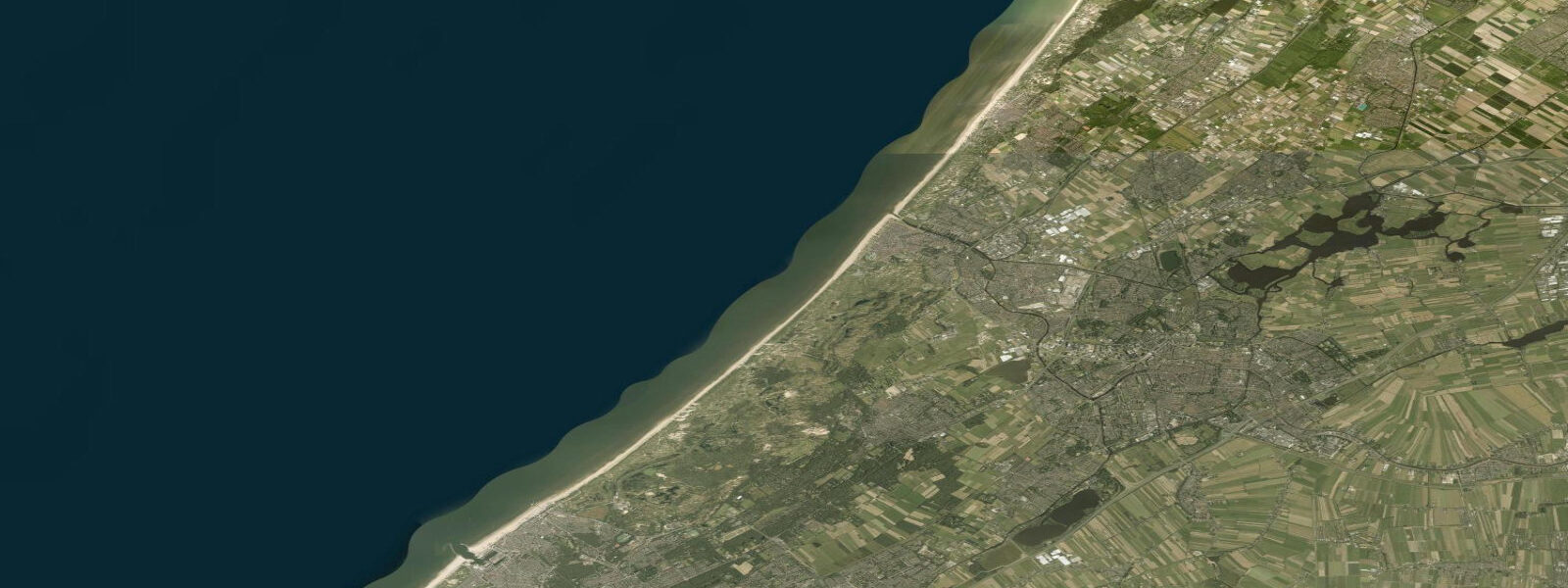
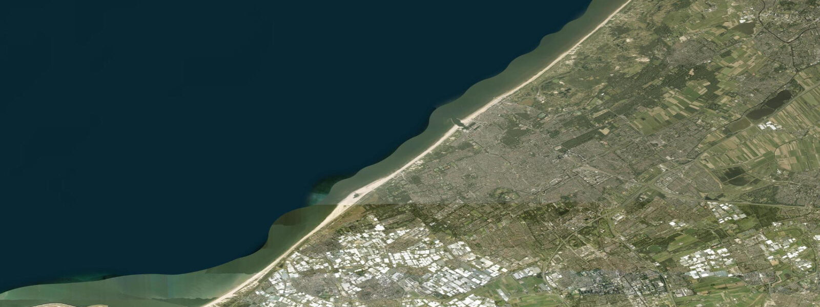
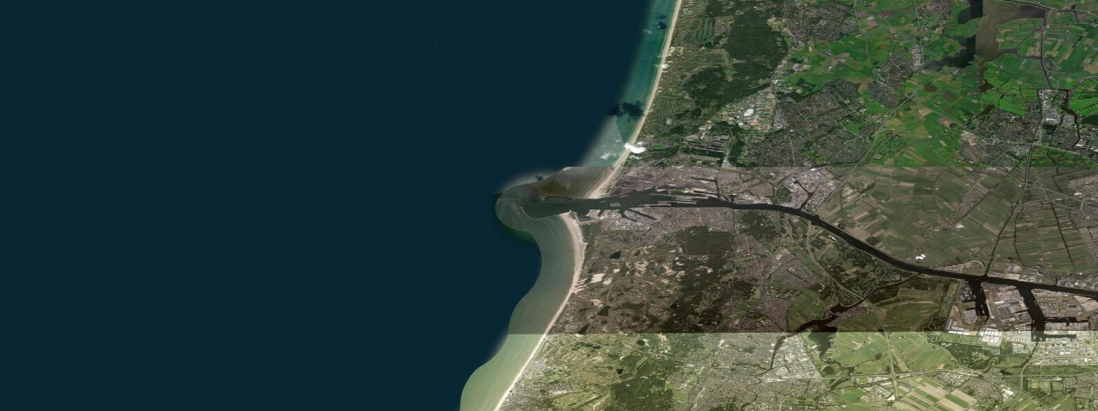
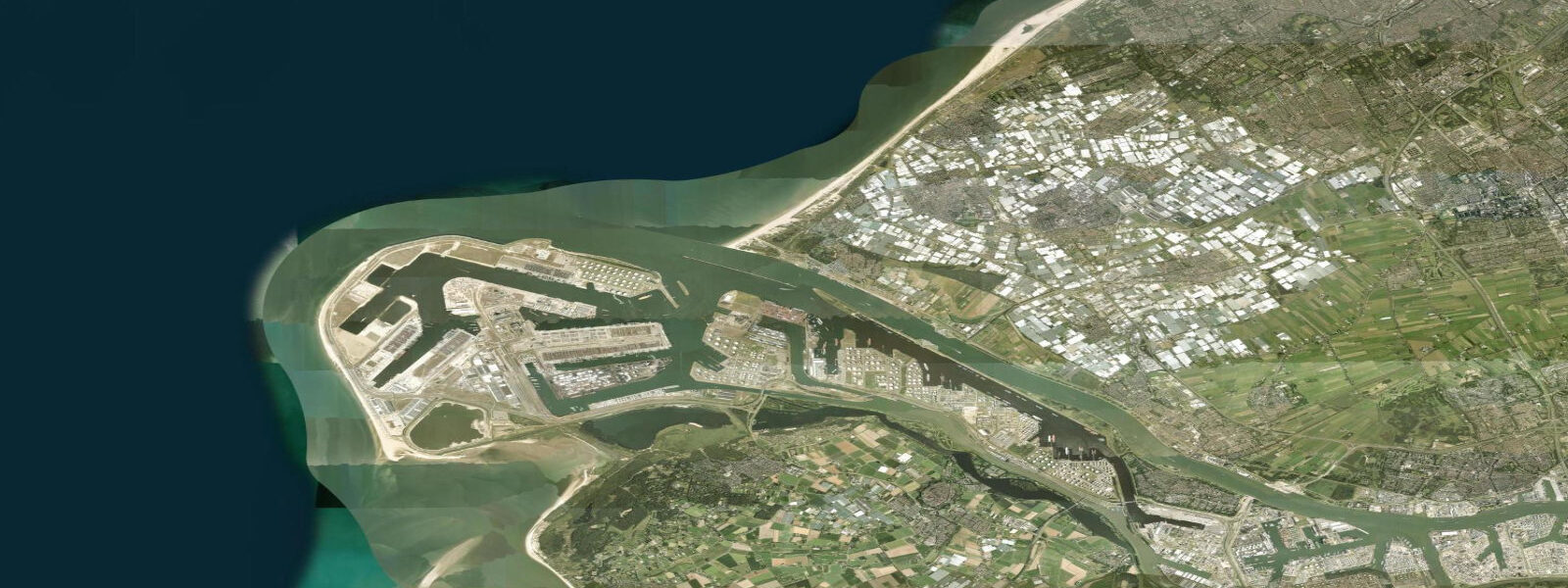
Katwijk aan Zee is where the Oude Rijn — the Old Rhine — reaches the North Sea. This is not the main Rhine delta (which exits through the Nieuwe Waterweg at Hoek van Holland and through the Haringvliet to the south), but a historic northern arm of the Rhine system that has been managed hydraulically since the 17th century. The Uitwateringskanaal sluice at Katwijk is one of the most important freshwater management structures in the Netherlands: its gates control the release of drainage water from a large catchment that includes Leiden, Alphen aan den Rijn, and the low-lying polder areas behind the dune coast. Without the sluice, the land behind Katwijk would flood. With it, the daily tidal cycle governs when the gates can open.
The operation is visible from the beach: the sluice gates, which span the Uitwateringskanaal outflow, are held closed on the flood tide — North Sea water at mean high water stands roughly 1.0 to 1.3 metres above the inland canal level on a spring tide, and opening the gates at that point would push saltwater inland, with serious consequences for agricultural land and freshwater supply. As the tide falls below the inland canal level, the gates open and the accumulated drainage water discharges to sea. The outflow plume extends 200 to 400 metres offshore on a strong ebb before mixing with the coastal current. This is not a subtle phenomenon — the fresh water is visibly darker and the surface texture differs from the surrounding sea.
Mean spring range at Katwijk is 1.6 to 1.8 metres, consistent with the southern North Sea coast. The tidal wave arrives from the north, having completed its circuit of the North Sea basin; at Katwijk it produces two equal-height high waters per day with a slight asymmetry in the ebb and flood durations. The ebb runs slightly longer than the flood — around 6 hours 30 minutes ebb versus 5 hours 50 minutes flood — which is typical of the Dutch North Sea coast and reflects the bathymetric influence of the shallow continental shelf.
Katwijk aan Zee beach is broad by North Sea standards. At mean low water, the dry sand extends 200 metres from the dune foot to the water's edge. At high spring water, the beach narrows to 30 to 40 metres before the dune stabilisation works. This is not dramatic by Atlantic standards but is significant enough that the beach transforms visibly between morning high water and afternoon low water. The sand is fine and pale; the beach faces west-northwest and is exposed to the prevailing Atlantic swell that wraps around the North Sea entrance. On days with onshore wind from the southwest, clean waves of 0.8 to 1.2 metres are common — not surfable by conventional reckoning but enough for bodyboarding and for the line of kite surfers who set up south of the sluice.
Anglers target the sluice outflow specifically. When the gates open on the falling tide and the fresh-water plume discharges, bass and flatfish — particularly flounder — move in to intercept the invertebrates and small fish carried out in the flow. The best position is 50 to 100 metres either side of the outflow channel, casting into the edge of the plume rather than directly into the fast-moving central discharge. This window typically lasts from about 45 minutes after the gates open until around low water, when flow rate diminishes. Mackerel and garfish appear in the plume zone from May through September.
Berkheide is the dune reserve immediately south of Katwijk town. It runs roughly 5 kilometres south to Wassenaar and contains one of the larger dune systems on the Holland coast, with grey dunes, wet slack vegetation, and scattered ponds that form in the dune valleys. Access is on foot from the beach car parks; several waymarked paths penetrate the reserve. The dunes are a designated Natura 2000 habitat — dogs must be on leads, and the marked paths should be kept to avoid disturbing nesting birds (Kentish plover historically bred here; natterjack toads use the slack ponds). The seaward face of Berkheide gives a view along the beach toward the Katwijk sluice and, on clear days, the North Sea horizon.
The ESA ESTEC space research centre is 2 kilometres inland from Katwijk — a useful fact for visitors noting the dense communications infrastructure visible above the dune tree line on the south side of town. It has nothing to do with tides, but the contrast between medieval sluice engineering and satellite tracking infrastructure is distinctively Dutch.
Tide data for Katwijk, South Holland comes from the Open-Meteo Marine API, a gridded model product. Timing accuracy is ±45 minutes, height accuracy ±0.3 m — usable for trip planning, not for navigation.
Tide questions about Katwijk, South Holland
Quick answers to the most common questions about tide times, range, and water access at Katwijk, South Holland.
What does the Katwijk sluice do and when does it open?
The Uitwateringskanaal sluice at Katwijk controls drainage of a large polder catchment that includes Leiden and the surrounding low-lying agricultural land. The gates are held shut during the flood tide and the first part of high water, preventing North Sea saltwater from pushing inland into the drainage system. Once the falling tide drops below the level of the inland canal, the pressure differential reverses and the gates are opened to discharge accumulated drainage water to sea. The opening typically occurs 1 to 2 hours after high water and the discharge continues through the ebb. The outflow plume is visible from the beach as a distinct dark-water streak extending offshore.
When is the best time to fish the Katwijk sluice outflow?
The productive window begins when the sluice gates open, roughly 1 to 2 hours after high water on the falling tide. Bass and flounder move into the outflow plume to feed on invertebrates and small fish carried out by the discharge. The best positions are 50 to 100 metres either side of the main outflow channel — casting into the plume edge rather than directly into the fast-running central discharge gives better presentation. This window runs until about low water when flow rate drops. From May through September, mackerel and garfish also appear in the plume zone. A rising tide closes the gates and ends the session.
How much does the Katwijk beach change between high and low tide?
At mean low water, the dry sand extends approximately 200 metres from the dune foot to the waterline. At high spring water, the beach narrows to 30 to 40 metres immediately in front of the dune stabilisation works. The total exposure across the tidal cycle is around 160 metres of foreshore — significant enough that morning and afternoon visits to the beach look quite different. The beach slope is gentle, so the water retreats smoothly rather than exposing dramatic rock platforms. The sand is fine and firm underfoot at lower tide states, making low water walks along the foreshore easier than at high tide.
Can I walk through the Berkheide dune reserve from Katwijk?
Berkheide is open to walkers via marked paths from the beach car parks south of Katwijk town. The reserve runs approximately 5 kilometres south toward Wassenaar and contains grey dunes, wet slack vegetation, and dune ponds. Several waymarked routes of 3 to 7 kilometres navigate the interior. Dogs must be kept on leads throughout, and walkers should stay on marked paths to protect nesting bird habitat and the natterjack toad populations in the slack ponds. The reserve is a designated Natura 2000 site. Tide state does not affect access — the paths are well above sea level — but the seaward dune face gives a good view back to the Katwijk sluice and beach.
Is kitesurfing or windsurfing possible at Katwijk?
Katwijk aan Zee has a kitesurf community that uses the beach south of the sluice, downwind of the main swimming area. The west-northwest-facing beach picks up the prevailing southwest sea breeze in the afternoon and receives the North Sea swell from the same direction. Usable kitesurf conditions occur with southwest to northwest wind; the flattest water is in the early morning before the sea breeze builds. Tide state matters mainly for the launch distance — at low water, a 200-metre carry to the waterline is common. At high water, launching and landing is closer to the dune foot. The sluice outflow on the ebb creates a short zone of choppier surface water immediately adjacent to the outflow channel; kiteboarders typically stay south of this.
8-day tide table — Katwijk, South Holland
Heights relative to MSL. Predictions: Open-Meteo Marine (MeteoFrance SMOC, 0.08° grid) — heights relative to MSL (not chart datum / LAT). Model-derived.
| Day | Type | Time | Height |
|---|---|---|---|
| Fri 19 Jun | Low | 02:42 | -1.3m |
| High | 06:46 | 1.0m | |
| Low | 11:16 | -0.4m | |
| High | 12:12 | -0.3m | |
| Low | 15:19 | -1.1m | |
| High | 18:53 | 0.5m | |
| Low | 23:42 | -1.0m | |
| Sat 20 Jun | High | 00:58 | -0.8m |
| Low | 03:24 | -1.3m | |
| High | 19:34 | 0.4m | |
| Sun 21 Jun | Low | 01:10 | -1.0m |
| High | 01:42 | -1.0m | |
| Low | 04:01 | -1.3m | |
| High | 08:21 | 0.7m | |
| Low | 16:47 | -1.2m | |
| High | 20:26 | 0.2m | |
| Mon 22 Jun | Low | 04:44 | -1.6m |
| High | 21:28 | 0.2m | |
| Tue 23 Jun | Low | 04:52 | -1.1m |
| High | 11:44 | 0.8m | |
| Low | 18:18 | -0.7m | |
| High | 23:52 | 0.5m | |
| Wed 24 Jun | Low | 06:18 | -0.9m |
| High | 12:38 | 0.8m | |
| Low | 19:08 | -0.8m | |
| Thu 25 Jun | High | 00:53 | 0.5m |
| Low | 05:25 | -1.0m | |
| Low | 07:10 | -1.0m | |
| High | 13:34 | 0.7m | |
| Low | 20:00 | -0.9m | |
| Fri 26 Jun | High | 01:00 | 0.6m |