Tivat tide times
Tivat tide forecast — heights relative to MSL.
Today's tide times for Tivat
Tide times at Tivat on Sunday, 21 June 2026: first low tide at 03:10am, first high tide at 10:00am. Sunrise 05:08am, sunset 08:25pm.
Tide chart for Tivat
24-hour cosine-interpolated curve around the present moment. Heights relative to MSL. Predictions: Predictions: Open-Meteo Marine (MeteoFrance SMOC, 0.08° grid).
Sun, moon and conditions on Sun 21 Jun
Snapshot at build time — refreshes daily. Sea state from Open-Meteo Marine.
Highs and lows next 7 days
Every predicted high and low for the next week, with the daily tidal coefficient (0–120; higher = bigger swing, > 95 means stronger currents).
Other spots nearby
The three closest curated TideTurtle locations to Tivat, measured by great-circle distance.
Today's solunar windows
Solunar tradition: major periods are the ≈3h windows around moon transit and opposition; minor are ≈2h around moonrise and moonset. Pair with the local tide stage and wind for the best read.
About tides at Tivat
A short guide to the coastline at Tivat — geography, sea state, and what the tide is actually doing under your feet.
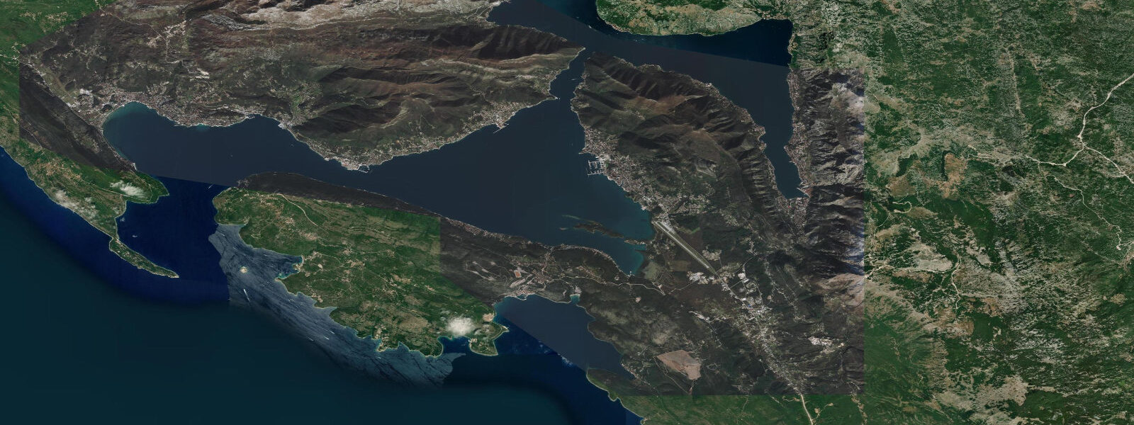
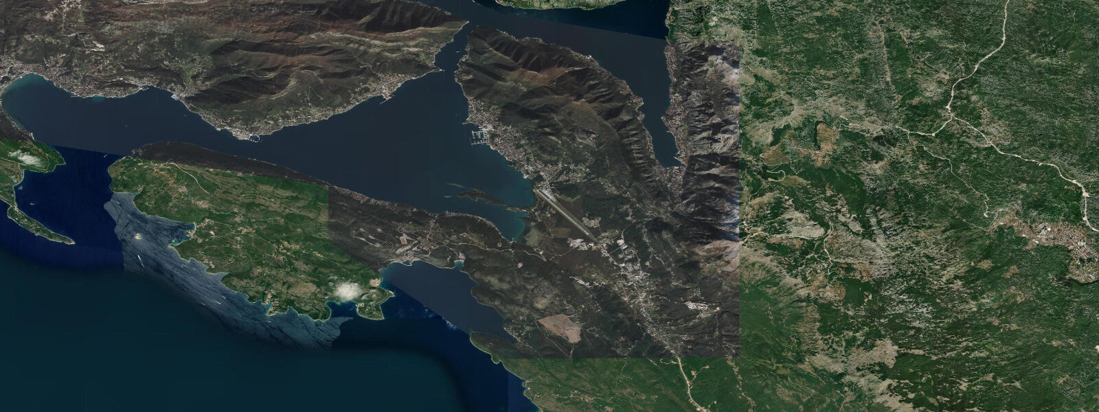
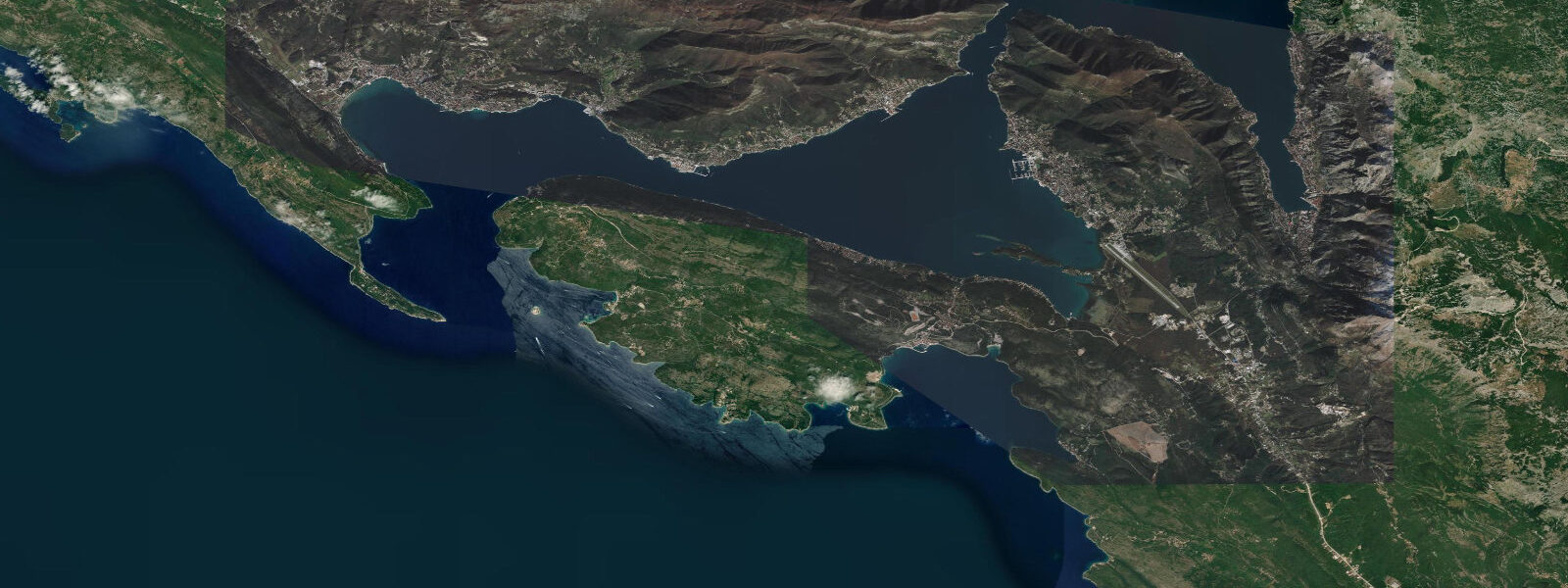
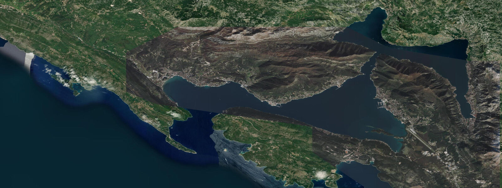
Tivat occupies the southern shore of the bay that shares its name — Tivat Bay — in the middle section of the Boka Kotorska system, positioned between the outer Herceg Novi Bay and the inner Risan and Kotor bays. The town might have remained modest were it not for the decision in 2006 to develop the former Yugoslav Navy arsenal on the waterfront into Porto Montenegro, a deep-water superyacht marina that opened in 2009 and has since grown into one of the Adriatic's most significant marina facilities. Porto Montenegro berths vessels up to 250 metres in length; the longest superyachts in the world — 80 to 140 metres of aluminium and glass — appear regularly in the marina basin from May through October, a concentration of vessel size that makes the Tivat waterfront one of the most photographed in the Mediterranean.
The converted arsenal buildings now hold a hotel, restaurants, retail, a yacht club, and the National Museum of Montenegro's Naval Heritage in the preserved submarine pen. Tivat Airport sits immediately adjacent to the marina — a short approach over the bay. The descent path brings aircraft down over the water between the hills; arriving passengers in a window seat get an aerial view of the full Boka Kotorska system and the marina basin below before landing.
The Verige Strait — the 90-metre-wide hydraulic constriction that divides Tivat Bay from the inner bays — lies approximately 500 metres to the west of Porto Montenegro's main basin entrance. 8 knots on springs, and is clearly visible from the marina's western waterfront on the larger tidal exchanges. 5 metres on spring tides.
The semidiurnal Adriatic pattern delivers two highs and two lows of roughly equal amplitude per day. The jugo's effect is felt at Tivat as a raised water level that brings the bay surface closer to the lower dock floats in the marina; a strong jugo-driven surge can add 30 to 50 centimetres above the astronomical prediction. The marina's floating pontoons accommodate this surge without issue, but skippers berthed in fixed-fender positions against the stone quay should allow for the possibility during forecast jugo periods.
The Verige Strait can be paddled by experienced kayakers at slack water; at peak spring flow the current is manageable for a fit paddler but takes conscious effort to cross. The timing of slack is approximately 20 to 30 minutes after the predicted high or low at Tivat. The open bay between Porto Montenegro and the Verige is sheltered from all wind directions except the south, where the bay mouth gives some fetch; for stand-up paddleboarding and flat-water kayaking, the inner bay between Tivat and the Verige is the calmest water in the bay system.
The Rose Peninsula (Luštica) forms the outer arm of Tivat Bay to the south-west and is accessible by a short ferry crossing from the Tivat harbour area. The peninsula has remained largely undeveloped compared with the town and marina strip, preserving olive groves, small stone villages, and several quiet pebble coves facing back into the bay. The Prevlaka Peninsula further south of Tivat separates Tivat Bay from the open Adriatic; a short drive or cycle over the peninsula gives access to several small pebble beaches on the open Adriatic side, where the south-westerly Adriatic swell reaches in summer and the water colour shifts from the enclosed bay blue to deeper Adriatic tones.
The bora — the cold north-easterly dropping off the Dinaric Alps — makes occasional appearances in the Boka in autumn and winter; in Tivat Bay the Luštica peninsula provides some shelter from the direct bora track, but marina operators and small-boat users monitor the forecast during the October-to-March bora season. Predictions on this page come from Open-Meteo Marine, a gridded global ocean model. 3 metres on height.
The Croatian Hydrographic Institute (HHI) provides the authoritative harmonic reference for the Adriatic and the Bay of Kotor system.
Tide questions about Tivat
Quick answers to the most common questions about tide times, range, and water access at Tivat.
When is the next high tide at Tivat?
The hero block at the top of this page shows the next predicted high at Tivat in local Central European Time (CET/CEST, UTC+1/UTC+2). Spring range at Tivat is approximately 0.38 to 0.5 metres — slightly smaller than Herceg Novi at the bay entrance and slightly larger than Kotor at the innermost bay. Two highs and two lows of roughly equal size occur each day, following the standard Adriatic semidiurnal pattern. Weather-driven water-level anomalies — particularly the jugo south-easterly — can add 30 to 50 centimetres above the predicted level during strong multi-day events.
What is Porto Montenegro and who uses it?
Porto Montenegro is a deep-water superyacht marina built from 2006 to 2009 in the former Yugoslav Navy arsenal on the Tivat waterfront. The facility accommodates vessels up to 250 metres in length and operates 365 days a year; the marina provides full refit, technical, and crew services alongside hotel, dining, and retail facilities in the converted arsenal buildings. The preserved submarine pen houses the National Museum of Montenegro's Naval Heritage. Peak season is June through August, when up to 450 berths may be occupied simultaneously. The marina is operated by a private consortium and charging international superyacht rates; the public promenade along the marina waterfront is accessible without charge.
How strong is the current through the Verige Strait near Tivat?
The Verige Strait — the 90-metre-wide constriction between Tivat Bay and the inner Risan and Kotor bays — carries the bay's main tidal exchange current. On spring tides the flow runs 0.3 to 0.8 knots, peaking roughly midway between the predicted high and low when the water-level difference between the two sides of the strait is greatest. The current reverses near the time of high and low water, with a slack period of 15 to 30 minutes. The strait is 500 metres west of Porto Montenegro's main basin; the current is visible from the western waterfront on larger tidal exchanges. Kayakers and small-boat operators should plan to cross during the slack window; the approach and current direction from the Tivat side is typically south-to-north on the flood and north-to-south on the ebb.
Is the Tivat Bay area good for paddleboarding and flat-water kayaking?
The bay between Porto Montenegro and the Verige Strait is one of the calmest stretches of water in the Bay of Kotor system — sheltered from all wind except southerly, with a short fetch and no significant swell penetration from the Adriatic. Stand-up paddleboarding and flat-water kayaking are practical here from April through October in normal conditions. The bora (north-easterly) does blow through the Boka occasionally and creates short-period chop even in the enclosed bay; check the forecast before launching in autumn and early winter. The small tidal range means launching and landing are possible from any low-sloped shore at any state of the tide; there are no intertidal hazards to plan around.
Where do these tide predictions come from?
Open-Meteo Marine, a free gridded global ocean model. The model estimates tidal height from oceanographic equations applied across a geographic grid rather than from harmonic analysis of a dedicated gauge record. Accuracy is typically within plus or minus 45 minutes on timing and 0.2 to 0.3 metres on height. For Tivat's spring range of 0.38 to 0.5 metres, that uncertainty covers a substantial fraction of the total signal. The Croatian Hydrographic Institute (HHI) publishes the authoritative harmonic data for the eastern Adriatic including the Bay of Kotor system. For vessel operations in the Tivat area and Porto Montenegro marina, use HHI charts and the Montenegro port authority guidance.
8-day tide table — Tivat
Heights relative to MSL. Predictions: Open-Meteo Marine (MeteoFrance SMOC, 0.08° grid) — heights relative to MSL (not chart datum / LAT). Model-derived.
| Day | Type | Time | Height |
|---|---|---|---|
| Sun 21 Jun | Low | 03:10 | -0.7m |
| High | 10:00 | -0.6m | |
| Mon 22 Jun | Low | 03:50 | -0.7m |
| Tue 23 Jun | — | ||
| Wed 24 Jun | — | ||
| Thu 25 Jun | High | 14:10 | -0.4m |
| Low | 21:00 | -0.6m | |
| Fri 26 Jun | — | ||
| Sat 27 Jun | High | 03:00 | -0.5m |
| Low | 08:00 | -0.6m | |
| High | 15:10 | -0.3m | |
| Low | 22:10 | -0.6m | |
| Sun 28 Jun | High | 01:00 | -0.5m |