Luštica Peninsula tide times
Luštica Peninsula tide forecast — heights relative to MSL.
Tide chart for Luštica Peninsula
24-hour cosine-interpolated curve around the present moment. Heights relative to MSL. Predictions: Predictions: Open-Meteo Marine (MeteoFrance SMOC, 0.08° grid).
Sun, moon and conditions on Sat 04 Jul
Snapshot at build time — refreshes daily. Sea state from Open-Meteo Marine.
Highs and lows next 7 days
Every predicted high and low for the next week, with the daily tidal coefficient (0–120; higher = bigger swing, > 95 means stronger currents).
Other spots nearby
The three closest curated TideTurtle locations to Luštica Peninsula, measured by great-circle distance.
Today's solunar windows
Solunar tradition: major periods are the ≈3h windows around moon transit and opposition; minor are ≈2h around moonrise and moonset. Pair with the local tide stage and wind for the best read.
About tides at Luštica Peninsula
A short guide to the coastline at Luštica Peninsula — geography, sea state, and what the tide is actually doing under your feet.
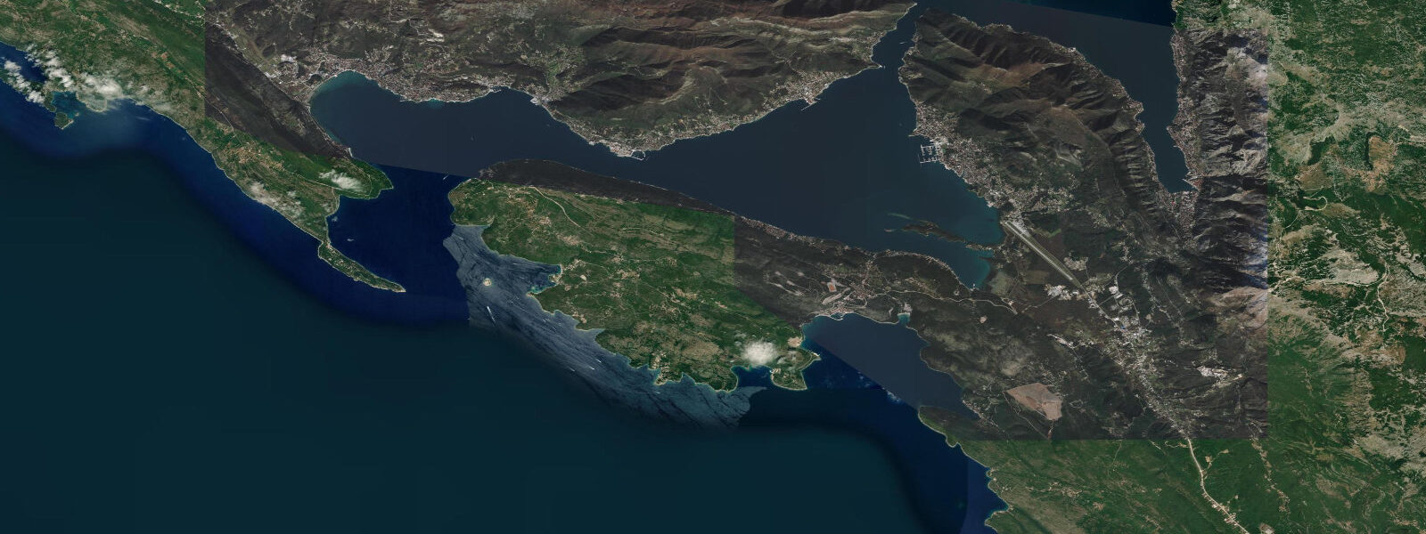
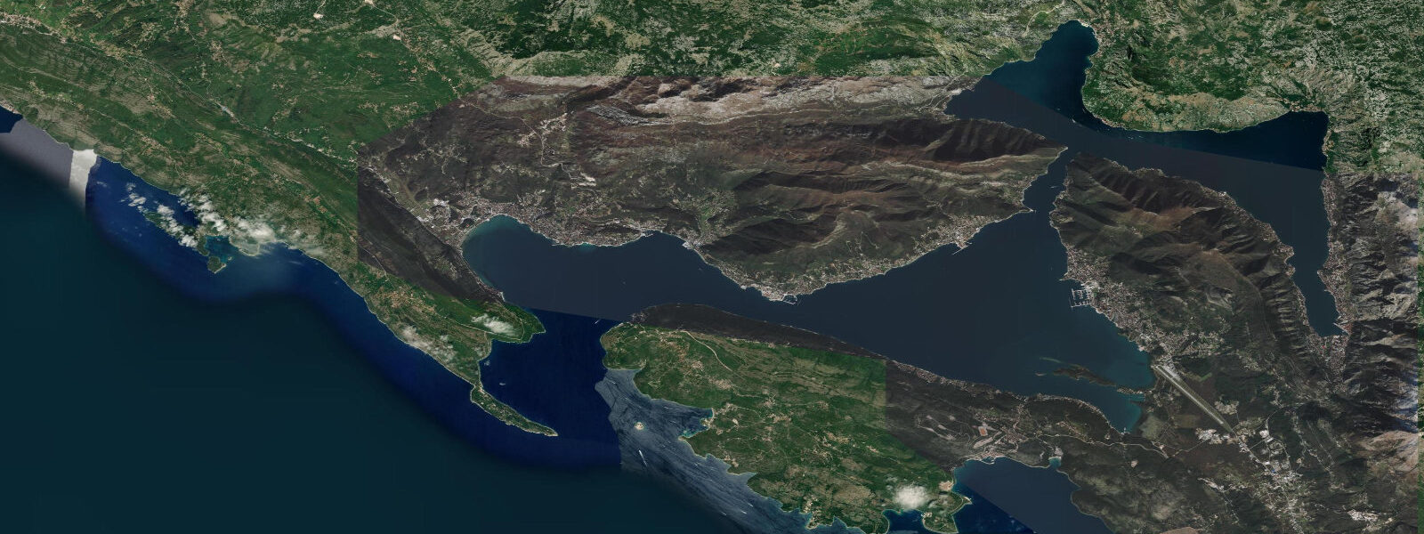
The Luštica Peninsula separates Tivat Bay — the innermost arm of the Bay of Kotor — from the open Adriatic to the south. From the narrow neck of land near the village of Krtoli to the rocky promontory of Cape Arza at its tip, the peninsula is roughly 16 km long and less than 5 km wide at its widest point: limestone karst terrain covered in maquis scrub, olive groves, and pine stands, with small fishing villages on the sheltered northern (bay) side and a more exposed rocky coast on the Adriatic-facing south.
The village of Rose (pronounced ROH-seh), on the northern shore of the peninsula at the entrance to Tivat Bay, is the traditional gateway: a cluster of stone houses around a small harbour, boats pulled up on the shingle, the karst hillside rising immediately behind. Rose is accessible by local boat from Tivat (15 minutes) or by a long road circuit around the peninsula. The Blue Cave (Plava špilja) on the southwestern tip is an accessible sea cave where bioluminescent plankton produce a blue glow visible on dark nights — the effect is most visible from inside the cave looking back toward the entrance, from late spring through early autumn when plankton concentrations are highest.
Žanjice Beach on the southern Adriatic-facing coast is the peninsula's most popular beach: a curved pebble-and-sand cove between limestone headlands, accessible by boat from Tivat or by a 30-minute walk from the nearest road. The exposure is southeast, and the beach is sheltered from the Bora but open to Jugo swell. In summer, day-tripper boats from Tivat and Kotor call at Žanjice as part of the standard bay tour. Mirišta and Dobreč beaches further west along the same coast offer comparable settings with fewer visitors.
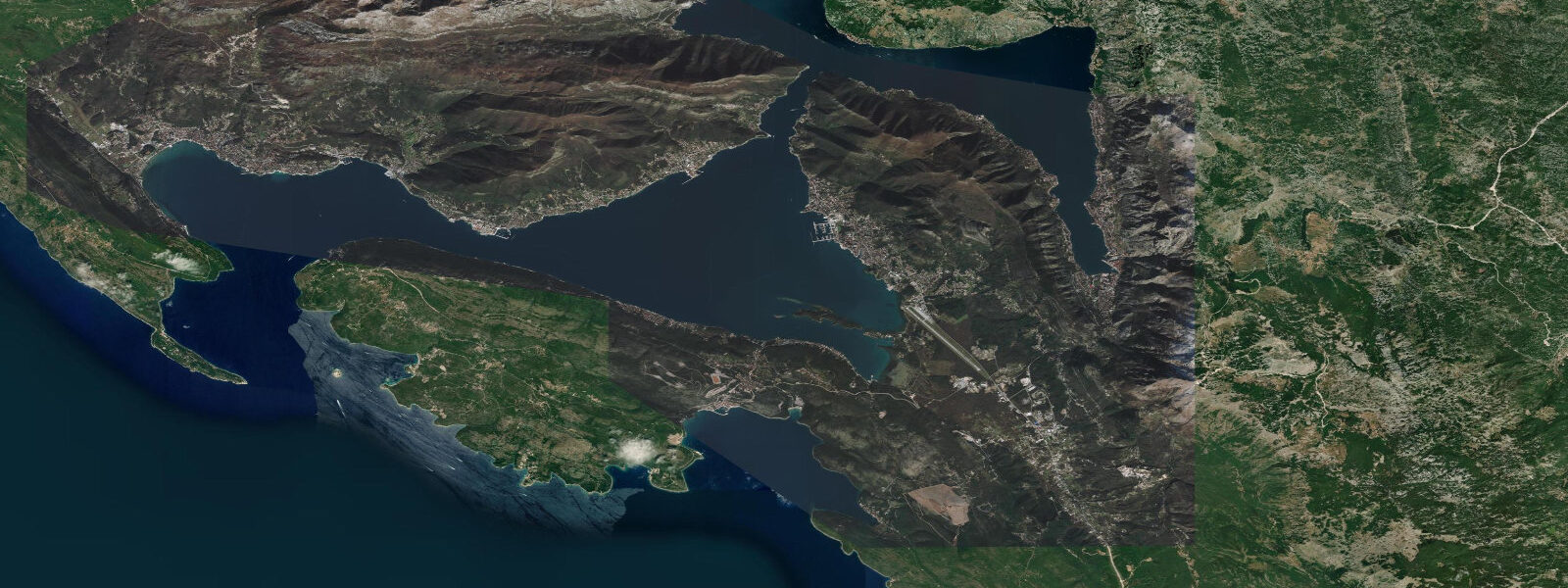
The tidal regime inside Tivat Bay is modified by the bay geometry: the Bay of Kotor's complex system of interconnected bays (the outer bay, Risan, Kotor, and Tivat bays) creates a resonance that slightly amplifies the Adriatic tidal signal at certain points and damps it at others. The spring range at Tivat and on the Luštica northern coast is 0.3 to 0.5 m — essentially the same as the outer Adriatic — but the tidal current through the narrow channel between the outer and inner bays is stronger than the open-sea average as the water is funnelled through the constriction. On the Adriatic-facing south coast the tidal signal is the standard 0.3 to 0.5 m spring range without the bay modification.
Photographers work the peninsula for the viewback to Sveti Stefan (the famous islet-hotel visible 15 km to the south), the karst cave-and-sea combinations on the southwest tip, and the evening light across Tivat Bay to the Orjen massif. The peninsula's undeveloped character — a large resort development project on the eastern end has proceeded slowly — makes it one of the less altered coastal landscapes on the Montenegrin Riviera.
Predictions on this page come from Open-Meteo Marine, a gridded global ocean model. Accuracy is typically within plus or minus 45 minutes on timing and 0.2 to 0.3 m on height. For authoritative Adriatic tide data, the Croatian Hydrographic Institute (HHI) publishes harmonic predictions covering Montenegrin waters; the Kotor gauge is the most relevant local reference.
Tide questions about Luštica Peninsula
Quick answers to the most common questions about tide times, range, and water access at Luštica Peninsula.
When is the next high tide at Luštica Peninsula?
The hero block at the top of this page shows the next predicted high in local Central European Time (CET/CEST, UTC+1/UTC+2). The Luštica Peninsula experiences an Adriatic semidiurnal tide with a spring range of 0.3 to 0.5 m. Inside Tivat Bay on the northern shore, the bay geometry creates localised tidal current amplification through the narrow channel between the outer and inner bay sections. The Croatian Hydrographic Institute (HHI) publishes the authoritative Adriatic tide tables; the Kotor gauge is the closest reference station.
What is the tidal range at Luštica Peninsula?
Mean spring range is 0.3 to 0.5 m, consistent with the central-southern Adriatic standard. Inside the Bay of Kotor the bay resonance slightly modifies this at specific points; the tidal current through the channel between Tivat Bay and the outer bay is noticeably stronger than the open-Adriatic average on spring tides. The Adriatic-facing beaches on the south coast (Žanjice, Mirišta) experience the standard open-sea Adriatic range without bay modification. Jugo (southerly) swell is the dominant sea-state driver on the south coast.
Where do these tide predictions come from?
Open-Meteo Marine, a free gridded global ocean model. At the 0.3 to 0.5 m spring range of this coast, the model's typical accuracy (plus or minus 45 minutes, 0.2 to 0.3 m) is a moderate fraction of the total signal. The Croatian Hydrographic Institute (HHI) publishes the most complete Adriatic harmonic tide tables for both the Croatian and Montenegrin coasts. The Kotor gauge is the nearest reference station to Luštica.
How do I reach Žanjice Beach and the Blue Cave?
Žanjice Beach is accessible by boat from Tivat (approximately 20 minutes) or by a 30-minute walk from the Žanjice village road end on the peninsula. Boat taxis from Tivat run throughout summer; day-tour boats from Kotor and Tivat include Žanjice as a standard stop. The Blue Cave at the southwestern tip is accessible by sea only — swimming entry or by small boat/kayak from Rose village or from the south coast. The bioluminescent effect is visible at night from late spring through early autumn when plankton concentrations are highest; a torch inside the cave is counterproductive as it suppresses the perception of bioluminescence.
Is this safe to use for navigation?
No. TideTurtle is a planning tool for recreational coastal activity, not a navigation resource. The Bay of Kotor entrance channel and the approaches to Tivat marina carry significant boat traffic including superyachts and local ferries. The Croatian Hydrographic Institute (HHI) publishes charts and Notices to Mariners for the area. The tidal current through the Verige channel between the outer and inner Bay of Kotor bays runs at 1 to 2 knots at springs and is a navigational consideration for small craft. Open-Meteo Marine gridded predictions do not replace authoritative navigation sources.
8-day tide table — Luštica Peninsula
Heights relative to MSL. Predictions: Open-Meteo Marine (MeteoFrance SMOC, 0.08° grid) — heights relative to MSL (not chart datum / LAT). Model-derived.
| Day | Type | Time | Height |
|---|---|---|---|
| Sat 04 Jul | — | ||
| Sun 05 Jul | Low | 01:15 | -0.7m |
| High | 19:00 | -0.4m | |
| Mon 06 Jul | Low | 14:00 | -0.5m |
| Tue 07 Jul | — | ||
| Wed 08 Jul | High | 11:10 | -0.3m |
| Low | 17:00 | -0.5m | |
| High | 22:00 | -0.4m | |
| Thu 09 Jul | — | ||
| Fri 10 Jul | Low | 06:00 | -0.5m |
| Sat 11 Jul | High | 01:00 | -0.5m |