Ada Bojana, Montenegro tide times
Ada Bojana, Montenegro tide forecast — heights relative to MSL.
Today's tide times for Ada Bojana, Montenegro
Tide times at Ada Bojana, Montenegro on Saturday, 4 July 2026: first low tide at 02:00am, first high tide at 06:50am, second low tide at 11:50am, second high tide at 06:15pm. Sunrise 05:12am, sunset 08:21pm.
Tide chart for Ada Bojana, Montenegro
24-hour cosine-interpolated curve around the present moment. Heights relative to MSL. Predictions: Predictions: Open-Meteo Marine (MeteoFrance SMOC, 0.08° grid).
Sun, moon and conditions on Sat 04 Jul
Snapshot at build time — refreshes daily. Sea state from Open-Meteo Marine.
Highs and lows next 7 days
Every predicted high and low for the next week, with the daily tidal coefficient (0–120; higher = bigger swing, > 95 means stronger currents).
Other spots nearby
The three closest curated TideTurtle locations to Ada Bojana, Montenegro, measured by great-circle distance.
Today's solunar windows
Solunar tradition: major periods are the ≈3h windows around moon transit and opposition; minor are ≈2h around moonrise and moonset. Pair with the local tide stage and wind for the best read.
About tides at Ada Bojana, Montenegro
A short guide to the coastline at Ada Bojana, Montenegro — geography, sea state, and what the tide is actually doing under your feet.
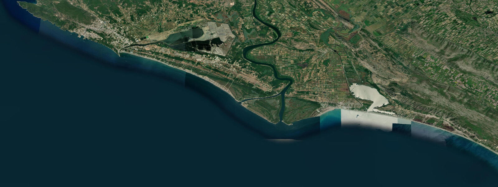
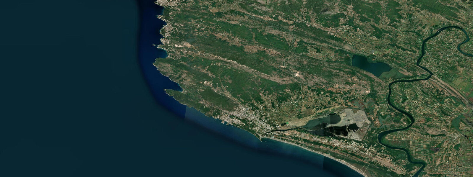
Ada Bojana is a triangular river island formed by the Bojana River, which marks the Montenegro-Albania border about 12 km south of Ulcinj. The island sits where the Bojana splits around a sand and gravel bar before entering the Adriatic — a geometry created by a shipwreck in 1858 that diverted the river's southern channel and progressively deposited sediment until a proper island formed. The wreck of the Turkish brigantine Ada is still buried in the island's fabric, and the island is named for it.
Tidal conditions on the Montenegro Adriatic coast are mixed semidiurnal with a small range — mean springs of approximately 0.3–0.5 m in the southern Adriatic at this latitude. These are not the dominant forces on the island. The Bojana River flow, the wind-driven Adriatic sea state, and the river mouth shoaling dynamics matter more on a day-to-day basis than the astronomical tide. River level in the Bojana is significantly affected by discharge from Lake Skadar (Shkodër) upstream — the largest lake in the Balkans — which rises and falls with seasonal precipitation in the Albanian and Montenegrin mountains. A wet winter season can raise the river level substantially by spring and alter the sandbar geometry at the mouth. Tide predictions on this site use Open-Meteo Marine (±45 min / ±0.2–0.3 m accuracy). For kitesurfing and windsurfing, wind forecast and wave height are the operationally relevant planning inputs.
The island is reached by a short bridge from the Ulcinj–Velika Plaža coast road. Ada Bojana has been informally a naturist destination since the 1970s and remains one of the most well-known nudist areas in the former Yugoslavia, though the island also has clothed sections near the bridge and on the northern beach. Several small restaurants and bars on the riverbank serve fish grilled over open wood fires — freshwater species from the Bojana (carp, catfish) alongside Adriatic sea bass and bream.
The beaches on the seaward side of the island — facing the Adriatic — are exposed to southwest and south swell and backed by low-profile sand dunes. The beach changes shape seasonally and after storm events as the river mouth shoaling redistributes sand. At the river-mouth end, the water is brackish and the bottom is soft silt; at the northern beach end, the Adriatic sand is cleaner and firmer underfoot.
For windsurfers and kitesurfers, Ada Bojana's position at the Bojana mouth creates reliable thermal wind conditions in summer — a sea breeze that builds from late morning across the flat water of the southern Adriatic and is channelled by the coastal topography. The flat water inside the southern river channel provides learning conditions; the open beach on the seaward side gives a wave option when south swell is running. Several rental and instruction outfits operate on the island from May through September.
The island's ecology is a mix of Mediterranean maquis, riverine vegetation, and the reed beds and mudflats of the Bojana estuary, which is a Ramsar-listed site. Migratory birds use the estuary as a staging point — Dalmatian pelicans, pygmy cormorants, and several heron species are recorded on the wetland system. The Albanian wetlands immediately south of the border (Velipojë) extend the same ecosystem southward. Bird counts on the estuary in autumn and spring migration periods are among the most significant in the eastern Adriatic.
Boat access from the Adriatic side is affected by the shifting bar at the river mouth, which changes position and depth from year to year. Small motorboats and kayaks can enter the river on an incoming meteorological sea state; larger vessels should verify current depth with local knowledge before attempting the bar crossing.
Tide questions about Ada Bojana, Montenegro
Quick answers to the most common questions about tide times, range, and water access at Ada Bojana, Montenegro.
What are the tides like at Ada Bojana?
The southern Adriatic at Ada Bojana has a mixed semidiurnal tide with a mean spring range of approximately 0.3–0.5 m. The tidal signal is real but modest — comparable to the water level effect of a moderate onshore wind. River level in the Bojana and Adriatic sea state are the more significant water level drivers on most days, particularly when Lake Skadar is high after winter rains. Tide predictions here use Open-Meteo Marine, with typical accuracy of ±45 minutes on timing and ±0.2–0.3 m on height. For kitesurfing and windsurfing, the wind forecast and wave height are the relevant planning inputs.
Is Ada Bojana a nudist beach?
Ada Bojana has been an informal naturist destination since the Yugoslav era and remains the most well-known nudist spot in Montenegro. The seaward beach and the riverside restaurant area have a long-established naturist tradition. The island also has clothed sections near the bridge and on the northern beach area. There is no formal enforcement either way — it is a self-organising mixed environment where both naturist and clothed visitors coexist without friction. The restaurants welcome everyone. High season (July–August) sees a significant international naturist clientele alongside Montenegrin and Albanian day visitors from Ulcinj.
Is Ada Bojana good for kitesurfing?
Ada Bojana is one of the better kitesurfing spots on the eastern Adriatic. The thermal sea breeze builds reliably from late morning through early afternoon in summer, driven by the temperature differential between the heated coast and the cooler sea. The southern river channel provides flat water for beginners and progression work; the open beach on the Adriatic side offers chop and occasional small waves when south swell is running. Several rental and instruction operations are active from May to September. The wide beach and river mouth area give plenty of room to rig, depower, and self-rescue safely.
How do I get to Ada Bojana from Ulcinj?
Ada Bojana is about 12 km south of Ulcinj via the Velika Plaža coast road. By car, allow 20–25 minutes. In summer, taxi services from Ulcinj run to the island bridge throughout the day. There is no regular bus service directly to the island — the nearest bus stop is at Velika Plaža beach from which the island bridge is a 3–4 km walk along the beach or road. The island is also accessible from Albania via the Buna/Bojana river route, but this requires crossing the international border through the formal crossing point at Muriqan, about 8 km inland.
What fish can I catch at Ada Bojana?
The Bojana River and estuary are productive for freshwater and brackish water species: European catfish, carp, and bream in the river channel, mullet in the brackish estuary zone. Sea bass and sea bream are caught from the Adriatic beach side, particularly in the early morning and around sunset. Several of the island's restaurants buy from local fishermen daily — catfish, carp, and sea bass grilled over wood are the standard menu. Night fishing from the riverbank with bottom rigs is a common local practice, particularly for catfish. A rod licence is required for fishing in Montenegrin waters.
7-day tide table — Ada Bojana, Montenegro
Heights relative to MSL. Predictions: Open-Meteo Marine (MeteoFrance SMOC, 0.08° grid) — heights relative to MSL (not chart datum / LAT). Model-derived.
| Day | Type | Time | Height |
|---|---|---|---|
| Sat 04 Jul | Low | 02:00 | -0.7m |
| High | 06:50 | -0.5m | |
| Low | 11:50 | -0.6m | |
| High | 18:15 | -0.3m | |
| Sun 05 Jul | Low | 01:10 | -0.7m |
| High | 18:50 | -0.4m | |
| Mon 06 Jul | Low | 01:50 | -0.7m |
| Tue 07 Jul | — | ||
| Wed 08 Jul | — | ||
| Thu 09 Jul | — | ||
| Fri 10 Jul | High | 13:10 | -0.3m |