Marina di Grosseto tide times
Marina di Grosseto tide forecast — heights relative to MSL.
Today's tide times for Marina di Grosseto
Tide times at Marina di Grosseto on Sunday, 21 June 2026: first high tide at 02:00, first low tide at 08:50. Sunrise 05:37, sunset 20:57.
Tide chart for Marina di Grosseto
24-hour cosine-interpolated curve around the present moment. Heights relative to MSL. Predictions: Predictions: Open-Meteo Marine (MeteoFrance SMOC, 0.08° grid).
Sun, moon and conditions on Sun 21 Jun
Snapshot at build time — refreshes daily. Sea state from Open-Meteo Marine.
Highs and lows next 7 days
Every predicted high and low for the next week, with the daily tidal coefficient (0–120; higher = bigger swing, > 95 means stronger currents).
Other spots nearby
The three closest curated TideTurtle locations to Marina di Grosseto, measured by great-circle distance.
Today's solunar windows
Solunar tradition: major periods are the ≈3h windows around moon transit and opposition; minor are ≈2h around moonrise and moonset. Pair with the local tide stage and wind for the best read.
Cycle dates near Marina di Grosseto
Last spring tide on Sun 21 Jun (range 0.3m). Next spring tide on Sat 27 Jun (range 0.2m). Next neap on Wed 24 Jun.
Spring tides cluster around new and full moons (biggest swings). Neap tides land on quarter moons (smallest swings). See the spring tide and neap tide glossary entries for the why.
About tides at Marina di Grosseto
A short guide to the coastline at Marina di Grosseto — geography, sea state, and what the tide is actually doing under your feet.
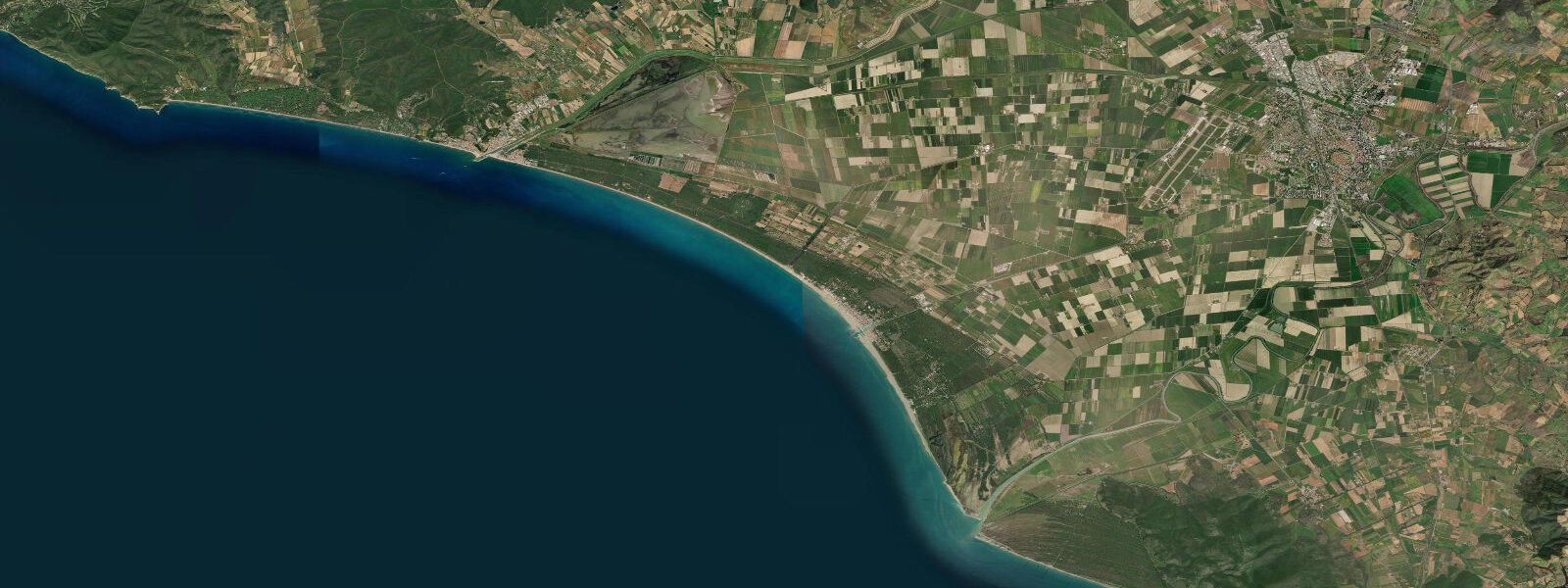
Marina di Grosseto occupies the mouth of the Bruna River on the Maremma coast of southern Tuscany, roughly 14 km west of the provincial capital Grosseto. The beach fringe here is characteristic Maremma: a broad sand beach backed by a dense pineta (umbrella-pine forest) that reaches almost to the high-water mark in places, giving the shoreline a character quite different from the rocky coves further north. The Parco Regionale della Maremma — one of Italy's most significant coastal nature reserves, protecting dunes, lagoons, and Uccellina hill scrub — begins approximately 10 km to the south at Principina a Mare.
Tidal range at Marina di Grosseto is around 0.2 m above Lowest Astronomical Tide, slightly below the Livorno value to the north, and among the smallest on any Italian monitored station. The Bruna river mouth is shallow and braided; the river outflow gradient, not the tide, drives current in the estuary channel. Anglers targeting sea bass (branzino) and sea bream (orata) in the estuary mouth fish state of current — which is primarily determined by river discharge and wind-driven surface set — not by tide tables.
Beach gradient is gentle, typical of prograding beach-ridge systems. The surf zone rarely exceeds ankle to knee depth for 30–50 m offshore in calm conditions. A 0.2 m tidal change translates to a horizontal shoreline shift of 15–30 m on a 1:100 beach slope — enough to expose or cover the lower foreshore, and relevant for anyone parking a kayak or launching a dinghy from the beach at different times of day.
The Maremma coast is low-lying. Historical wetland drainage (the Bonifica della Maremma, completed in the mid-20th century) lowered the water table and cleared malaria-risk marshes but left the coastal plain at near-sea-level elevations. Storm surge events driven by southerly libeccio or scirocco winds pile water against this flat coast efficiently; the combination of low gradient and shallow near-shore bathymetry amplifies surge height relative to steeper stretches of coast.
Open-Meteo Marine supplies the tide predictions on this page (±45 min / ±0.2–0.3 m). ISPRA's Rete Mareografica Nazionale is the authoritative source for historical and real-time sea-level data on the Maremma coast.
Tide questions about Marina di Grosseto
Quick answers to the most common questions about tide times, range, and water access at Marina di Grosseto.
What is the tidal range at Marina di Grosseto, and does it affect angling in the Bruna estuary?
Mean tidal range is approximately 0.2 m above Lowest Astronomical Tide — one of the smallest recorded on the Italian coast. In the Bruna estuary, river outflow and wind-driven surface current dominate over tidal forcing. Anglers targeting branzino and orata near the river mouth should focus on river discharge conditions (post-rain turbidity reduces visibility; moderate flow concentrates baitfish near the channel edge) and wind direction rather than tidal stage. High tide does push a subtle influx of saltier water slightly upstream and can activate feeding activity near the boundary, but the effect is modest compared to Atlantic estuaries.
How does the small tidal range affect beach access and kayak launches?
A 0.2 m range on a gentle-gradient beach translates to a horizontal shoreline shift of roughly 15–30 m between low and high tide on a 1:100 slope. In practice this means the lowest foreshore sand is exposed at low tide and covered at high, which matters for kayak and dinghy launching: beaching at low water may require dragging across an extra 20–30 m of wet sand to reach the pine-backed dry zone. For most recreational activities the variation is minor compared to swell-height and wind-driven beach run-up, which can easily exceed the tidal signal on days with southerly fetch.
Is the Parco Regionale della Maremma accessible from Marina di Grosseto by sea?
The Parco Regionale della Maremma begins approximately 10 km south at Principina a Mare. The park's coastal stretch includes the Uccellina hills dropping to cliffs, protected dunes, and restricted access zones. Sea-kayakers can paddle the coastal edge of the park but should check current park regulations on water access and landing — some stretches are designated no-landing conservation zones, particularly during breeding seasons. No motorised watercraft are permitted in the inshore zone within the park boundaries. Tidal state is not a constraint for sea access; wind and swell from the south-west are the practical limiting factors.
What makes the Maremma coast susceptible to storm surge despite its small astronomical tidal range?
The Maremma coast south of Grosseto is one of the flattest and lowest-lying stretches of the Italian Tyrrhenian coast, a legacy of the 20th-century wetland drainage programme (Bonifica della Maremma). Coastal plain elevations sit close to mean sea level. Shallow near-shore bathymetry amplifies surge: when libeccio (south-westerly) or scirocco (south-easterly) winds push a pressure trough and sustained fetch toward the coast, the shallow gradient converts that energy into height. Historical surge events have temporarily raised sea level by 0.3–0.6 m above astronomical prediction, which on this low coast is enough to overtop the primary dune line at some points.
How accurate are the tide predictions for Marina di Grosseto, and what are the limitations?
Tide predictions shown here are produced by Open-Meteo Marine, with typical accuracy of ±45 minutes on timing and ±0.2–0.3 m on height in fair conditions. At Marina di Grosseto, the total astronomical range is only around 0.2 m, so model uncertainty of ±0.2–0.3 m spans — or exceeds — the full predicted signal. Height precision is therefore low; timing of high and low water is more useful than the predicted height values. Meteorological surges driven by libeccio or scirocco can add 0.3–0.6 m on top of the astronomical tide, and these are not represented in the tide predictions shown. For accurate sea-level monitoring on the Maremma coast, refer to ISPRA Rete Mareografica Nazionale gauge data. The predictions on this page are a general orientation tool and should not be used for safety-critical decisions.
8-day tide table — Marina di Grosseto
Heights relative to MSL. Predictions: Open-Meteo Marine (MeteoFrance SMOC, 0.08° grid) — heights relative to MSL (not chart datum / LAT). Model-derived.
| Day | Type | Time | Height |
|---|---|---|---|
| Sun 21 Jun | High | 02:00 | -0.4m |
| Low | 08:50 | -0.7m | |
| Mon 22 Jun | — | ||
| Tue 23 Jun | High | 04:00 | -0.4m |
| Low | 22:50 | -0.6m | |
| Wed 24 Jun | High | 05:00 | -0.4m |
| Thu 25 Jun | Low | 00:00 | -0.6m |
| High | 19:00 | -0.4m | |
| Fri 26 Jun | Low | 01:00 | -0.6m |
| Sat 27 Jun | High | 20:15 | -0.4m |
| Sun 28 Jun | Low | 01:00 | -0.5m |