Civitavecchia tide times
Civitavecchia tide forecast — heights relative to MSL.
Today's tide times for Civitavecchia
Tide times at Civitavecchia on Sunday, 21 June 2026: first high tide at 02:00, first low tide at 09:00. Sunrise 05:36, sunset 20:52.
Tide chart for Civitavecchia
24-hour cosine-interpolated curve around the present moment. Heights relative to MSL. Predictions: Predictions: Open-Meteo Marine (MeteoFrance SMOC, 0.08° grid).
Sun, moon and conditions on Sun 21 Jun
Snapshot at build time — refreshes daily. Sea state from Open-Meteo Marine.
Highs and lows next 7 days
Every predicted high and low for the next week, with the daily tidal coefficient (0–120; higher = bigger swing, > 95 means stronger currents).
Other spots nearby
The three closest curated TideTurtle locations to Civitavecchia, measured by great-circle distance.
Today's solunar windows
Solunar tradition: major periods are the ≈3h windows around moon transit and opposition; minor are ≈2h around moonrise and moonset. Pair with the local tide stage and wind for the best read.
Cycle dates near Civitavecchia
Last spring tide on Sun 21 Jun (range 0.3m). Next spring tide on Fri 26 Jun (range 0.2m). Next neap on Wed 24 Jun.
Spring tides cluster around new and full moons (biggest swings). Neap tides land on quarter moons (smallest swings). See the spring tide and neap tide glossary entries for the why.
About tides at Civitavecchia
A short guide to the coastline at Civitavecchia — geography, sea state, and what the tide is actually doing under your feet.
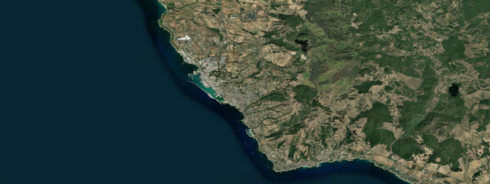
Civitavecchia is Rome's sea door. The city sits 80 kilometres northwest of central Rome — two hours by regional train, or a direct toll-road run — and handles the volume of ferry traffic that keeps the capital connected to Sardinia, Corsica, Sicily, Barcelona, and the western islands. On any given morning in summer, four or five large ferries are in port simultaneously. The harbour infrastructure is functional on a scale that makes aesthetic judgements beside the point.
The port's deep roots help contextualise that infrastructure. The harbour basin was built in the 2nd century AD on the orders of Emperor Trajan — the Portus Traiani — and the hexagonal inner dock he created is still visible in modified form. Michelangelo designed the fortress of the Forte Michelangelo, completed in 1535, which stands at the port entrance and still shapes the skyline. The old fishermen's quarter of the Pirgo district north of the centre and the hot spring pools at Terme Taurine (Roman-era sulphurous springs in use since antiquity) provide texture beyond the ferry infrastructure.
Tidal range at Civitavecchia is 0.3 metres — standard Tyrrhenian microtidal. The open northern Lazio coast is more exposed to northwest swells than the sheltered bays to the south, and the Civitavecchia anchorage can be choppy in libeccio conditions. Ferry operators have fixed schedules and the harbour entrance is protected, but small boat operators and kayakers should check weather before working the exposed stretches north and south of the port.
Beach options are limited immediately around the industrial port but improve toward the south — the Fiumaretta beach and Punta della Mattonara area south of town offer accessible swimming. The Tyrrhenian water here is clear when conditions are calm, with sandy and mixed-rock bottom. Thermal tourism centred on the Terme dei Papi — a large thermal park 4 kilometres north using the same ancient sulphurous springs Trajan bathed in — draws a separate visitor stream unconnected to the ferry traffic.
For the traveller in transit, Civitavecchia is usually a threshold rather than a destination. For the Italian history enthusiast, the density of Roman, Renaissance, and early modern maritime infrastructure in a single working port is actually rare — most of it was built, destroyed, and rebuilt over the same 400 metres of waterfront the car ferries now occupy.
Predictions on this page come from Open-Meteo Marine, a gridded global ocean model. Accuracy is typically within plus or minus 45 minutes on timing and 0.2 to 0.3 metres on height — model-derived, not from a local gauge. For authoritative Italian tide data, consult ISPRA (Istituto Superiore per la Protezione e la Ricerca Ambientale) through the Rete Mareografica Nazionale.
Tide questions about Civitavecchia
Quick answers to the most common questions about tide times, range, and water access at Civitavecchia.
What is the tidal range at Civitavecchia?
Civitavecchia sits on the Tyrrhenian coast of Lazio within the Mediterranean's microtidal regime. Spring tidal range is approximately 0.3 metres. Wind and atmospheric pressure dominate water level variation: libeccio (southwest wind) produces the most significant sea-state changes on this exposed northern stretch of coast. Ferry departures are scheduled without reference to tide state — the port operates at all tidal levels.
Which ferry routes run from Civitavecchia?
Civitavecchia is Italy's busiest domestic ferry hub. Year-round routes connect to Olbia, Cagliari, and Porto Torres in Sardinia, and to Palermo and Catania in Sicily. Seasonal services run to Bastia and Porto-Vecchio in Corsica, and to Barcelona. Grimaldi, Tirrenia, Moby, Corsica Ferries, and GNV operate the main routes. Overnight crossings to Sardinia (9–12 hours depending on destination) are the dominant passenger traffic.
What is the history of Civitavecchia's port?
The harbour was built under Emperor Trajan in the 2nd century AD as the Portus Traiani, replacing an earlier anchorage at nearby Centumcellae. The hexagonal inner dock Trajan commissioned was one of the most sophisticated harbour engineering projects in the ancient world. Michelangelo designed the Forte Michelangelo, begun under Pope Julius II in 1508, which still stands at the port entrance. The port was heavily bombed in 1943 and rebuilt; the working waterfront today is the fourth or fifth version built on the same site in two thousand years.
Are there beaches near Civitavecchia?
Immediately adjacent to the port, beach options are limited by industrial infrastructure. The best accessible beaches are south of the centre: Fiumaretta and Punta della Mattonara, reachable by bus or bike, have clear Tyrrhenian water and mixed sand-and-rock bottom. The coast north of the port toward Santa Marinella (12 kilometres) is cleaner and more developed for swimming. The Terme dei Papi thermal park, 4 kilometres north, uses sulphurous springs and is a separate attraction from the sea.
Are the tide predictions on this page suitable for navigation or ferry planning?
No. Predictions here come from Open-Meteo Marine, a global ocean model providing indicative tide timing and height guidance — not certified nautical data. For passage planning or berthing decisions, use Italian Hydrographic Institute (Istituto Idrografico della Marina) official publications or ISPRA's Rete Mareografica Nazionale. Ferry departure and arrival times are fixed by operators independent of tide state; for ferry schedules, check operator websites directly.
8-day tide table — Civitavecchia
Heights relative to MSL. Predictions: Open-Meteo Marine (MeteoFrance SMOC, 0.08° grid) — heights relative to MSL (not chart datum / LAT). Model-derived.
| Day | Type | Time | Height |
|---|---|---|---|
| Sun 21 Jun | High | 02:00 | -0.4m |
| Low | 09:00 | -0.7m | |
| Mon 22 Jun | — | ||
| Tue 23 Jun | High | 04:00 | -0.4m |
| Low | 23:00 | -0.6m | |
| Wed 24 Jun | High | 05:00 | -0.4m |
| Thu 25 Jun | Low | 00:00 | -0.6m |
| High | 05:50 | -0.4m | |
| Low | 12:10 | -0.6m | |
| High | 19:00 | -0.4m | |
| Fri 26 Jun | Low | 01:00 | -0.6m |
| High | 06:50 | -0.4m | |
| Low | 13:00 | -0.6m | |
| High | 19:50 | -0.4m | |
| Sat 27 Jun | — | ||
| Sun 28 Jun | Low | 01:00 | -0.5m |