Vieste tide times
Vieste tide forecast — heights relative to MSL.
Today's tide times for Vieste
Tide times at Vieste on Sunday, 21 June 2026: first low tide at 03:10. Sunrise 05:20, sunset 20:33.
Tide chart for Vieste
24-hour cosine-interpolated curve around the present moment. Heights relative to MSL. Predictions: Predictions: Open-Meteo Marine (MeteoFrance SMOC, 0.08° grid).
Sun, moon and conditions on Sun 21 Jun
Snapshot at build time — refreshes daily. Sea state from Open-Meteo Marine.
Highs and lows next 7 days
Every predicted high and low for the next week, with the daily tidal coefficient (0–120; higher = bigger swing, > 95 means stronger currents).
Other spots nearby
The three closest curated TideTurtle locations to Vieste, measured by great-circle distance.
Today's solunar windows
Solunar tradition: major periods are the ≈3h windows around moon transit and opposition; minor are ≈2h around moonrise and moonset. Pair with the local tide stage and wind for the best read.
About tides at Vieste
A short guide to the coastline at Vieste — geography, sea state, and what the tide is actually doing under your feet.
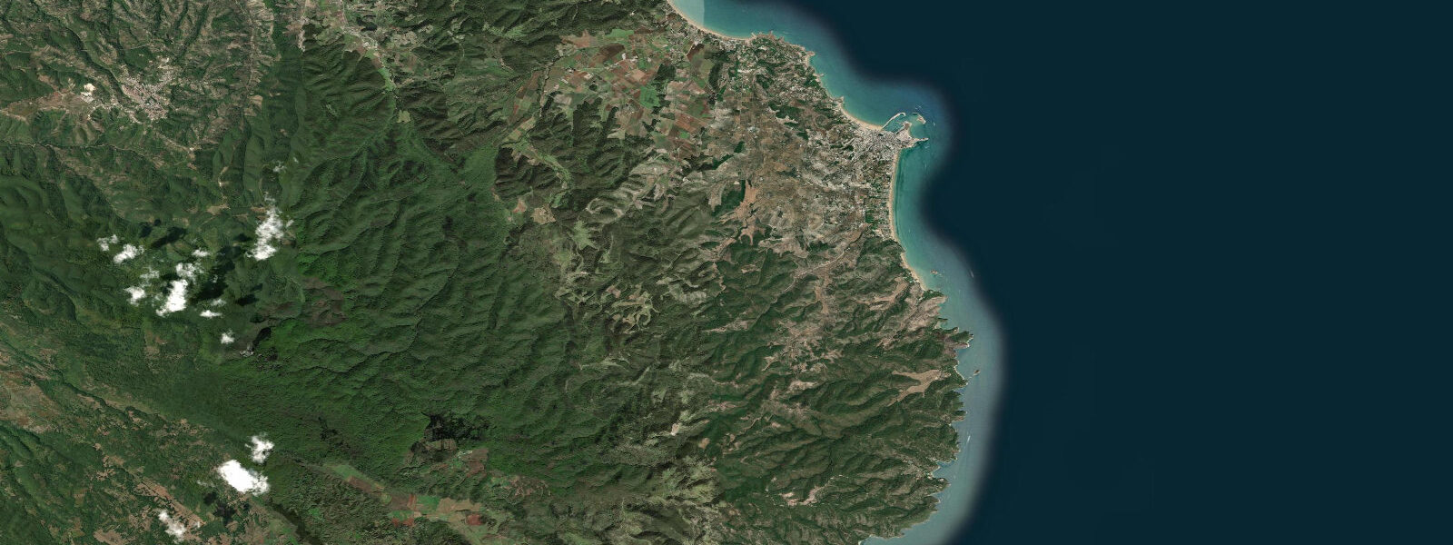
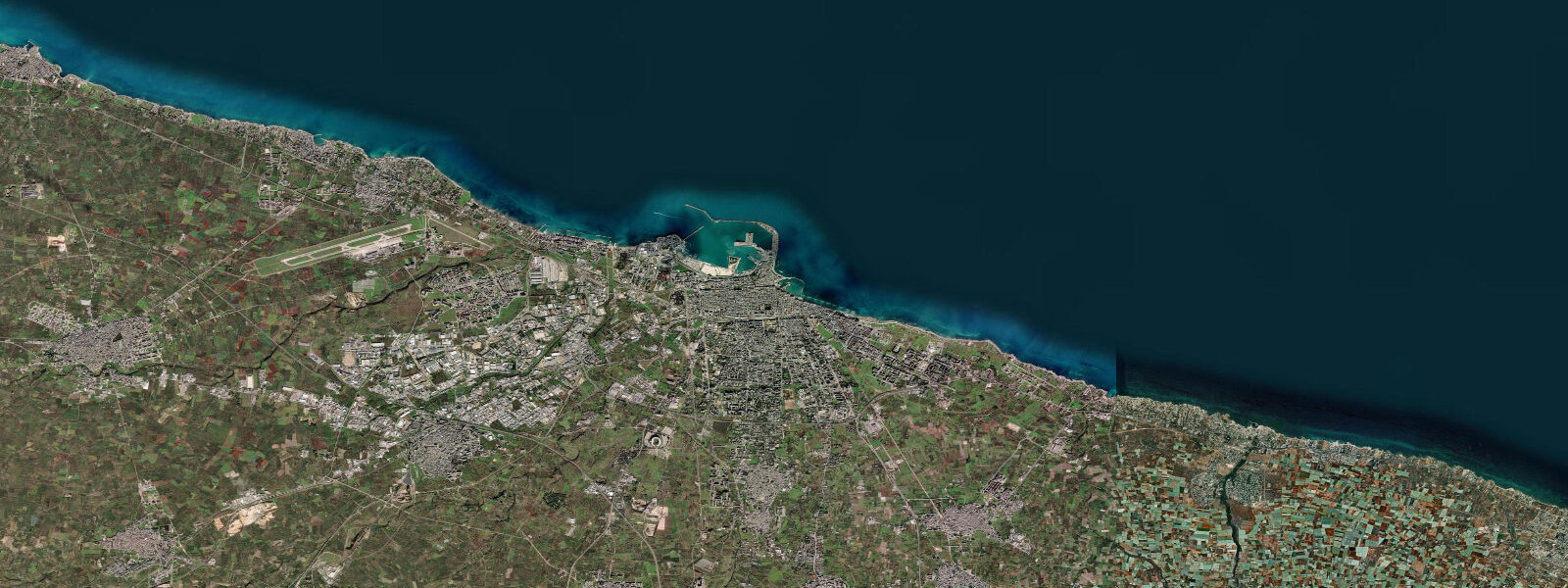
Vieste stands on the eastern tip of the Gargano peninsula — the great limestone promontory that projects from Puglia into the Adriatic like Italy's spur. White sea stacks (faraglioni) rise from the water immediately below the town's cliff-edge historic centre, the most photographed being the Pizzomunno monolith, a 25 m column of white limestone that stands directly off Spiaggia del Castello, the main town beach. Local legend attributes the Pizzomunno's solitude to a fisherman turned to stone by sirens — a story the town has merchandised thoroughly.
The Gargano coastline alternates between sheer white limestone cliffs (up to 50–80 m), sea caves (grotte marine, accessible only by small boat), and sand beaches backed by Aleppo pine. North of Vieste the coast runs to Peschici; south toward Mattinata the cliffs become more continuous. The Parco Nazionale del Gargano covers the entire peninsula including a 15 km stretch of offshore islands (Isole Tremiti, 25 km to the north).
Tidal range at Vieste is approximately 0.35 m above Chart Datum — consistent with central-Adriatic values and slightly above Bari's figure due to Vieste's more northerly position on the basin. The tidal pattern is semidiurnal with clear spring-neap variation (roughly 0.45 m spring, 0.25 m neap).
For sea-cave access, even a 0.35 m tidal change matters: the Grotta Campana and Grotta Sfondata — entered at water level by small boat — have clearance at high tide that can be reduced to near-impassable at low tide in some cases, or vice versa depending on the cave's orientation. Local boat-tour operators know these windows and schedule accordingly; first-time visitors should defer to their timing. Kayakers seeking to enter sea caves independently should check both tidal state and swell height — a 0.5 m south-easterly swell amplifies wave surge inside caves far more than the tide itself.
Open-Meteo Marine provides the tide predictions on this page (±45 min / ±0.2–0.3 m). For authoritative Adriatic sea-level data, ISPRA maintains gauge stations at Bari and further north at Ortona; Vieste-specific surge forecasts are available from the Centro Funzionale Regionale Puglia weather service.
Tide questions about Vieste
Quick answers to the most common questions about tide times, range, and water access at Vieste.
What is the tidal range at Vieste, and how does it affect access to the sea caves (grotte marine)?
Tidal range at Vieste is approximately 0.35 m above Chart Datum (spring range around 0.45 m, neap around 0.25 m). The sea caves along the Gargano coast — including the Grotta Campana, Grotta Sfondata, and others accessible by small boat from Vieste — have entrance geometries where a 0.35 m tidal change can shift clearance between comfortable and tight. Local boat-tour operators time entries to avoid low-water periods in caves where the ceiling height is marginal. Independently arriving kayakers should check tidal state before attempting cave entry; swell height is equally important, as wave surge inside a cave amplifies with any southerly swell regardless of tide height.
How tall is the Pizzomunno sea stack, and what is its geological origin?
The Pizzomunno is a 25 m (approximately 82 ft) monolith of Cretaceous white limestone standing directly off Spiaggia del Castello in Vieste. It is the most photographed natural feature on the Gargano coast. The Gargano peninsula is a remnant of the Apulian carbonate platform — limestone deposited in shallow tropical seas during the Mesozoic — that has been tectonically uplifted and eroded by waves and groundwater dissolution (karstification). The Pizzomunno and other faraglioni along this coast are resistant limestone remnants left standing as the surrounding softer or more fractured rock eroded faster. The white colour is characteristic of the fine-grained Cretaceous limestone (calcari di Bari and related units) that underlies the entire Gargano.
Is kayaking or paddleboarding appropriate near the Vieste sea stacks, and what conditions should I watch for?
The sea stacks and cliff bases around Vieste are an exceptional paddling environment in calm conditions — clear water, dramatic topography, cave access. Tidal current is negligible (0.35 m range generates no meaningful stream). The hazards are swell and wind: south-easterly and southerly swells from a long Adriatic fetch produce wave surge at cliff bases and cave entrances that can be disproportionate to offshore swell height due to reflection and constriction. Bora (north-easterly) conditions build quickly and can pin paddlers against a lee shore. Check both 24-hour wind and swell forecasts. Summer mornings before the sea breeze establishes are typically the lowest-risk window for cliff-face paddling.
What marine wildlife can divers and snorkellers expect around the Gargano coast?
The limestone reef and wall systems off Vieste support grouper (cernia), moray eels, sea bream, painted comber, and octopus in the shallower rocky zones. The Isole Tremiti marine reserve 25 km offshore — one of Italy's oldest — hosts denser posidonia oceanica seagrass meadows and greater fish biomass due to historical protection. Near Vieste, tidal current contributes nothing meaningful to water circulation; visibility is controlled by sea state and plankton cycles (mid-summer brings plankton blooms that reduce viz to 5–8 m; late spring and early autumn often give 15–20 m). No special tide-timing is needed for reef dives near Vieste.
How reliable are the Vieste tide predictions shown, and are they appropriate for sea-cave access planning?
Tide predictions on this page are generated by Open-Meteo Marine with typical accuracy of ±45 minutes on timing and ±0.2–0.3 m on height. For sea-cave access at Vieste, these predictions give useful general guidance on whether the tide is rising or falling and the approximate phase. However, for close-clearance cave entries, a ±45-minute timing uncertainty and ±0.2–0.3 m height uncertainty are non-trivial given cave entrance clearances that may be 0.5–1.0 m at the critical point. Wave surge inside caves, which is controlled by offshore swell rather than tide, is not reflected in these predictions at all. Always defer to local boat-tour operators who know specific cave conditions in real time. These predictions are an orientation tool, not a safety guarantee.
7-day tide table — Vieste
Heights relative to MSL. Predictions: Open-Meteo Marine (MeteoFrance SMOC, 0.08° grid) — heights relative to MSL (not chart datum / LAT). Model-derived.
| Day | Type | Time | Height |
|---|---|---|---|
| Sun 21 Jun | Low | 03:10 | -0.7m |
| Mon 22 Jun | High | 21:00 | -0.5m |
| Tue 23 Jun | Low | 05:00 | -0.6m |
| High | 13:00 | -0.4m | |
| Wed 24 Jun | Low | 06:00 | -0.6m |
| Thu 25 Jun | High | 14:10 | -0.4m |
| Low | 20:50 | -0.5m | |
| Fri 26 Jun | High | 01:10 | -0.5m |
| Low | 21:10 | -0.5m | |
| Sat 27 Jun | High | 02:10 | -0.4m |
| Low | 08:10 | -0.6m | |
| High | 15:10 | -0.3m |