Kinsale tide times
Kinsale tide forecast — heights relative to MSL.
Today's tide times for Kinsale
Tide times at Kinsale on Sunday, 21 June 2026: first high tide at 01:00, first low tide at 04:35, second high tide at 10:22, second low tide at 16:53, third high tide at 22:55. Sunrise 05:15, sunset 21:55.
Tide chart for Kinsale
24-hour cosine-interpolated curve around the present moment. Heights relative to MSL. Predictions: Predictions: Open-Meteo Marine (MeteoFrance SMOC, 0.08° grid).
Sun, moon and conditions on Sun 21 Jun
Snapshot at build time — refreshes daily. Sea state from Open-Meteo Marine.
Highs and lows next 7 days
Every predicted high and low for the next week, with the daily tidal coefficient (0–120; higher = bigger swing, > 95 means stronger currents).
Other spots nearby
The three closest curated TideTurtle locations to Kinsale, measured by great-circle distance.
Today's solunar windows
Solunar tradition: major periods are the ≈3h windows around moon transit and opposition; minor are ≈2h around moonrise and moonset. Pair with the local tide stage and wind for the best read.
Cycle dates near Kinsale
Last spring tide on Sun 21 Jun (range 2.6m). Next spring tide on Sat 27 Jun (range 2.4m). Next neap on Wed 24 Jun.
Spring tides cluster around new and full moons (biggest swings). Neap tides land on quarter moons (smallest swings). See the spring tide and neap tide glossary entries for the why.
About tides at Kinsale
A short guide to the coastline at Kinsale — geography, sea state, and what the tide is actually doing under your feet.
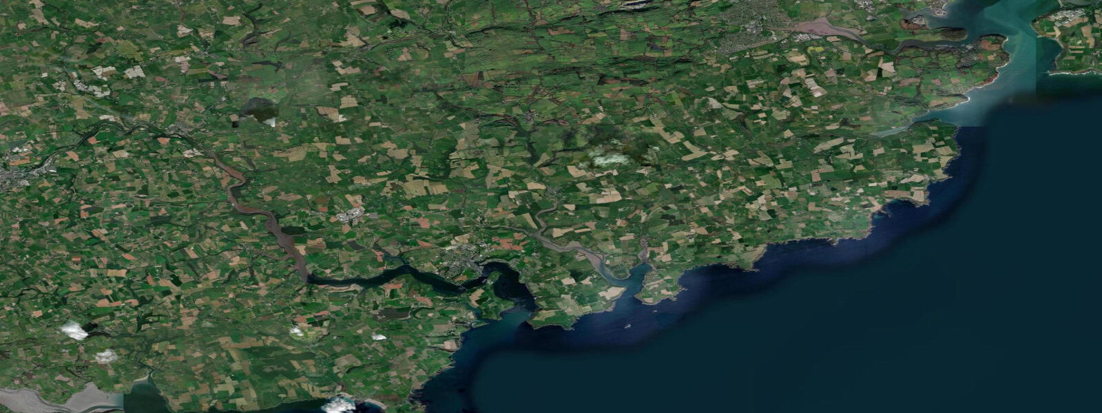
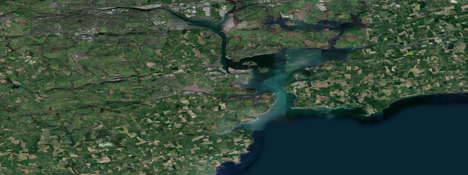
Kinsale sits at the mouth of the Bandon River where it meets a wide tidal inlet on the south Cork coast, roughly 25 kilometres southwest of Cork city. The town is compact, steeply terraced above the water, and has been a commercial fishing harbour for centuries. Today it combines a working fishing fleet — prawns, crab, demersal fish — with one of Ireland's more developed charter angling industries and an active leisure-sailing scene.
The tidal character here is semidiurnal with a mean range of approximately 3.5 metres above LAT. On spring tides the range approaches 4.1 metres; on neap tides it drops to around 1.7 metres. The critical local feature is the drying characteristic of Kinsale harbour itself: at low water springs, much of the inner harbour dries to soft mud, leaving moored boats lying on their sides or sitting on legs. Visiting sailors need to account for this; the harbour master's office can advise on berths that hold water through the low-water period. The flood tide runs northeast into the estuary; the ebb reverses southwest toward the harbour mouth and open sea.
The Old Head of Kinsale headland lies approximately 10 kilometres south of the town — a dramatic promontory extending into the Celtic Sea, recognisable by the lighthouse on its tip. The headland forms a navigational waypoint for coastal traffic and produces productive fishing ground in its lee. RMS Lusitania was sunk by a German U-boat 18 kilometres south-southwest of the Old Head on 7 May 1915; 1,198 people died. A memorial stands in the town.
For shore anglers, the best bass marks are at the harbour mouth and on the sandbanks that expose at low water on the eastern shore. Charter boats work the Lusitania wreck and the inshore reefs for pollock, ling, and cod. The town itself is compact enough to walk — restaurants, a good chandlery, and the 17th-century Charles Fort at the harbour mouth are all within reach of any berth.
Open-Meteo Marine predictions carry ±45 minutes timing uncertainty and ±0.2–0.3 metres height uncertainty. Passage planning for the Old Head approaches and offshore banks should reference UKHO Admiralty chart 2081 and Marine Institute Ireland published data.
Tide questions about Kinsale
Quick answers to the most common questions about tide times, range, and water access at Kinsale.
Does Kinsale harbour dry out at low tide?
Yes. On spring tides, much of the inner harbour dries to soft mud, leaving moored vessels aground. The drying height varies by berth — finger pontoons in the marina hold water through the low-water period, but drying moorings on the river side can expose up to 2.5 metres of keel at low water springs. Visitors arriving by sea should contact the harbour master in advance to confirm whether a berth holds water at their expected arrival time. On neap tides, drying extent is considerably less.
What is the tidal range at Kinsale?
Mean spring range at Kinsale is approximately 4.1 metres above LAT; mean neap range around 1.7 metres. The mean range is close to 3.5 metres. Tides are semidiurnal — two high waters and two lows per day. The flood enters the estuary from the southwest and runs northeast up the Bandon River; the ebb reverses. High water at Kinsale follows high water at Cork (Cobh) by a few minutes given the positions on the same tidal system.
Is charter fishing available at Kinsale?
Kinsale is one of Ireland's main charter-angling bases. Several operators run full-day and half-day trips targeting pollock and ling on the inshore reefs, bottom species on the offshore banks, and seasonal shark (blue and porbeagle) further offshore. Wreck fishing over the Lusitania site approximately 18 kilometres south-southwest of the Old Head of Kinsale is a specific draw for experienced anglers. Most operators work the tide — morning trips timed to the flood or ebb depending on the target mark. Book in advance during summer months.
Where is the Old Head of Kinsale and what are the tidal conditions there?
The Old Head of Kinsale is a headland 10 kilometres south of the town, terminating in a lighthouse. Tidal streams around the headland accelerate on springs — typically 1.5–2.0 knots in the closest approaches — and the overfalls off the southern tip can produce steep, confused seas when wind and tide oppose. Passage-makers rounding the headland on a coastal route should consult the UKHO tidal atlas for the Irish Sea (NP256) for accurate stream timings. The area south and southwest of the headland is productive fishing ground, particularly for demersal species, but exposed to Celtic Sea weather systems.
How accurate are the tide times shown for Kinsale?
Tide predictions for Kinsale on TideTurtle come from Open-Meteo Marine model output, which carries a forecast uncertainty of roughly ±45 minutes on timing and ±0.2–0.3 metres on height. For day-visitor and recreational use — checking whether the harbour has water, timing a beach walk — this is generally adequate. For berthing a keel boat in a tidal harbour like Kinsale, where drying the boat is a real possibility, always cross-check against Marine Institute Ireland tide tables or UKHO publications. TideTurtle does not replace official nautical charts or pilotage guides.
7-day tide table — Kinsale
Heights relative to MSL. Predictions: Open-Meteo Marine (MeteoFrance SMOC, 0.08° grid) — heights relative to MSL (not chart datum / LAT). Model-derived.
| Day | Type | Time | Height |
|---|---|---|---|
| Sun 21 Jun | High | 01:00 | -0.4m |
| Low | 04:35 | -1.8m | |
| High | 10:22 | 0.7m | |
| Low | 16:53 | -1.8m | |
| High | 22:55 | 0.8m | |
| Mon 22 Jun | Low | 05:24 | -1.6m |
| High | 11:22 | 0.7m | |
| Low | 17:49 | -1.6m | |
| High | 23:55 | 0.8m | |
| Tue 23 Jun | Low | 06:21 | -1.5m |
| High | 12:22 | 0.7m | |
| Low | 18:50 | -1.5m | |
| Wed 24 Jun | High | 00:55 | 0.7m |
| Low | 07:19 | -1.4m | |
| High | 13:21 | 0.7m | |
| Low | 19:50 | -1.4m | |
| Thu 25 Jun | High | 01:53 | 0.8m |
| Low | 08:20 | -1.2m | |
| High | 14:16 | 0.9m | |
| Low | 20:51 | -1.2m | |
| Fri 26 Jun | High | 02:43 | 0.9m |
| Low | 09:19 | -1.3m | |
| High | 15:08 | 0.9m | |
| Low | 21:46 | -1.3m | |
| Sat 27 Jun | High | 03:36 | 0.9m |
| Low | 10:10 | -1.3m | |
| High | 15:56 | 1.0m | |
| Low | 22:35 | -1.4m |