Kuta Lombok tide times
Kuta Lombok tide forecast — heights relative to MSL.
Today's tide times for Kuta Lombok
Tide times at Kuta Lombok on Sunday, 21 June 2026: first low tide at 08:00, first high tide at 13:51, second low tide at 20:10. Sunrise 06:28, sunset 18:04.
Tide chart for Kuta Lombok
24-hour cosine-interpolated curve around the present moment. Heights relative to MSL. Predictions: Predictions: Open-Meteo Marine (MeteoFrance SMOC, 0.08° grid).
Sun, moon and conditions on Sun 21 Jun
Snapshot at build time — refreshes daily. Sea state from Open-Meteo Marine.
Highs and lows next 7 days
Every predicted high and low for the next week, with the daily tidal coefficient (0–120; higher = bigger swing, > 95 means stronger currents).
Other spots nearby
The three closest curated TideTurtle locations to Kuta Lombok, measured by great-circle distance.
Today's solunar windows
Solunar tradition: major periods are the ≈3h windows around moon transit and opposition; minor are ≈2h around moonrise and moonset. Pair with the local tide stage and wind for the best read.
Cycle dates near Kuta Lombok
Last spring tide on Sun 21 Jun (range 1.7m). Next spring tide on Sat 27 Jun (range 1.6m). Next neap on Tue 23 Jun.
Spring tides cluster around new and full moons (biggest swings). Neap tides land on quarter moons (smallest swings). See the spring tide and neap tide glossary entries for the why.
About tides at Kuta Lombok
A short guide to the coastline at Kuta Lombok — geography, sea state, and what the tide is actually doing under your feet.
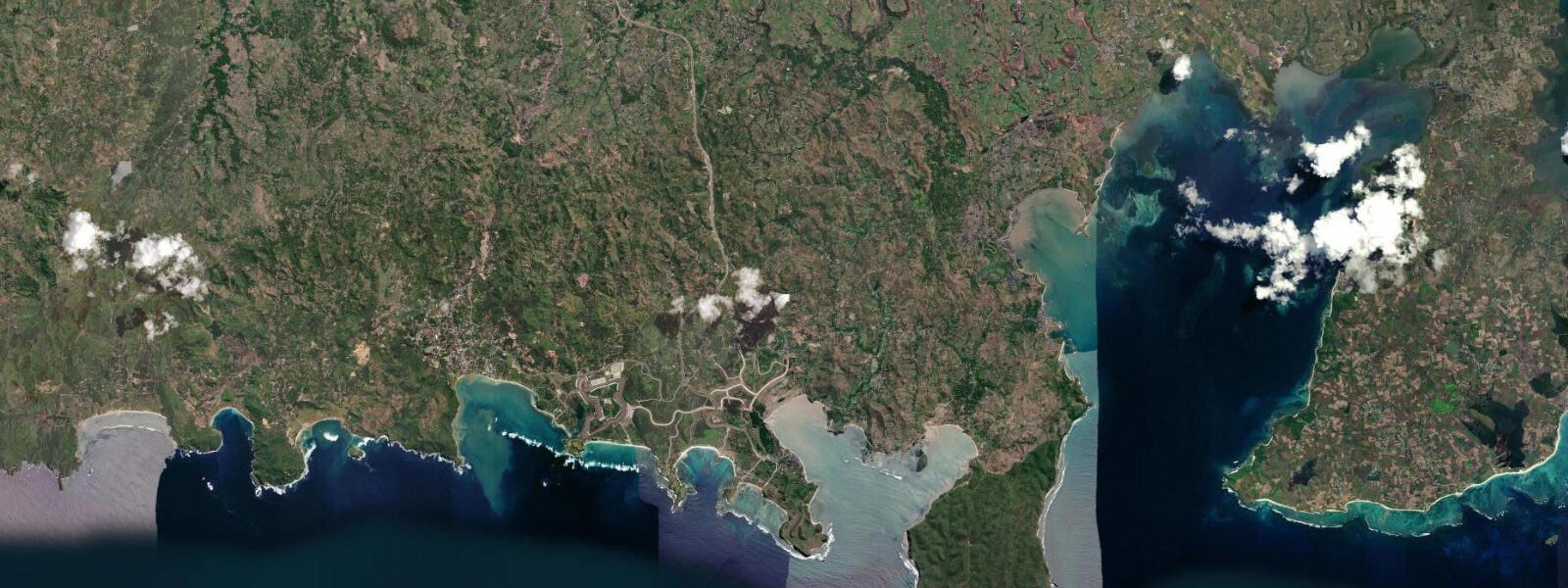
Kuta Lombok is on the south coast of the island, facing the Indian Ocean directly — a different world from the north-coast Gili Islands circuit and separated from it by Lombok's central volcanic spine. The landscape is the first thing to register: rugged volcanic headlands alternating with wide, horseshoe bays of white sand, fishing villages with outrigger fishing boats pulled above the high-water line, and the Indian Ocean horizon unobstructed in every direction to the south. 5 m, significantly larger than the north-coast Lombok Strait side, because the south coast has direct Indian Ocean exposure and the full tidal signal propagates without the geometric constraints that apply in the strait.
The wide sandy flats at Kuta Bay expose dramatically at low spring water — the beach extends 80–100 m from the vegetation line to the waterline at the lowest predicted lows. The surf breaks that define Kuta Lombok's reputation among wave-riders are tide-sensitive in the way all reef breaks are. The four main breaks in the immediate Kuta area — Seger, Are Guling (known locally as the Ekas Right and the Grupuk Inside and Outside, depending on reference), and the beach breaks at Kuta Bay — shift in character with the tidal state.
5 m of water covers the reef and allows clean takeoffs. 5 m), Seger is too shallow for all but the smallest swells. Mawi, 10 km west of Kuta along a rough coast track, is one of the heaviest and most respected breaks in Indonesia — a left-hand reef break that breaks over sharp volcanic rock.
Mawi is accessible only at high-to-mid tide; at low spring the approach channel is impassable and the reef itself is exposed on the inner section. Visitors should be experienced surfers and be aware that Mawi is remote — the nearest medical facilities with any capacity are in Praya, 25 km north. The Mandalika Special Economic Zone development has changed Kuta's character since 2017.
3 km MotoGP-standard racing circuit built directly behind Seger Beach — held its first MotoGP round in 2022. The circuit has brought significant infrastructure investment to the area: the main road along the south coast improved markedly, accommodation capacity increased, and access to previously remote bays (Selong Belanak, 20 km west) improved. The development also brought displacement of some traditional fishing communities; the tidal fishing practices of Seger village are less visible now than they were before construction.
Shore fishing from the rocky headlands east of Kuta Bay is productive for trevally, mackerel, and occasional bluefin tuna that run close to the south coast in the SE trade season (June–September). The flood tide across the rocky points at the east end of Kuta Bay — accessible on foot at low water, impassable at high spring — is the standard casting window. Anglers work the current seams around the exposed headland rocks during the flood.
The angler tradition that scores fishing days by the lunar cycle rates the three days either side of the full and new moon most highly; those periods align with the spring tides that produce the most current on the Kuta headlands. Kuta Bay beach itself is a family beach — the bay is sheltered by headlands on both sides and produces gentle surf in the centre even when the reef breaks outside are active. At high spring the bay is deep enough for swimming close to the beach; at low spring the inner tidal flat exposes 50–60 m and the swimming zone retreats to the outer bay.
3 m. BIG (Badan Informasi Geospasial) publishes the authoritative Indonesian tide tables.
Tide questions about Kuta Lombok
Quick answers to the most common questions about tide times, range, and water access at Kuta Lombok.
What is the tidal range at Kuta Lombok and how does it affect the surf breaks?
Spring tidal range at Kuta Lombok is 3.0–3.5 m — larger than the north coast because of direct Indian Ocean exposure. The reef breaks around Kuta are tide-sensitive in the standard way for reef breaks: Seger reef works best from mid-tide upward on the flood, when 1.0–1.5 m of water covers the reef. At low spring (below 0.5 m), Seger is too shallow for comfortable surfing on all but very small swells. Mawi, 10 km west, breaks over sharp volcanic rock and is accessible only at high-to-mid tide — the approach channel to Mawi becomes impassable at low spring. For the beach breaks inside Kuta Bay, the tidal effect is gentler; the bay is sheltered and the breaks shift shape with the tide rather than becoming dangerous or inaccessible. Check the predicted low-water height before surfing any of the Kuta reef breaks.
How has the Mandalika Circuit development changed Kuta Lombok?
The Pertamina Mandalika Circuit, a 4.3 km MotoGP-standard venue built behind Seger Beach, hosted its first MotoGP Grand Prix in 2022. The development is part of the Indonesian government's Mandalika Special Economic Zone, which has brought significant infrastructure change to the south coast. Road quality on the coastal route from Praya to Kuta improved substantially. Accommodation capacity in Kuta increased with new hotels and guesthouses built for circuit race weekends. Remote bays to the west (Selong Belanak, Mawi) became more accessible. The circuit is visible from Seger Beach; during race weekends (MotoGP typically in October) accommodation in Kuta fills completely. Outside race weekends, the circuit has no practical effect on the beach or surf environment.
What should I know before surfing Mawi?
Mawi is a heavy left-hand reef break 10 km west of Kuta along a rough coastal track (4WD or motorbike recommended). The break works on south to southwest Indian Ocean swell and is one of the most powerful reef breaks in Lombok. Mawi requires high-to-mid tide for safe access — at low spring the approach channel is a tidal flat and the inner reef is exposed. The wave breaks over sharp volcanic rock; wipeouts carry a reef contact risk. There is no medical facility at Mawi; the nearest hospital with basic emergency capacity is in Praya, 25–30 km north. Only experienced surfers familiar with hollow, powerful reef breaks should surf Mawi. The best swell window is the SE trade season (May–September) when consistent south swells from the Southern Ocean arrive at 1.5–3.0 m. Local guides in Kuta can advise on current swell and tide conditions.
Is Kuta Lombok good for fishing?
Yes. The south coast of Lombok has productive shore and boat fishing. Shore anglers work the rocky headlands east of Kuta Bay and the exposed rock platforms at the headland tips between adjacent bays. The flood tide across the rocks is the standard productive window — trevally, mackerel, and occasional bluefin tuna follow the current around the headland points. The headland east of Seger beach is accessible on foot at low water; the path from the beach (15 minutes) reaches a flat rock shelf that is above the high-tide line. The angler tradition that uses the lunar cycle to score fishing days rates the three days either side of the full and new moon most highly — those spring-tide periods coincide with the strongest current on the headlands. Boat fishing for skipjack and yellowfin tuna operates from local fishermen's boats out of Kuta harbour; charter arrangements are informal and available through accommodation operators.
Where do the tide predictions for Kuta Lombok come from?
Predictions on this page are from Open-Meteo Marine, a free gridded global ocean model, with typical accuracy of ±45 minutes on timing and ±0.2–0.3 m on height. At Kuta Lombok, where the spring range reaches 3.0–3.5 m, the model uncertainty of ±0.2–0.3 m is a smaller fraction of the total signal than at lower-range coasts — the predictions are more practically reliable here than they are at microtidal sites. BIG (Badan Informasi Geospasial) publishes the authoritative Indonesian tide tables and is the reference for any safety-critical coastal activity. For surf planning, always combine the tide prediction with the current swell forecast; the tidal state determines whether a reef break is rideable, but the swell forecast determines whether it is worth paddling out.
8-day tide table — Kuta Lombok
Heights relative to MSL. Predictions: Open-Meteo Marine (MeteoFrance SMOC, 0.08° grid) — heights relative to MSL (not chart datum / LAT). Model-derived.
| Day | Type | Time | Height |
|---|---|---|---|
| Sun 21 Jun | Low | 08:00 | -0.2m |
| High | 13:51 | 1.3m | |
| Low | 20:10 | -0.4m | |
| Mon 22 Jun | High | 02:39 | 1.3m |
| Low | 08:45 | -0.1m | |
| High | 14:44 | 1.0m | |
| Low | 20:52 | -0.3m | |
| Tue 23 Jun | High | 15:48 | 0.8m |
| Low | 21:42 | -0.1m | |
| Wed 24 Jun | High | 17:10 | 0.7m |
| Thu 25 Jun | Low | 12:36 | -0.1m |
| High | 18:43 | 0.6m | |
| Low | 23:57 | 0.1m | |
| Fri 26 Jun | High | 06:38 | 1.2m |
| Low | 13:50 | -0.3m | |
| High | 20:03 | 0.7m | |
| Sat 27 Jun | Low | 01:08 | 0.1m |
| High | 07:34 | 1.2m | |
| Low | 14:38 | -0.4m | |
| High | 21:00 | 0.8m | |
| Sun 28 Jun | Low | 02:08 | 0.1m |
| High | 07:00 | 1.2m |