Vestmannaeyjar (Westman Islands) tide times
Vestmannaeyjar (Westman Islands) tide forecast — heights relative to MSL.
Today's tide times for Vestmannaeyjar (Westman Islands)
Tide times at Vestmannaeyjar (Westman Islands) on Friday, 19 June 2026: first high tide at 00:00, first low tide at 02:21, second high tide at 08:25, second low tide at 14:25, third high tide at 20:52. Sunrise 03:04, sunset 23:40.
Tide chart for Vestmannaeyjar (Westman Islands)
24-hour cosine-interpolated curve around the present moment. Heights relative to MSL. Predictions: Predictions: Open-Meteo Marine (MeteoFrance SMOC, 0.08° grid).
Sun, moon and conditions on Fri 19 Jun
Snapshot at build time — refreshes daily. Sea state from Open-Meteo Marine.
Highs and lows next 7 days
Every predicted high and low for the next week, with the daily tidal coefficient (0–120; higher = bigger swing, > 95 means stronger currents).
Other spots nearby
The three closest curated TideTurtle locations to Vestmannaeyjar (Westman Islands), measured by great-circle distance.
Today's solunar windows
Solunar tradition: major periods are the ≈3h windows around moon transit and opposition; minor are ≈2h around moonrise and moonset. Pair with the local tide stage and wind for the best read.
Cycle dates near Vestmannaeyjar (Westman Islands)
Last spring tide on Fri 19 Jun (range 2.4m). Next neap on Wed 24 Jun.
Spring tides cluster around new and full moons (biggest swings). Neap tides land on quarter moons (smallest swings). See the spring tide and neap tide glossary entries for the why.
About tides at Vestmannaeyjar (Westman Islands)
A short guide to the coastline at Vestmannaeyjar (Westman Islands) — geography, sea state, and what the tide is actually doing under your feet.
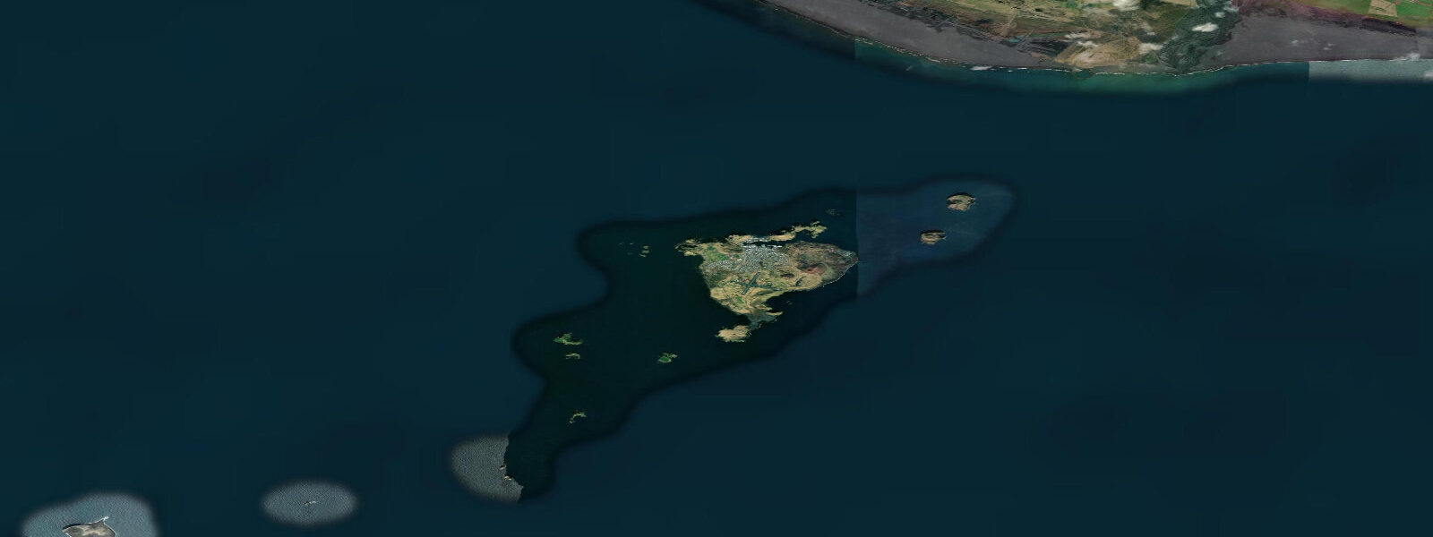
The Westman Islands are a volcanic archipelago 10 kilometres off Iceland's south coast — fifteen islands and thirty rock stacks rising from the North Atlantic, inhabited on only one (Heimaey) and formed by the same volcanic activity that created Iceland itself. The most recent major event was in 1973 when Eldfell volcano erupted without warning on Heimaey, covering a third of the town in lava and ash in five months. The eruption expanded the island by 2.5 square kilometres. The lava field from that eruption is still warm in places and has been partly excavated to reveal buried houses — the Pompei of the North exhibition runs tours.
Tidal range at Vestmannaeyjar is 3.0 to 4.0 metres at springs. The island group's exposed North Atlantic position receives full tidal exchange, and the channels between the islands create strong tidal currents — understanding them matters for any boat trip between the islands. The harbour at Heimaey is protected and functional year-round; the open-ocean crossing from the mainland (by ferry or small plane) is weather-dependent.
The puffin colony on the Westman Islands is the largest in the world: approximately 8 to 10 million Atlantic puffins nest in burrows on the cliff tops and grassy slopes between May and August. The density is extraordinary — from the cliff edge at Stórhöfði you can watch puffins landing, taking off, and queuing at burrow entrances continuously. The birds arrive in May, raise one chick, and leave in August. Local children participate in the puffin rescue (Puffin Patrol) — newly fledged birds disorientated by town lights are collected and released at sea.
Seakayaking in the island channels is the premium water activity. The rock stacks and sea caves are accessible in calm conditions, and the marine life around the islands is exceptional: harbour seals, grey seals, porpoises, minke whales, and orca are present in the channels. The current patterns between the stacks require experience — local guiding is the correct approach. Rigid inflatable boat (RIB) tours cover more ground more safely for those without kayaking experience.
Heimaey town is small (approximately 4,000 people) and functional. The aquarium and natural history museum document the island's marine environment. The Þjóðhátíð festival in the first weekend of August — a national gathering in the natural amphitheatre of Herjólfsdalur valley — draws 15,000+ people, equivalent to three times the island's population, for bonfires, music, and fireworks that can be seen from the mainland.
Predictions on this page come from Open-Meteo Marine, a gridded global ocean model. Accuracy is typically within plus or minus 45 minutes on timing and 0.2 to 0.3 metres on height — model-derived, not from a local gauge. For authoritative Icelandic tide data, consult the Icelandic Meteorological Office (Veðurstofa Íslands).
Tide questions about Vestmannaeyjar (Westman Islands)
Quick answers to the most common questions about tide times, range, and water access at Vestmannaeyjar (Westman Islands).
What is the tidal range at the Westman Islands?
Spring tidal range is 3.0 to 4.0 metres at the Westman Islands. The channels between the islands and stacks carry strong tidal currents on both ebb and flood. This is important for boat and kayak navigation — local guide knowledge of current timing is valuable. The Heimaey harbour is sheltered and the tidal range there manifests as a significant water-level change visible on the harbour walls.
How do I get to the Westman Islands?
Ferry from Landeyjahöfn (south coast, 35-minute crossing) or Þorlákshöfn (2.5-hour crossing, used when weather prevents Landeyjahöfn). The Herjólfur ferry runs several times daily; advance booking is recommended in summer. Eagle Air also runs small-plane flights from Reykjavík's domestic airport (25 minutes). Both transport types are weather-dependent — the crossing can be cancelled in severe conditions. Check status before departure.
When is the best time to see puffins at Vestmannaeyjar?
May through early August. Atlantic puffins arrive in May and the colony is at full activity through July. By mid-August the birds are departing. The cliff top at Stórhöfði, accessible by road (the highest point on the island), gives the best views into the nesting burrows. Early morning or evening visits show the birds returning from fishing trips with sand eels in their beaks. The Puffin Patrol rescue runs August to early September.
What happened in the 1973 Eldfell eruption?
On 23 January 1973, with no warning, a fissure opened through the centre of Heimaey town. The entire population (5,000 people) was evacuated overnight by fishing boat to the mainland — fortunately the fleet was in harbour due to a storm. The eruption continued for five months, burying 400 houses in lava and ash and adding 2.5 square kilometres to the island. The lava flow was partially stopped by pumping seawater onto its leading edge. The Eldheimar museum is built around an excavated house; the 1973 lava field is still slightly warm.
Is sea kayaking in the Westman Islands suitable for beginners?
Not independently — the tidal currents between the islands and stacks, combined with the open North Atlantic exposure, require experience and knowledge of local conditions. Guided kayak tours are the appropriate option for most visitors; local operators manage the routing to avoid the strongest currents and provide safety equipment. RIB boat tours cover the sea caves and rock stacks without the paddling requirement and are accessible regardless of kayaking ability.
7-day tide table — Vestmannaeyjar (Westman Islands)
Heights relative to MSL. Predictions: Open-Meteo Marine (MeteoFrance SMOC, 0.08° grid) — heights relative to MSL (not chart datum / LAT). Model-derived.
| Day | Type | Time | Height |
|---|---|---|---|
| Fri 19 Jun | High | 00:00 | -0.8m |
| Low | 02:21 | -1.6m | |
| High | 08:25 | 0.5m | |
| Low | 14:25 | -1.6m | |
| High | 20:52 | 0.8m | |
| Sat 20 Jun | Low | 03:15 | -1.5m |
| High | 09:16 | 0.4m | |
| Low | 15:21 | -1.5m | |
| High | 21:42 | 0.6m | |
| Sun 21 Jun | Low | 04:08 | -1.5m |
| High | 10:12 | 0.1m | |
| Low | 16:17 | -1.5m | |
| High | 22:36 | 0.2m | |
| Mon 22 Jun | Low | 05:01 | -1.5m |
| High | 11:13 | 0.0m | |
| Low | 17:19 | -1.3m | |
| High | 23:37 | 0.1m | |
| Tue 23 Jun | Low | 05:58 | -1.3m |
| High | 12:22 | 0.0m | |
| Low | 18:26 | -1.2m | |
| Wed 24 Jun | High | 00:42 | 0.1m |
| Low | 07:00 | -1.2m | |
| High | 13:26 | 0.1m | |
| Low | 19:41 | -1.1m | |
| Thu 25 Jun | High | 01:47 | 0.0m |
| Low | 07:56 | -1.2m | |
| High | 14:33 | 0.2m | |
| Low | 20:41 | -1.1m | |
| High | 23:00 | -0.8m |