West End, Roatan tide times
West End, Roatan tide forecast — heights relative to MSL.
Tide chart for West End, Roatan
24-hour cosine-interpolated curve around the present moment. Heights relative to MSL. Predictions: Predictions: Open-Meteo Marine (MeteoFrance SMOC, 0.08° grid).
Sun, moon and conditions on Fri 03 Jul
Snapshot at build time — refreshes daily. Sea state from Open-Meteo Marine.
Highs and lows next 7 days
Every predicted high and low for the next week, with the daily tidal coefficient (0–120; higher = bigger swing, > 95 means stronger currents).
Other spots nearby
The three closest curated TideTurtle locations to West End, Roatan, measured by great-circle distance.
Today's solunar windows
Solunar tradition: major periods are the ≈3h windows around moon transit and opposition; minor are ≈2h around moonrise and moonset. Pair with the local tide stage and wind for the best read.
About tides at West End, Roatan
A short guide to the coastline at West End, Roatan — geography, sea state, and what the tide is actually doing under your feet.
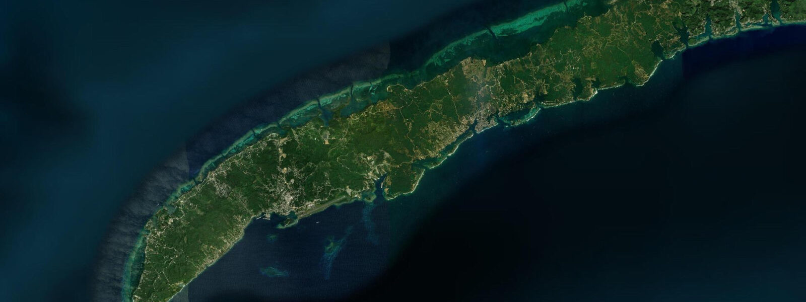
West End occupies the western tip of Roatan, the largest Bay Island off Honduras's Caribbean coast. It is a small town rather than a resort — wooden Caribbean buildings on either side of a single sandy lane, dive shops and small restaurants opening directly onto the beach, and the reef crest visible as a white line of foam from the porch. Half Moon Bay, on the north side of the West End point, is the main swimming and snorkelling beach: a short crescent of sand with calm, clear water and the reef accessible in a 5-minute swim.
The tidal regime is Caribbean microtidal: spring range 0.3 to 0.5 metres, mixed semidiurnal. Trade wind setup, Caribbean weather systems, and the interaction between tidal flow and the reef passage dominate water-level variation far more than the astronomical signal. The reef at West End runs parallel to the island's southwest shore and the dive sites cluster along the western reef crest — Sandy Shores, Spooky Channel, Hole in the Wall — at depths from 6 m on the shallow reef flat to 30+ m on the wall drop-off.
The primary activity out of West End is diving and snorkelling. The proximity of good reef to shore, the concentration of PADI dive shops in a 200 m stretch, and the price point (certification courses cheaper here than most Caribbean destinations) make West End one of the busiest dive training centres in the western Caribbean. Sandy Shores, immediately offshore from the beach, is the standard first open-water site: sandy bottom at 12 m, scattered coral heads, visibility typically 15 to 20 m, and gentle current. For more experienced divers, the deeper sites on the south wall — CoCo View Wall, Prince Albert Wall — involve some current on the predicted flood, running east along the wall.
Snorkellers at Half Moon Bay can reach the reef crest in less than 10 minutes from the waterline. The elkhorn and staghorn colonies at the crest are in partial recovery after past bleaching; brain coral, sea fans, and damselfish schools are dense even on the shallow sections. The best clarity is in the morning before afternoon trade wind chop reduces the surface visibility. Near the predicted slack at high water, current is minimal and the in-water experience is most relaxed.
For anglers, the passage between the West End reef and the deep water to the southwest holds barracuda, jack, and snapper on the reef edges. Small-boat anglers fishing the reef line on the predicted incoming tide find jack crevalle most active in the first two hours of the flood as baitfish are pushed against the reef face. Larger-game offshore fishing — mahi-mahi, wahoo, and marlin — runs from Roatan's main port at Coxen Hole, not from West End, which lacks the deep-water dock infrastructure.
Families find West End manageable: the lane is too narrow for significant vehicle traffic, the beach is short enough that children can be supervised easily, and the reef is accessible without a boat. Half Moon Bay is calm on most days; exceptions occur during north swell events in winter (November–March), when 0.5 to 1.0 m swell wraps around the headland and makes the bay rougher than usual. The incoming tide at those times pushes water directly into the bay mouth and can produce confused surface chop near the headland rocks.
Sunset from the western point of West End is directly over the Caribbean — the sun sets into open water with no land in the near frame. The low palm-fringed headland and the reef foam in the middle ground are a standard composition for photographers. The low tide exposes the rocky shelf below the headland and provides foreground texture in the last hour of light.
Predictions on this page come from Open-Meteo Marine, a global gridded ocean model. Accuracy is ±45 minutes on timing and ±0.2 to 0.3 metres on height. For dive planning, combine the tide prediction with current local operator knowledge of the specific wall sites — current at the deeper sites runs stronger and has more site-specific variation than the broad tidal prediction captures.
Tide questions about West End, Roatan
Quick answers to the most common questions about tide times, range, and water access at West End, Roatan.
When is the next high tide at West End, Roatan?
The predicted next high tide at West End is shown at the top of this page in Central Standard Time (CST, UTC-6; Honduras does not observe daylight saving). Spring range is 0.3 to 0.5 metres — Caribbean microtidal. For snorkelling, the slack near the high water mark gives the calmest current on the reef. Predictions come from Open-Meteo Marine (gridded, ±45 min / ±0.2–0.3 m).
How close is the reef to the beach at West End?
The reef crest off Half Moon Bay is accessible in a 5–10 minute swim from the waterline — roughly 150 to 200 m offshore. Shallow coral heads begin in 2–3 m of water well before the crest. No boat is required for the snorkel; fins and mask are sufficient. The morning hours before the trade wind generates surface chop give the best conditions. Dive operators along the main lane offer guided reef snorkel trips for those who prefer a boat approach to the deeper reef sections.
Is West End or West Bay better for diving?
West End has more accessible and numerous dive shops, lower prices, and immediate beach access to the reef. West Bay, 4 km east by water taxi, has a wider beach and the reef immediately offshore in very shallow water — better for casual snorkellers but less convenient for multi-tank diving. Both access the same reef system. West End tends to attract divers staying for days or weeks for courses; West Bay attracts day visitors from Coxen Hole cruise ships.
Where do tide predictions for West End, Roatan come from?
West End has more accessible and numerous dive shops, consistently lower prices for courses and guided dives, and immediate beach access to the reef crest from Half Moon Bay without a boat. West Bay, 4 km east accessible by water taxi (10 minutes, BZD ~25 round trip), has a wider beach and the reef immediately offshore in very shallow water — better for casual snorkellers but less convenient for multi-tank diving. Both beaches access the same Roatan barrier reef system. West End tends to attract divers staying for days or weeks working through certification courses; West Bay attracts day visitors from Coxen Hole cruise ship terminal. Neither is inherently better — the choice depends on whether you prioritise beach width or dive shop proximity.
Is this safe to use for navigation?
No. TideTurtle is a planning tool, not a nautical almanac. Navigation around the West End reef, including the passage between the reef and the open Caribbean to the southwest, requires current charts and awareness of the reef hazards on the approach from the west and south. The reef crest at West End is within 50 m of the surface in places and unmarked by navigation aids. Open-Meteo Marine gridded predictions are not a substitute for authoritative harmonic data for any vessel operation. For dive boats operating along the wall, local operator briefings on current and depth are the operational standard.
8-day tide table — West End, Roatan
Heights relative to MSL. Predictions: Open-Meteo Marine (MeteoFrance SMOC, 0.08° grid) — heights relative to MSL (not chart datum / LAT). Model-derived.
| Day | Type | Time | Height |
|---|---|---|---|
| Fri 03 Jul | — | ||
| Sat 04 Jul | — | ||
| Sun 05 Jul | Low | 06:50 | 0.0m |
| High | 13:10 | 0.1m | |
| Mon 06 Jul | — | ||
| Tue 07 Jul | — | ||
| Wed 08 Jul | — | ||
| Thu 09 Jul | Low | 10:10 | -0.1m |
| Fri 10 Jul | High | 04:00 | 0.1m |
| Low | 11:00 | -0.1m | |
| High | 17:00 | 0.2m | |