West Bay, Roatan tide times
West Bay, Roatan tide forecast — heights relative to MSL.
Today's tide times for West Bay, Roatan
Tide times at West Bay, Roatan on Saturday, 27 June 2026: first high tide at 06:00am, first low tide at 12:50pm. Sunrise 05:16am, sunset 06:22pm.
Tide chart for West Bay, Roatan
24-hour cosine-interpolated curve around the present moment. Heights relative to MSL. Predictions: Predictions: Open-Meteo Marine (MeteoFrance SMOC, 0.08° grid).
Sun, moon and conditions on Sat 27 Jun
Snapshot at build time — refreshes daily. Sea state from Open-Meteo Marine.
Highs and lows next 7 days
Every predicted high and low for the next week, with the daily tidal coefficient (0–120; higher = bigger swing, > 95 means stronger currents).
Other spots nearby
The three closest curated TideTurtle locations to West Bay, Roatan, measured by great-circle distance.
Today's solunar windows
Solunar tradition: major periods are the ≈3h windows around moon transit and opposition; minor are ≈2h around moonrise and moonset. Pair with the local tide stage and wind for the best read.
About tides at West Bay, Roatan
A short guide to the coastline at West Bay, Roatan — geography, sea state, and what the tide is actually doing under your feet.
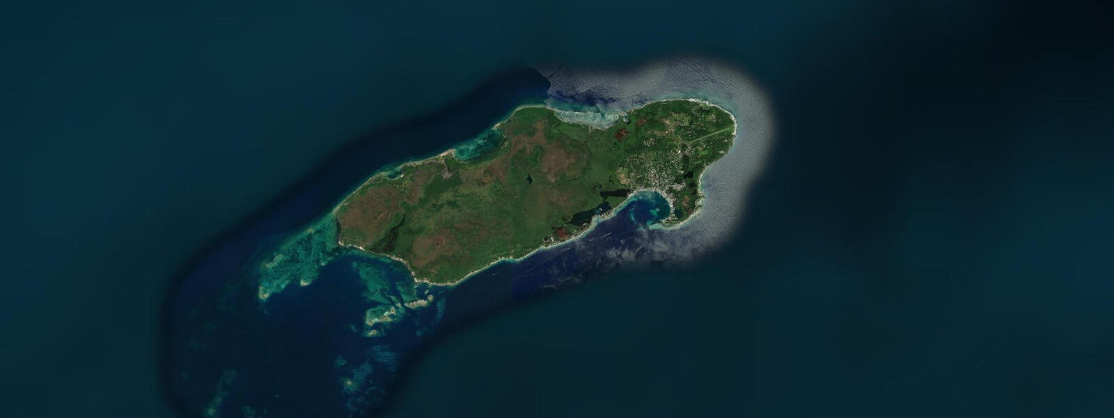
West Bay sits at the southwest tip of Roatan, the largest of Honduras’s Bay Islands, where the barrier reef swings closest to shore and the beach is as close to the Caribbean postcard ideal as this island gets. The sand is fine white coral, the water grades from pale turquoise inshore to deep blue at the reef line, and the reef crest is no more than 80–150 m from the beach at low water. This proximity is the defining fact for every activity here.
The tidal regime is microtidal — spring range 0.3–0.5 m above Chart Datum, mixed semidiurnal pattern with two highs and two lows per day, the two highs commonly differing by 5–10 cm. Neap range narrows to 0.1–0.2 m. In practical terms, the tide is a secondary variable at West Bay: the reef is accessible at all tidal stages, and the beach width changes by 8–12 m over a full spring cycle — noticeable but never limiting.
What the tide does control is passage depth between the reef crest and the shore. The inner lagoon averages 0.5–1.2 m at mid-tide. On a spring low, that depth drops to 0.2–0.7 m — thin enough that kayaks and stand-up paddleboards graze the bottom in places and small motorized pangas need to take care on the entry line through the reef pass. On the flood, the passage fills and small-boat transit becomes straightforward. Dive boats and glass-bottom boats use the deeper western pass regardless of tidal state, but the direct, shorter entry through the inner reef is tide-dependent.
For snorkellers, the reef crest at West Bay is one of the most accessible in the Bay Islands group. At high water, even novice swimmers can float over the shallowest sections with 0.6–1.0 m of clearance above the coral heads. The inner side of the reef has buttress formations, sea fans, and a resident population of parrotfish, queen angelfish, and yellowtail snapper. The east-to-west flood current along the reef runs 0.3–0.5 knots on spring tides — enough to carry a snorkeller 100–150 m down the reef in 30 minutes without effort. Dive boats deploy from the beach into 2–5 m of water on the inland side of the reef for pre-dive kitting, then cross the crest into deeper water on the seaward face.
For beach families, West Bay works well on any tide. The inner lagoon stays shallow and calm regardless — the reef absorbs swell energy before it reaches the beach. The water temperature is 27–29 °C year-round. Morning visits (before 10:00) avoid the worst of the midday heat and the tour-boat crowds arriving from Coxen Hole and the cruise ships when a vessel is in port at Mahogany Bay; the beach transitions from quiet to busy between 09:30 and 11:00 on ship days.
Photographers get the best light at West Bay before 09:00 and after 16:30. The beach faces roughly south-southwest, so direct morning light hits the reef from the east; the lagoon reflections are sharpest in the early-low-water window. Late afternoon low water — common in some lunar cycle periods — exposes sand flats between the beach and the reef crest that produce excellent foreground texture for wide-angle shots. The reef’s colour in the upper metre is best shot when the sun is above 30° elevation and the surface is calm.
Sport fishing from West Bay focuses on the reef edge and the drop-off beyond. Mutton snapper and grouper hold on the reef structure at all tides; the drop-off on the seaward face of the reef, where the bottom falls from 5 m to 15 m in 50 horizontal metres, concentrates jack and barracuda on the ebb as water drains from the lagoon. Charter pangas operate from the beach; the 20-minute run to the east end of the island reaches deeper water for pelagic species.
All tide predictions for West Bay come from the Open-Meteo Marine gridded model. Timing accuracy is ±45 minutes; height accuracy is ±0.3 m above Chart Datum. For the small tidal range here, the height uncertainty is a significant fraction of the signal — treat the predictions as orientation data rather than precision timing.
Tide questions about West Bay, Roatan
Quick answers to the most common questions about tide times, range, and water access at West Bay, Roatan.
What is the tidal range at West Bay, Roatan, and does it affect snorkelling on the reef?
West Bay has a mixed semidiurnal tidal range of 0.3–0.5 m on spring tides and 0.1–0.2 m on neaps. The reef crest is accessible for snorkelling at all tidal stages. At high spring water, clearance over the shallowest coral heads reaches 0.8–1.2 m — comfortable for swimmers of all abilities. At low spring water the same sections can be as shallow as 0.2–0.5 m, where accidental contact with coral is a real risk. Snorkel the inner reef crest sections on the upper half of the tide and move to deeper buttress formations at low water. Tide predictions from the Open-Meteo Marine gridded model carry ±45 minutes timing uncertainty and ±0.3 m height uncertainty.
Can small boats and kayaks transit the inner reef pass at West Bay at low tide?
The passage between the reef crest and the beach at West Bay averages 0.5–1.2 m depth at mid-tide. On a spring low water, the shallowest sections drop to 0.2–0.4 m — tight for kayaks and borderline for shallow-draft pangas. Dive and tour boats use the western deep pass regardless of tidal state; the direct inner-lagoon entry is practical only in the upper half of the tidal range. If your charter or rental departs on a rising tide, the return trip will be easier. Paddleboarders and kayakers planning a reef-circuit route should check the tide chart first and plan the shallow-passage crossing for the flood, not the ebb.
When is West Bay beach least crowded?
West Bay is quiet before 09:30 and after 16:00 on most days. On cruise ship port days — when a vessel docks at Mahogany Bay, 6 km east — the beach absorbs tour-bus arrivals from 10:00 to 15:00 and becomes visibly crowded. The Honduras Tourism Institute publishes cruise schedules at the Mahogany Bay port; the West Bay beach vendors know the schedule better than anyone. Early morning low-water windows give you the widest beach and fewest people simultaneously. Weekday mornings outside the November–April high season are the quietest combination.
What fish species do anglers target from West Bay, and how does tidal state affect them?
The reef edge and drop-off beyond West Bay hold mutton snapper, yellowtail snapper, grouper, and barracuda as resident species. Jack and larger barracuda concentrate on the seaward face of the reef on the ebb, when current drains from the lagoon and funnels through the reef passes — a reliable 90-minute feeding window around each low water. Pelagic species (wahoo, mahi-mahi, tuna) require a longer run east toward the deeper water off the island’s north coast. Charter pangas are available from the beach; confirm departure timing relative to the tide when booking for reef fishing.
Is West Bay suitable for children, and how does the tide affect safety?
West Bay is one of the best family beaches in the Bay Islands. The barrier reef absorbs virtually all incoming swell, leaving the inner lagoon consistently calm regardless of offshore conditions. The beach slope is gentle; the water is 0.3–0.8 m deep for the first 20–30 m from shore at mid-tide. Tidal range of 0.3–0.5 m on springs means the swim zone changes modestly — at high water the water reaches slightly closer to the beach access walkways; at low water the sandflat widens. The only tidal consideration for families is the lagoon-interior wading area: at a spring low, some sections between the beach and the reef crest expose as shallow as 0.2 m, which is fine for small children but means reef shoes are worth wearing across the inner flat.
5-day tide table — West Bay, Roatan
Heights relative to MSL. Predictions: Open-Meteo Marine (MeteoFrance SMOC, 0.08° grid) — heights relative to MSL (not chart datum / LAT). Model-derived.
| Day | Type | Time | Height |
|---|---|---|---|
| Sat 27 Jun | High | 06:00 | 0.1m |
| Low | 12:50 | -0.1m | |
| Sun 28 Jun | — | ||
| Mon 29 Jun | — | ||
| Tue 30 Jun | High | 08:00 | 0.1m |
| Wed 01 Jul | Low | 15:00 | -0.0m |