Bora Bora tide times
Bora Bora tide forecast — heights relative to MSL.
Today's tide times for Bora Bora
Tide times at Bora Bora on Friday, 26 June 2026: first high tide at 02:00pm. Sunrise 06:35am, sunset 05:44pm.
Tide chart for Bora Bora
24-hour cosine-interpolated curve around the present moment. Heights relative to MSL. Predictions: Predictions: Open-Meteo Marine (MeteoFrance SMOC, 0.08° grid).
Sun, moon and conditions on Fri 26 Jun
Snapshot at build time — refreshes daily. Sea state from Open-Meteo Marine.
Highs and lows next 7 days
Every predicted high and low for the next week, with the daily tidal coefficient (0–120; higher = bigger swing, > 95 means stronger currents).
Other spots nearby
The three closest curated TideTurtle locations to Bora Bora, measured by great-circle distance.
Today's solunar windows
Solunar tradition: major periods are the ≈3h windows around moon transit and opposition; minor are ≈2h around moonrise and moonset. Pair with the local tide stage and wind for the best read.
About tides at Bora Bora
A short guide to the coastline at Bora Bora — geography, sea state, and what the tide is actually doing under your feet.
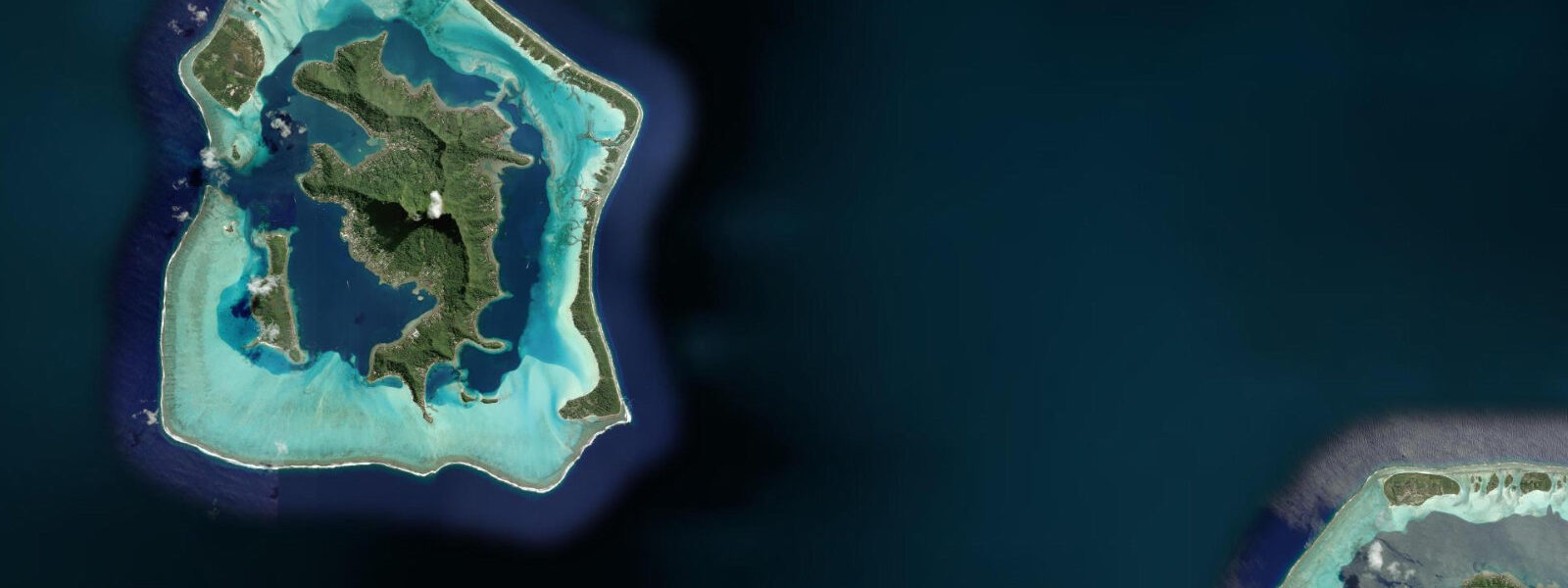
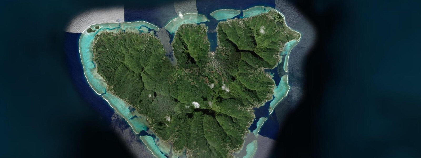
Bora Bora sits 230 kilometres northwest of Papeete, and in the popular imagination it is the template for the tropical atoll — volcanic peak, turquoise lagoon, overwater bungalows on stilts above the reef flat. The reality holds up. Mount Otemanu rises 727 m from the lagoon's edge, a basalt spire above the green lower slopes. The barrier reef completely encircles the lagoon, broken by a single navigable pass on the western side. The main settlement at Vaitape is on the main island; the motu — low sand-and-coral islets — ring the reef and carry most of the resort infrastructure.
The astronomical tidal range at Bora Bora matches the Society Islands signal: spring range 0.4–0.5 m, mixed semidiurnal. The higher high water reaches approximately 0.3 m above Chart Datum on springs; the lower low drops to 0.1 m below. For the reef flat that rims the lagoon interior — the shallow platform between the motu and the deeper central lagoon — this 0.4 m swing means the difference between a snorkelling depth of 0.6 m and 1.0 m over the shallowest coral heads. The shallow-water tidal effect is the one variable that changes meaningfully for anyone in the water rather than on a boat.
Farepiti Pass, the only navigable entry through the barrier reef, carries all vessel traffic entering and leaving the lagoon. The same trade-wind-driven pass current dynamic as at Papeete applies here: ENE winds push a surface drift against the eastern reef face, raising lagoon level, and the excess exits through Farepiti on the west. Pass outflow runs 1.5–2.5 knots on a strong trade day. Charter operators and resort water taxis transit the pass constantly and know the current state; visiting sailors should call Bora Bora Marina on VHF 9 for pass conditions before entry. The astronomical high water represents the minimum hydraulic pressure driving the pass current outbound.
For snorkellers, Bora Bora's lagoon is a consistently clear environment — visibility 15–25 m over the coral gardens in calm conditions. The coral heads off the eastern motu, in 1.5–4.0 m of water, hold a healthy population of lemon sharks, blacktip reef sharks, eagle rays, and the resident stingray community that is fed daily by the resort operators. Low-water neap conditions — when the total lagoon depth is at its minimum — push the stingrays into slightly deeper water off the sand flats and the shark activity concentrates in the channel between the motu and the main island. This is not a hazard-driven pattern but an observation for underwater photographers who want to find the animals.
For paddlers, Bora Bora's inner lagoon is one of the flattest paddling environments in the Pacific. The main island's bulk blocks the ENE trades across the western lagoon; the eastern lagoon, between the motu and the reef, gets more wind. A circumnavigation of the main island by kayak or SUP — roughly 32 km — is a full day's effort with no technical difficulty. The tidal current running through the Farepiti Pass channel sets southwest on the outbound flow; paddlers rounding the northwest tip of the main island between the pass and Vaitape need to account for a 0.3–0.5 knot cross-current on the leg nearest the pass entrance.
Anglers work the pass edges for trevally and wahoo, where the outbound current concentrates baitfish in the rip lines off the channel buoys. The drop-off from lagoon to oceanic depth begins immediately outside the pass — a 10-minute boat ride from Vaitape puts a small boat over 200 m of water. Yellowfin and big-eye tuna are caught trolling in these depths. Inside the lagoon, bone fishing on the sand flats at low water is a specialist option — bonefish populations exist though they are not as well-known or guided as in the Caribbean or Kiribati.
For photographers, the classic shot — Otemanu reflected in calm lagoon water at dawn — is taken from the eastern motu, facing west. The mountain catches first light from 06:00 in June; from 05:45 in December. Low water at dawn creates the widest and flattest reflective surface on the sand flats between the motu and the main island. Resort pontoons and overwater bungalow platforms obscure some of the western shoreline; the best unobstructed approach is by kayak at first light before the resort activity begins.
All tide predictions for Bora Bora come from the Open-Meteo Marine gridded model. Timing accuracy is ±45 minutes; height accuracy is ±0.3 m above Chart Datum.
Tide questions about Bora Bora
Quick answers to the most common questions about tide times, range, and water access at Bora Bora.
What is the tidal range at Bora Bora and how does it affect snorkelling over the reef flat?
Bora Bora's spring tidal range is 0.4–0.5 m, mixed semidiurnal. Over the shallow coral heads on the inner reef flat — depths of 0.5–1.5 m at mid-tide — a 0.4 m swing changes the snorkelling character significantly. At high water, the shallowest coral heads have 0.8–1.0 m of cover, comfortable for snorkellers without touching coral. At low neap water, the same heads may have 0.3–0.4 m of cover — requiring care to avoid contact and fin damage. The best snorkelling conditions combine high water with calm, low-wind conditions that maintain visibility. Model uncertainty is ±45 minutes timing and ±0.3 m height — treat stated low-water depths as indicative, not exact.
How do boats enter Bora Bora's lagoon through Farepiti Pass?
Farepiti Pass on the west side of the barrier reef is the only navigable entry to Bora Bora's lagoon. The pass runs 200–250 m wide between marked buoys; outbound lagoon flow driven by ENE trade winds typically runs 1.5–2.5 knots. The safest entry window is around astronomical high water, when the pressure differential between lagoon and ocean is at its minimum and pass flow is slowest. In strong trade conditions (winds above 20 knots), even the high-water slack can carry 1.0–1.5 knots through the pass — entering against this current in a 1.5 m swell creates a short, steep chop that is uncomfortable in small craft. Call Bora Bora Marina on VHF 9 for current pass conditions before approach.
Where can you find sharks and rays inside the lagoon and what tidal conditions are best?
The resident lemon and blacktip reef shark population at Bora Bora concentrates in the channel between the eastern motu and the main island, in 3–8 m of water. The stingray community on the sand flats is fed daily by resort operators near the main island's northwest shore. At low-water neap conditions, stingrays move off the shallowest sand flats into slightly deeper water; shark activity concentrates in the channel. At high water, both species range more widely across the coral gardens and sand flats. Neither pattern represents a hazard differential — both tidal states offer reliable sightings. Underwater photographers prefer the low-water concentration pattern for predictable framing.
Can you kayak around the main island of Bora Bora and how long does it take?
Circumnavigating the main island of Bora Bora by kayak is approximately 32 km and takes 6–8 hours for a paddler maintaining 4–5 km/h. The western lagoon is sheltered by the island's own mass and stays calm through most trade-wind conditions. The eastern lagoon, between the main island and the motu, gets more wind chop when ENE trades are above 15 knots. The critical section is the northwest corner near Farepiti Pass, where the outbound pass current sets southwest at 0.3–0.5 knots — plan this section at or after high water when the current is weakest. Start the circumnavigation clockwise (heading south from Vaitape first) to tackle the pass section on the return with the current already easing.
What fishing is possible at Bora Bora and when is the best time?
The pass edges at Farepiti yield trevally and wahoo where outbound current concentrates baitfish in rip lines off the channel buoys — the ebb window at dawn and dusk is the most productive period. Ten minutes outside the pass the bottom drops to 200 m; yellowfin and big-eye tuna are caught trolling here year-round. Inside the lagoon, the sand flats at low water support a small population of bonefish — specialist light-tackle fishing requiring a guide and specific permit. Lagoon fishing for parrotfish and triggerfish on the reef heads is possible by snorkel-and-spear with a valid French Polynesia fishing permit. Bone fishing peaks in the drier months (June–October) when clear water improves spotting on the flats.
8-day tide table — Bora Bora
Heights relative to MSL. Predictions: Open-Meteo Marine (MeteoFrance SMOC, 0.08° grid) — heights relative to MSL (not chart datum / LAT). Model-derived.
| Day | Type | Time | Height |
|---|---|---|---|
| Fri 26 Jun | High | 14:00 | 0.7m |
| Sat 27 Jun | Low | 17:50 | 0.6m |
| Sun 28 Jun | High | 00:00 | 0.7m |
| Mon 29 Jun | Low | 06:00 | 0.6m |
| High | 12:10 | 0.7m | |
| Tue 30 Jun | — | ||
| Wed 01 Jul | — | ||
| Thu 02 Jul | Low | 06:50 | 0.6m |
| Fri 03 Jul | High | 13:00 | 0.8m |