Sørvágsvatn, Vágar Island tide times
Sørvágsvatn, Vágar Island tide forecast — heights relative to MSL.
Today's tide times for Sørvágsvatn, Vágar Island
Tide times at Sørvágsvatn, Vágar Island on Saturday, 4 July 2026: first high tide at 01:00am, first low tide at 04:16am, second high tide at 10:10am, second low tide at 04:08pm, third high tide at 10:24pm. Sunrise 03:47am, sunset 11:18pm.
Tide chart for Sørvágsvatn, Vágar Island
24-hour cosine-interpolated curve around the present moment. Heights relative to MSL. Predictions: Predictions: Open-Meteo Marine (MeteoFrance SMOC, 0.08° grid).
Sun, moon and conditions on Sat 04 Jul
Snapshot at build time — refreshes daily. Sea state from Open-Meteo Marine.
Highs and lows next 7 days
Every predicted high and low for the next week, with the daily tidal coefficient (0–120; higher = bigger swing, > 95 means stronger currents).
Other spots nearby
The three closest curated TideTurtle locations to Sørvágsvatn, Vágar Island, measured by great-circle distance.
Today's solunar windows
Solunar tradition: major periods are the ≈3h windows around moon transit and opposition; minor are ≈2h around moonrise and moonset. Pair with the local tide stage and wind for the best read.
Cycle dates near Sørvágsvatn, Vágar Island
Next spring tide on Sun 05 Jul (range 1.6m). Next neap on Thu 09 Jul.
Spring tides cluster around new and full moons (biggest swings). Neap tides land on quarter moons (smallest swings). See the spring tide and neap tide glossary entries for the why.
About tides at Sørvágsvatn, Vágar Island
A short guide to the coastline at Sørvágsvatn, Vágar Island — geography, sea state, and what the tide is actually doing under your feet.
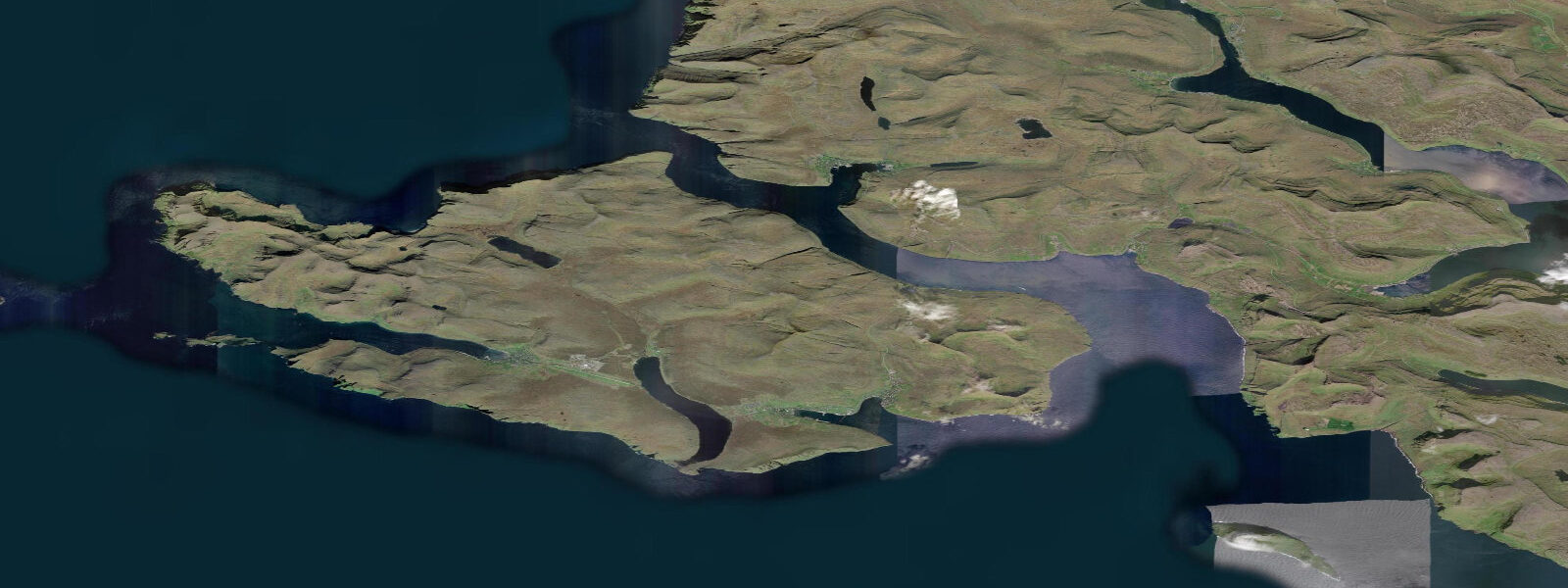
Vágar is the island that holds the Faroe Islands' only airport, and Sørvágsvatn — also known as Leitisvatn — is the lake on its western plateau that has become the most photographed natural feature in the entire archipelago. The lake is 3.4 km long, contains 54 million cubic metres of freshwater, and sits at an elevation of 30 m above sea level. From the clifftop path above the Trælanípa cliff face on the lake's southern shore, an optical illusion of perspective makes the lake appear to float 30 m directly above the open Atlantic. The image, widely circulated since around 2010, has driven a significant increase in hiking traffic to Vágar and prompted the introduction of a ticketed entry system for the path in 2019.
The tidal coast below the Trælanípa cliff gives the illusion its grounding in physical reality. The Atlantic at the cliff base runs semidiurnal tides with a mean spring range of approximately 1.5–2.0 m at Vágar's west coast, consistent with Faroese archipelago norms. The cliff drops vertically 142 m from the lake plateau to the sea. The cliff base is not accessible on foot; the view of the lake appearing to hover above the sea is from the clifftop path, and the perspective depends on standing at the correct angle above the lake's outlet waterfall, Bøsdalafossur, which drops through a ravine that cuts through the cliff to the sea.
The hiking route from Sørvágur village to Trælanípa and the lake viewpoint takes approximately 1.5–2 hours one way (about 5 km, with 200 m of ascent). A second, longer route extends around the lake to the Bøsdalafossur waterfall at the lake's outlet and then along the cliff edge — the full circuit is 11 km and takes 4–5 hours in good conditions. Both routes depart from the Sørvágur village centre, which is 5 km from Vágar airport. Entry to the hiking area requires a ticket purchased online or at the village; this controls access and funds path maintenance.
Sørvágsvatn and its catchment are protected. The lake supplies freshwater to Sørvágur via a regulated intake; the flow over Bøsdalafossur and through the ravine to the sea is the natural overflow. The ravine contains nesting seabirds — northern fulmars and puffins use the grassy cliff ledges above the ravine walls from April through August.
The western coast of Vágar is exposed to the full North Atlantic fetch. Swell runs consistently against the cliff base throughout the year, and in westerly gales the waves break against the cliff face and spray rises well above the cliff edge — conditions in which the iconic photograph cannot be safely taken and the path should not be walked. The lake's level varies slightly with seasonal precipitation; a wet winter raises the lake and increases the waterfall flow. The tidal state at the cliff base does not affect lake level — the 30 m vertical separation is absolute.
For birders, the lake margins and surrounding moorland hold Faroese subspecies of common snipe and meadow pipit, with white-tailed eagles regularly sighted overhead. Vágar is one of the more reliable eagle-watching locations in the archipelago. The cliff communities on the west coast hold kittiwakes, razorbills, and guillemots in season. The moorland from May to July has Arctic skua patrolling, targeting smaller birds near the lake.
Vágar airport serves routes to Copenhagen, Reykjavik, Edinburgh, London, and several other European cities. Rental cars and buses to Sørvágur run from the airport — Sørvágur is 5 km from the terminal, about 8 minutes by car on the road through the Vágatunnilin tunnel. Weather at Vágar is changeable in a way that matters practically — the hike to Trælanípa in low cloud is a very different experience from the clear-day spectacle. Check the forecast before booking.
Tide predictions here use Open-Meteo Marine. Timing accuracy is typically ±45 minutes; height accuracy ±0.2–0.3 m. The tidal data is relevant primarily to the approach by sea toward the west coast of Vágar and for understanding the cliff-base environment visible from above.
Tide questions about Sørvágsvatn, Vágar Island
Quick answers to the most common questions about tide times, range, and water access at Sørvágsvatn, Vágar Island.
What is the Sørvágsvatn lake illusion?
From the clifftop path above Trælanípa, the lake appears to float far above the open Atlantic due to an optical illusion of perspective. The lake is 30 m above sea level, separated from the cliff edge by the plateau terrain — but from the correct viewpoint the foreground recedes in a way that removes all visual reference for the true relationship between lake and sea. The lake drains to the sea via Bøsdalafossur waterfall through a ravine that cuts through the cliff. The illusion is most striking in morning side-light with the lake surface calm. It is a real topographic feature photographed from a specific angle, not a photo manipulation.
How do I hike to Trælanípa and Sørvágsvatn?
The trailhead is at Sørvágur village, 5 km from Vágar airport. A ticket is required and must be purchased online via the official Faroe Islands tourism website or at the village kiosk — introduced in 2019 to manage visitor numbers and fund path maintenance. The hike to the lake viewpoint above Trælanípa takes 1.5–2 hours one way (about 5 km, 200 m ascent). The full circuit to Bøsdalafossur waterfall and back is 11 km and takes 4–5 hours. Wear waterproof footwear; the path crosses boggy moorland throughout. Cloud cover makes the lake illusion disappear entirely — check the forecast before booking your ticket.
What are the tides at Vágar's west coast?
The west coast of Vágar is open North Atlantic — mean spring range is approximately 1.5–2.0 m, semidiurnal. The cliff at Trælanípa drops vertically 142 m to the sea and Atlantic swell runs against the base year-round. The tidal state does not affect the lake's water level (the lake is 30 m above sea level with no physical connection to the sea except through the cliff ravine outlet). The tide determines the exposed foreshore area at the cliff base and is relevant for anyone approaching by boat. Tide predictions use Open-Meteo Marine (±45 min / ±0.2–0.3 m).
Is there a ferry to Vágar island?
Vágar is connected to the main Faroe Islands road network via the Vágatunnilin subsea tunnel to Streymoy island (opened 2002), so you can drive from Tórshavn to Sørvágur in about 30 minutes. There is no regular passenger ferry to Vágar from other islands. The international airport on Vágar is the main entry point for visitors arriving from outside the Faroes — routes include Copenhagen, Reykjavik, Edinburgh, London, and several other European cities. The 300 bus from the airport to Sørvágur takes about 8 minutes; taxis are available at the terminal.
What wildlife is there around Sørvágsvatn?
The moorland around the lake holds meadow pipits, Faroese common snipe, and skylark. White-tailed eagles are regularly seen over the plateau — Vágar is noted as a reliable eagle location in the archipelago. The west-coast cliffs hold kittiwakes, guillemots, razorbills, and northern fulmars from April to August. The Bøsdalafossur ravine has puffins and fulmars nesting in the cliff ledges. Arctic skua patrols the moorland from May to July, aggressively targeting smaller birds near the lake shore. The lake itself holds no fish — it is acidic, nutrient-poor moorland water with insufficient productivity to support a fish population.
8-day tide table — Sørvágsvatn, Vágar Island
Heights relative to MSL. Predictions: Open-Meteo Marine (MeteoFrance SMOC, 0.08° grid) — heights relative to MSL (not chart datum / LAT). Model-derived.
| Day | Type | Time | Height |
|---|---|---|---|
| Sat 04 Jul | High | 01:00 | -0.4m |
| Low | 04:16 | -1.3m | |
| High | 10:10 | 0.1m | |
| Low | 16:08 | -1.3m | |
| High | 22:24 | 0.3m | |
| Sun 05 Jul | Low | 04:53 | -1.4m |
| High | 10:54 | -0.0m | |
| Low | 16:45 | -1.2m | |
| High | 23:01 | 0.3m | |
| Mon 06 Jul | Low | 05:33 | -1.3m |
| High | 11:34 | -0.0m | |
| Low | 17:33 | -1.1m | |
| High | 23:41 | 0.2m | |
| Tue 07 Jul | Low | 06:18 | -1.3m |
| Wed 08 Jul | High | 00:34 | 0.2m |
| Low | 07:11 | -1.2m | |
| Thu 09 Jul | High | 01:39 | 0.0m |
| Low | 08:12 | -1.2m | |
| High | 14:43 | 0.0m | |
| Low | 20:50 | -1.0m | |
| Fri 10 Jul | High | 02:53 | 0.0m |
| Low | 09:25 | -1.2m | |
| High | 15:51 | 0.0m | |
| Low | 22:08 | -1.1m | |
| Sat 11 Jul | High | 00:00 | -0.9m |