Puerto López tide times
Puerto López tide forecast — heights relative to MSL.
Today's tide times for Puerto López
Tide times at Puerto López on Sunday, 21 June 2026: first low tide at 01:52am, first high tide at 08:18am, second low tide at 02:33pm, second high tide at 08:37pm. Sunrise 06:24am, sunset 06:26pm.
Tide chart for Puerto López
24-hour cosine-interpolated curve around the present moment. Heights relative to MSL. Predictions: Predictions: Open-Meteo Marine (MeteoFrance SMOC, 0.08° grid).
Sun, moon and conditions on Sun 21 Jun
Snapshot at build time — refreshes daily. Sea state from Open-Meteo Marine.
Highs and lows next 7 days
Every predicted high and low for the next week, with the daily tidal coefficient (0–120; higher = bigger swing, > 95 means stronger currents).
Other spots nearby
The three closest curated TideTurtle locations to Puerto López, measured by great-circle distance.

Today's solunar windows
Solunar tradition: major periods are the ≈3h windows around moon transit and opposition; minor are ≈2h around moonrise and moonset. Pair with the local tide stage and wind for the best read.
Cycle dates near Puerto López
Last spring tide on Sat 20 Jun (range 1.9m). Next spring tide on Fri 26 Jun (range 1.5m). Next neap on Thu 25 Jun.
Spring tides cluster around new and full moons (biggest swings). Neap tides land on quarter moons (smallest swings). See the spring tide and neap tide glossary entries for the why.
About tides at Puerto López
A short guide to the coastline at Puerto López — geography, sea state, and what the tide is actually doing under your feet.
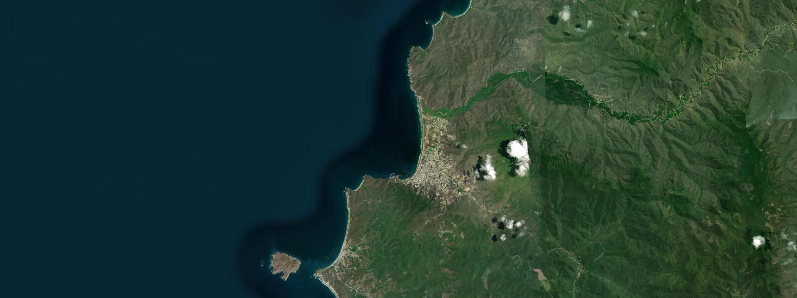
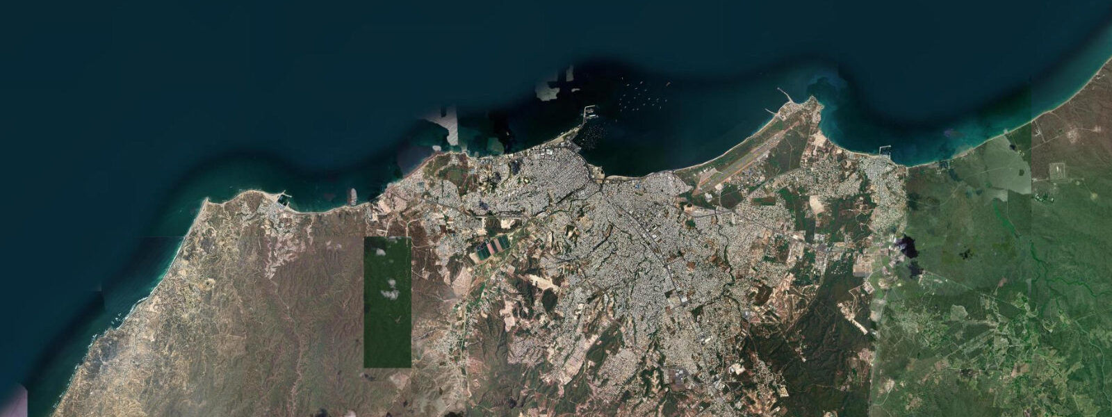
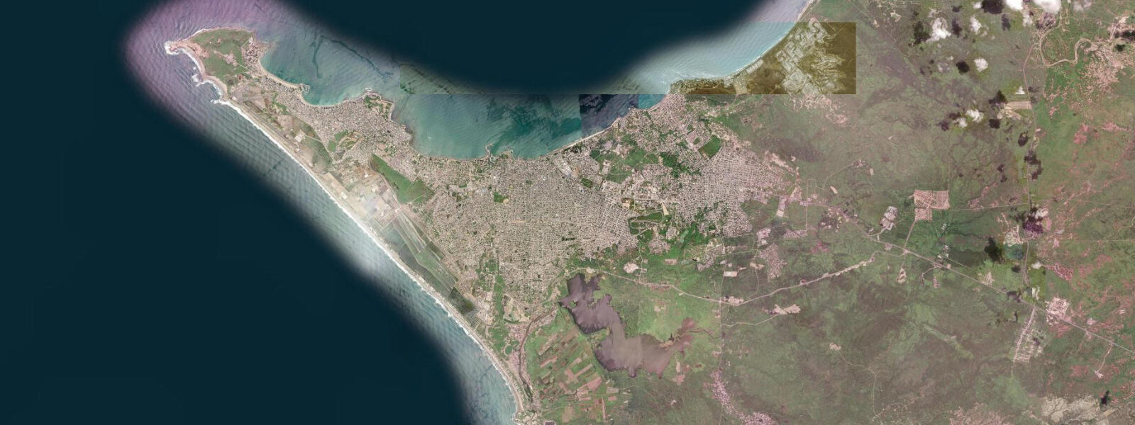
Puerto López is a working fishing town on Manabí Province's Pacific coast, 60 km north of Montañita and 170 km northwest of Guayaquil. It has no resort infrastructure of note, and that is precisely its draw: the beach is wide, the fishing fleet anchors in the open bay, and the access point to Machalilla National Park is a short walk from the market. For six months of the year — June through November — the waters offshore fill with humpback whales, and Puerto López becomes one of Ecuador's most visited natural-history destinations.
The tidal regime follows the same mixed semidiurnal pattern as the rest of the Manabí-Guayas coast: two unequal highs and two unequal lows per day, with spring range around 2.5 m above Chart Datum. The bay itself is open to the SW; there is no natural headland to shelter the beach from swell, and on larger swells the surf closes out across the bay mouth. The fishing fleet launches and returns through the surf line when conditions allow — typically the best windows are in the early morning before the afternoon SE wind picks up.
At low water the beach extends broadly south toward the rocky point at Punta La Pared; the sand flat between the point and the town beach exposes roughly 80–100 m of wet sand at a spring low. The rocky intertidal zone at Punta La Pared is accessible at low water: the exposed shelf here hosts sea urchins, chitons, and several species of hermit crab, and it is one of the more accessible intertidal foraging environments on the Ecuadorian coast.
Machalilla National Park encompasses the coastline north and south of Puerto López, including the dry tropical forest of Isla de la Plata — sometimes called the 'Galápagos of the mainland' for its blue-footed booby, frigatebird, and red-footed booby colonies. Boats to Isla de la Plata depart from Puerto López harbour, a 1.5-hour crossing. The best sea conditions for the crossing are generally on the flood tide in the morning before the wind reaches its afternoon peak; the return crossing in the late afternoon can be choppy.
Humpback whale season (June–September) is the defining event in Puerto López's calendar. The whales come to breed in the warm Ecuadorian inshore water, which sits 3–5°C warmer than the open Humboldt Current water to the south and west. Whale-watching boats operate under MAAE (Ministerio del Ambiente, Agua y Transición Ecológica) regulations; tour operators leave the harbour in the morning, typically on the flood tide. Encounters with mothers and calves are most common in July–August.
Shore fishing from the beach and from Punta La Pared targets corvina, lisa (mullet), and jacks on the incoming tide. Local fishers use hand lines from pangas anchored just outside the surf zone, targeting pargo and dorado on the run-out tide when deeper water fish move over the shelf. Tide predictions come from Open-Meteo Marine: accuracy ±45 min / ±0.2–0.3 m. INOCAR publishes official Ecuadorian tide tables.
The town market on the main square operates daily mornings (06:00–10:00); the fish section gets the best selection in the hour after the morning boats return from the previous night's and dawn fishing. The market is the clearest window into the working economy of a Ecuadorian coastal fishing town — the transaction between the arriving boats and the market buyers happens in full view on the dock immediately adjacent. Visit at high tide in the morning for the most active landings.
The national park entrance gate north of town marks the southern boundary of Machalilla National Park; the park fee applies to beach access beyond the gate. The dry tropical forest behind the beach at Los Frailes, 20 km north within the park boundary, is the best-preserved dry forest on the Ecuadorian coast and features a secluded beach accessible by a 45-minute walk from the road.
Tide questions about Puerto López
Quick answers to the most common questions about tide times, range, and water access at Puerto López.
When do the humpback whales arrive near Puerto López, and does tide affect sightings?
Humpback whales arrive in waters off Puerto López from June through September, with peak concentration in July and August when mothers with calves are most frequently sighted. Whale watching boats typically depart in the morning on the flood tide, when sea conditions are calmer — the afternoon SE wind raises a short chop that makes the offshore crossing less comfortable. Whale sightings themselves are not correlated with tide state; the whales are found in open water 5–20 km offshore and their presence is driven by water temperature and breeding season, not tidal cycle. Boats operating under MAAE regulations must maintain a minimum 100 m distance from any whale.
Where do the tide predictions on this page come from?
Open-Meteo Marine, a free gridded global ocean model. Accuracy is typically ±45 minutes on timing and ±0.2–0.3 m on height. The official source for Ecuadorian tide predictions is INOCAR (Instituto Oceanográfico de la Armada del Ecuador), which publishes harmonic tide tables for mainland and Galápagos ports. For navigation or commercial fishing operations, use INOCAR tables. This page is not for navigation. INOCAR's annual published tables are freely downloadable from their official website. The INOCAR website (inocar.mil.ec) publishes the current year's tide tables for download.
What is accessible at low tide at Puerto López?
At spring low water the beach extends approximately 80–100 m across the bay toward Punta La Pared, exposing a wide sand and cobble flat. The rocky intertidal shelf at Punta La Pared becomes accessible on foot within two hours of the predicted low — the exposed platform carries sea urchins, chitons, and intertidal fish in pools. This is within Machalilla National Park; collecting or disturbing marine life is prohibited. The rock platforms are slippery; appropriate footwear is necessary. The intertidal rock platforms at Punta La Pared are within Machalilla National Park; stay on visible paths to avoid damaging the fragile biological crust.
Is the boat crossing to Isla de la Plata better at a particular tide state?
The crossing is primarily governed by wind and swell, not tide height. That said, the calmest sea conditions are typically in the morning before the daily SE wind builds — usually before 11:00. Most operators depart 07:00–09:00. On a flood-tide morning the harbour mouth is marginally easier to exit through the surf zone than on an ebb; local pangas make the judgment call based on surf height and direction on the day. Confirm departure arrangements with your tour operator. The Machalilla National Park entrance gate north of Puerto López marks the park boundary; sea crossing permits for Isla de la Plata are included in the park entry fee.
Is there a rip current risk at Puerto López beach?
Yes. The bay is open to SW swell without a sheltering headland; on days with swell above 1.0 m, rip currents form at the rock groyne structures and at the river mouths on either side of the main beach. Rips are most active at mid-tide on a falling water level when the wave set-up drives water laterally along the beach and out through the low points. Swim parallel to shore if caught. There is no permanent lifeguard on the beach; always assess surf conditions before entering the water.
7-day tide table — Puerto López
Heights relative to MSL. Predictions: Open-Meteo Marine (MeteoFrance SMOC, 0.08° grid) — heights relative to MSL (not chart datum / LAT). Model-derived.
| Day | Type | Time | Height |
|---|---|---|---|
| Sun 21 Jun | Low | 01:52 | -0.6m |
| High | 08:18 | 1.3m | |
| Low | 14:33 | -0.4m | |
| High | 20:37 | 1.0m | |
| Mon 22 Jun | Low | 02:46 | -0.4m |
| High | 09:11 | 1.2m | |
| Low | 15:33 | -0.3m | |
| High | 21:42 | 0.9m | |
| Tue 23 Jun | Low | 03:42 | -0.3m |
| High | 10:11 | 1.1m | |
| Low | 16:41 | -0.3m | |
| High | 22:51 | 0.9m | |
| Wed 24 Jun | Low | 04:47 | -0.2m |
| High | 11:07 | 1.1m | |
| Low | 17:38 | -0.3m | |
| High | 23:54 | 0.9m | |
| Thu 25 Jun | Low | 05:53 | -0.1m |
| High | 12:02 | 1.0m | |
| Low | 18:37 | -0.3m | |
| Fri 26 Jun | High | 00:51 | 0.9m |
| Low | 06:51 | -0.1m | |
| High | 12:54 | 1.0m | |
| Low | 19:26 | -0.4m | |
| Sat 27 Jun | High | 01:46 | 1.0m |
| Low | 07:41 | -0.2m | |
| High | 13:41 | 1.1m | |
| Low | 18:00 | -0.1m |