
Montañita tide times
Montañita tide forecast — heights relative to MSL.
Today's tide times for Montañita
Tide times at Montañita on Sunday, 21 June 2026: first low tide at 01:52am, first high tide at 08:18am, second low tide at 02:36pm, second high tide at 08:37pm. Sunrise 06:24am, sunset 06:25pm.
Tide chart for Montañita
24-hour cosine-interpolated curve around the present moment. Heights relative to MSL. Predictions: Predictions: Open-Meteo Marine (MeteoFrance SMOC, 0.08° grid).
Sun, moon and conditions on Sun 21 Jun
Snapshot at build time — refreshes daily. Sea state from Open-Meteo Marine.
Highs and lows next 7 days
Every predicted high and low for the next week, with the daily tidal coefficient (0–120; higher = bigger swing, > 95 means stronger currents).
Other spots nearby
The three closest curated TideTurtle locations to Montañita, measured by great-circle distance.
Today's solunar windows
Solunar tradition: major periods are the ≈3h windows around moon transit and opposition; minor are ≈2h around moonrise and moonset. Pair with the local tide stage and wind for the best read.
Cycle dates near Montañita
Last spring tide on Sat 20 Jun (range 1.8m). Next spring tide on Fri 26 Jun (range 1.4m). Next neap on Thu 25 Jun.
Spring tides cluster around new and full moons (biggest swings). Neap tides land on quarter moons (smallest swings). See the spring tide and neap tide glossary entries for the why.
About tides at Montañita
A short guide to the coastline at Montañita — geography, sea state, and what the tide is actually doing under your feet.
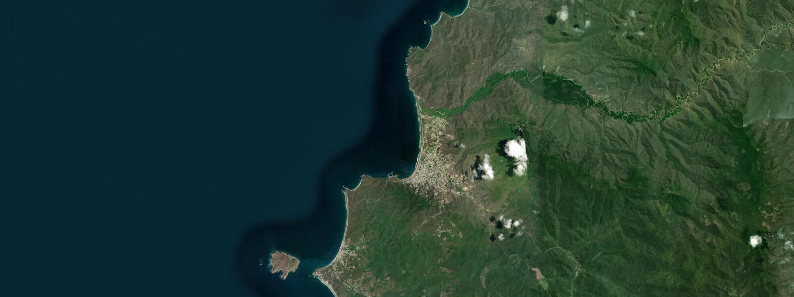
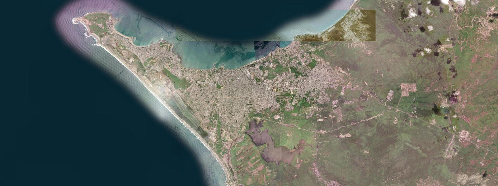
Montañita sits at the southern end of a curved bay on the Ruta del Spondylus, 160 km west of Guayaquil, where a rocky headland deflects the prevailing SW groundswell into a reliable right-hand point break. The village has been Ecuador's surf epicentre since the 1970s and remains so: the point is surfable year-round, with the best-shaped waves arriving between December and May when the swell window from the Southern Ocean opens most directly to this stretch of coast.
The tide here follows a mixed semidiurnal pattern. On most days there are two highs and two lows, but the heights are unequal — one high typically runs 0.3–0.6 m taller than the other. Spring range at nearby Salinas runs 2.5–3.0 m above Chart Datum; Montañita's range is comparable. The point break at Montañita works best from mid- to high tide, when the water covers the rocks on the inside section and the wave peels cleanly from the headland. At low water the inside of the point becomes shallow and rocky; the beach break to the north of the point activates instead and draws bodyboarders and beginners.
The water here is cooler than the latitude suggests. The Humboldt Current upwells cold, nutrient-rich water along the Ecuadorian coast; sea surface temperatures at Montañita typically run 18–22°C from June through November and 23–26°C from December through May, during the wet season when the Intertropical Convergence Zone pushes south and the upwelling relaxes. The cool water accounts for the rich marine life visible from the beach: frigatebirds and boobies work the bait balls close inshore, and dolphins are regular companions just outside the break.
For paddlers and kayakers, the bay north of the point is well-sheltered from the prevailing SW swell. The calmer water between the headland and Palmar beach, 4 km to the north, is navigable by kayak in the mornings before the afternoon wind picks up. High water gives the most comfortable paddling depth over the reef shelves at the northern end of the bay.
The beach itself runs roughly 400 m between the point and the river mouth at the north end of town. At low water a wide sand apron is exposed; beach walkers can reach the neighbouring Curia beach to the north when the sand bar is above water at low tide — typically accessible for two to three hours centred on the predicted low. The river mouth shoals shift seasonally, and the channel depth varies; crossing is generally safe on foot at low water but should be assessed visually.
Fishing from the point rocks targets corvina (Cilus gilberti) and various jacks (Caranx species) on the incoming tide, when the current sweeps bait around the headland. Local pangas anchor just outside the break and hand-line for pargo (snapper) and dorado (mahi-mahi) on the run-out.
Tide predictions here come from Open-Meteo Marine, a gridded global ocean model. Accuracy is typically within ±45 minutes on timing and ±0.2–0.3 m on height. INOCAR (Instituto Oceanográfico de la Armada del Ecuador) publishes official harmonic tide tables for Ecuadorian ports; for navigation or time-critical activities, use INOCAR tables or contact the Capitanía de Puerto in Santa Elena.
The village itself is compact and oriented around the main street running perpendicular to the beach. Accommodation ranges from simple hostels to mid-range surf camps; the backpacker circuit that made Montañita famous on the South American coast has been joined by more upscale visitors in recent years, but the beach character remains dominated by the surf scene. Surf lessons and board rentals operate from the beach; the instruction zone is north of the main break, away from the experienced surfers on the point.
Photographers working the beach have two productive windows: dawn (06:00–07:30), when the low sun from the SE lights the wave faces and the surfers are already in the water, and the hour before sunset when the warm light hits the cliff above town. The spring high-water mark on the beach — visible as a line of organic debris — typically sits 3–5 m from the small cliff at the northern end; at spring high tide the beach narrows to a thin strip and the spray from breaking waves can reach the clifftop path.
Tide questions about Montañita
Quick answers to the most common questions about tide times, range, and water access at Montañita.
What tide state is best for surfing the Montañita point break?
The point break at Montañita works best from mid- to high tide. At low water the inside section of the wave becomes shallow and the rocks on the inside of the point are exposed; most experienced surfers move to the beach break to the north or wait for the tide to push back up. The tidal window from roughly 1.0 m above Chart Datum through the high is generally the cleanest shape on the point, subject to swell size and direction. Check the tide curve on this page to find that window for today. The point break can be surfed year-round but June–October delivers the most consistent swell direction from the Southern Ocean.
Where do the tide predictions on this page come from?
Open-Meteo Marine, a free gridded global ocean model. Accuracy is typically within ±45 minutes on timing and ±0.2–0.3 m on height. The official source for Ecuadorian tide predictions is INOCAR (Instituto Oceanográfico de la Armada del Ecuador), which publishes annual tide tables for Ecuadorian ports. For time-critical activities — navigation, commercial fishing, research — use INOCAR tables rather than this page. These predictions are not for navigation. For the March equinox and September equinox periods, the swell windows align most favourably with the dominant SW groundswell direction.
Why is the water at Montañita cooler than expected for an equatorial location?
The Humboldt Current (Corriente de Humboldt) runs northward along the South American Pacific coast, upwelling cold deep water onto the shelf. At Montañita, sea surface temperatures typically run 18–22°C from June through November — noticeably cool for 2°S latitude. During the wet season (December–May) the upwelling weakens and temperatures rise to 23–26°C. During El Niño years, the upwelling breaks down more significantly and temperatures can exceed 27°C, which also disrupts the marine productivity that normally makes this coast so biologically rich.
Can you walk from Montañita to Curia beach at low tide?
Yes — at low water the sand bar at the Montañita river mouth is typically above water and walkable, opening a route to Curia beach roughly 1 km to the north. The crossing is generally accessible for two to three hours centred on the predicted low. The sand bar shifts seasonally; always assess the depth visually before crossing and check the predicted low on this page. The river mouth can run stronger after heavy rain in the wet season (December–May), when crossing is less advisable regardless of tide state.
Is Montañita's coast safe for swimming outside of the surf break?
The bay north of the point is calmer and safer for casual swimming than the break itself; the beach break can produce shore break and rip currents, especially at mid-tide on a larger swell. There are no permanent lifeguards on the beach; swim parallel to shore if caught in a rip. Jellyfish presence increases in January–March during the warm season. The underwater topography changes with tide state — at low water the reef platforms east of the point are shallow enough to cause injury to anyone swept across them.
7-day tide table — Montañita
Heights relative to MSL. Predictions: Open-Meteo Marine (MeteoFrance SMOC, 0.08° grid) — heights relative to MSL (not chart datum / LAT). Model-derived.
| Day | Type | Time | Height |
|---|---|---|---|
| Sun 21 Jun | Low | 01:52 | -0.5m |
| High | 08:18 | 1.3m | |
| Low | 14:36 | -0.3m | |
| High | 20:37 | 1.0m | |
| Mon 22 Jun | Low | 02:45 | -0.4m |
| High | 09:13 | 1.2m | |
| Low | 15:38 | -0.3m | |
| High | 21:45 | 0.9m | |
| Tue 23 Jun | Low | 03:42 | -0.3m |
| High | 10:11 | 1.1m | |
| Low | 16:39 | -0.3m | |
| High | 22:54 | 0.9m | |
| Wed 24 Jun | Low | 04:48 | -0.1m |
| High | 11:07 | 1.0m | |
| Low | 17:39 | -0.3m | |
| High | 23:55 | 0.9m | |
| Thu 25 Jun | Low | 05:53 | -0.1m |
| High | 12:04 | 1.0m | |
| Low | 18:38 | -0.3m | |
| Fri 26 Jun | High | 00:53 | 0.9m |
| Low | 06:53 | -0.1m | |
| High | 12:55 | 1.0m | |
| Low | 19:26 | -0.4m | |
| Sat 27 Jun | High | 01:46 | 0.9m |
| Low | 07:42 | -0.2m | |
| High | 13:41 | 1.0m | |
| Low | 18:00 | -0.1m |