Frederikshavn tide times
Frederikshavn tide forecast — heights relative to MSL.
Today's tide times for Frederikshavn
Tide times at Frederikshavn on Friday, 19 June 2026: first low tide at 02:37am, first high tide at 09:00am, second low tide at 03:00pm, second high tide at 09:12pm. Sunrise 04:18am, sunset 10:19pm.
Tide chart for Frederikshavn
24-hour cosine-interpolated curve around the present moment. Heights relative to MSL. Predictions: Predictions: Open-Meteo Marine (MeteoFrance SMOC, 0.08° grid).
Sun, moon and conditions on Fri 19 Jun
Snapshot at build time — refreshes daily. Sea state from Open-Meteo Marine.
Highs and lows next 7 days
Every predicted high and low for the next week, with the daily tidal coefficient (0–120; higher = bigger swing, > 95 means stronger currents).
Other spots nearby
The three closest curated TideTurtle locations to Frederikshavn, measured by great-circle distance.
Today's solunar windows
Solunar tradition: major periods are the ≈3h windows around moon transit and opposition; minor are ≈2h around moonrise and moonset. Pair with the local tide stage and wind for the best read.
Cycle dates near Frederikshavn
Last spring tide on Fri 19 Jun (range 0.4m). Next spring tide on Wed 24 Jun (range 0.4m). Next neap on Tue 23 Jun.
Spring tides cluster around new and full moons (biggest swings). Neap tides land on quarter moons (smallest swings). See the spring tide and neap tide glossary entries for the why.
About tides at Frederikshavn
A short guide to the coastline at Frederikshavn — geography, sea state, and what the tide is actually doing under your feet.
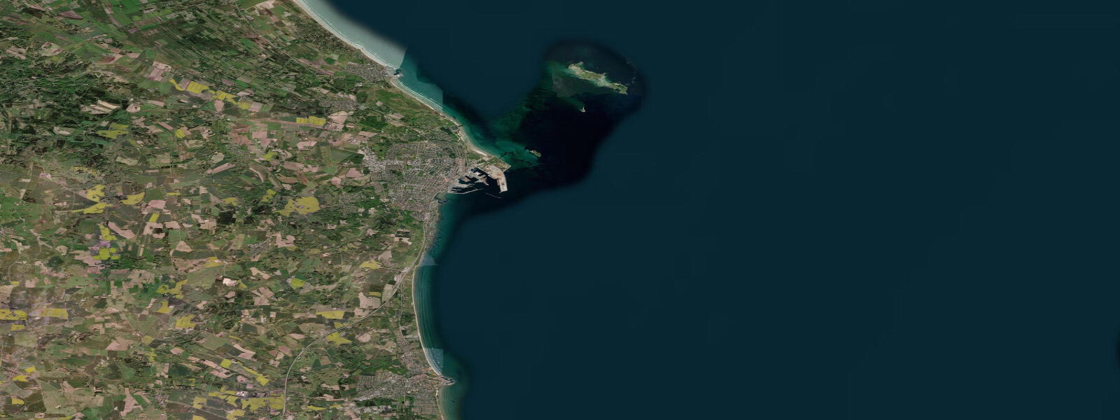
Frederikshavn sits on the Kattegat coast of north Jutland, 30 kilometres south of Skagen, and its character is defined by the ferry port — one of the busiest in Scandinavia for international crossings. Stena Line connects Frederikshavn to Gothenburg, Sweden (3 hours 15 minutes), and ColorLine runs overnight to Oslo, Norway (12 hours). The port infrastructure dominates the town's waterfront and the ferry departures structure much of the local economy.
The Kattegat tidal regime at Frederikshavn is modest: mean spring range around 0.5 metres, in a pattern that blends semidiurnal and diurnal components depending on the phase of the lunar cycle. The Kattegat receives tidal energy from both the North Sea (through the Skagerrak and around Skagen) and indirectly from the Baltic via the Danish straits. The interference between these competing inputs produces an irregular tidal pattern that is more noticeable than the Baltic's near-zero tide but far smaller than the North Sea coast to the west.
Water level variation at Frederikshavn is more often driven by wind and atmospheric pressure than by the tide. Sustained NW winds from the Skagerrak push water into the Kattegat against the Swedish and Danish coasts, raising sea levels along Frederikshavn's beach and harbour approach by 30 to 50 cm during major events.
Bangsbo Fort, 3 kilometres south of the town centre, is a preserved coastal artillery battery from the German occupation (1940-1945). The fort's sea-facing guns covered the Kattegat approach and the ferry routes; the museum presents the occupation history alongside the coastal defence context. Nearby, the Bangsbo River estuary runs through a small wooded valley to the Kattegat — a gentle tidal inlet supporting eel and sea trout in the lower reach.
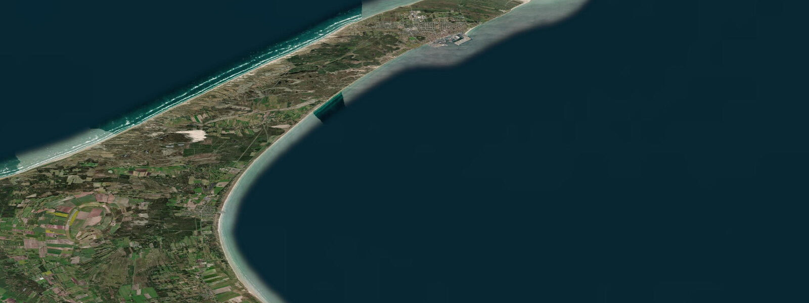
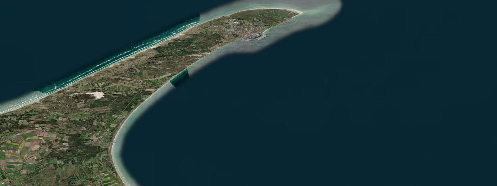
The beaches north of Frederikshavn toward Skagen are extensive sandy North Sea-facing shores — dunes backed by Hulsig Hede heathland, with several access points for beach walking, horse riding, and limited 4WD. The Skagen Odde peninsula narrows here to a few kilometres wide, with the Kattegat on the east and the Skagerrak on the west.
Fishing from Frederikshavn Harbour breakwaters and the northern beaches produces cod, whiting, and flatfish from autumn through spring when cold Kattegat water concentrates demersal species inshore. Mackerel jigging from the harbour in summer is popular with families. Charter boats depart for wreck fishing on the scattered debris from WWII naval engagements in the outer Kattegat.
Predictions on this page come from Open-Meteo Marine, a gridded global ocean model. Accuracy is typically within plus or minus 45 minutes on timing and 0.2 to 0.3 metres on height — model-derived, not from a local gauge. For authoritative Danish sea-level data, consult DMI (Danmarks Meteorologiske Institut) at dmi.dk/hav.
Tide questions about Frederikshavn
Quick answers to the most common questions about tide times, range, and water access at Frederikshavn.
What ferries depart from Frederikshavn?
Stena Line operates Frederikshavn-Gothenburg year-round (3 hours 15 minutes), with multiple daily crossings in summer and reduced frequency in winter. ColorLine runs Frederikshavn-Oslo overnight (approximately 12 hours). Both operators offer cabins, restaurants, and car transport. The port is walkable from the train station. Frederikshavn is also a stop on the GotlandsBåten and several Baltic cruise routes. Check operator websites for current timetables — ferry schedules respond to demand and seasonality.
What is the tidal range at Frederikshavn?
Mean spring range at Frederikshavn is approximately 0.5 metres — the Kattegat receives a weakened tidal signal from the North Sea via the Skagerrak, blended with residual Baltic tidal energy from the Danish straits. The resulting pattern is irregular, sometimes appearing semidiurnal (two unequal highs per day) and sometimes nearly diurnal (one dominant high per day) depending on the lunar cycle. Wind-driven water level changes frequently exceed the astronomical tide — NW winds can raise coastal levels 30 to 50 cm above the predicted state.
Where can I go for beach walks near Frederikshavn?
The beaches north of Frederikshavn toward Skagen are the most scenic. Tversted Beach (25 km north) and the Bunken Klitplantage dune landscape give miles of walking on firm sand and through coastal heath. Jerup Strand (15 km north) is quieter and less visited. South of Frederikshavn, the Bangsbo estuary and Knivholt Manor forest provide shorter walks with some tidal inlet character. Driving is practical — buses serve the coastal villages but less frequently than in summer.
Is there good fishing at Frederikshavn?
Yes, particularly in autumn and winter when cod, whiting, and flatfish move inshore into the Kattegat. The harbour breakwaters are productive for mackerel in summer. Bangsbo River mouth and the northern beaches from Frederikshavn toward Skagen produce sea trout (havørred) in September through November — the most prized shore target in Denmark. Charter boats depart for wreck fishing on the Kattegat floor. A Danish fishing license is required for freshwater fishing in the river; saltwater fishing from shore requires no license.
Is Frederikshavn a useful base for exploring North Jutland?
Yes. Skagen (tip of Denmark, 30 km north) is the main tourist draw — the Skagen Painters Museum, Grenen sandbar, and Råbjerg Mile migrating dune are all within day-trip distance. Hirtshal ferry port (connections to Norway, Iceland, Faroe Islands) is 70 km west. Aalborg (city, Limfjord, Utzon Center) is 70 km south. The E45 motorway and regional rail connect efficiently. Accommodation in Frederikshavn itself is practical and less expensive than Skagen in high season.
8-day tide table — Frederikshavn
Heights relative to MSL. Predictions: Open-Meteo Marine (MeteoFrance SMOC, 0.08° grid) — heights relative to MSL (not chart datum / LAT). Model-derived.
| Day | Type | Time | Height |
|---|---|---|---|
| Fri 19 Jun | Low | 02:37 | -0.5m |
| High | 09:00 | -0.1m | |
| Low | 15:00 | -0.5m | |
| High | 21:12 | -0.1m | |
| Sat 20 Jun | Low | 16:03 | -0.4m |
| Low | 18:42 | -0.4m | |
| High | 22:16 | -0.1m | |
| Sun 21 Jun | Low | 04:19 | -0.5m |
| High | 11:18 | -0.2m | |
| Low | 16:52 | -0.5m | |
| High | 19:10 | -0.4m | |
| Low | 19:40 | -0.4m | |
| High | 23:21 | -0.2m | |
| Mon 22 Jun | Low | 05:24 | -0.7m |
| Low | 07:45 | -0.6m | |
| Tue 23 Jun | High | 12:54 | -0.3m |
| Low | 21:35 | -0.5m | |
| Wed 24 Jun | High | 02:50 | -0.1m |
| Low | 07:20 | -0.4m | |
| Low | 09:52 | -0.4m | |
| High | 15:40 | -0.1m | |
| Low | 19:23 | -0.3m | |
| High | 21:10 | -0.3m | |
| Thu 25 Jun | Low | 11:00 | -0.5m |
| High | 15:00 | -0.1m | |
| Low | 23:04 | -0.5m | |
| Fri 26 Jun | High | 01:00 | -0.3m |