Grenen, Skagen tide times
Grenen, Skagen tide forecast — heights relative to MSL.
Today's tide times for Grenen, Skagen
Tide times at Grenen, Skagen on Friday, 19 June 2026: first low tide at 02:00am, first high tide at 08:47pm. Sunrise 04:15am, sunset 10:21pm.
Tide chart for Grenen, Skagen
24-hour cosine-interpolated curve around the present moment. Heights relative to MSL. Predictions: Predictions: Open-Meteo Marine (MeteoFrance SMOC, 0.08° grid).
Sun, moon and conditions on Fri 19 Jun
Snapshot at build time — refreshes daily. Sea state from Open-Meteo Marine.
Highs and lows next 7 days
Every predicted high and low for the next week, with the daily tidal coefficient (0–120; higher = bigger swing, > 95 means stronger currents).
Other spots nearby
The three closest curated TideTurtle locations to Grenen, Skagen, measured by great-circle distance.
Today's solunar windows
Solunar tradition: major periods are the ≈3h windows around moon transit and opposition; minor are ≈2h around moonrise and moonset. Pair with the local tide stage and wind for the best read.
Cycle dates near Grenen, Skagen
Next spring tide on Thu 25 Jun (range 0.5m). Next neap on Wed 24 Jun.
Spring tides cluster around new and full moons (biggest swings). Neap tides land on quarter moons (smallest swings). See the spring tide and neap tide glossary entries for the why.
About tides at Grenen, Skagen
A short guide to the coastline at Grenen, Skagen — geography, sea state, and what the tide is actually doing under your feet.
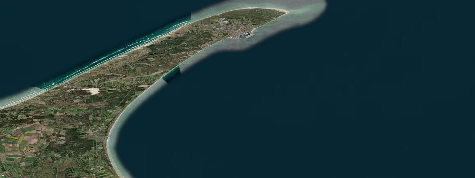
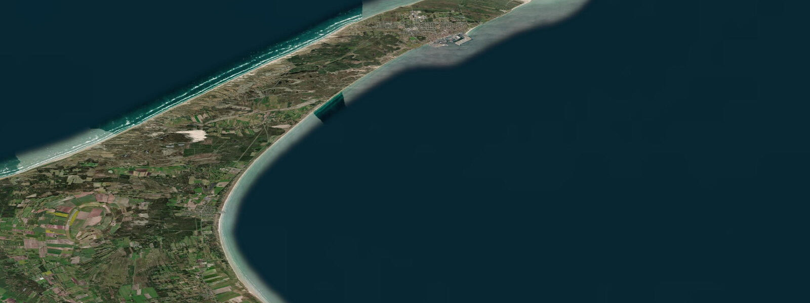
Grenen is the precise geographic tip of Denmark — a curved sandspit extending northeast from Skagen where the Skagerrak meets the Kattegat. The two seas are identifiable with the naked eye: opposing surface currents converge in a visible standing wave at the tip, and a colour contrast between the deeper blue-green of the Skagerrak and the slightly more turbid Kattegat is apparent in good light conditions. The tidal regime at Grenen reflects the meeting of two distinct tidal systems. The Skagerrak, open to the North Sea, carries a meaningful semidiurnal tidal signal. The Kattegat, partially enclosed by Sweden and Denmark to the east, has a much reduced tidal range. Where they converge, the net tidal movement is modest — mean spring range around 0.4 to 0.6 metres — but the currents at the spit tip itself are a different matter. The meeting of two opposing tidal bodies produces unpredictable cross-currents and rip conditions that make swimming at Grenen prohibited and genuinely dangerous. People drown here.
The walk to the tip from the Grenen car park takes 20 to 25 minutes along the beach on foot, or visitors can take the Sandormen — a small tractor-pulled cart operating seasonally, nicknamed "the sand worm" — which runs along the beach to the tip and back. The walk is the better option for watching the wave action change as you approach the point: the surf line angles differently on each side of the narrowing spit, and the convergence becomes increasingly apparent in the last 200 metres.
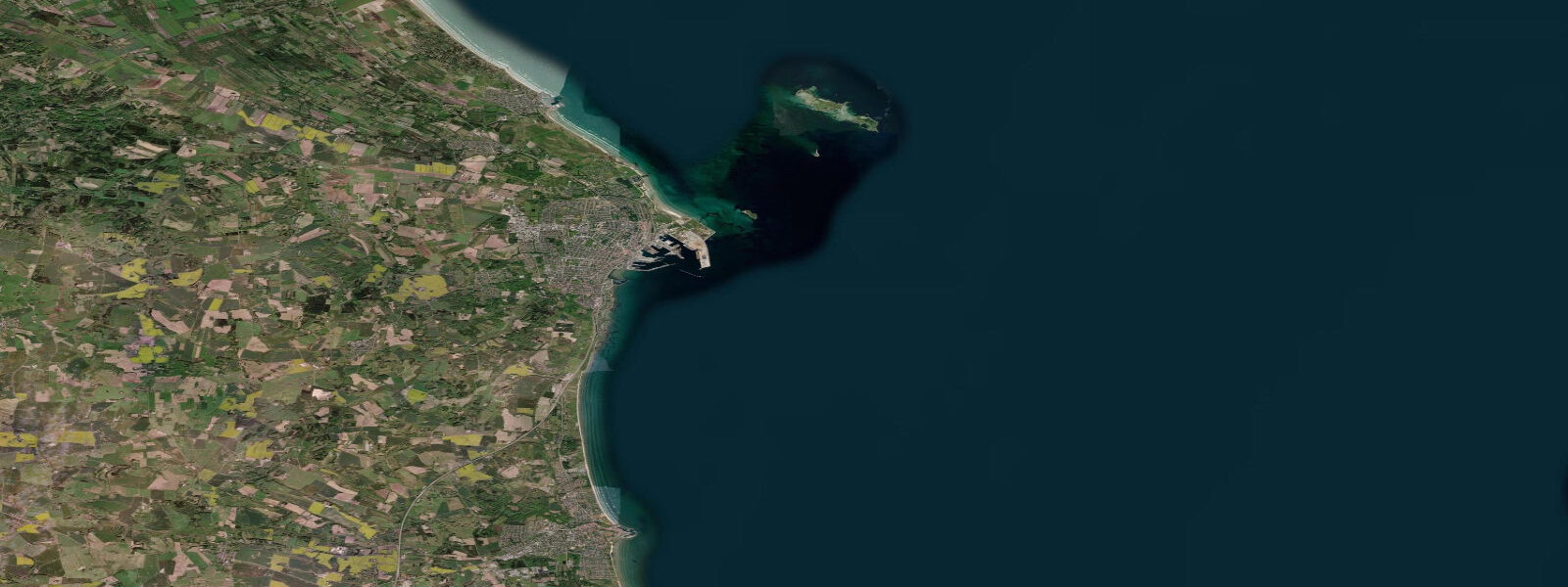
Raw seals haul out on the outer sandbanks visible from Grenen on calm days, typically grey seals in the colder months. Bring binoculars — they are far enough out that naked-eye identification is difficult. The Skagen lighthouse (Skagens Fyr, the white tower) and the older Tilsandede Kirke — the sand-buried church, of which only the tower remains above the dune — are within easy reach of the Grenen area and add context to the dune-dynamic story of this coast.
Twenty kilometres south, the Råbjerg Mile is one of northern Europe's largest migrating dune systems: a free-moving parabolic dune mass approximately 1 km wide and 40 metres high that has been moving south at roughly 15 metres per year for centuries, burying everything in its path including trees, roads, and farmsteads. The dune is accessible year-round and requires no entry fee. In winter, it is largely deserted; in summer, families climb the windward face and run down the leeward slip face. Both experiences are accurate representations of what a live dune system looks like.
The Skagen painter colony — Michael Ancher, Anna Ancher, P.S. Krøyer, and others — worked here from the 1870s through the early 1900s, attracted specifically by the quality of light at the meeting of two seas. The Skagens Museum in the town holds the main collection.
Predictions on this page come from Open-Meteo Marine, a gridded global ocean model. Accuracy is typically within plus or minus 45 minutes on timing and 0.2 to 0.3 metres on height — model-derived, not from a local gauge. For authoritative Danish sea-level data, consult DMI (Danmarks Meteorologiske Institut) at dmi.dk/hav.
Tide questions about Grenen, Skagen
Quick answers to the most common questions about tide times, range, and water access at Grenen, Skagen.
Can you swim at Grenen where the two seas meet?
No. Swimming at the tip of Grenen is prohibited and the prohibition is not precautionary overreach — people have drowned here. The convergence of two tidal bodies with opposing currents creates unpredictable rip conditions that can develop quickly and are not visible from the surface until you are in them. The beach on the Skagerrak side (west of the spit) has designated supervised swimming areas further south near Skagen town during summer. The Kattegat side (east of the spit) is generally calmer but still subject to the cross-current zone near the tip. Stay clear of the point itself in the water.
What is the Sandormen tractor at Grenen?
The Sandormen (Danish: sand worm) is a small tractor-pulled passenger cart that runs along the beach from the Grenen car park to the tip of the spit and back, operating seasonally from approximately May through October. The ride takes around 10 minutes each way and costs a small per-person fee. It is useful if you have limited mobility, are travelling with young children, or want to move quickly. The walk (20 to 25 minutes each way on soft sand) gives a better sense of how the wave pattern changes as the spit narrows, and lets you stop where you like. Both options leave from the same car park.
Is it possible to see seals at Grenen?
Grey seals haul out on the outer sandbanks visible from the tip of Grenen, primarily in the colder months from October through April when the seals are less disturbed by summer boat traffic. Binoculars are essential — the sandbanks are far enough from the beach that naked-eye identification of individual animals is not reliable. Common seals are also present in the broader Skagen area. There is no guarantee of a sighting on any given visit; calm, low-wind days when the sandbanks are not wave-washed give the best conditions for hauled-out seals to be visible.
How far is the Råbjerg Mile from Grenen?
The Råbjerg Mile migrating dune system is approximately 20 kilometres south of Grenen by road, signed from the main route south of Skagen. It is a straightforward day-trip addition if you are already at Grenen. The dune is accessible year-round with no admission charge, reached by a short walk from a car park. Visiting both in the same trip gives a coherent picture of the same dune dynamics at different scales: the sand accumulation actively building the Grenen spit, and the Råbjerg Mile showing what a fully mobile dune mass looks like as it moves south through the landscape at 15 metres per year.
What makes the light at Skagen unusual for photography?
Skagen's position at the junction of two seas and at the extreme northern tip of Jutland means that the sun tracks at a lower angle relative to the horizon than at most European coastal locations, even in summer. The light stays oblique for longer periods of the day — during June, the sun barely drops below the horizon at its lowest point, and the golden hour extends well into what would be darkness further south. The Skagen painters documented this in the 1870s to 1900s; the same quality remains. Practically, the hour before sunset and the hour after sunrise produce long shadows and warm-toned light with the water as a reflective background on both sides of the spit simultaneously.
8-day tide table — Grenen, Skagen
Heights relative to MSL. Predictions: Open-Meteo Marine (MeteoFrance SMOC, 0.08° grid) — heights relative to MSL (not chart datum / LAT). Model-derived.
| Day | Type | Time | Height |
|---|---|---|---|
| Fri 19 Jun | Low | 02:00 | -0.5m |
| High | 20:47 | -0.2m | |
| Sat 20 Jun | Low | 03:03 | -0.6m |
| High | 10:00 | -0.2m | |
| Low | 15:22 | -0.4m | |
| High | 21:55 | -0.2m | |
| Sun 21 Jun | Low | 03:55 | -0.5m |
| High | 22:50 | -0.2m | |
| Mon 22 Jun | Low | 05:06 | -0.6m |
| High | 11:50 | -0.3m | |
| Low | 17:12 | -0.6m | |
| Tue 23 Jun | High | 00:18 | -0.2m |
| Low | 06:00 | -0.5m | |
| High | 12:22 | -0.2m | |
| Low | 18:00 | -0.5m | |
| Low | 20:40 | -0.5m | |
| Wed 24 Jun | High | 07:50 | -0.4m |
| Low | 09:10 | -0.4m | |
| Thu 25 Jun | High | 02:00 | 0.0m |
| Low | 10:15 | -0.4m | |
| High | 14:20 | -0.1m | |
| Low | 20:15 | -0.4m | |
| Low | 22:00 | -0.4m | |
| Fri 26 Jun | High | 01:00 | -0.2m |