Providencia, Colombia tide times
Providencia, Colombia tide forecast — heights relative to MSL.
Today's tide times for Providencia, Colombia
Tide times at Providencia, Colombia on Saturday, 4 July 2026: first high tide at 02:00, first low tide at 09:50. Sunrise 06:03, sunset 18:56.
Tide chart for Providencia, Colombia
24-hour cosine-interpolated curve around the present moment. Heights relative to MSL. Predictions: Predictions: Open-Meteo Marine (MeteoFrance SMOC, 0.08° grid).
Sun, moon and conditions on Sat 04 Jul
Snapshot at build time — refreshes daily. Sea state from Open-Meteo Marine.
Highs and lows next 7 days
Every predicted high and low for the next week, with the daily tidal coefficient (0–120; higher = bigger swing, > 95 means stronger currents).
Other spots nearby
The three closest curated TideTurtle locations to Providencia, Colombia, measured by great-circle distance.


Today's solunar windows
Solunar tradition: major periods are the ≈3h windows around moon transit and opposition; minor are ≈2h around moonrise and moonset. Pair with the local tide stage and wind for the best read.
About tides at Providencia, Colombia
A short guide to the coastline at Providencia, Colombia — geography, sea state, and what the tide is actually doing under your feet.
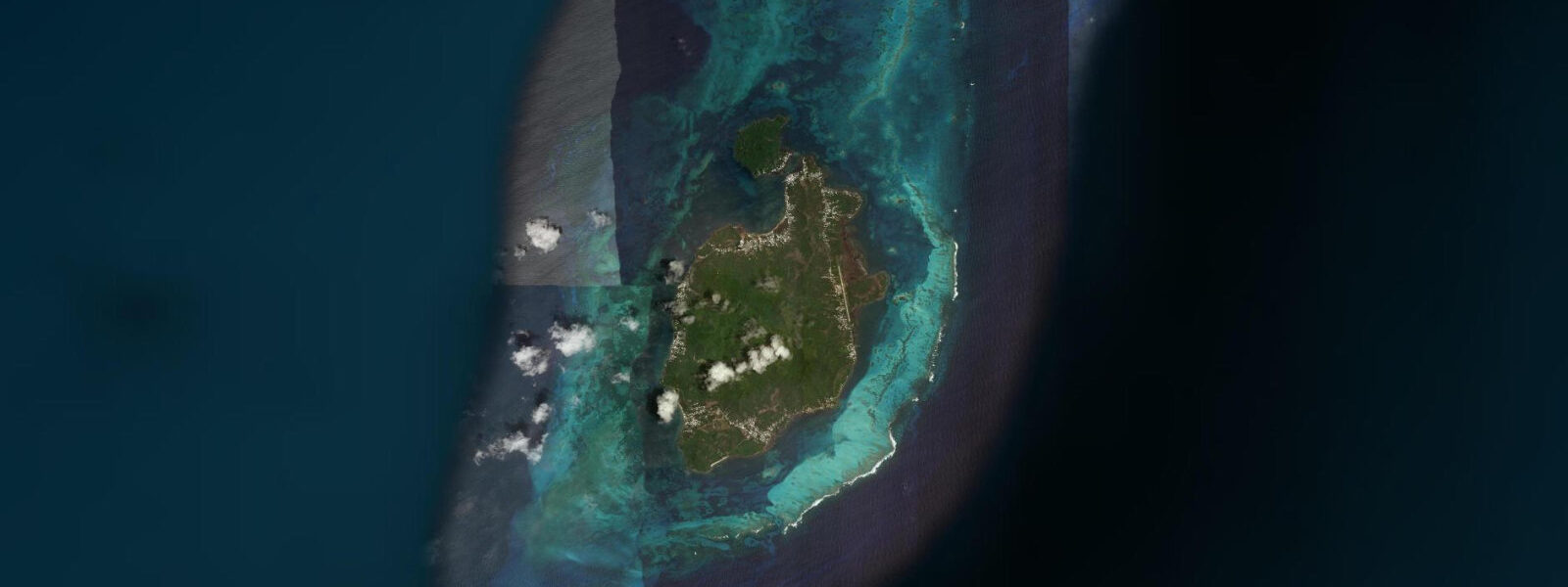
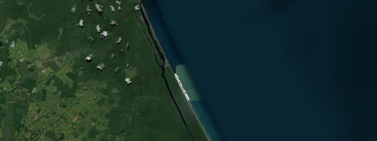
Providencia — officially Old Providence — sits 80 km northeast of San Andrés in the western Caribbean, a volcanic island rising to 360 m at El Pico, forested and steep compared to the flat coral-sand San Andrés. The island is small (17 km²), moves slowly, and is encircled by the Old Providence McBean Lagoon National Natural Park, a barrier reef system designated part of the UNESCO Seaflower Biosphere Reserve. The English-Creole speaking Raizal community has maintained a culture distinct from both mainland Colombia and the English Caribbean since the island's settlement by English Puritans in 1631.
The tidal pattern is microtidal Caribbean: spring range 25–40 cm, mixed semidiurnal. Open-Meteo Marine provides forecast data — timing accuracy ±45 minutes, height accuracy ±0.2–0.3 m. The barrier reef absorbs most of the Caribbean swell before it reaches the lagoon, making conditions inside the McBean Lagoon nearly flat regardless of tidal state. The ocean side of the reef experiences more pronounced tidal flow through the reef passes.
The McBean Lagoon reef complex is one of the healthiest coral systems in the wider Caribbean basin. Hurricane Beta in 2020 caused significant damage to Providencia (estimated 98% of structures affected), which paradoxically reduced diving pressure during reconstruction. Recovery of both the island and the reef is ongoing. The main dive sites — Southwest Bay wall, Manta's Place, Nick's Place — operate from dive boats based at the island's small hotels. Fish populations are dense by Caribbean standards: schooling creole wrasse, yellowfin grouper, tiger grouper, and regular eagle ray sightings on the wall dives.
For anglers, the channel between Providencia and its sister islet Santa Catalina (connected by a pedestrian bridge called the Lovers Bridge) concentrates baitfish and produces snapper, barracuda, and jacks from the rocks and the bridge itself. Offshore, the shelf edge northwest of the island is within panga range and holds wahoo and mahimahi in the December–April season.
Kayakers working the lagoon side of the island have calm, flat water protected by the barrier reef, with excellent visibility over the coral garden. A circumnavigation of the lagoon takes 4–6 hours — a full day at a relaxed pace with stops to snorkel. The lagoon bottom is patchy reef and white sand at 1–5 m depth, ideal for paddling and snorkelling without needing dive equipment.
Beach families use the southwest bay beaches — Manzanillo Bay and South West Bay have the finest sand and clearest water on the island. The water temperature is 27–29°C year-round. Providencia has no mass-market resort infrastructure: accommodation runs to small locally-owned cabanas and one or two modest hotels that survived the 2020 hurricane reconstruction.
Tide questions about Providencia, Colombia
Quick answers to the most common questions about tide times, range, and water access at Providencia, Colombia.
How do I get to Providencia from San Andrés?
Satena Airlines operates propeller aircraft flights from San Andrés to El Embrujo airport on Providencia — the crossing takes 25–30 minutes. The schedule runs a limited number of departures per day and the seat allocation is small (around 30 passengers per flight), so booking well in advance is essential, particularly in Colombian school holidays (June–July, December). There is a catamaran ferry service that operates the 80-km crossing — the trip takes approximately 3 hours and is weather-dependent. The ferry is rougher and slower but gives a different perspective on the island's approach by sea. No direct flights to Providencia from the Colombian mainland operate regularly.
What is the condition of the Providencia reef after Hurricane Beta?
Hurricane Beta (Category 2) made direct landfall on Providencia in November 2020, causing extensive structural damage to the island. The reef system experienced bleaching and breakage from the storm surge and wave action. Recovery of the coral, assessed in subsequent years, has been partial and variable by site: the deeper wall sections (below 15 m) recovered faster than the shallow reef flat which bore the brunt of the storm energy. The reef remains one of the least-impacted in the wider Caribbean due to the island's low human population and minimal agricultural runoff. Dive operators active on the island as of 2024 report continuing recovery, with intact corals and healthy fish populations on the deeper sites.
What tidal conditions affect diving and snorkelling at Providencia?
Tidal range is 25–40 cm at springs — microtidal. Inside the McBean Lagoon, conditions are dominated by the barrier reef's swell-absorbing effect rather than tidal state. The reef passes (the breaks in the barrier where tidal water exchanges between lagoon and ocean) see stronger flow during peak tidal phases, which concentrates fish and improves diving quality on the oceanic side. Dive operators time wall dives to coincide with the slack water at the passes — typically within 1 hour of high water and 1 hour of low water. Open-Meteo Marine provides forecast data with ±45-minute timing accuracy and ±0.2–0.3 m height accuracy.
What makes Providencia different from San Andrés for visitors?
San Andrés is a commercial island with 70,000 residents, duty-free shops, large hotels, a busy airport, and beach resort infrastructure. Providencia has around 5,000 residents, minimal commercial development, no duty-free shopping, and a pace defined by the Raizal community's own rhythm. The reef around Providencia is significantly more intact than the heavily dived San Andrés reef. The landscape is volcanic and mountainous rather than flat coral sand. Visitors who find San Andrés too urban and too touristy typically prefer Providencia; the trade-off is higher logistics complexity, limited accommodation options, and reconstruction impacts still visible post-Hurricane Beta.
What is the best time of year to visit Providencia?
December through April is the dry season with the clearest water (visibility 20–30 m on the reef wall), calmest seas for the inter-island crossing, and most consistent diving conditions. The northeast trades are steady and strong in this season, which is excellent for sailing and kitesurfing but makes some exposed anchorages uncomfortable for small boats. May through October is the wet season with more cloud, heavier rain, and occasional tropical disturbances (September–October carry hurricane risk). The water temperature (27–29°C) and snorkelling quality in the lagoon are consistent year-round; it is the open-ocean conditions and visibility that vary seasonally.
7-day tide table — Providencia, Colombia
Heights relative to MSL. Predictions: Open-Meteo Marine (MeteoFrance SMOC, 0.08° grid) — heights relative to MSL (not chart datum / LAT). Model-derived.
| Day | Type | Time | Height |
|---|---|---|---|
| Sat 04 Jul | High | 02:00 | 0.3m |
| Low | 09:50 | 0.0m | |
| Sun 05 Jul | High | 17:10 | 0.3m |
| Mon 06 Jul | Low | 10:10 | 0.0m |
| Tue 07 Jul | High | 03:50 | 0.2m |
| Wed 08 Jul | — | ||
| Thu 09 Jul | Low | 02:00 | 0.1m |
| High | 06:00 | 0.2m | |
| Low | 11:50 | 0.1m | |
| High | 19:00 | 0.4m | |
| Fri 10 Jul | Low | 12:00 | 0.0m |
| High | 18:00 | 0.4m | |