
San Andrés, Colombia tide times
San Andrés, Colombia tide forecast — heights relative to MSL.
Today's tide times for San Andrés, Colombia
Tide times at San Andrés, Colombia on Saturday, 4 July 2026: first low tide at 10:10, first high tide at 17:00. Sunrise 06:06, sunset 18:56.
Tide chart for San Andrés, Colombia
24-hour cosine-interpolated curve around the present moment. Heights relative to MSL. Predictions: Predictions: Open-Meteo Marine (MeteoFrance SMOC, 0.08° grid).
Sun, moon and conditions on Sat 04 Jul
Snapshot at build time — refreshes daily. Sea state from Open-Meteo Marine.
Highs and lows next 7 days
Every predicted high and low for the next week, with the daily tidal coefficient (0–120; higher = bigger swing, > 95 means stronger currents).
Other spots nearby
The three closest curated TideTurtle locations to San Andrés, Colombia, measured by great-circle distance.

Today's solunar windows
Solunar tradition: major periods are the ≈3h windows around moon transit and opposition; minor are ≈2h around moonrise and moonset. Pair with the local tide stage and wind for the best read.
About tides at San Andrés, Colombia
A short guide to the coastline at San Andrés, Colombia — geography, sea state, and what the tide is actually doing under your feet.
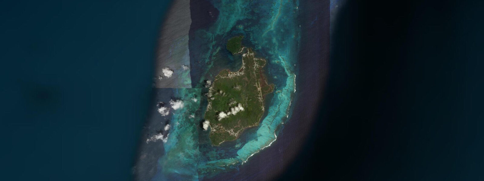
San Andrés is a coral island 750 km northwest of the Colombian mainland, in the southwestern Caribbean. It is simultaneously one of Colombia's most popular tourist destinations, a UNESCO Seaflower Biosphere Reserve, a free-port commercial zone, and the cultural centre of an English-speaking Raizal community whose roots predate Colombian sovereignty. The tensions between those identities — conservation and commerce, mainland Colombian tourism and indigenous Raizal culture — are present in every aspect of the island.
The tidal regime is oceanic Caribbean microtidal: spring range 0.3 to 0.4 metres. This is the open western Caribbean, and the tidal signal is among the smallest in the Americas. Wind setup, Caribbean weather systems, and the meander of the Caribbean Current drive far larger short-term water-level changes than the astronomical tide. The tide prediction on this page describes a small background signal; for any on-water activity planning, the wind and weather forecast is the primary operational variable.
The Sea of Seven Colours is the island's signature visual. The reef flat on the west side of the island, between the shore and the outer reef crest, grades through named colour zones as depth changes over the carbonate sand bottom: from bright white in centimetre-depth shallows, through cyan, turquoise, and multiple shades of blue as depth increases to 5 m at the outer flat edge. The effect is most vivid from above — from the bluffs above Spratt Bight or from a boat at reef-flat level. Snorkelling the flat in 1 to 3 m of water is the standard activity; the coral heads scattered across the flat hold damselfish, parrotfish, and occasional sea turtle.
Providencia (Old Providence) island, two hours north by small aircraft or a 3-hour boat journey, is within the same Seaflower Biosphere Reserve and is dramatically less developed. The barrier reef surrounding Providencia is larger and more intact than the San Andrés reef, with a wall system that rival anything in the western Caribbean for coral cover and fish density. Divers who make the extra transit to Providencia find a fraction of the San Andrés visitor volume and reef quality that the main island's proximity to Colombian tourism cannot replicate.
Diving at San Andrés itself is on the outer reef wall on the east side of the island, in 10 to 40 m of water. The current along the wall runs south to north on the flood; the slack at the turn of tide (±45 min from Open-Meteo) is the standard guide for non-current dives. Several dive operators are based in the Spratt Bight hotel zone, and the range of sites — wall, coral garden, wreck — caters to all certification levels.
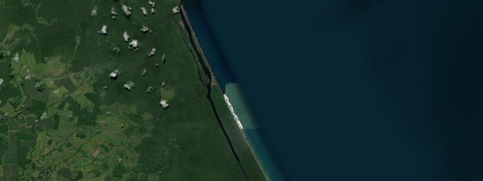
Snorkelling, kayaking, and glass-bottom boat tours on the west-side reef flat are the mainstream tourist activities and are accessible from the main Spratt Bight beach. The flat is calm on most days; the outer reef crest absorbs any Atlantic swell before it reaches the flat, leaving the inside almost always swimable. The sand bar at the northwest tip, accessible by wading at low water (the 0.3 to 0.4 m tidal drop is just enough to expose the bar at spring low), is a popular morning activity.
Families on San Andrés have the full range of Caribbean beach infrastructure: beach chairs, water sports rentals, food service, and a range of accommodation from budget hostels to resort hotels along the west coast. The island is small enough (11 km long) to circuit by motor scooter in an hour; the east coast, less developed and more Raizal in character, has a different atmosphere from the tourist Spratt Bight zone.
Predictions on this page come from Open-Meteo Marine, a global gridded ocean model. Accuracy is ±45 minutes on timing and ±0.2 to 0.3 metres on height. DIMAR (Colombian Navy Maritime Directorate) publishes authoritative tidal tables for San Andrés.
Tide questions about San Andrés, Colombia
Quick answers to the most common questions about tide times, range, and water access at San Andrés, Colombia.
When is the next high tide at San Andrés?
The predicted next high tide at San Andrés is shown at the top of this page in Colombia Standard Time (COT, UTC-5). Spring range is 0.3 to 0.4 metres — oceanic Caribbean microtidal. The tide is a minor variable; wind and weather dominate. Predictions come from Open-Meteo Marine (gridded, ±45 min / ±0.2–0.3 m); DIMAR publishes the authoritative harmonic tables for the Colombian Caribbean including San Andrés.
What is the Sea of Seven Colours and when is it most vivid?
The Sea of Seven Colours is the name for the colour gradient on the west-side reef flat, where depth changes over carbonate sand produce a transition from near-white shallows through cyan, turquoise, and multiple shades of blue as depth increases to 5 m. The effect is most vivid in full overhead sun — late morning to early afternoon on clear-sky days. From a boat on the flat or from the bluffs above Spratt Bight are the best viewpoints. Cloudy days and wind-disturbed water reduce the colour contrast significantly.
Is Providencia worth the extra travel from San Andrés?
For divers and reef snorkellers, yes. Providencia's barrier reef is larger, more intact, and less visited than San Andrés; the wall system on the east side has coral cover and fish density that the San Andrés outer reef cannot match at current visitor volumes. The crossing by fast boat takes 3 hours (seasonal; some months not available) or 30 minutes by small aircraft from San Andrés. Accommodation is limited — 2–3 small guesthouses and lodges. Overnight stay rather than a day trip maximises the diving.
What cultural activities are there beyond the beach?
The Raizal community, English-speaking descendants of the original settlers, maintain cultural traditions distinct from mainland Colombian identity: Baptist church music, Creole English (Creole Islander language), and seafaring history. The Museum of the Sea (Museo del Mar) in San Andrés town covers the island's natural and cultural history. La Loma, the hill settlement in the island's interior, is the main Raizal community with the original Baptist Church (1847). Vallenato and Colombian commercial music dominate the tourist zone; Raizal culture is concentrated in the east coast and La Loma.
Is this safe to use for navigation?
No. TideTurtle is a planning tool, not a nautical almanac. Navigation around San Andrés, through the reef passages, and on the route to Providencia requires current DIMAR charts. The outer reef on San Andrés's east side and the reef passages around Providencia have complex bathymetry requiring local knowledge. Open-Meteo Marine predictions are not a substitute for authoritative harmonic data for any vessel operation.
7-day tide table — San Andrés, Colombia
Heights relative to MSL. Predictions: Open-Meteo Marine (MeteoFrance SMOC, 0.08° grid) — heights relative to MSL (not chart datum / LAT). Model-derived.
| Day | Type | Time | Height |
|---|---|---|---|
| Sat 04 Jul | Low | 10:10 | 0.0m |
| High | 17:00 | 0.2m | |
| Sun 05 Jul | — | ||
| Mon 06 Jul | — | ||
| Tue 07 Jul | Low | 00:00 | 0.1m |
| High | 17:50 | 0.3m | |
| Wed 08 Jul | — | ||
| Thu 09 Jul | Low | 02:00 | 0.1m |
| High | 06:00 | 0.1m | |
| Low | 11:50 | 0.0m | |
| High | 19:06 | 0.4m | |
| Fri 10 Jul | Low | 03:10 | 0.0m |
| High | 18:00 | 0.4m | |