Zhanjiang tide times
Zhanjiang tide forecast — heights relative to MSL.
Today's tide times for Zhanjiang
Tide times at Zhanjiang on Sunday, 21 June 2026: first low tide at 08:00am, first high tide at 02:57pm, second low tide at 09:42pm. Sunrise 05:57am, sunset 07:22pm.
Tide chart for Zhanjiang
24-hour cosine-interpolated curve around the present moment. Heights relative to MSL. Predictions: Predictions: Open-Meteo Marine (MeteoFrance SMOC, 0.08° grid).
Sun, moon and conditions on Sun 21 Jun
Snapshot at build time — refreshes daily. Sea state from Open-Meteo Marine.
Highs and lows next 7 days
Every predicted high and low for the next week, with the daily tidal coefficient (0–120; higher = bigger swing, > 95 means stronger currents).
Other spots nearby
The three closest curated TideTurtle locations to Zhanjiang, measured by great-circle distance.
Today's solunar windows
Solunar tradition: major periods are the ≈3h windows around moon transit and opposition; minor are ≈2h around moonrise and moonset. Pair with the local tide stage and wind for the best read.
Cycle dates near Zhanjiang
Last spring tide on Sun 21 Jun (range 2.2m). Next spring tide on Thu 25 Jun (range 1.6m). Next neap on Tue 23 Jun.
Spring tides cluster around new and full moons (biggest swings). Neap tides land on quarter moons (smallest swings). See the spring tide and neap tide glossary entries for the why.
About tides at Zhanjiang
A short guide to the coastline at Zhanjiang — geography, sea state, and what the tide is actually doing under your feet.
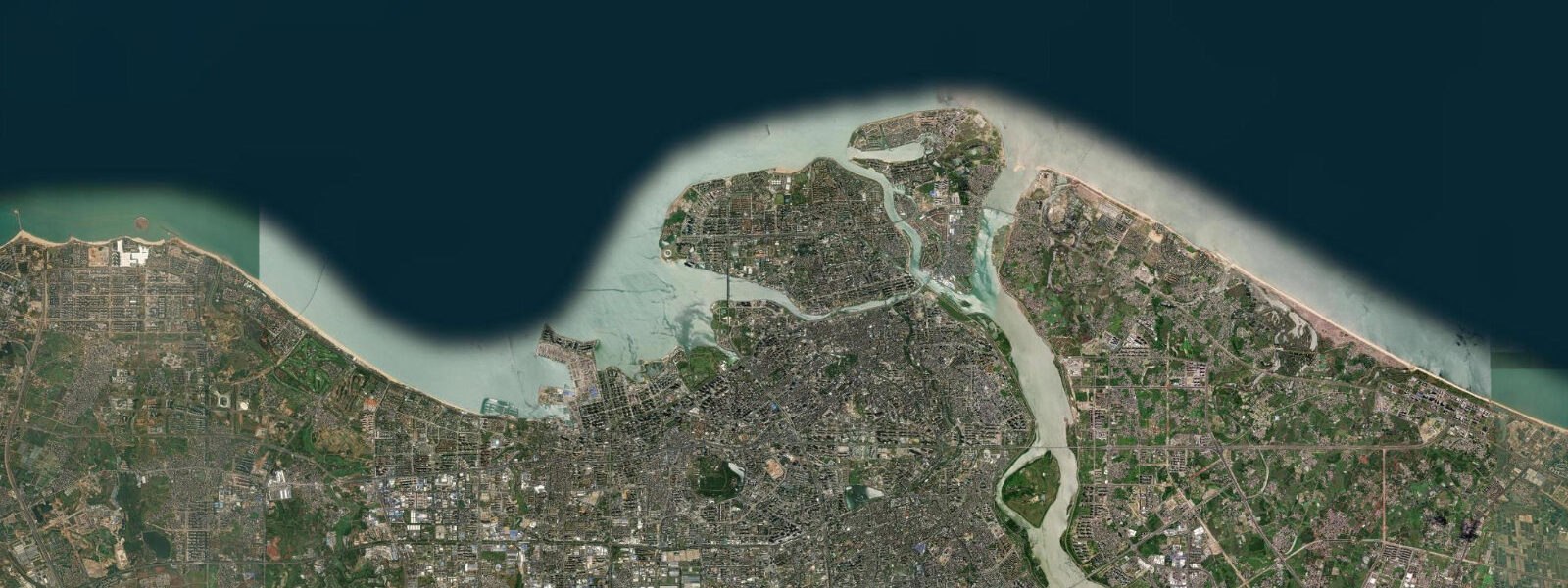
Zhanjiang sits on the Leizhou Peninsula in southern Guangdong, flanked by the Leizhou Bay to the east and the Beibu Gulf (Gulf of Tonkin's western extension) to the west. This southern exposure to the open South China Sea gives Zhanjiang the largest tidal range in Guangdong province: approximately 2.0 m mean range, rising to around 2.8 m on spring tides — compared to 1.0 to 1.5 m at Shenzhen and Zhuhai further north. The regime is mixed semidiurnal: two unequal high waters and two low waters per day, with the tidal inequality large enough to be significant for coastal users.
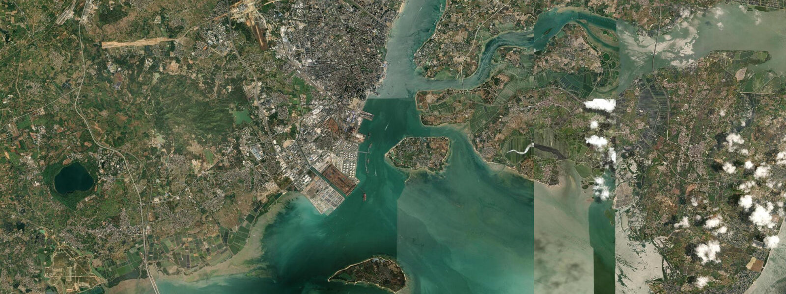
Zhanjiang is the southernmost major port in Guangdong and the main deepwater port for southern China's petrochemical industry. The port handles steel, iron ore, and petroleum products; a major integrated steel plant (Baosteel-WISCO Zhanjiang Steel Base, operational from 2015) operates on the northeast coast of Leizhou Bay. The port channel is dredged to 17 m below chart datum — one of the deepest in the South China Sea — to accommodate the 200,000 DWT ore carriers serving the steel plant.
Donghai Island (东海岛), connected to the Zhanjiang mainland by a 6 km causeway, is the second-largest offshore island in Guangdong. The eastern coastline of Donghai Island faces directly into the South China Sea and carries a 30 km beach — Dragon King Beach (龙王沙滩) — largely undeveloped, with windswept dune vegetation and wave-exposed sand. The beach is backed by low sand dunes and a coastal forest belt planted as windbreak. At low water, wave energy at Donghai is significantly higher than at the sheltered Leizhou Bay side: swell from the southeast refracted around the peninsula reaches the eastern shore with periods of 8 to 12 seconds in autumn and winter.
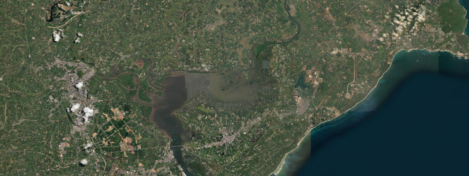
The mangrove forests of Zhanjiang National Nature Reserve are the most extensive mangrove ecosystem in China: approximately 20,000 hectares distributed across the tidal inlets and mudflats of Leizhou Bay and the Beibu Gulf coast. The reserve was designated in 1990 and is one of the few places in China where the full tidal cycle drives a functioning mangrove ecosystem at scale — mangrove aerial roots are exposed at low water and submerged to 0.5 to 1.5 m at high water. The reserve supports populations of egrets, cormorants, and the Chinese white dolphin (Sousa chinensis); the dolphin population in the Beibu Gulf is one of the larger remaining groups in South China. Boat access to the mangrove channels is available from Zhanjiang's waterfront and from Lianjiang to the northeast.
The Leizhou Peninsula itself has a distinctive volcanic landscape in its interior — the Leiqiong World Geopark covers remnant volcanic cones and lava fields from eruptions that ended approximately 10,000 years ago. The peninsula's southern tip is 40 km north of Hainan Island across the Qiongzhou Strait; ferries cross the strait to Haikou every 1 to 2 hours.
Zhanjiang's seafood is the primary culinary identity: oysters from Leizhou Bay, mud crab, and the local speciality gejia zheng xie (steamed crab with egg custard) are served at the waterfront restaurants around the Beibu Gulf fishing harbour. The early morning fish market at the port (4:00 to 7:00) is one of the more chaotic and productive fish markets in southern China.
Tide predictions on this page come from Open-Meteo Marine, a global ocean model. Accuracy is typically within plus or minus 45 minutes on timing and 0.2 to 0.3 metres on height — model-derived, not from a local gauge. For authoritative official tide data for Zhanjiang and the Leizhou Peninsula, the State Oceanic Administration / National Hydrographic Centre (SOA/NHC) publishes official tide tables.
Tide questions about Zhanjiang
Quick answers to the most common questions about tide times, range, and water access at Zhanjiang.
Why is the tidal range at Zhanjiang larger than at Shenzhen or Guangzhou?
Zhanjiang's larger range — approximately 2.0 m mean versus 1.0 to 1.5 m further north — reflects its direct South China Sea exposure. The Leizhou Peninsula's south and east coasts face open ocean with no estuarine damping (unlike the Pearl River Delta coast to the north) and no sheltered embayment reducing tidal amplitude. The Beibu Gulf to the west and Leizhou Bay to the east both focus tidal energy onto the peninsula from different directions, contributing to the larger range. The effect is analogous to how exposed Atlantic coasts in Europe show larger ranges than sheltered sea coast: open-ocean exposure plus local geometry determines the outcome.
What makes Zhanjiang's mangrove forest significant?
The Zhanjiang National Nature Reserve covers approximately 20,000 hectares of tidal mangrove across Leizhou Bay and the Beibu Gulf coast — the largest area of mangrove forest in China. The reserve's scale means the tidal cycle drives a genuinely functional ecosystem: at low water, aerial roots (pneumatophores) are fully exposed and the mudflat fauna (crabs, molluscs, mudskippers) is active; at high water, the canopy stands in 0.5 to 1.5 m of water and the aquatic fauna uses the flooded root zone for shelter and feeding. The reserve supports Chinese white dolphins (Sousa chinensis) in the bay, egrets and herons in the forest, and extensive invertebrate communities on the mudflat. Mangrove forests of this scale are increasingly rare in South China due to aquaculture pond conversion.
Is the beach on Donghai Island accessible and worth visiting?
Dragon King Beach on the eastern coast of Donghai Island is a 30 km undeveloped beach — one of the longest in Guangdong. Access is by the mainland causeway (6 km from Zhanjiang city), then road along the island to the eastern coast. The beach is wave-exposed from the southeast with swell periods of 8 to 12 seconds in autumn and winter, making it one of the few beaches in Guangdong suitable for bodysurfing or surfing. There is minimal infrastructure — a few basic stalls near the main access points, no lifeguards, minimal shade. The combination of scale, relative emptiness, and surf exposure makes it notable in a region dominated by sheltered, developed beaches.
How do I reach Hainan Island from Zhanjiang?
Cross-strait ferries depart from Lianhe Ferry Terminal in Zhanjiang (Xuwen County, 150 km south of Zhanjiang city by road) to Xinhai Ferry Terminal in Haikou, Hainan. The crossing takes 60 to 90 minutes; ferries run every 1 to 2 hours, 24 hours a day. The Qiongzhou Strait is approximately 20 km wide at the crossing point. Tidal currents in the strait run at 1.5 to 2.5 knots through the crossing; the ferry schedule accounts for these. Alternatively, high-speed rail from Zhanjiang West to Haikou via the cross-strait high-speed rail link (under construction, scheduled completion 2027) will provide a faster connection.
Are the tide predictions on this page official data I can use for port operations or navigation?
No. The predictions here come from Open-Meteo Marine, a global ocean model with typical accuracy of plus or minus 45 minutes on timing and 0.2 to 0.3 metres on height. For vessel operations at Zhanjiang port — where the port channel is dredged to 17 m and 200,000 DWT ore carriers operate on tide-dependent arrival windows — only official gauge-based tide data from the State Oceanic Administration / National Hydrographic Centre (SOA/NHC) and the Zhanjiang Port Authority is appropriate. Model accuracy of ±45 min is not sufficient for large-vessel under-keel clearance calculations or port traffic management.
8-day tide table — Zhanjiang
Heights relative to MSL. Predictions: Open-Meteo Marine (MeteoFrance SMOC, 0.08° grid) — heights relative to MSL (not chart datum / LAT). Model-derived.
| Day | Type | Time | Height |
|---|---|---|---|
| Sun 21 Jun | Low | 08:00 | -0.0m |
| High | 14:57 | 1.7m | |
| Low | 21:42 | -0.5m | |
| Mon 22 Jun | High | 04:04 | 1.0m |
| Low | 09:26 | 0.0m | |
| High | 15:52 | 1.3m | |
| Low | 22:13 | -0.3m | |
| Tue 23 Jun | High | 04:55 | 1.2m |
| Low | 10:35 | 0.1m | |
| High | 16:56 | 0.9m | |
| Low | 22:40 | -0.1m | |
| Wed 24 Jun | High | 05:45 | 1.3m |
| Low | 12:04 | 0.0m | |
| High | 18:15 | 0.7m | |
| Low | 23:18 | -0.0m | |
| Thu 25 Jun | High | 06:37 | 1.4m |
| Low | 13:25 | -0.1m | |
| High | 19:48 | 0.6m | |
| Fri 26 Jun | Low | 00:11 | 0.1m |
| High | 07:34 | 1.5m | |
| Sat 27 Jun | Low | 01:04 | 0.2m |
| High | 08:20 | 1.7m | |
| Sun 28 Jun | Low | 01:54 | 0.3m |
| High | 07:00 | 1.5m |