Haikou tide times
Haikou tide forecast — heights relative to MSL.
Today's tide times for Haikou
Tide times at Haikou on Saturday, 27 June 2026: first high tide at 10:40am. Sunrise 06:01am, sunset 07:21pm.
Tide chart for Haikou
24-hour cosine-interpolated curve around the present moment. Heights relative to MSL. Predictions: Predictions: Open-Meteo Marine (MeteoFrance SMOC, 0.08° grid).
Sun, moon and conditions on Sat 27 Jun
Snapshot at build time — refreshes daily. Sea state from Open-Meteo Marine.
Highs and lows next 7 days
Every predicted high and low for the next week, with the daily tidal coefficient (0–120; higher = bigger swing, > 95 means stronger currents).
Other spots nearby
The three closest curated TideTurtle locations to Haikou, measured by great-circle distance.
Today's solunar windows
Solunar tradition: major periods are the ≈3h windows around moon transit and opposition; minor are ≈2h around moonrise and moonset. Pair with the local tide stage and wind for the best read.
About tides at Haikou
A short guide to the coastline at Haikou — geography, sea state, and what the tide is actually doing under your feet.
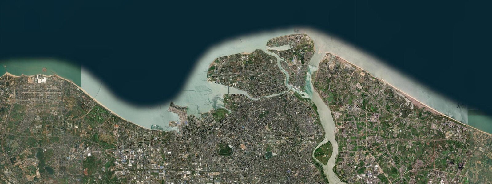
Haikou is Hainan's provincial capital, positioned on the island's north coast at the mouth of the Nandu River where it opens into Hainan Strait. The tidal regime here is mixed semidiurnal: two highs and two lows per day with noticeable inequality between consecutive highs. Spring range is around 1.2 m, slightly lower than the south coast at Sanya — the northern shelf geometry moderates the tidal signal somewhat. The tidal window opens modestly. At low water springs, broad sandy shallows and mudflats extend across the inner bay; at high water springs, the shoreline tightens against the mangrove fringe.
Hainan Strait is the most significant tidal feature in Haikou's immediate geography. This 30 km channel separating Hainan from Guangdong on the mainland runs the ferry service to Hai'an (crossing time approximately 1.5 hours). Tidal current in the strait runs east-west, strengthening on the mid-flood and mid-ebb. In strong northeast monsoon conditions (October through February), opposing wind-against-ebb creates a short, steep chop in the western approaches. Ferry operators manage this routinely, but passengers who are prone to seasickness should note that crossings in a northeast gale combined with an ebbing tide are the roughest conditions of the year.
Meilan International Mangrove Wetland Park occupies the eastern shore of Haidian Island, the low-lying island connected to central Haikou by bridge. At high tide, the mangrove roots are submerged and the park's boardwalk gives you a view directly into the canopy from water level. At low tide, the pneumatophores (breathing roots) are exposed and the inter-tidal mud is active with mudskippers, fiddler crabs, and wading birds — grey heron, little egret, and black-faced spoonbill in winter. The birdwatching is best two hours before and one hour after low water.
The volcanic rock coast west of the old town — marketed locally as the Haikou Lava Park — is Hainan's most unusual intertidal geology. Basalt from ancient eruptions forms irregular tide pools that hold sea urchins, chitons, and small reef fish through the tidal cycle. The pools are most accessible and most interesting at low tide, when the full basalt platform is exposed. High water covers the platform entirely; the water is clear enough for wading at mid-tide but the uneven rock makes non-slip footwear essential at all stages.
The grey mullet and snapper fishing off Haikou's rocky headlands follows a straightforward pattern: the last two hours of the ebb concentrate bait fish in the gullies between the basalt stacks, drawing predators. Shore anglers work the tide-change windows — from about 90 minutes before low water to 90 minutes after — as the most reliable feeding periods. Squid jigging from the pier at Xiuying Harbour is productive after dark on the high-water slack, when squid move inshore to feed around the lights.
Haidian Island's west-facing beach is the main family swimming spot in Haikou. The bottom gradient is very gentle and the 1 m depth contour sits roughly 60 m offshore at low tide, giving small children an extensive paddling zone. Longshore current is generally weak inside the island's sheltering geometry. The water temperature at Haikou runs cooler than Sanya by 1–2°C in winter — around 20–21°C in January — which is the main reason most international visitors head south to the resort coast.
The inner harbour at Haikou is industrial and not suitable for recreational water contact, but the breakwater on the eastern mole is a popular cast-net and rod-fishing platform. Access to the breakwater is tide-independent; the fishing is best on the flood, when mackerel and small trevally follow bait fish into the harbour mouth.
For photographers, the combination of the old volcanic rock coast and the mangroves gives two very different intertidal landscapes within 15 minutes of each other. The lava park at golden hour, with tide receding and the basalt pools reflecting the sky, is the signature shot.
Tidal predictions here use the Open-Meteo Marine gridded model (±45 minutes on timing, ±0.3 m on height). Not for navigation.
Tide questions about Haikou
Quick answers to the most common questions about tide times, range, and water access at Haikou.
How do tides affect the Hainan Strait ferry crossing from Haikou?
Tidal current in Hainan Strait runs east-west and peaks on mid-flood and mid-ebb. Ferries operate on a fixed schedule regardless of tide. The roughest crossings occur when the northeast monsoon wind (October through February) blows against an ebbing tide — the opposing flow creates short, steep chop in the western approaches. This is manageable for the ferry but uncomfortable for seasickness-prone passengers. In summer, conditions are generally calmer. Always check the China MSA or ferry operator for weather warnings before booking during typhoon season.
What is the best time to visit the Meilan mangrove park?
For birdwatching — which is the main draw — arrive two hours before low water and plan to stay through low water slack. This is when the inter-tidal mud is exposed and active: mudskippers and fiddler crabs are visible in the gullies between roots, and wading birds concentrate at the mud margins. High tide gives a different experience — the boardwalk sits at canopy level and you are looking into, not down at, the mangroves. Winter months (November through March) add migratory species including black-faced spoonbill.
Is the volcanic lava park accessible at all tide stages?
The basalt platform at Haikou Lava Park is fully exposed at low water springs and submerged at high. Mid-tide gives a partial exposure. The most interesting visit is at or just after low water, when the tide pools are at maximum extent and populated with sea urchins, chitons, and small reef fish. Non-slip footwear is essential — the basalt is irregular and algae-covered in the intertidal zone. At high water, the wave-cut benches are covered and the coastline reverts to a simple low cliff profile.
What is the tidal range at Haikou compared to Sanya?
Haikou's spring range is around 1.2 m, slightly less than Sanya's 1.5 m. Both are modest by global standards. The tidal regime at Haikou is mixed semidiurnal — two highs and two lows per day with noticeable size difference between consecutive cycles. The diurnal inequality means one of the two daily lows is often significantly lower than the other, which is when the lava platform and mangrove flats are most fully exposed. The reduced range compared to Sanya reflects Haikou's position on the north coast, which has a slightly different tidal resonance with the South China Sea.
What fishing is available from the shore around Haikou?
Shore fishing is most productive around tide changes — the 90 minutes before and after both low and high water. The volcanic rock coast west of the old town holds grey mullet and snapper in the basalt gullies; low-tide rock hopping gives access to ledges that are submerged at other stages. The Xiuying Harbour breakwater is a popular platform for mackerel and trevally on the flood tide. After dark, squid jigging from the pier at high-water slack is productive. The mangrove channels on Haidian Island hold small barramundi and milkfish — best on the last hour of the flood.
8-day tide table — Haikou
Heights relative to MSL. Predictions: Open-Meteo Marine (MeteoFrance SMOC, 0.08° grid) — heights relative to MSL (not chart datum / LAT). Model-derived.
| Day | Type | Time | Height |
|---|---|---|---|
| Sat 27 Jun | High | 10:40 | 1.2m |
| Sun 28 Jun | — | ||
| Mon 29 Jun | Low | 02:34 | -0.3m |
| High | 12:00 | 1.4m | |
| Low | 16:00 | 1.1m | |
| High | 16:45 | 1.1m | |
| Tue 30 Jun | — | ||
| Wed 01 Jul | Low | 03:58 | -0.5m |
| High | 13:06 | 1.3m | |
| Thu 02 Jul | Low | 04:40 | -0.5m |
| High | 13:40 | 1.3m | |
| Low | 17:21 | 1.1m | |
| High | 19:50 | 1.2m | |
| Fri 03 Jul | Low | 05:22 | -0.4m |
| High | 14:00 | 1.2m | |
| High | 21:00 | 1.2m | |
| Sat 04 Jul | Low | 05:58 | -0.3m |