Getxo tide times
Getxo tide forecast — heights relative to MSL.
Today's tide times for Getxo
Tide times at Getxo on Sunday, 21 June 2026: first high tide at 02:00, first low tide at 03:35, second high tide at 10:02, second low tide at 15:50, third high tide at 22:20. Sunrise 06:31, sunset 21:55.
Tide chart for Getxo
24-hour cosine-interpolated curve around the present moment. Heights relative to MSL. Predictions: Predictions: Open-Meteo Marine (MeteoFrance SMOC, 0.08° grid).
Sun, moon and conditions on Sun 21 Jun
Snapshot at build time — refreshes daily. Sea state from Open-Meteo Marine.
Highs and lows next 7 days
Every predicted high and low for the next week, with the daily tidal coefficient (0–120; higher = bigger swing, > 95 means stronger currents).
Other spots nearby
The three closest curated TideTurtle locations to Getxo, measured by great-circle distance.

Today's solunar windows
Solunar tradition: major periods are the ≈3h windows around moon transit and opposition; minor are ≈2h around moonrise and moonset. Pair with the local tide stage and wind for the best read.
Cycle dates near Getxo
Last spring tide on Sun 21 Jun (range 2.7m). Next spring tide on Sat 27 Jun (range 2.3m). Next neap on Wed 24 Jun.
Spring tides cluster around new and full moons (biggest swings). Neap tides land on quarter moons (smallest swings). See the spring tide and neap tide glossary entries for the why.
About tides at Getxo
A short guide to the coastline at Getxo — geography, sea state, and what the tide is actually doing under your feet.
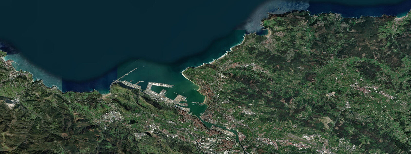
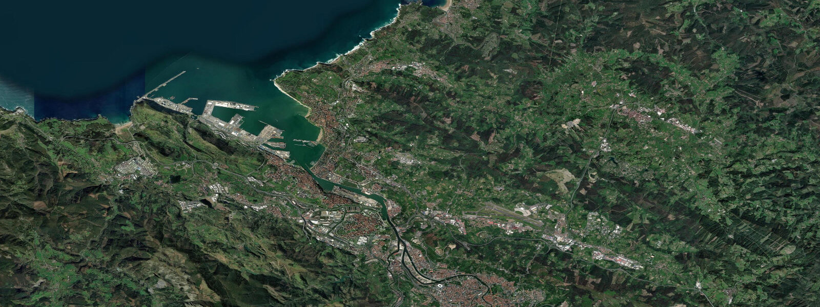
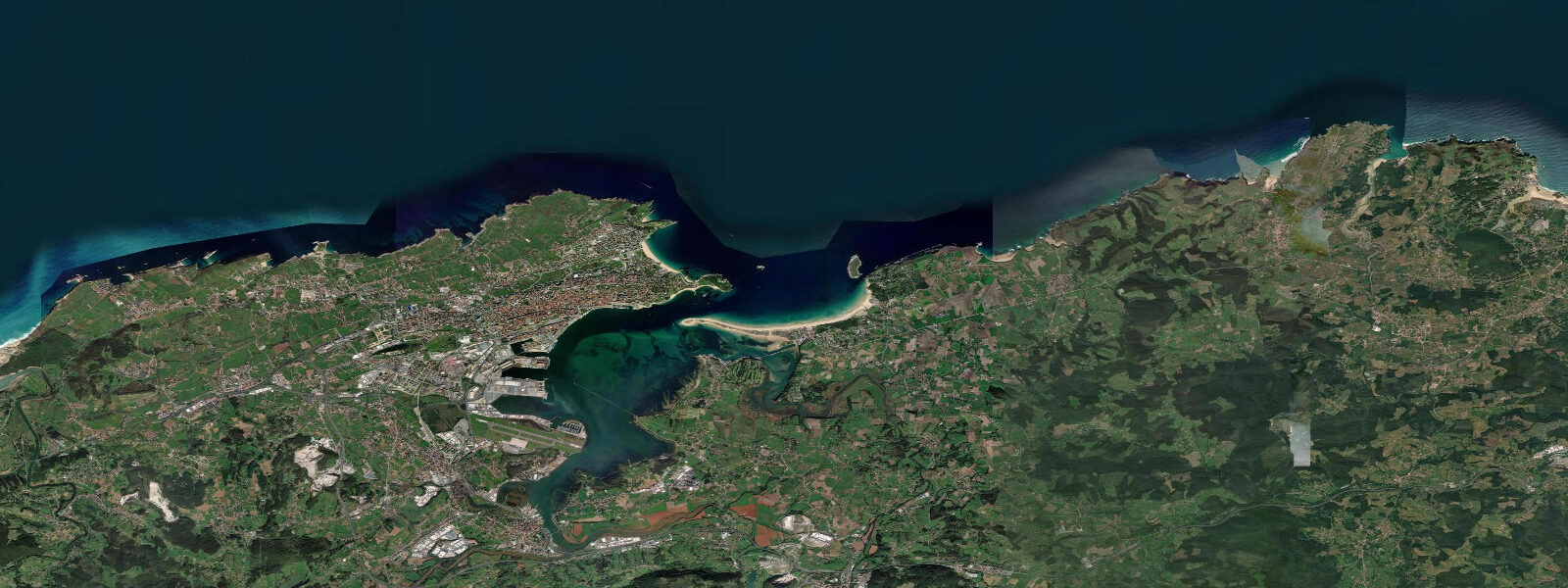
Getxo is the coastal suburb at the mouth of the Nervión estuary, where the river that carries Bilbao's industrial and maritime history meets the Bay of Biscay. The estuary mouth is wide and tidal; the Nervión runs 12 kilometres inland to Bilbao's city centre, with the Guggenheim Museum sitting 3 kilometres from the river 9 kilometres upstream. Getxo itself is a residential suburb of Bilbao with a different character from the city: clifftop mansions from the 19th-century industrial wealth, a marina, a small fishing port, and Arrigunaga beach below the limestone cliffs on the open Atlantic side.
The tidal range at the Nervión mouth is approximately 3.5 metres on mean springs. The estuary amplifies this: tidal currents in the main channel reach 2 to 3 knots on the ebb as the full volume of the upper estuary empties. The ría (tidal estuary) of Bilbao has been dredged and channelised since the 19th century to allow ocean-going vessels to reach Bilbao's port. The suspension bridge — Puente Bizkaia (Puente Colgante), 1893 — crosses the estuary 1.5 kilometres upstream from the sea at Getxo–Portugalete. It is a UNESCO World Heritage Site and operates as a transporter bridge: a gondola suspended from the bridge deck carries cars and passengers across the estuary every 8 minutes. The bridge deck is also a walkway at 45 metres above the water.
Arrigunaga beach, on the open Atlantic side of the Getxo headland, is a 300-metre pocket beach under limestone cliffs. The beach faces northwest and is exposed to Atlantic swell — it picks up 1 to 3 metre waves in autumn and winter that make it a local surf spot. At high water on spring tides, Arrigunaga is nearly entirely submerged; at low water the beach expands and the rock platforms at its base are accessible. The cliffs above have been eroded into caves and arches by Atlantic wave action.
The Getxo marina (Puerto Deportivo de Getxo) is on the sheltered estuary side, protected from Bay of Biscay weather. Sailing races in the estuary are a regular feature of the Basque summer calendar. The Arriluce breakwater on the outer mole of the marina is a fishing point for local anglers targeting lubina (sea bass) and dorada (gilt-head bream) — the tidal current that runs past the breakwater brings food, and the structure creates an ambush point. Best fishing is on the last two hours of the flood tide.
Bilbao is 20 minutes by metro from Getxo (Neguri or Bidezabal stations). The Guggenheim Museum is at Abandoibarra on the left bank of the Nervión — a titanium-clad building by Frank Gehry that has become the shorthand for Bilbao's reinvention. The ría walk from the museum to the Puente Bizkaia transporter bridge is 4.5 kilometres along the waterfront and passes the old port infrastructure, converted warehouses, and the working river.
Tide predictions on this page come from Open-Meteo Marine, a gridded global ocean model. Accuracy is typically within plus or minus 45 minutes on timing and 0.2 to 0.3 metres on height — model-derived, not from a local gauge. For authoritative official data, Puertos del Estado (puertos.es) publishes gauge-based tide tables for Bilbao (Zierbena gauge, at the outer estuary entrance).
Tide questions about Getxo
Quick answers to the most common questions about tide times, range, and water access at Getxo.
What is the Puente Bizkaia (Puente Colgante) and how does it work?
Puente Bizkaia — also called the Vizcaya Bridge or Puente Colgante (Hanging Bridge) — is a transporter bridge built in 1893 across the Nervión estuary at Getxo–Portugalete, 1.5 km upstream from the sea. Rather than a drawbridge or ferry, a gondola suspended from the bridge deck carries cars, cyclists, and pedestrians across the 164-metre-wide estuary every 8 minutes. The bridge deck at 45 metres above the water is also a walkway with views of the estuary and bay. It is a UNESCO World Heritage Site — the world's oldest working transporter bridge. Tickets for the gondola and bridge deck walk are sold at the Getxo and Portugalete towers.
What is the tidal range at Getxo and how does it affect the Nervión estuary?
Mean spring tidal range at the Nervión mouth is approximately 3.5 metres. The estuary amplifies tidal currents: the ebb current in the main channel runs at 2 to 3 knots on springs as the upper estuary drains. The estuary was dredged to a maintained depth of 13.5 metres to allow container ships to reach Bilbao's inner port. For small boat users, the tidal current in the main channel is significant — a kayaker or small motorboat fighting the ebb at the estuary mouth faces a 2 to 3 knot contrary current. Work with the tide, not against it.
Is Arrigunaga beach good for surfing?
Arrigunaga is a local surf spot rather than a destination break — a 300-metre pocket beach under limestone cliffs, northwest-facing, that picks up Atlantic swells when they reach the Nervión mouth. Wave size runs 0.5 to 2 metres in autumn and winter, typically beach-break quality. The beach is better known as a scenic spot (cliffs, sea caves, view of the Bilbao coast) than as a serious surf destination. For quality surf near Bilbao, Bakio and Plentzia (10 to 20 km west) are better beaches, and Mundaka (30 km east) is the benchmark break of the Basque coast.
How do I get from Getxo to the Guggenheim Museum in Bilbao?
Bilbao Metro Line 1 runs from Neguri or Bidezabal stations in Getxo directly to Moyúa (for the Guggenheim, 5 min walk) in about 20 minutes. The metro runs every 5 to 10 minutes at peak times. Alternatively, the ría walk along the Nervión from Getxo takes about 2 hours on foot (4.5 km one way, fully flat waterfront path). The transporter bridge crossing at Getxo–Portugalete adds a useful detour if walking — cross to the Portugalete side and walk along the left bank to reach the museum area.
Are the tide predictions on this page official forecasts I can use for navigation or safety planning?
No. Predictions shown here come from Open-Meteo Marine, a global ocean model with typical accuracy of plus or minus 45 minutes on timing and 0.2 to 0.3 metres on height. For navigation in the Nervión estuary or Bay of Biscay, and for any safety-critical decision involving tidal currents or water depths, use the official gauge-based predictions from Puertos del Estado (puertos.es). The Zierbena tide gauge at the outer Nervión entrance is the closest official reference point for Getxo and Bilbao.
8-day tide table — Getxo
Heights relative to MSL. Predictions: Open-Meteo Marine (MeteoFrance SMOC, 0.08° grid) — heights relative to MSL (not chart datum / LAT). Model-derived.
| Day | Type | Time | Height |
|---|---|---|---|
| Sun 21 Jun | High | 02:00 | -1.4m |
| Low | 03:35 | -1.8m | |
| High | 10:02 | 0.7m | |
| Low | 15:50 | -1.5m | |
| High | 22:20 | 0.9m | |
| Mon 22 Jun | Low | 04:32 | -1.6m |
| High | 11:01 | 0.6m | |
| Low | 16:53 | -1.4m | |
| High | 23:21 | 0.7m | |
| Tue 23 Jun | Low | 05:32 | -1.4m |
| High | 12:03 | 0.5m | |
| Low | 17:57 | -1.3m | |
| Wed 24 Jun | High | 00:27 | 0.6m |
| Low | 06:32 | -1.3m | |
| High | 13:05 | 0.6m | |
| Thu 25 Jun | Low | 07:27 | -1.3m |
| High | 14:01 | 0.6m | |
| Fri 26 Jun | Low | 08:21 | -1.3m |
| High | 14:51 | 0.8m | |
| Low | 20:53 | -1.4m | |
| Sat 27 Jun | High | 03:16 | 0.7m |
| Low | 09:10 | -1.4m | |
| High | 15:36 | 0.8m | |
| Low | 21:38 | -1.5m | |
| Sun 28 Jun | High | 01:00 | -0.2m |