Tioman Island, Malaysia tide times
Tioman Island, Malaysia tide forecast — heights relative to MSL.
Today's tide times for Tioman Island, Malaysia
Tide times at Tioman Island, Malaysia on Saturday, 4 July 2026: first low tide at 08:00am, first high tide at 12:37pm, second low tide at 06:57pm, second high tide at 11:22pm. Sunrise 06:59am, sunset 07:15pm.
Tide chart for Tioman Island, Malaysia
24-hour cosine-interpolated curve around the present moment. Heights relative to MSL. Predictions: Predictions: Open-Meteo Marine (MeteoFrance SMOC, 0.08° grid).
Sun, moon and conditions on Sat 04 Jul
Snapshot at build time — refreshes daily. Sea state from Open-Meteo Marine.
Highs and lows next 7 days
Every predicted high and low for the next week, with the daily tidal coefficient (0–120; higher = bigger swing, > 95 means stronger currents).
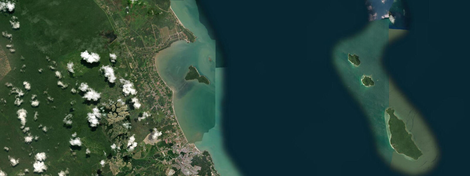
Other spots nearby
The three closest curated TideTurtle locations to Tioman Island, Malaysia, measured by great-circle distance.
Today's solunar windows
Solunar tradition: major periods are the ≈3h windows around moon transit and opposition; minor are ≈2h around moonrise and moonset. Pair with the local tide stage and wind for the best read.
Cycle dates near Tioman Island, Malaysia
Last spring tide on Sat 04 Jul (range 2.2m). Next spring tide on Thu 09 Jul (range 1.7m). Next neap on Wed 08 Jul.
Spring tides cluster around new and full moons (biggest swings). Neap tides land on quarter moons (smallest swings). See the spring tide and neap tide glossary entries for the why.
About tides at Tioman Island, Malaysia
A short guide to the coastline at Tioman Island, Malaysia — geography, sea state, and what the tide is actually doing under your feet.
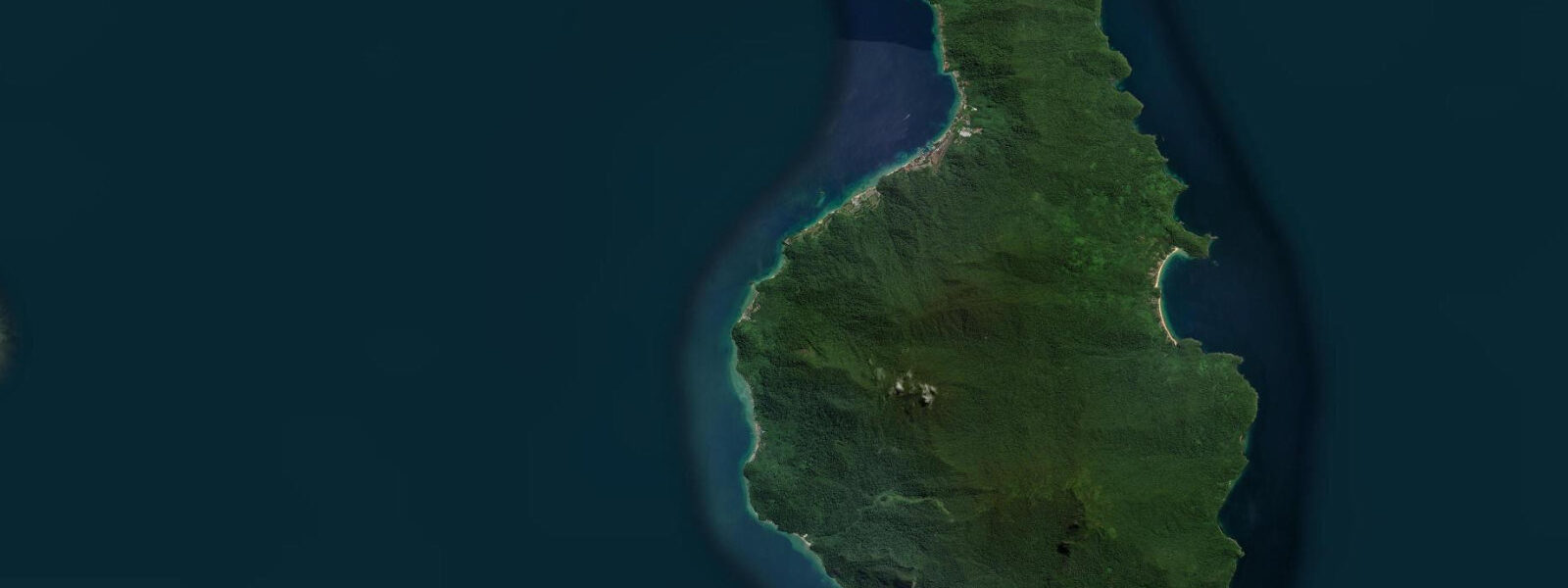
Tioman Island lies 56 km off the Johor coast of Pahang, large enough at 39 km long and 12 km wide to hold a closed rainforest interior, freshwater rivers and waterfalls, a village road circuit, and a range of accommodation from backpacker bungalows to mid-range resorts. The island has duty-free status — alcohol, tobacco, and electronics are available at the ferry jetty terminal — and Tekek, the main kampung on the central west coast, holds the airstrip, the main dive strip, and the island's administrative functions.
The bays on the west coast each have distinct character. Salang in the north is the backpacker and dive hub, with a coral-ringed bay and a party atmosphere that gets loud after dark. Juara, on the east coast accessible by 4WD track through the jungle (or by a 2.5-hour boat ride around the island), is exposed to the northeast monsoon swell and gets the island's best wave action from November to February; out of monsoon season its broad beach is wide, clear, and quiet, with the best forest access of any bay. Paya, Genting, and Mukut on the southern west coast are quieter, smaller, and mostly accessible only by water taxi from Tekek or Mersing.
The marine park boundary is tightly enforced: anchoring on the reef is prohibited, boat traffic in the bay snorkel zones is restricted, and the fish life on the inner reef is noticeably denser than on less-managed islands nearby. Hawksbill and green turtles nest on the sandy beaches of Juara, where the Juara Turtle Project has monitored and protected nests since the early 2000s. The coral at Tekek and Salang bays is accessible from the beach at low to mid tide; the deeper reef slope beyond 5 m requires a boat or a strong snorkel swim.
The South China Sea here is mixed semidiurnal, spring range 1.2 to 1.8 m. Tioman's elongated shape introduces a practical complication: tidal timing on the east coast (Juara) lags the west coast (Tekek) by up to 40 minutes because the island's bulk delays the tidal wave reaching the eastern shore. Anyone crossing the jungle track between Tekek and Juara on a low-tide deadline — to catch the morning snorkel window or meet a water taxi at a specific bay — should account for this offset.
The MV Pulau Sipadan wreck, 11 km offshore in 40 m of water, is the main technical dive: a 74 m coastal freighter sitting upright, penetrable with lights. The resident napoleon wrasse and barracuda school at the island channel sites are the highlight for open-water recreational divers. Film geography footnote: Tioman's twin volcanic peaks — Bukit Nenek Semukut — served as the visual inspiration for Bali Ha'i in the 1958 South Pacific film; the island was the location shoot stand-in and that historical footnote appears in every travel piece written about Tioman. Predictions on this page come from Open-Meteo Marine (gridded model, ±45 min / ±0.2–0.3 m). The Tekek to Juara jungle trail is a 3 km route crossing the central ridge at 500 m; it is marked and passable for fit walkers in 2 to 3 hours in each direction. The trail is steep, muddy after rain, and unmaintained in places — use hiking footwear, not sandals, and start early before the midday heat. The Juara side descent leads to the beach through secondary jungle with hornbills audible overhead. The trail is the most direct experience of Tioman's rainforest interior available without a guide. The island sits in a designated marine park, and dive sites around Renggis Island and Tulai are strongly affected by tidal state. Visibility on the shallow tops of Renggis peaks at low water slack on neap tides, when current is minimal and suspended material has had time to settle. The ferry jetty at Genting village is tidal — the ramp is steep at low water and small boats sometimes ground on the lowest spring lows; arrival times should be checked against the tide before booking day trips. Orang Asli fishing communities along the north and south coasts have worked Tioman's waters for generations; they read subtle current signs at the channel mouths that no gridded model captures. Turtle nesting on the east coast beaches at Juara is concentrated at high water, when gravid females can approach the upper beach directly. The Juara Turtle Project monitors nesting season from May through September and the highest nest densities correlate with the highest tides of each month.
Tide questions about Tioman Island, Malaysia
Quick answers to the most common questions about tide times, range, and water access at Tioman Island, Malaysia.
When is the next high tide at Tioman Island?
The hero block shows the next predicted high at Tioman in Malaysia Standard Time (MYT, UTC+8). Mixed semidiurnal, spring range 1.2 to 1.8 m. Note that the east coast (Juara) tide timing lags the west coast (Tekek) by up to 40 minutes because Tioman's bulk delays the tidal wave reaching the eastern shore. The 7-day table shows the western coast prediction; add 40 minutes for Juara-side activities. Predictions from Open-Meteo Marine (gridded model, ±45 min / ±0.2–0.3 m). Note that the 40-minute east/west coast lag at Tioman means the tide table prediction applies to the Tekek (west) side; add 40 minutes for Juara-side activity planning.
What is the tidal range at Tioman?
Spring range runs 1.2 to 1.8 m; neap range about 0.7 to 1.0 m. The mixed semidiurnal pattern means two unequal highs and two unequal lows per day. The inner reef bays at Tekek and Salang are most accessible for surface snorkelling at mid to low tide when the shallow reef flat is in 0.3 to 0.8 m of water. At spring high, the flat is covered by 1.5 to 2 m and snorkelling requires swimming further from the beach.
Where do these predictions come from?
Open-Meteo Marine, a free gridded global ocean model, accuracy ±45 min / ±0.2–0.3 m. Jabatan Laut Malaysia publishes authoritative harmonic predictions for Malaysian waters; Tioman Island is a named reference station in the Malaysian tide tables. The 40-minute east/west coast lag is a local correction to apply on top of any model or reference station output. The Tioman Island reference station in the Malaysian tide tables provides gauge-calibrated timing; JLM publishes this data annually. The 40-minute east/west coast lag is a local correction to apply on top of the reference station output.
When is Tioman open and how do I get there?
High season is March through October. Berjaya Air operates a small aircraft service from Kuala Lumpur and Singapore to Tekek airstrip; schedules are thin and the aircraft is a small turboprop — book early in peak season. Ferries from Mersing (2 to 2.5 hours) and Tanjung Gemok (2 hours) run when the South China Sea permits; they slow or suspend in the northeast monsoon (November–February). Book accommodation before travelling in June to August — capacity on the island is finite and the backpacker chalets at Salang and Juara fill early.
Is this safe to use for navigation?
No. TideTurtle is a planning tool. The South China Sea approaches to Tioman, the rocky headlands on the northern and southern tips, and the inter-bay reef passages require proper chart navigation. Malaysia Marine Department chart products cover Tioman waters. Private boats approaching Juara Bay from the south should be aware of the reef shoals extending from the southern headland that are submerged at high water. The South China Sea reefs around Tioman's headlands are the main vessel hazard; Malaysia Marine Department chart products cover Tioman waters and the approaches from Mersing.
7-day tide table — Tioman Island, Malaysia
Heights relative to MSL. Predictions: Open-Meteo Marine (MeteoFrance SMOC, 0.08° grid) — heights relative to MSL (not chart datum / LAT). Model-derived.
| Day | Type | Time | Height |
|---|---|---|---|
| Sat 04 Jul | Low | 08:00 | 0.3m |
| High | 12:37 | 1.8m | |
| Low | 18:57 | 0.4m | |
| High | 23:22 | 0.8m | |
| Sun 05 Jul | Low | 05:41 | -0.4m |
| High | 13:05 | 1.8m | |
| Mon 06 Jul | Low | 06:22 | -0.2m |
| High | 13:36 | 1.7m | |
| Low | 20:06 | 0.2m | |
| Tue 07 Jul | High | 01:38 | 0.9m |
| Low | 07:12 | -0.0m | |
| High | 14:00 | 1.5m | |
| Low | 20:38 | -0.0m | |
| Wed 08 Jul | High | 02:50 | 1.0m |
| Low | 21:10 | -0.2m | |
| Thu 09 Jul | High | 04:00 | 1.1m |
| Low | 09:18 | 0.4m | |
| High | 14:48 | 1.1m | |
| Low | 21:53 | -0.5m | |
| Fri 10 Jul | High | 05:17 | 1.3m |
| Low | 10:56 | 0.6m | |
| High | 15:22 | 0.9m | |
| Low | 22:42 | -0.6m |