Hurghada tide times
Hurghada tide forecast — heights relative to MSL.
Today's tide times for Hurghada
Tide times at Hurghada on Wednesday, 29 July 2026: first low tide at 03:00am, first high tide at 06:18am, second low tide at 12:40pm, second high tide at 07:00pm. Sunrise 06:06am, sunset 07:35pm.
Tide chart for Hurghada
24-hour cosine-interpolated curve around the present moment. Heights relative to MSL. Predictions: Predictions: Open-Meteo Marine (MeteoFrance SMOC, 0.08° grid).
Sun, moon and conditions on Wed 29 Jul
Snapshot at build time — refreshes daily. Sea state from Open-Meteo Marine.
Highs and lows next 7 days
Every predicted high and low for the next week, with the daily tidal coefficient (0–120; higher = bigger swing, > 95 means stronger currents).
Other spots nearby
The three closest curated TideTurtle locations to Hurghada, measured by great-circle distance.
Today's solunar windows
Solunar tradition: major periods are the ≈3h windows around moon transit and opposition; minor are ≈2h around moonrise and moonset. Pair with the local tide stage and wind for the best read.
Cycle dates near Hurghada
Next spring tide on Fri 31 Jul (range 0.5m). Last neap on Wed 29 Jul.
Spring tides cluster around new and full moons (biggest swings). Neap tides land on quarter moons (smallest swings). See the spring tide and neap tide glossary entries for the why.
About tides at Hurghada
A short guide to the coastline at Hurghada — geography, sea state, and what the tide is actually doing under your feet.
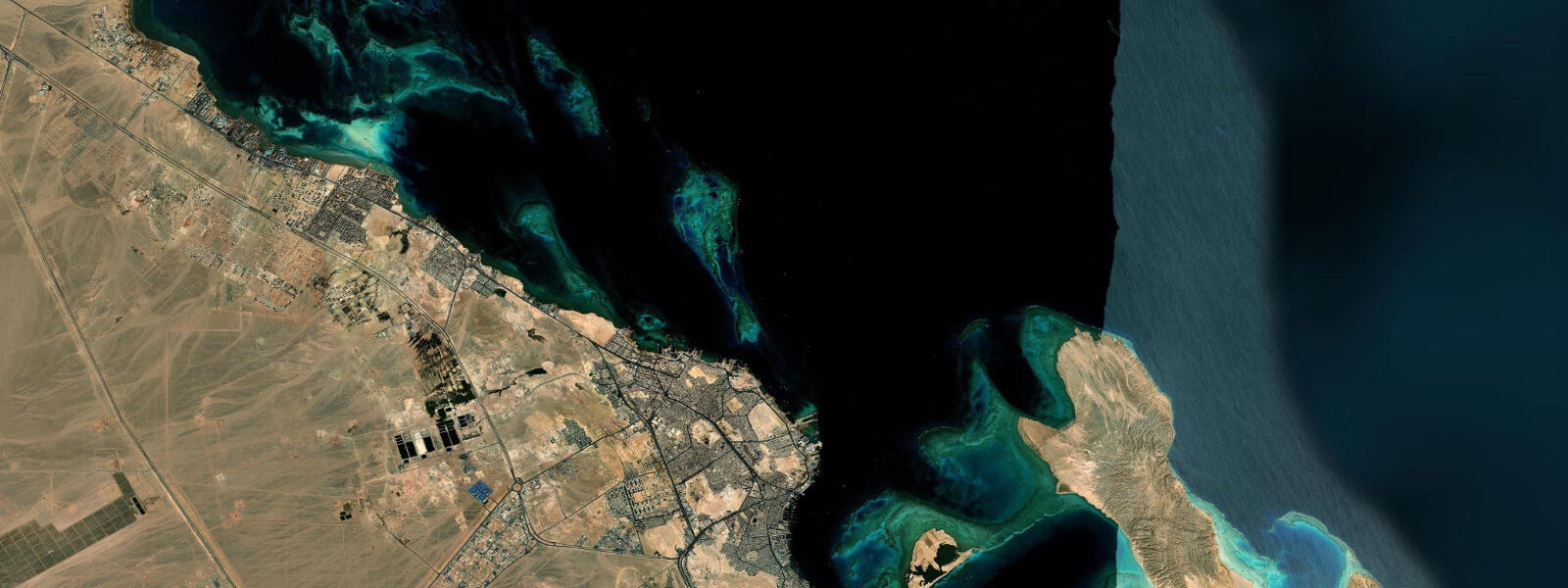
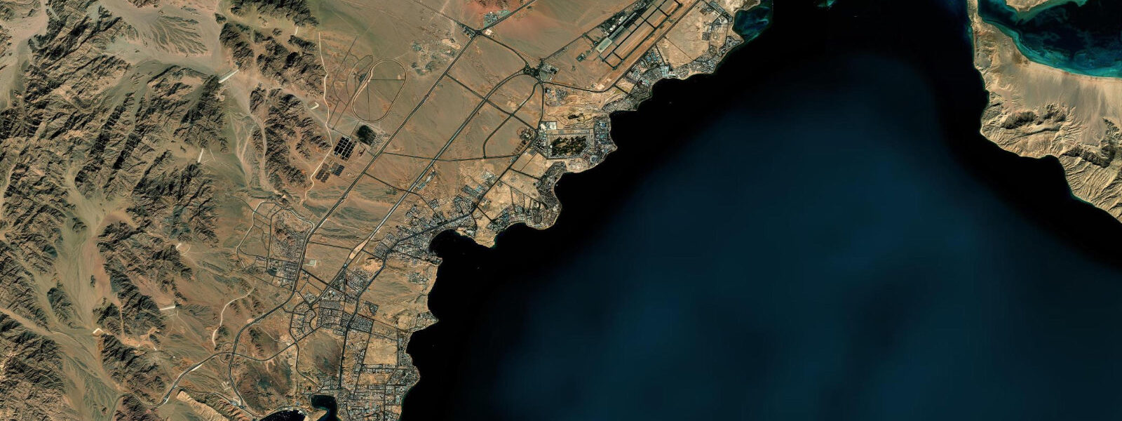
Hurghada runs along the western shore of the Red Sea where the Eastern Desert meets the coast in a long strip of resort marinas, the original fishing-port old town at El Dahar, and the modern Marina Boulevard development at the south end. The marina, with the white minaret of El Mina Mosque rising above the harbour wall and the line of dive boats, glass-bottom tour boats, and small-fleet fishing craft moored along the stone quay, is the operational centre of the Hurghada coast. Offshore, the Giftun Islands — Big Giftun and Small Giftun — sit eight to ten kilometres east, the closest of the Hurghada island chain and the standard daily destination for the snorkelling and dive boats that leave the marina each morning.
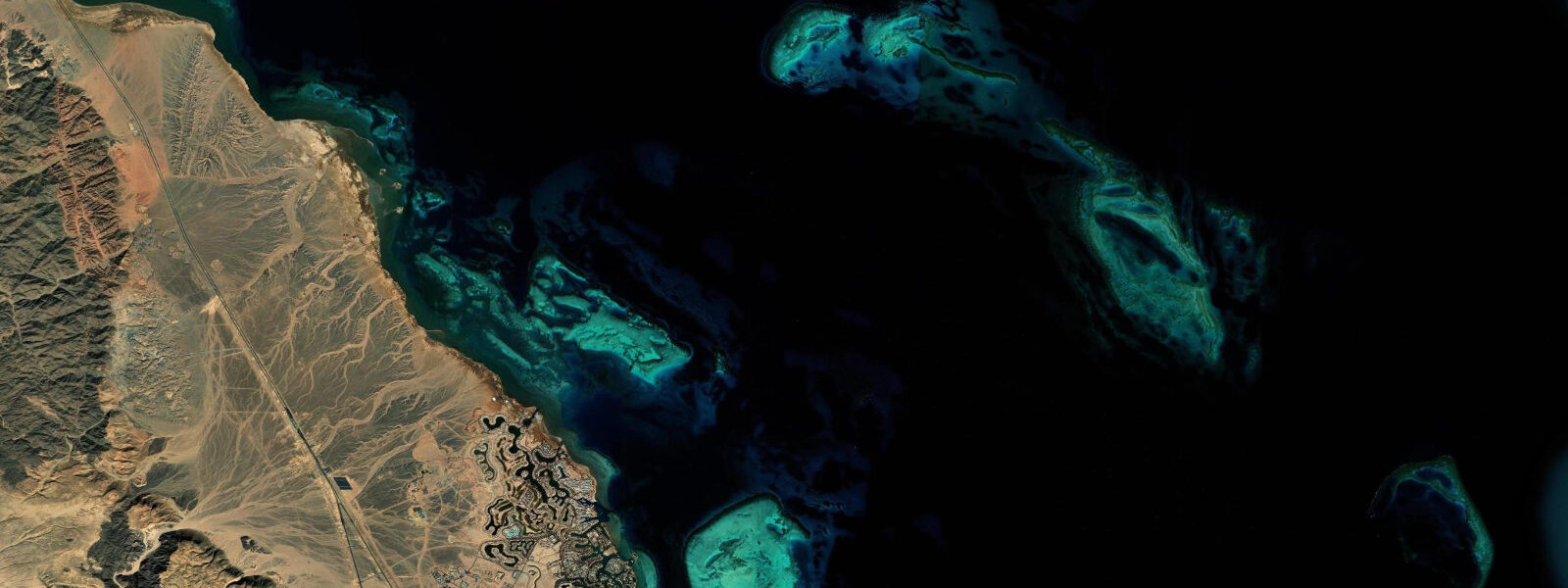
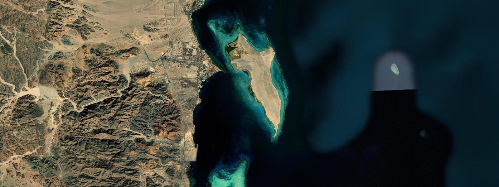
The Mahmya beach on the western shore of Big Giftun, the long sand spit at Small Giftun, and the reef channel between the two islands are the day-trip standards. South of the city, the Sahl Hasheesh bay holds a separate resort coast with its own arc of fringing reef and the Old Town pier reaching out to the offshore reef edge, and beyond that the Safaga and El Quseir reaches continue south toward Marsa Alam. The tide here is semidiurnal and small.
Mean astronomical range at Hurghada is about 50 to 80 cm; spring tides at new and full moons push toward the upper end of that band, and neaps compress toward 30 to 40 cm. Two highs and two lows of similar size each day, roughly 12 hours 25 minutes apart. That is enough range on a fringing-reef coast to drain the inner reef flat at low water — visibly so on the long shallow shelves at Giftun Saghir, off the Mahmya beach on Big Giftun, and along the reef terrace south of Sahl Hasheesh — and to change the shore-entry depth at the house reefs by half a metre between the highs and lows.
The fringing-reef geometry here is consistent along the entire Hurghada coast: a narrow shore strip, a shallow reef flat 50 to 200 metres wide, the reef edge breaking, and the wall dropping to 30 metres or more on the seaward side. The shore-entry house reefs at Sahl Hasheesh, El Mina, and the El Dahar headland follow the same template. Wind matters.
The prevailing northerly down the Red Sea length stacks water against the southern coast in steady summer weather and relaxes level along the Hurghada reach when the wind eases or shifts. The seasonal Khamsin transition in spring and autumn brings stronger southerlies and noticeable surge against the Marina Boulevard breakwater. Dive-charter operators schedule the day around the change of wind and the predicted slack between flood and ebb at the offshore island sites; the slack window — about 30 to 45 minutes either side of the predicted high or low — is the low-current drift window.
Shore anglers along the rocky points north of El Dahar work the incoming tide for grouper and snapper on the reef edge, and the kitesurf coast at El Gouna and the bay between Hurghada and Safaga sees its strongest sessions on the steady summer northerly. The Egyptian Hydrographic Department operates the gauge network along the Red Sea coast and is the authoritative source for tide and water-level data — the reference to consult for any reef navigation, marina pilotage, or commercial dive-boat scheduling. The predictions on this page come from Open-Meteo Marine, a gridded global ocean model.
3 metres on height. For a coast with mean range under a metre, that uncertainty is a non-trivial fraction of the total signal. Treat the predicted highs and lows as the rhythm of the day and weight the Egyptian Hydrographic Department gauge data and the local dive-operator briefing for any decision that depends on precise water level.
Tide questions about Hurghada
Quick answers to the most common questions about tide times, range, and water access at Hurghada.
When is the next high tide at Hurghada?
The hero block at the top of this page shows the next predicted high at Hurghada in local Egypt Standard Time (EET, UTC+2, no DST). Hurghada sees two highs and two lows roughly 12 hours 25 minutes apart — semidiurnal Red Sea pattern. The astronomical range is small, around 50 to 80 cm in mean conditions, and the prevailing northerly Red Sea wind modulates water level by tens of centimetres on top of the predicted swing. For authoritative Red Sea coast tide data, the Egyptian Hydrographic Department is the source of record.
What's the typical tide range at Hurghada?
Mean astronomical range at Hurghada runs about 50 to 80 cm. Spring tides at new and full moons push toward the upper end of that band; neap tides during the quarter moons compress toward 30 to 40 cm. The Red Sea tidal signal is small compared to ocean coasts, but the swing is enough on the spring tides to drain the inner reef flat at the Giftun Islands, expose the table corals at the reef-edge shelves off Sahl Hasheesh, and noticeably change shore-entry depth at the marina-front and El Dahar house reefs.
Where do these tide predictions come from?
Open-Meteo Marine, a free gridded global ocean model. The model estimates tidal height from oceanographic equations applied across a geographic grid rather than from harmonic analysis of a dedicated Hurghada gauge record. Accuracy is typically within plus or minus 45 minutes on timing and within roughly 0.2 to 0.3 metres on height. On a coast with a mean range under a metre, that height uncertainty is a meaningful fraction of the total signal. The Egyptian Hydrographic Department is the authoritative source for Egyptian Red Sea tide data and is the reference for any reef navigation, marina pilotage, or dive-boat scheduling decision that depends on precise water level.
When can I snorkel the Giftun Island reef flat?
Big Giftun and Small Giftun, the offshore islands eight to ten kilometres east of Hurghada Marina Boulevard, hold long shallow reef terraces that change visibly between the highs and lows. The inner reef flat at the Mahmya beach on Big Giftun and the lagoon at Small Giftun are easiest to wade and snorkel at mid to high water on a spring tide; at the lowest spring lows the reef flat drains to ankle depth and the shallow corals are exposed and fragile, so the operators ask snorkellers to stay in the deeper channels. Check the 7-day table on this page for the predicted high and aim for a 90-minute window either side.
Is this safe to use for navigation?
No. For dive-boat operations, marina pilotage at Hurghada or the Sahl Hasheesh basin, or any vessel transit to the Giftun Islands or Safaga, use the Egyptian Hydrographic Department authoritative tide tables and Egyptian Maritime Affairs and Safety Authority Notices to Mariners. Open-Meteo Marine gridded predictions do not replace gauge-calibrated harmonic data for navigational use in the Red Sea. Reef navigation in the Giftun and Safaga island chain requires chart work and operator-side experience with the local fringing-reef geometry, where shallow reef edges sit close to deep-water anchorages.
8-day tide table — Hurghada
Heights relative to MSL. Predictions: Open-Meteo Marine (MeteoFrance SMOC, 0.08° grid) — heights relative to MSL (not chart datum / LAT). Model-derived.
| Day | Type | Time | Height |
|---|---|---|---|
| Wed 29 Jul | Low | 03:00 | -0.1m |
| High | 06:18 | 0.2m | |
| Low | 12:40 | -0.3m | |
| High | 19:00 | 0.2m | |
| Thu 30 Jul | Low | 00:54 | -0.2m |
| High | 06:42 | 0.2m | |
| Low | 13:06 | -0.3m | |
| Fri 31 Jul | High | 07:20 | 0.2m |
| Low | 13:40 | -0.3m | |
| High | 20:00 | 0.3m | |
| Sat 01 Aug | Low | 02:06 | -0.2m |
| High | 07:50 | 0.2m | |
| Low | 14:06 | -0.3m | |
| Sun 02 Aug | High | 21:00 | 0.3m |
| Mon 03 Aug | Low | 03:20 | -0.2m |
| High | 09:10 | 0.2m | |
| Low | 15:21 | -0.3m | |
| Tue 04 Aug | High | 10:00 | 0.2m |
| Low | 16:06 | -0.2m | |
| High | 22:12 | 0.2m | |
| Wed 05 Aug | Low | 02:00 | -0.1m |