Zhuhai tide times
Zhuhai tide forecast — heights relative to MSL.
Today's tide times for Zhuhai
Tide times at Zhuhai on Sunday, 21 June 2026: first low tide at 08:00am, first high tide at 02:24pm, second low tide at 09:26pm. Sunrise 05:42am, sunset 07:12pm.
Tide chart for Zhuhai
24-hour cosine-interpolated curve around the present moment. Heights relative to MSL. Predictions: Predictions: Open-Meteo Marine (MeteoFrance SMOC, 0.08° grid).
Sun, moon and conditions on Sun 21 Jun
Snapshot at build time — refreshes daily. Sea state from Open-Meteo Marine.
Highs and lows next 7 days
Every predicted high and low for the next week, with the daily tidal coefficient (0–120; higher = bigger swing, > 95 means stronger currents).
Other spots nearby
The three closest curated TideTurtle locations to Zhuhai, measured by great-circle distance.

Today's solunar windows
Solunar tradition: major periods are the ≈3h windows around moon transit and opposition; minor are ≈2h around moonrise and moonset. Pair with the local tide stage and wind for the best read.
Cycle dates near Zhuhai
Last spring tide on Sun 21 Jun (range 1.6m). Next spring tide on Sat 27 Jun (range 1.8m). Next neap on Tue 23 Jun.
Spring tides cluster around new and full moons (biggest swings). Neap tides land on quarter moons (smallest swings). See the spring tide and neap tide glossary entries for the why.
About tides at Zhuhai
A short guide to the coastline at Zhuhai — geography, sea state, and what the tide is actually doing under your feet.
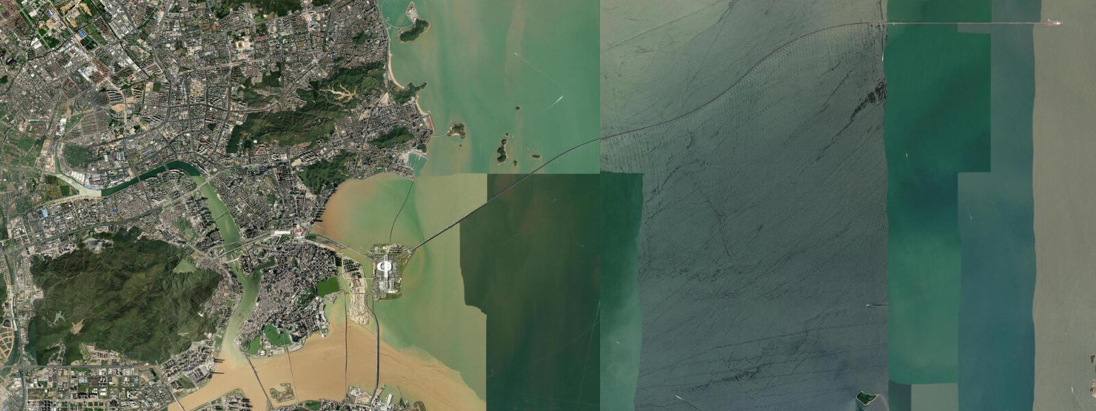
Zhuhai occupies the western bank of the Pearl River estuary, directly across the boundary from Macau and linked to Hong Kong by the 55 km Hong Kong–Zhuhai–Macau Bridge — the longest sea-crossing bridge in the world when it opened in 2018. The city is the westernmost of the original four Special Economic Zones designated in 1980. Tidal conditions are mixed semidiurnal with a mean range of approximately 1.0 to 1.2 m above chart datum — modest, reflecting the estuary geometry and the Pearl River's interference with tidal propagation.
The Pearl River estuary at Zhuhai is a complex tidal environment. Freshwater discharge from the Pearl River system (annual mean approximately 10,000 m³/s, peaking at 30,000+ m³/s in June–August flood season) modulates the tidal signal: during high discharge, the freshwater head reduces tidal amplitude in the upper estuary, and salinity at the Zhuhai waterfront drops from 25 ppt in the dry season to near-zero during summer floods. The lower tidal range relative to the open South China Sea coast reflects this interaction.
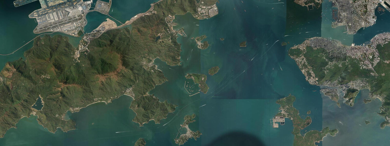
The Hong Kong–Zhuhai–Macau Bridge (HZMB) crosses the outer Pearl River estuary via a combination of viaduct, artificial islands, and a 6.7 km immersed tube tunnel that passes under the main shipping channel. The bridge carries private cars and cross-boundary coaches (not trucks or public transit); the tunnel section was the most technically demanding element, requiring precise placement of 33 tunnel sections on the estuary bed in water depths of 20 to 40 m with tidal currents of 1.5 to 2.0 knots. The construction required 500,000 tonnes of marine-grade steel. The Hong Kong and Zhuhai boundary ports are purpose-built artificial islands at the bridge's ends.
Zhuhai's coast is characterised by island geography. The city encompasses 146 islands; the most visited is Hengqin Island, now a major development zone co-administered with Macau, containing the Chimelong Ocean Kingdom theme park (the world's largest aquarium by water volume at 48.75 million litres) and the new Guangdong–Macau In-Depth Cooperation Zone. Wanzai on the Hengqin channel is a fishing and seafood village that has survived the development push, with a morning market still supplied by local fishing boats.
The Zhuhai Fishing Girl statue (珠海渔女, 1982) on Xianglu Bay is the city's emblem — a 8.7 m figure of a woman holding a pearl, standing on rocks at the water's edge. The statue has become the symbolic representation of the city internationally.
Zhuhai's coastal amenity is primarily the Lovers Road (情侣路) promenade — a 28 km seafront esplanade running the full length of the city's eastern shore from Jida in the north to Xiangzhou harbour in the south, with views across the estuary to the bridge and to Macau. The promenade is used for cycling, walking, and kite-flying; it functions as Zhuhai's main public open space. Sunset from the promenade looking east across the estuary is the standard Zhuhai photograph.
Tide predictions on this page come from Open-Meteo Marine, a global ocean model. Accuracy is typically within plus or minus 45 minutes on timing and 0.2 to 0.3 metres on height — model-derived, not from a local gauge. For authoritative official tide data for the Pearl River estuary and Guangdong coast, the State Oceanic Administration / National Hydrographic Centre (SOA/NHC) publishes official tide tables.
Tide questions about Zhuhai
Quick answers to the most common questions about tide times, range, and water access at Zhuhai.
How does the Hong Kong–Zhuhai–Macau Bridge affect tidal currents in the Pearl River estuary?
The bridge crosses the outer Pearl River estuary at a point where tidal currents in the main Lingding Yang channel run at 1.5 to 2.0 knots on the ebb. The 6.7 km immersed tube tunnel under the main navigation channel was built to avoid obstructing shipping and to minimise disruption to tidal flow — bridge piers in the main channel would have created local current acceleration and scour. The tunnel sections were placed in pre-dredged trenches on the estuary bed in 20 to 40 m of water during carefully timed low-current windows in the tidal cycle. The bridge's artificial islands at each end of the tunnel act as minor flow deflectors but do not significantly alter the estuary's overall tidal hydrology.
Why is the tidal range at Zhuhai smaller than at the open South China Sea coast?
Zhuhai sits at the mouth of the Pearl River estuary, where fresh water discharging from the Pearl River system interacts with the tidal signal propagating in from the South China Sea. Mean tidal range on the open Guangdong coast (Zhanjiang) is approximately 2.0 m; at Zhuhai it is 1.0 to 1.2 m. This reduction has two causes: the estuary geometry dissipates tidal energy as the wave propagates inland through a widening to narrowing funnel, and during summer peak discharge (June–August), the freshwater head suppresses tidal amplitude further. The salinity at the Zhuhai waterfront ranges from 25 ppt in winter to near-zero during the summer flood peak.
Can I cross the HZMB bridge as a foreign tourist?
Yes, with the correct documents. Foreign passport holders can cross the Hong Kong–Zhuhai–Macau Bridge using the shuttle bus service (cross-boundary coaches) that runs between the Hong Kong Boundary Crossing Facility (artificial island) and the Zhuhai and Macau border ports. You cannot drive a private vehicle across unless it has a specific cross-boundary permit. The process: take the shuttle bus from the HK BCF (accessible by ferry from multiple HK terminals) to the Zhuhai or Macau port, then clear immigration. The bridge itself is not scenic from the bus — most of the crossing is at low elevation over open water.
What is Chimelong Ocean Kingdom on Hengqin Island?
Chimelong Ocean Kingdom (长隆海洋王国) on Hengqin Island is one of the world's largest marine theme parks, with the world's largest aquarium by water volume (48.75 million litres in its main ocean tank). The park opened in 2014 and holds multiple Guinness records for exhibit scale. Its main tank houses whale sharks, beluga whales, and a variety of pelagic species; the whale shark display is the centrepiece. The park is accessible from Zhuhai by metro (Hengqin line) or bus, and from Macau by shuttle. It is a full-day destination.
Are the tide predictions on this page official data suitable for navigation or maritime planning?
No. The predictions shown here come from Open-Meteo Marine, a global ocean model with typical accuracy of plus or minus 45 minutes on timing and 0.2 to 0.3 metres on height. They are appropriate for general coastal orientation and planning leisure activities — not for vessel navigation in the Pearl River estuary, harbour approaches, or any safety-critical maritime use. Tidal currents in the Pearl River estuary channels can reach 2 to 3 knots on the ebb during peak discharge; navigation here requires official data from the State Oceanic Administration / National Hydrographic Centre (SOA/NHC) and local maritime authority notices.
8-day tide table — Zhuhai
Heights relative to MSL. Predictions: Open-Meteo Marine (MeteoFrance SMOC, 0.08° grid) — heights relative to MSL (not chart datum / LAT). Model-derived.
| Day | Type | Time | Height |
|---|---|---|---|
| Sun 21 Jun | Low | 08:00 | 0.3m |
| High | 14:24 | 1.3m | |
| Low | 21:26 | -0.3m | |
| Mon 22 Jun | High | 04:19 | 0.9m |
| Low | 22:00 | -0.1m | |
| Tue 23 Jun | High | 04:57 | 1.1m |
| Low | 10:54 | 0.2m | |
| High | 16:42 | 0.8m | |
| Low | 22:33 | -0.0m | |
| Wed 24 Jun | High | 18:00 | 0.7m |
| Low | 23:05 | 0.1m | |
| Thu 25 Jun | High | 06:08 | 1.4m |
| Low | 13:11 | -0.0m | |
| High | 19:23 | 0.6m | |
| Low | 23:45 | 0.2m | |
| Fri 26 Jun | High | 06:51 | 1.5m |
| Low | 14:16 | -0.1m | |
| Sat 27 Jun | High | 07:39 | 1.6m |
| Low | 15:02 | -0.2m | |
| High | 21:47 | 0.6m | |
| Sun 28 Jun | Low | 01:07 | 0.4m |
| High | 07:00 | 1.6m |