
Dapeng Peninsula, Shenzhen tide times
Dapeng Peninsula, Shenzhen tide forecast — heights relative to MSL.
Today's tide times for Dapeng Peninsula, Shenzhen
Tide times at Dapeng Peninsula, Shenzhen on Sunday, 21 June 2026: first low tide at 08:00am, first high tide at 01:36pm, second low tide at 07:51pm. Sunrise 05:38am, sunset 07:09pm.
Tide chart for Dapeng Peninsula, Shenzhen
24-hour cosine-interpolated curve around the present moment. Heights relative to MSL. Predictions: Predictions: Open-Meteo Marine (MeteoFrance SMOC, 0.08° grid).
Sun, moon and conditions on Sun 21 Jun
Snapshot at build time — refreshes daily. Sea state from Open-Meteo Marine.
Highs and lows next 7 days
Every predicted high and low for the next week, with the daily tidal coefficient (0–120; higher = bigger swing, > 95 means stronger currents).
Other spots nearby
The three closest curated TideTurtle locations to Dapeng Peninsula, Shenzhen, measured by great-circle distance.
Today's solunar windows
Solunar tradition: major periods are the ≈3h windows around moon transit and opposition; minor are ≈2h around moonrise and moonset. Pair with the local tide stage and wind for the best read.
Cycle dates near Dapeng Peninsula, Shenzhen
Last spring tide on Sun 21 Jun (range 1.2m). Next spring tide on Sat 27 Jun (range 1.5m). Next neap on Mon 22 Jun.
Spring tides cluster around new and full moons (biggest swings). Neap tides land on quarter moons (smallest swings). See the spring tide and neap tide glossary entries for the why.
About tides at Dapeng Peninsula, Shenzhen
A short guide to the coastline at Dapeng Peninsula, Shenzhen — geography, sea state, and what the tide is actually doing under your feet.
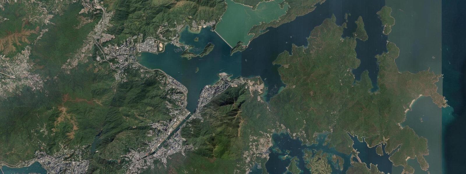
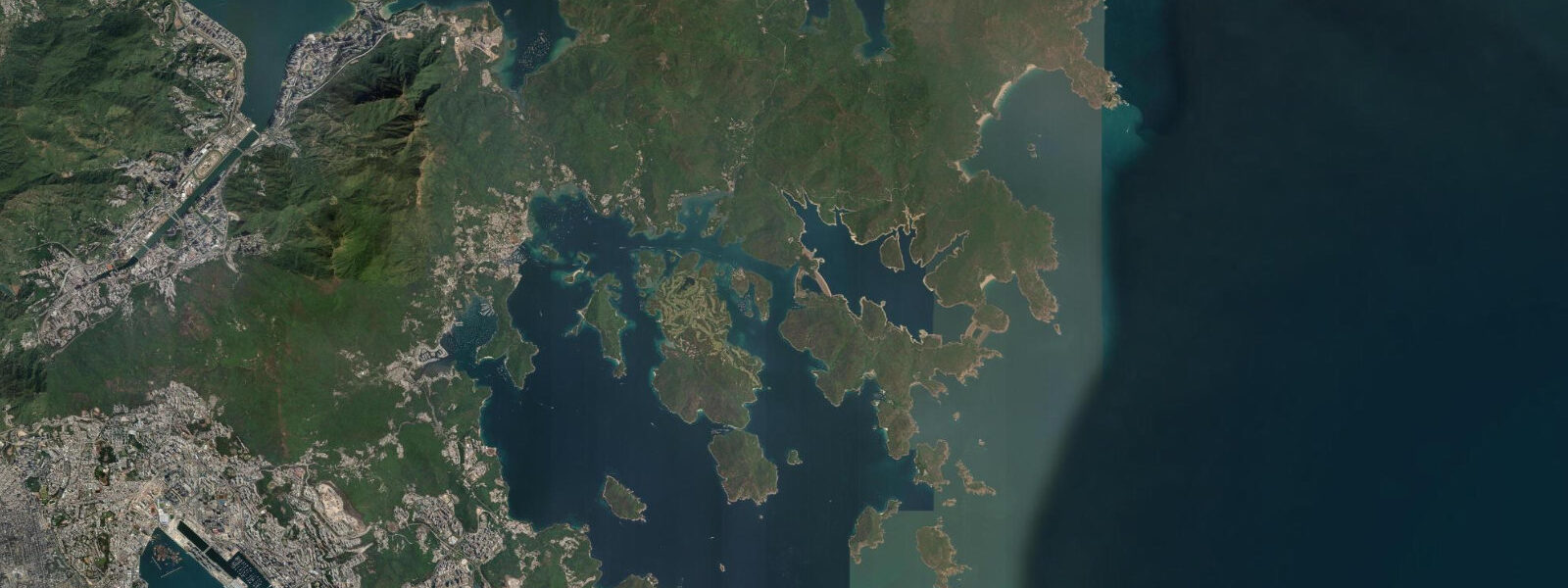
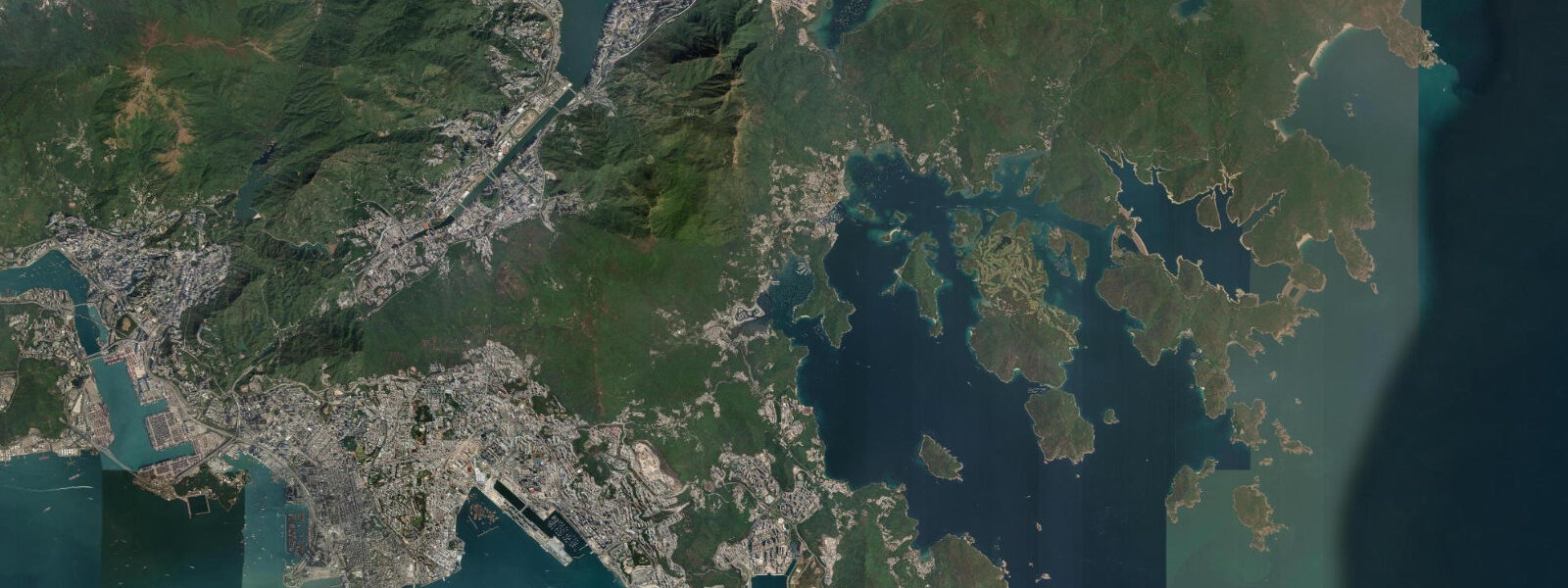
The Dapeng Peninsula projects southeast from Shenzhen's eastern edge into Daya Bay, forming the only significant stretch of undeveloped coastline within an hour of one of the world's most densely built cities. Shenzhen's 17 million residents live primarily on the western side of the municipality; Dapeng, designated as the Dapeng New District in 2011, has retained its natural coast through protected status. Tidal regime is mixed semidiurnal: two unequal high waters and two unequal low waters per day. Mean tidal range at Daya Bay is approximately 1.2 to 1.5 m above chart datum.
Dongchong and Xichong beaches at the peninsula's southern tip are the destination. Neither has road access. Dongchong is reached by a 5 km hiking trail over the ridge from Nan'ao township, descending through subtropical forest to a 1.5 km crescent of white-grey sand; Xichong, 2 km further east, is accessible by boat from Nan'ao or by a separate 8 km trail. Both beaches face south into the South China Sea and are sheltered from the northeast by the peninsula ridge. The water clarity here is notably better than the Pearl River Delta coastline — Daya Bay, away from the Pearl River plume, has visibility of 5 to 10 m in winter and spring.
At low water, the rocky headlands flanking both beaches expose wide tidal reef platforms. The reef is mixed substrate — granite boulders, coralline rubite, and a sparse hard coral community in the shallow subtidal (0.5 to 2 m depth). Rock pools at low water contain mantis shrimp, small blennies, sea urchins, and banded coral shrimp. The best reef walking is at the lower of the two daily low waters, when the larger tidal inequality exposes the fullest extent of the platform — this lower low water occurs once per day and is typically 0.3 to 0.5 m lower than the higher low water.
Nan'ao township at the base of the peninsula has guesthouses, seafood restaurants, and the boat pier for water access to Dongchong and Xichong. The boat from Nan'ao to Dongchong takes 20 minutes and runs on demand when enough passengers (typically 6 to 10) are waiting; price is around 30 to 50 RMB per person. Arriving by the hiking trail and returning by boat (or vice versa) avoids retracing the same route.
The Dapeng Ancient Fortress (Dapeng Suocheng), a Ming-dynasty garrison fort built in 1394 in the township of Dapeng, is a 35-minute drive from Dongchong. The fort walls and several of the internal buildings survive largely intact — one of the best-preserved coastal military fortresses in Guangdong. General Liu Jin-Biao and General Lai En-Jue, both from Dapeng, played significant roles in the First and Second Opium Wars; the garrison's local connections to 19th-century resistance are documented in the fort museum.
Tide predictions on this page come from Open-Meteo Marine, a global ocean model. Accuracy is typically within plus or minus 45 minutes on timing and 0.2 to 0.3 metres on height — model-derived, not from a local gauge. For authoritative official tide data for Guangdong coastal waters, the State Oceanic Administration / National Hydrographic Centre (SOA/NHC) publishes official tide tables.
Tide questions about Dapeng Peninsula, Shenzhen
Quick answers to the most common questions about tide times, range, and water access at Dapeng Peninsula, Shenzhen.
How do I get to Dongchong or Xichong beach from Shenzhen?
From central Shenzhen (Futian or Luohu), take Metro Line 8 east to Tanxin station (60 to 70 min), then a bus or taxi to Nan'ao township (30 min). From Nan'ao: boats to Dongchong run on demand from the pier (20 min, 30–50 RMB per person, departs when 6 to 10 passengers gather) and to Xichong (30 min). Alternatively, hike from Nan'ao to Dongchong via the ridge trail (5 km, 90 min one-way, well-marked). Plan 4 to 5 hours total from central Shenzhen to beach. A private car or taxi from Shenzhen to Nan'ao takes 60 to 90 min and costs 150 to 250 RMB.
What is the best tide for reef walking at Dapeng?
Reef walking is best at the lower of the two daily low waters — the South China Sea's mixed semidiurnal tide produces two unequal lows per day, with the lower one typically 0.3 to 0.5 m below the higher. At the lower low water, the tidal reef platform at Dongchong and Xichong is fully exposed, and rock pools in the subtidal zone are accessible. The higher low water covers more of the reef and leaves less platform exposed. Check the day's tide prediction for the time of the lower low water; the platform is walkable for approximately 1 to 1.5 hours either side of that mark.
Why is the water clearer at Dapeng than at other Shenzhen beaches?
Dapeng Peninsula sits in Daya Bay, east of the Pearl River Delta plume. The Pearl River carries one of the largest sediment loads in Asia — the turbid plume extends west and south from the estuary, but Daya Bay is protected from it by the Dapeng and Shuangyue Bay headlands. The result is significantly better visibility than the central and western Shenzhen coast: 5 to 10 m in winter and spring (February–May), dropping to 3 to 5 m in summer when coastal upwelling stirs sediment. This relative clarity supports the sparse hard coral community in the subtidal zone at Dongchong and Xichong.
What is the Dapeng Ancient Fortress?
Dapeng Suocheng (大鹏所城) is a Ming-dynasty coastal garrison fort built in 1394 in Dapeng township, 35 km northeast of central Shenzhen. The fort was established to defend the coast against Japanese pirate raids (wokou) and later became a major base during the Opium Wars. The walls (1.5 km perimeter), four gate towers, and several original buildings survive in good condition — one of the most intact Ming coastal fortresses in Guangdong. The fort museum covers its 600-year history including the roles of locally born generals Liu Jin-Biao and Lai En-Jue. Entry is free; the fort is within walking distance of Nan'ao bus terminus.
Are the tide predictions on this page official data suitable for navigation?
No. The predictions here come from Open-Meteo Marine, a global ocean model with typical accuracy of plus or minus 45 minutes on timing and 0.2 to 0.3 metres on height. They are appropriate for planning reef walks, beach visits, and boat trips — not for vessel navigation, harbour approaches, or any safety-critical maritime decision. For official tide tables covering Daya Bay and the Guangdong coast, use data published by the State Oceanic Administration / National Hydrographic Centre (SOA/NHC) of China.
8-day tide table — Dapeng Peninsula, Shenzhen
Heights relative to MSL. Predictions: Open-Meteo Marine (MeteoFrance SMOC, 0.08° grid) — heights relative to MSL (not chart datum / LAT). Model-derived.
| Day | Type | Time | Height |
|---|---|---|---|
| Sun 21 Jun | Low | 08:00 | 0.5m |
| High | 13:36 | 1.0m | |
| Low | 19:51 | -0.2m | |
| Mon 22 Jun | High | 02:56 | 0.7m |
| Low | 08:00 | 0.3m | |
| High | 11:01 | 0.8m | |
| Low | 20:34 | -0.1m | |
| Tue 23 Jun | High | 11:45 | 0.6m |
| High | 15:25 | 0.6m | |
| Low | 21:15 | 0.0m | |
| Wed 24 Jun | High | 04:11 | 0.9m |
| Low | 10:08 | 0.1m | |
| High | 12:36 | 0.4m | |
| Low | 14:10 | 0.3m | |
| High | 16:37 | 0.5m | |
| High | 19:10 | 0.4m | |
| Low | 22:02 | 0.1m | |
| Thu 25 Jun | High | 04:54 | 1.1m |
| Low | 11:07 | 0.0m | |
| High | 13:18 | 0.3m | |
| Low | 14:58 | 0.2m | |
| High | 18:00 | 0.4m | |
| High | 20:34 | 0.5m | |
| Low | 22:49 | 0.2m | |
| Fri 26 Jun | High | 05:38 | 1.1m |
| Low | 12:04 | -0.1m | |
| High | 14:15 | 0.2m | |
| Low | 15:47 | 0.1m | |
| Sat 27 Jun | High | 06:15 | 1.3m |
| Low | 12:54 | -0.1m | |
| High | 15:11 | 0.1m | |
| Low | 16:33 | 0.1m | |
| High | 22:10 | 0.5m | |
| Sun 28 Jun | Low | 00:18 | 0.4m |
| High | 07:00 | 1.4m |