Natal tide times
Natal tide forecast — heights relative to MSL.
Today's tide times for Natal
Tide times at Natal on Sunday, 21 June 2026: first low tide at 02:26, first high tide at 08:44, second low tide at 15:07. Sunrise 05:29, sunset 17:16.
Tide chart for Natal
24-hour cosine-interpolated curve around the present moment. Heights relative to MSL. Predictions: Predictions: Open-Meteo Marine (MeteoFrance SMOC, 0.08° grid).
Sun, moon and conditions on Sun 21 Jun
Snapshot at build time — refreshes daily. Sea state from Open-Meteo Marine.
Highs and lows next 7 days
Every predicted high and low for the next week, with the daily tidal coefficient (0–120; higher = bigger swing, > 95 means stronger currents).
Other spots nearby
The three closest curated TideTurtle locations to Natal, measured by great-circle distance.
Today's solunar windows
Solunar tradition: major periods are the ≈3h windows around moon transit and opposition; minor are ≈2h around moonrise and moonset. Pair with the local tide stage and wind for the best read.
Cycle dates near Natal
Last spring tide on Sat 20 Jun (range 1.4m). Next spring tide on Fri 26 Jun (range 1.5m). Next neap on Mon 22 Jun.
Spring tides cluster around new and full moons (biggest swings). Neap tides land on quarter moons (smallest swings). See the spring tide and neap tide glossary entries for the why.
About tides at Natal
A short guide to the coastline at Natal — geography, sea state, and what the tide is actually doing under your feet.
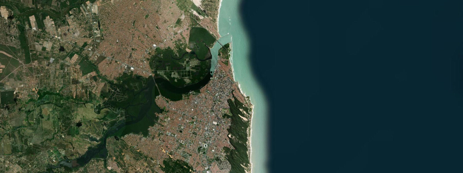
Natal sits at the northeastern corner of Brazil, where the coastline pivots from a northward to an eastward bearing. At this latitude the city is approximately 7,400 km from Dakar — the closest South American city to the African coast. Tides here are semidiurnal, running two high and two low waters in each 24-hour cycle. DHN/FEMAR data records a mean tidal range of approximately 2.6 m above LAT (Lowest Astronomical Tide) for the Natal gauge.
This is a mesotidal coast. The 2–4 m range category means tidal state is visible in how much beach is exposed: at a typical low tide, the foreshore widens considerably, exposing sandbanks and shallow reef structures that disappear well before high water. Spring tides, occurring around new and full moon, push that range toward its upper limit.
Natal's beaches, including Praia do Forte (backed by the 17th-century Forte dos Reis Magos) and Praia de Ponta Negra to the south, change character through the tidal cycle. The Morro do Careca, a tall dune that drops directly to the sea at Ponta Negra, is most photogenic at low water when a wider section of sand separates the dune base from the shoreline.
The Forte dos Reis Magos, built on a reef platform exposed at low tide, was positioned deliberately by Portuguese settlers to take advantage of tidal exposure — the reef provides a natural defensive perimeter for part of the tidal cycle. At low water you can walk the reef approach; at high water the moat effect is restored.
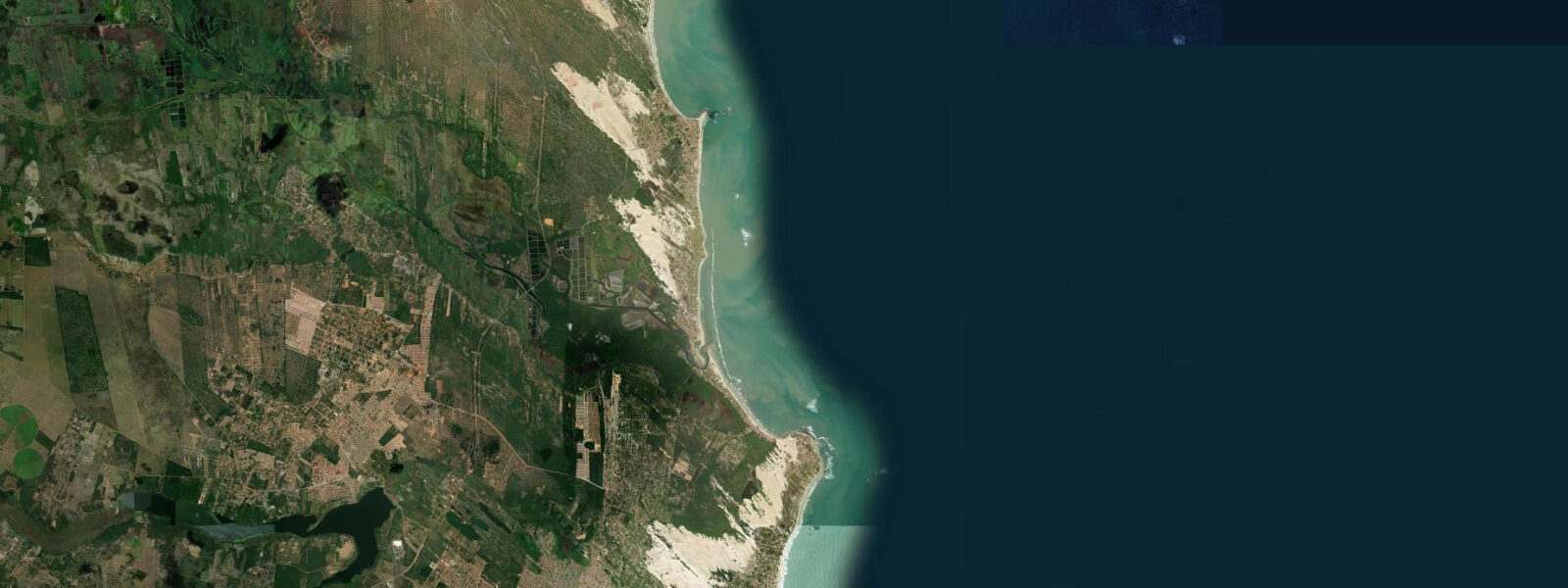
For offshore activities — boat tours to the Maracajaú reef system, 60 km north — operators check tide and current state. The reef is a federally protected área de proteção ambiental; snorkelling access is timed to low tide when the coral heads are shallowest and clearest.
Tidal data for Natal is published by DHN (Diretoria de Hidrografia e Navegação) and accessible through FEMAR. Open-Meteo Marine predictions shown here carry a typical accuracy of ±45 minutes on timing and ±0.2–0.3 m on height; for navigation and commercial operators, use official DHN tables.
Tide questions about Natal
Quick answers to the most common questions about tide times, range, and water access at Natal.
What is the tidal range in Natal, Brazil?
Natal has a semidiurnal, mesotidal regime. DHN/FEMAR records a mean tidal range of approximately 2.6 m above LAT (Lowest Astronomical Tide). Spring tides — occurring around new and full moon — push the range toward the higher end of that figure. The difference is visible on the beach: at low water the foreshore can widen by 30–50 m compared to high tide conditions.
When is the best time to visit Forte dos Reis Magos?
The fort sits on a reef platform that is partially exposed at low tide, which opens up the reef walk and gives you a cleaner view of the structure from the landward side. Visit within 2 hours either side of low water. Check that day's tide table — low water times shift roughly 50 minutes later each day. The fort is also best photographed in the early morning before haze builds.
Do tides affect buggy tours near Natal?
Yes. Beach buggies north of Natal travel along the strand between the dune line and the surf. At high water the available sand narrows significantly, and some river and creek crossings become deeper. Most operators time the departure to catch low water in the northern section around Genipabu. If you book a full-day tour, confirm with the operator which tidal window they're targeting — it affects both the route and the river crossing logistics.
Are there sea turtles near Natal?
Loggerhead and hawksbill sea turtles nest along several beaches in Rio Grande do Norte state. The most active protection work is centred further south at Praia das Tartarugas near Pipa, about 85 km from Natal. The TAMAR Project (Projeto TAMAR) monitors nesting in the region; turtle emergence is primarily nocturnal and seasonal (roughly October through March for nesting). Visits to nesting beaches are regulated — contact TAMAR for current protocols.
How accurate are the tide predictions on this site for Natal?
Tide times and heights shown here are modelled from Open-Meteo Marine, which provides global tidal coverage. Typical accuracy is ±45 minutes on timing and ±0.2–0.3 m on height relative to observed water levels. For navigation, commercial fishing, or any safety-critical use, consult official DHN (Diretoria de Hidrografia e Navegação) tide tables, available at mar.mil.br. Tideturtle.com provides informational guidance only and is not a substitute for official nautical publications.
7-day tide table — Natal
Heights relative to MSL. Predictions: Open-Meteo Marine (MeteoFrance SMOC, 0.08° grid) — heights relative to MSL (not chart datum / LAT). Model-derived.
| Day | Type | Time | Height |
|---|---|---|---|
| Sun 21 Jun | Low | 02:26 | -0.5m |
| High | 08:44 | 0.9m | |
| Low | 15:07 | -0.5m | |
| Mon 22 Jun | High | 09:48 | 0.8m |
| Low | 16:08 | -0.4m | |
| High | 22:25 | 0.7m | |
| Tue 23 Jun | Low | 04:34 | -0.3m |
| High | 10:54 | 0.8m | |
| Low | 17:06 | -0.3m | |
| High | 23:22 | 0.8m | |
| Wed 24 Jun | Low | 05:40 | -0.3m |
| High | 11:53 | 0.8m | |
| Low | 18:04 | -0.3m | |
| Thu 25 Jun | High | 00:17 | 0.8m |
| Low | 06:38 | -0.4m | |
| High | 12:50 | 0.7m | |
| Low | 18:54 | -0.4m | |
| Fri 26 Jun | High | 01:07 | 0.8m |
| Low | 07:26 | -0.5m | |
| High | 13:41 | 0.8m | |
| Low | 19:40 | -0.5m | |
| Sat 27 Jun | High | 01:53 | 0.9m |
| Low | 08:08 | -0.6m | |
| High | 14:22 | 0.8m | |
| Low | 20:00 | -0.5m |