Bizerte tide times
Bizerte tide forecast — heights relative to MSL.
Today's tide times for Bizerte
Tide times at Bizerte on Sunday, 21 June 2026: first high tide at 01:00am, first low tide at 08:50am. Sunrise 05:00am, sunset 07:44pm.
Tide chart for Bizerte
24-hour cosine-interpolated curve around the present moment. Heights relative to MSL. Predictions: Predictions: Open-Meteo Marine (MeteoFrance SMOC, 0.08° grid).
Sun, moon and conditions on Sun 21 Jun
Snapshot at build time — refreshes daily. Sea state from Open-Meteo Marine.
Highs and lows next 7 days
Every predicted high and low for the next week, with the daily tidal coefficient (0–120; higher = bigger swing, > 95 means stronger currents).
Other spots nearby
The three closest curated TideTurtle locations to Bizerte, measured by great-circle distance.
Today's solunar windows
Solunar tradition: major periods are the ≈3h windows around moon transit and opposition; minor are ≈2h around moonrise and moonset. Pair with the local tide stage and wind for the best read.
About tides at Bizerte
A short guide to the coastline at Bizerte — geography, sea state, and what the tide is actually doing under your feet.
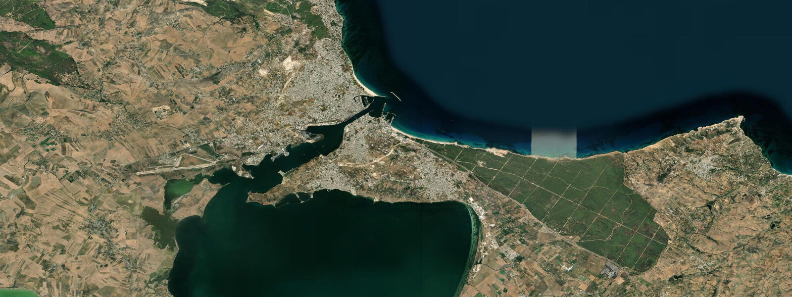
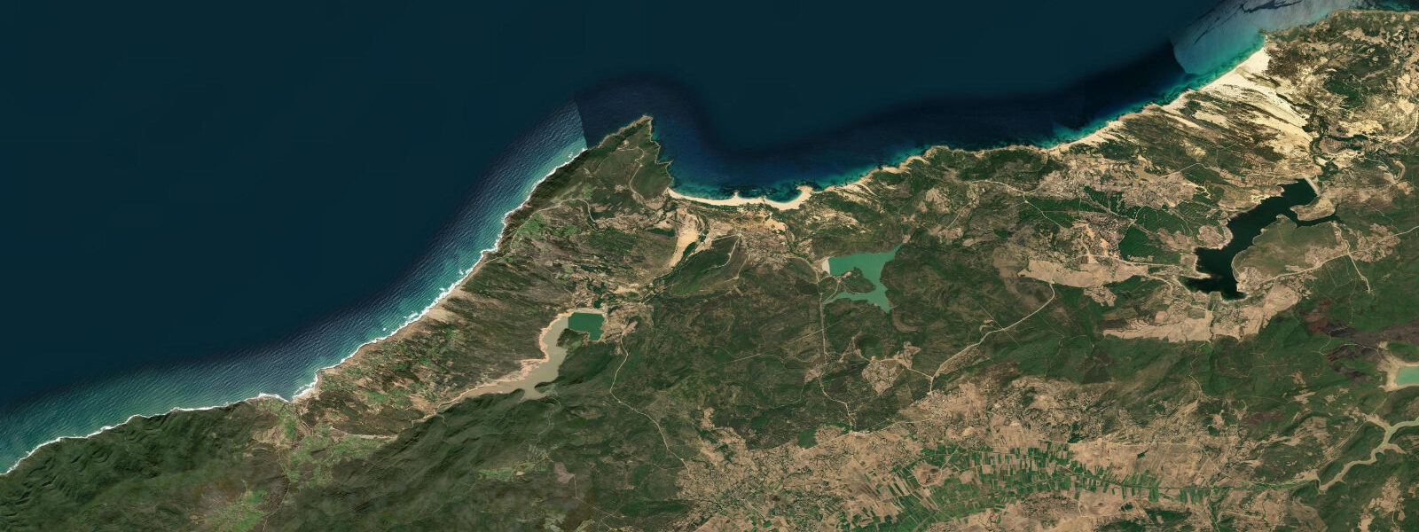
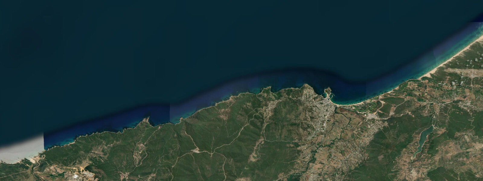
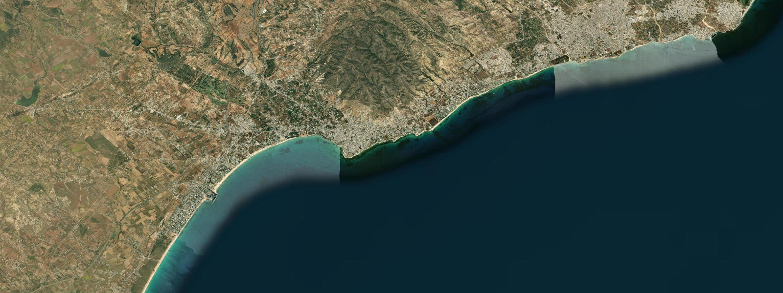
Bizerte stands at the northernmost point of Africa, on a coast where the Mediterranean narrows and begins to turn. The city occupies the western shore of the Bizerte Channel, a 0.6 km wide passage connecting the open Mediterranean to Lac de Bizerte — a 150 km² brackish lagoon that reaches back into the flat coastal plain behind the city. Lac Ichkeul, a freshwater lake protected as a UNESCO World Heritage Site, feeds into the lagoon from the west via the Oued Tinja; the full hydrological sequence runs from open sea through the channel into the lagoon and then into the lake, a linked system that has structured human settlement here for millennia. The Vieux Port (old port) sits at the southern end of this channel passage, with the kasbah and its Ottoman-era towers rising immediately above it. The Fort Sidi el-Hani occupies the north bank of the channel opposite the old town. The arrangement — port town on the channel, fort on the opposing bank, lagoon behind — has been the operative geography of Bizerte since the Phoenicians first established a settlement here, and the Spanish and Ottoman periods later contested it. Tide at Bizerte is Mediterranean microtidal. The spring range is roughly 0.35 m, with two unequal highs and two unequal lows per day in a semidiurnal pattern. What actually moves water through the Bizerte Channel is not the astronomical tide but the sea-level differential between the open Mediterranean and the lagoon — a gradient driven by wind, atmospheric pressure, and seasonal variation. The Tramontane and Gregale winds of autumn and winter can hold the lagoon 30 to 50 cm above its mean level for days, which reverses or amplifies the channel current depending on direction. The net tidal exchange between the sea and the lagoon is weak but regular and has supported shellfish farming in the lagoon margins — oyster and mussel culture has operated in the Lac de Bizerte since the 1970s. Mullet, sea bream, and sea bass are the principal commercial species. Shore fishing along the Corniche, the beach road east of the town centre, works on the incoming tide when fish follow bait into the shallower water along the sandy beach margin. The Corniche beaches face the open Mediterranean northeast; the sandy beach extends 8 km toward Cap Blanc (the actual northernmost cape, 12 km northeast of the town). Swimming and beach use peak June through September; water temperature runs 22–26°C in summer, dropping to 14–16°C in winter. The swell at Corniche is generally small in summer — the Mediterranean summer is a low-wind season — and increases in autumn with the first Tramontane episodes. For kayakers crossing the channel entrance, the current at the narrow passage can run at 1 to 2 knots when the sea-lagoon pressure differential is active; the strongest flows occur during the hours immediately following a shift in wind direction. The city's beach clubs and seasonal restaurants are concentrated along the Corniche road; the fish market near the Vieux Port is the best place to read what the local fleet is catching. Tide predictions at Bizerte come from Open-Meteo Marine, a gridded global ocean model. Accuracy is typically ±45 min on timing and ±0.2–0.3 m on height. On this coast, where the spring range itself is only 0.35 m, the meteorological forecast from INM (Institut National de la Météorologie, Tunisia) matters considerably more than the tidal prediction for any water-level sensitive activity.
The broader city of Bizerte has a population of roughly 135,000 and functions as both a commercial port and a summer resort destination for Tunisians from Tunis and the interior. The port handles container traffic, ferry services to Italy, and the coastal fishing fleet. The old medina, kasbah, and the Spanish fort on the hill above the Vieux Port are accessible on foot from the waterfront; the kasbah walls and the sea-gate are the most photographed structures. The Corniche road east of the centre passes beach clubs, restaurants, and the public beach before reaching the Cap Blanc lighthouse 12 km from the town. The drive or cycle along the Corniche on a calm evening, with the open Mediterranean on one side and the lagoon plain behind, is the most straightforward way to understand Bizerte's geography.
Tide questions about Bizerte
Quick answers to the most common questions about tide times, range, and water access at Bizerte.
What is the tidal range at Bizerte?
Bizerte has a Mediterranean microtidal regime. Spring tidal range is approximately 0.35 m, with two highs and two lows per day in a semidiurnal pattern. The highs and lows are unequal — the diurnal inequality varies through the lunar cycle. On most days, wind-driven sea-level changes from the Tramontane or Gregale will produce water-level swings of comparable magnitude to the astronomical tide. For planning around specific water levels at the Bizerte Channel or the Corniche beach, the INM (Institut National de la Météorologie, Tunisia) meteorological forecast is at least as important as the tide prediction. Tide predictions here come from Open-Meteo Marine, a gridded global ocean model; accuracy is typically ±45 min on timing and ±0.2–0.3 m on height.
What is the Bizerte Channel current, and does tide drive it?
The Bizerte Channel is 0.6 km wide and connects the open Mediterranean to Lac de Bizerte. The current through the channel is driven primarily by the sea-level differential between the lagoon and the sea, which is set by wind forcing and atmospheric pressure rather than the astronomical tide. When the Tramontane or Gregale drives elevated sea level against the coast, water pushes into the lagoon through the channel; as conditions relax, the flow reverses. The current can reach 1 to 2 knots at the narrowest section during active pressure gradients. Kayakers and small-boat operators crossing the channel entrance should time passage for slack conditions, which roughly correspond to neutral or shifting wind rather than a specific tide state.
Is the Lac de Bizerte connected to Lac Ichkeul?
Yes. Lac de Bizerte is a large brackish lagoon (approximately 150 km²) connected to the Mediterranean by the Bizerte Channel. The Oued Tinja river and a canal link Lac Ichkeul — a freshwater lake — to the eastern end of the Lac de Bizerte. The three-part system (Mediterranean, brackish lagoon, freshwater lake) forms the hydrological foundation for the UNESCO World Heritage wetlands at Ichkeul. The salinity gradient across the system supports different fish and shellfish communities at each stage; mullet, bream, and sea bass move through the lagoon seasonally, following the salinity gradient. Ichkeul is one of the most important wintering grounds for migratory waterbirds in the western Mediterranean, with peak bird populations from October through February.
When is the best season for swimming at the Bizerte Corniche?
The Corniche beaches east of Bizerte are most comfortable for swimming from late May through September. Sea temperature peaks at 24–26°C in July and August. The Mediterranean summer is a low-wind, low-swell season; the water along the Corniche is typically calm and clear. September remains warm (22–24°C) and less crowded than August. From October onward, Tramontane and Gregale episodes bring northerly and northeasterly winds that build swell directly into the northeast-facing beach; by December through March, water temperatures drop to 14–16°C. The small tidal range means the beach width is relatively stable across the tidal cycle — the slope is shallow enough that the water line moves only a few metres between predicted high and low.
What fishing is available at Bizerte?
Shore fishing along the Corniche and from the breakwaters around the Vieux Port targets mullet, sea bream (dorade), and sea bass (loup), with occasional catches of sar (white sea bream) and oblada. The fish market near the Vieux Port stocks the local commercial catch from trawlers and lagoon seine nets and is a reliable indicator of what is running. The incoming tide — what there is of it at 0.35 m spring range — is the traditional shore-casting window, when fish follow bait fish into shallower margins. Lac de Bizerte and the channel margins support a commercial fishery for mullet, bream, and cephalopods (squid, octopus). The solunar angler tradition, which rates fishing activity by moon transit periods, is followed locally; those period times are shown in the tide table header on this page, framed as the angler tradition that says fish bite more during major periods — not as a scientific prediction.
8-day tide table — Bizerte
Heights relative to MSL. Predictions: Open-Meteo Marine (MeteoFrance SMOC, 0.08° grid) — heights relative to MSL (not chart datum / LAT). Model-derived.
| Day | Type | Time | Height |
|---|---|---|---|
| Sun 21 Jun | High | 01:00 | -0.4m |
| Low | 08:50 | -0.6m | |
| Mon 22 Jun | — | ||
| Tue 23 Jun | — | ||
| Wed 24 Jun | High | 04:00 | -0.3m |
| Low | 11:00 | -0.5m | |
| Thu 25 Jun | — | ||
| Fri 26 Jun | High | 19:10 | -0.3m |
| Sat 27 Jun | Low | 13:00 | -0.5m |
| High | 20:00 | -0.3m | |
| Sun 28 Jun | Low | 00:00 | -0.4m |