Sainte-Marie tide times
Sainte-Marie tide forecast — heights relative to MSL.
Today's tide times for Sainte-Marie
Tide times at Sainte-Marie on Saturday, 4 July 2026: first high tide at 04:00am, first low tide at 09:10am. Sunrise 06:55am, sunset 05:48pm.
Tide chart for Sainte-Marie
24-hour cosine-interpolated curve around the present moment. Heights relative to MSL. Predictions: Predictions: Open-Meteo Marine (MeteoFrance SMOC, 0.08° grid).
Sun, moon and conditions on Sat 04 Jul
Snapshot at build time — refreshes daily. Sea state from Open-Meteo Marine.
Highs and lows next 7 days
Every predicted high and low for the next week, with the daily tidal coefficient (0–120; higher = bigger swing, > 95 means stronger currents).
Other spots nearby
The three closest curated TideTurtle locations to Sainte-Marie, measured by great-circle distance.
Today's solunar windows
Solunar tradition: major periods are the ≈3h windows around moon transit and opposition; minor are ≈2h around moonrise and moonset. Pair with the local tide stage and wind for the best read.
Cycle dates near Sainte-Marie
Last spring tide on Sat 04 Jul (range 0.5m). Next spring tide on Fri 10 Jul (range 0.4m). Next neap on Wed 08 Jul.
Spring tides cluster around new and full moons (biggest swings). Neap tides land on quarter moons (smallest swings). See the spring tide and neap tide glossary entries for the why.
About tides at Sainte-Marie
A short guide to the coastline at Sainte-Marie — geography, sea state, and what the tide is actually doing under your feet.
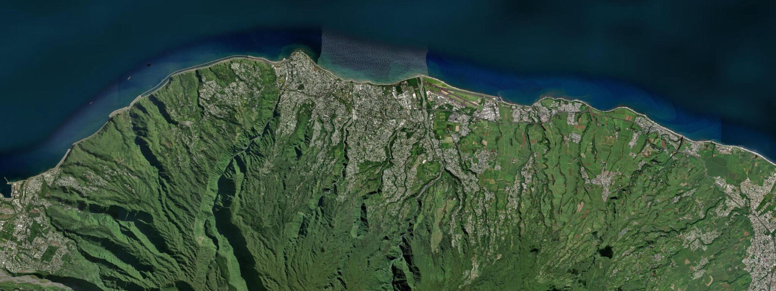
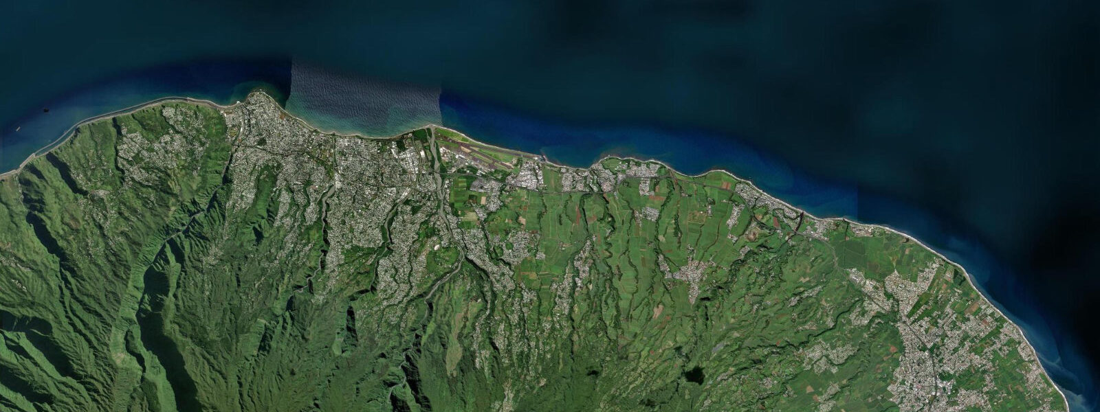
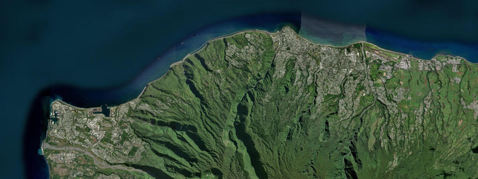
Sainte-Marie sits on Réunion's north coast, immediately east of the island capital Saint-Denis. It is the first town east of the airport — Roland Garros Airport occupies the coastal flat right at the Sainte-Marie boundary, which gives flight approaches and departures a spectacular low-level passage over the Indian Ocean before touchdown. The town itself is a mix of residential suburbs and coastal strip, with a quiet beach area that serves the local population of the northern coast between the capital and the windward east.
The north coast here sits in the partial lee of the island's northern highlands but is exposed to the southeast trade wind (the alizé) that prevails for much of the year. This exposure is what makes Sainte-Marie one of the better kitesurfing access points on Réunion's north coast — the consistent southeast alizé blows at 15-25 knots on most afternoons through the austral winter (May-October), which is exactly the window that kitesurfers and windsurfers seek. The beach at Sainte-Marie is used by the local kitesurfing community as a launch point, though the reef and shallow sections near shore require local knowledge to navigate safely on a downwind run.
Tides at Sainte-Marie follow the SW Indian Ocean semi-diurnal pattern with spring ranges of approximately 0.5-0.9 m — Réunion's north coast sees the smallest tidal ranges on the island due to its position relative to the tidal wave propagation across the SW Indian Ocean. The practical consequence is that the reef structure is more consistently submerged than on the south coast, and the limited tidal variation means the beach character doesn't change dramatically through the tidal cycle the way it does on high-range Gulf sites. What you see at high tide is broadly what you see at low tide — a modest change in waterline rather than the dramatic flat-to-full beach transformation of the Arabian Gulf.
The water colour off Sainte-Marie on a trade wind day is the vivid blue of Indian Ocean water in 5-15 m depth. The shallow lagoon colour gives way quickly to deeper water, unlike the murky shallows of the Gulf sites. Sea temperatures are 24-28°C year-round, varying less than 4°C across the annual cycle — the classic tropical island consistency that makes it swimmable every month of the year if conditions allow.
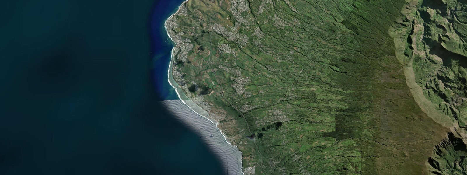
For those arriving at Réunion via the airport, Sainte-Marie is effectively the first coastal experience of the island. The waterfront drive east from the airport gives an immediate impression of the north coast character — rocky shoreline, sea grape vegetation, the distant cone of Piton des Neiges rising inland to 3,000 m, and the trade wind rippling the ocean surface to the northeast. The scale of Réunion's volcanic topography — from sea level to the Indian Ocean's highest peak in under 30 km — is apparent from the coastal road in a way that maps don't convey. This north coast strip is the most accessible introduction to that geography.
The north coast between Sainte-Marie and Sainte-Suzanne is one of the island's more accessible sections for a half-day drive combining coastal and agricultural landscapes. The sugarcane fields that come down to the coastal road, the occasional roadside market selling vanilla and tropical fruits, and the dramatic mountain backdrop of the northern cirques visible on clear days combine to give a sense of the island's economy and ecology simultaneously. This stretch of coast is ordinary Réunion — not the volcanic drama of the south or the resort infrastructure of the west — and that ordinariness is its value for visitors who want to understand the island rather than just photograph its extremes. One additional note for timing: the Saturday morning market at Sainte-Marie is a good introduction to the north coast's agricultural-coastal economy — vanilla, tropical fruit, fresh fish from the overnight boats, and the kind of relaxed transaction that belongs to a place that earns its living from the land and sea rather than from passing tourists.
Tide questions about Sainte-Marie
Quick answers to the most common questions about tide times, range, and water access at Sainte-Marie.
What are tides like at Sainte-Marie?
Sainte-Marie is on Réunion's north coast where the tidal range is among the smallest on the island — spring ranges of 0.5-0.9 m. The semi-diurnal pattern (two highs and two lows per day) is consistent with the wider SW Indian Ocean. The small tidal range means beach and reef conditions don't change dramatically through the tidal cycle, unlike high-range sites in the Gulf. For kitesurfers and windsurfers the tide matters mainly in terms of reef exposure — at spring low tide some sections near the northern launch area become very shallow. Open-Meteo gridded predictions (±45 min, ±0.3 m). The trade wind forecast is generally more operationally important than the tide for planning water activities here.
Is Sainte-Marie good for kitesurfing?
Sainte-Marie is one of Réunion's reliable kitesurfing access points on the north coast, benefiting from the consistent southeast alizé that blows at 15-25 knots on most afternoons from May through October. The beach provides a usable launch window, though the reef and shallow water near shore require local knowledge — a first session with a local instructor or guide is strongly recommended for anyone unfamiliar with the specific site geometry. The kitesurfing community in Réunion is centred more on the west coast sites (Saint-Gilles-les-Bains, Saint-Leu) which have better-developed facilities, but Sainte-Marie's proximity to Saint-Denis makes it practical for the north coast. Check current spot conditions with local kitesurfing clubs before committing to a session.
Is swimming safe at Sainte-Marie beach?
Réunion's north coast has a more complex safety situation than the lagoon-protected west coast beaches. Sainte-Marie beach does not have the full lagoon enclosure of the west coast sites, and shark activity in Réunion's waters — particularly around the north and east coasts — has been a genuine concern since a series of incidents from 2011 onwards. Réunion's prefecture and surf authorities post current beach status; bathing regulations vary and some beaches have restricted or prohibited swimming periods. Always check current local status before entering the water. For the full lagoon swimming experience with safety infrastructure, the west coast from Boucan Canot to Saint-Leu remains the reference standard on Réunion.
What is the best time of year to visit Sainte-Marie?
May through October is the dry season and trade wind season — the most reliable and comfortable period overall. Air temperatures of 22-28°C at sea level, the southeast alizé blowing consistently for kitesurfing and windsurfing, and negligible cyclone risk make this the sweet spot for active coastal visits. June-August sees the strongest trade winds, best for kite and windsurf but potentially breezy for casual beach visits. November to April is the austral summer: hotter (28-34°C), more humid, and within the cyclone season. Direct cyclone hits on Réunion are rare but the island takes indirect swells and heavy rain from passing systems that can make outdoor coastal activities difficult for days at a time.
What other activities are available near Sainte-Marie?
Sainte-Marie itself is low-key; the town is primarily residential and the beach strip is local in character. The Saint-Denis waterfront promenade is 10 minutes west and has a broader range of cafés, restaurants, and the harbour area with more visitor infrastructure. East of Sainte-Marie, the coastal road toward Sainte-Suzanne follows the shoreline past rocky cliffs and small beaches to the Cascade Niagara waterfall near Sainte-Suzanne — a short detour worth making for the contrast of fresh water over tropical vegetation against the ocean backdrop. Inland from Sainte-Marie, the mountain road toward Plaine des Palmistes climbs into Réunion's eastern highlands and the UNESCO Pitons, Cirques and Remparts World Heritage landscape, transitioning from coast to cloud forest to volcanic plateau within a single drive.
8-day tide table — Sainte-Marie
Heights relative to MSL. Predictions: Open-Meteo Marine (MeteoFrance SMOC, 0.08° grid) — heights relative to MSL (not chart datum / LAT). Model-derived.
| Day | Type | Time | Height |
|---|---|---|---|
| Sat 04 Jul | High | 04:00 | 0.8m |
| Low | 09:10 | 0.3m | |
| Sun 05 Jul | High | 03:18 | 0.8m |
| Low | 09:42 | 0.4m | |
| High | 16:10 | 0.8m | |
| Low | 22:06 | 0.5m | |
| Mon 06 Jul | High | 16:45 | 0.8m |
| Low | 23:10 | 0.5m | |
| Tue 07 Jul | High | 04:45 | 0.8m |
| Low | 11:10 | 0.5m | |
| Wed 08 Jul | High | 06:00 | 0.8m |
| Low | 12:10 | 0.5m | |
| Thu 09 Jul | High | 20:10 | 0.8m |
| Fri 10 Jul | Low | 03:00 | 0.5m |
| High | 21:15 | 0.9m | |
| Sat 11 Jul | Low | 03:00 | 0.5m |