Saint-Denis tide times
Saint-Denis tide forecast — heights relative to MSL.
Today's tide times for Saint-Denis
Tide times at Saint-Denis on Saturday, 4 July 2026: first high tide at 04:00am, first low tide at 09:10am, second high tide at 03:42pm, second low tide at 09:18pm. Sunrise 06:55am, sunset 05:49pm.
Tide chart for Saint-Denis
24-hour cosine-interpolated curve around the present moment. Heights relative to MSL. Predictions: Predictions: Open-Meteo Marine (MeteoFrance SMOC, 0.08° grid).
Sun, moon and conditions on Sat 04 Jul
Snapshot at build time — refreshes daily. Sea state from Open-Meteo Marine.
Highs and lows next 7 days
Every predicted high and low for the next week, with the daily tidal coefficient (0–120; higher = bigger swing, > 95 means stronger currents).
Other spots nearby
The three closest curated TideTurtle locations to Saint-Denis, measured by great-circle distance.
Today's solunar windows
Solunar tradition: major periods are the ≈3h windows around moon transit and opposition; minor are ≈2h around moonrise and moonset. Pair with the local tide stage and wind for the best read.
Cycle dates near Saint-Denis
Last spring tide on Sat 04 Jul (range 0.5m). Next spring tide on Fri 10 Jul (range 0.4m). Next neap on Thu 09 Jul.
Spring tides cluster around new and full moons (biggest swings). Neap tides land on quarter moons (smallest swings). See the spring tide and neap tide glossary entries for the why.
About tides at Saint-Denis
A short guide to the coastline at Saint-Denis — geography, sea state, and what the tide is actually doing under your feet.
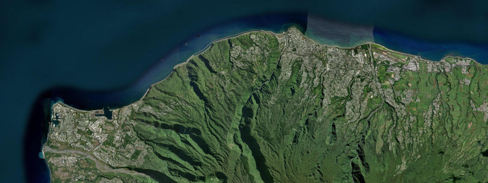
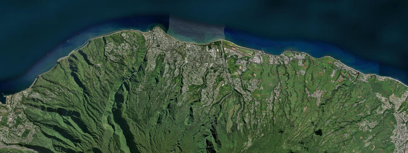
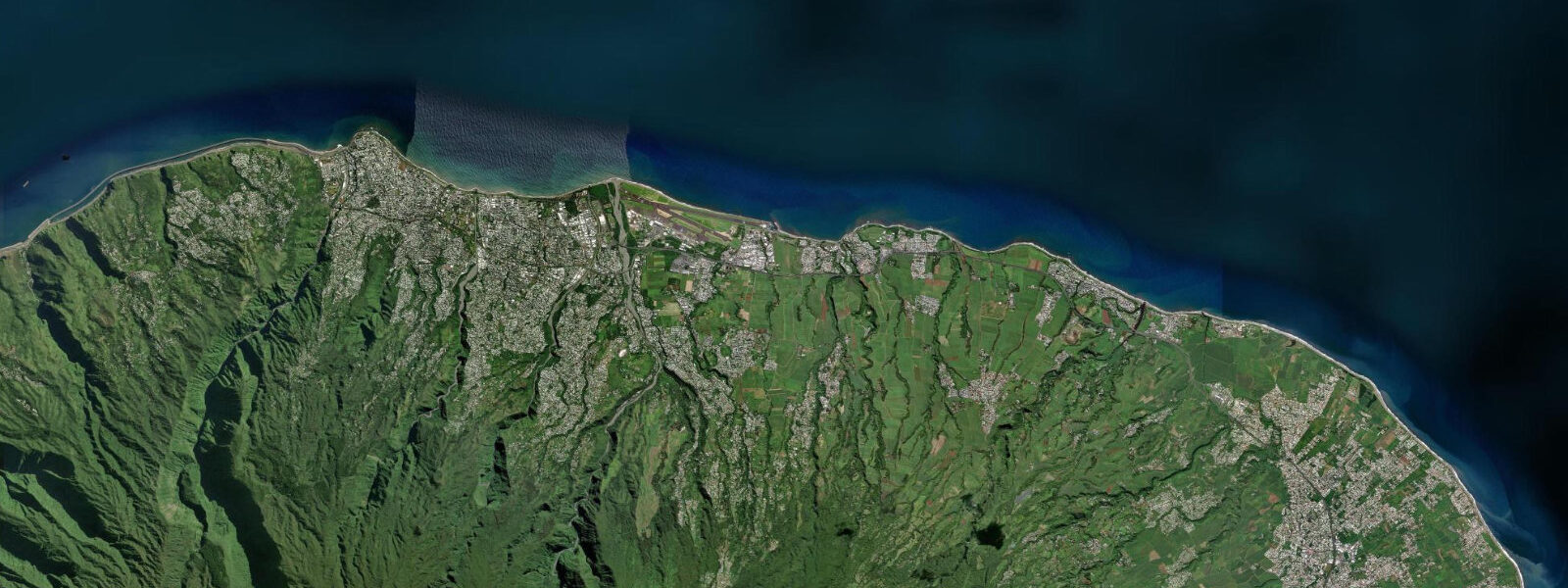
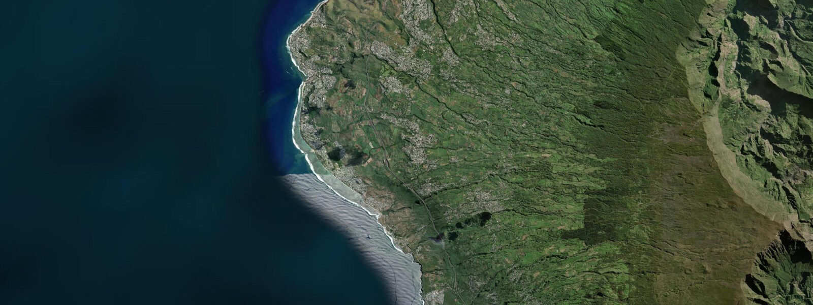
Saint-Denis is the prefecture of Réunion and its largest city, a tropical urban centre of 150,000 people on the northern coast of the island where the basalt lava flows of the Plaine des Galets reach the sea and the Indian Ocean arrives without a coral reef barrier. The north coast of Réunion has no fringing reef — unlike the west coast, where the reef lagoon creates a calm turquoise environment — and the seafront at Saint-Denis is a constructed promenade on a rocky shoreline rather than a sandy beach. The Barachois is the city's seafront promenade: a palm-lined sea wall walk along the rocky shoreline, with a recreational area on the landward side and the Indian Ocean on the seaward side, the water often rough in the northeast trade swell that characterises the north coast.
Creole architecture in the city centre — the single-storey wooden houses with decorative ironwork verandas and louvred shutters adapted to the tropical climate — is the most visible cultural heritage. The Villa de la Légion on the Rue de Paris and the Musée Léon Dierx, one of the oldest art museums in the southern hemisphere (1911), are the standard heritage stops. The Cathedral Saint-Denis on the Rue de Paris dates from 1829. The Avenue de la Victoire, lined with flame trees (flamboyants), is the main commercial and promenade axis of the centre.
Roland Garros Airport, named after the aviator born in Saint-Denis in 1888, sits on the coastal flat 7 km east of the city centre — the runway approach is over the sea, and the beach immediately below the approach path at La Rivière-des-Galets attracts spectator visits. The airport lies between two lava deltas where river systems built the coastal plain; the land here is geologically young and still being extended by occasional lava flows from Piton de la Fournaise.
The Indian Ocean tidal regime at Saint-Denis is mixed semidiurnal: mean spring range 0.8 to 1.2 m, with two unequal highs and two unequal lows per day. The absence of a reef means the north coast is exposed to Indian Ocean swell — this is not the calm lagoon environment of Le Port or Saint-Gilles-les-Bains on the west coast. Low water on the north coast exposes volcanic rock platforms that are accessible for rock-pooling and shore fishing; the platform fauna includes sea urchins, octopus, and small reef fish in the lava pools. Shore anglers fish the Barachois rocks and the river-mouth platforms at Saint-Denis for carangue (jacks), bichique (glassfisch fry), and mullet.
Cyclone season (November to April) affects the north coast most directly when cyclone tracks approach from the northeast; the Barachois promenade is closed during storm warnings and wave overtopping can affect the sea wall. Outside cyclone season, the north coast is dry and sunny in the morning, with cloud building over the inland peaks in the afternoon — the classic Réunion coastal climate pattern.
Predictions on this page come from Open-Meteo Marine, a gridded global ocean model. Accuracy is typically within plus or minus 45 minutes on timing and 0.2 to 0.3 m on height — at Saint-Denis's 0.8 to 1.2 m spring range, the height uncertainty is roughly 20 to 30 percent of the total signal. For authoritative Réunion sea-level data, SHOM (Service Hydrographique et Océanographique de la Marine) publishes harmonic tide tables for Réunion; the Saint-Denis gauge is a SHOM reference station.
Tide questions about Saint-Denis
Quick answers to the most common questions about tide times, range, and water access at Saint-Denis.
When is the next high tide at Saint-Denis?
The hero block at the top of this page shows the next predicted high at Saint-Denis in local Réunion Time (RET, UTC+4). Saint-Denis has an Indian Ocean mixed semidiurnal tide — two unequal highs and two unequal lows per day — with a spring range of 0.8 to 1.2 m. SHOM (Service Hydrographique et Océanographique de la Marine) publishes the authoritative harmonic tide tables for Réunion; the Saint-Denis gauge is an official SHOM reference station.
What is the tidal range at Saint-Denis?
Mean spring range at Saint-Denis is 0.8 to 1.2 m — a genuine Indian Ocean mixed semidiurnal tide that produces a visible rise and fall on the rocky north coast shoreline. Neap range compresses to roughly 0.3 to 0.5 m. The absence of a reef on the north coast means that swell directly affects the Barachois promenade and the rock platforms; wave height from Indian Ocean swell or cyclone approach is a more critical planning variable than the tide alone.
Where do these tide predictions come from?
Open-Meteo Marine, a free gridded global ocean model. At Saint-Denis's 0.8 to 1.2 m spring range, the model's typical accuracy (plus or minus 45 minutes, 0.2 to 0.3 m) is 20 to 30 percent of the total signal. For authoritative Réunion tide data, SHOM publishes harmonic predictions for the Saint-Denis reference station. SHOM's Réunion tide tables are available through the official SHOM website and through the Port Réunion harbour master.
Is there a beach at Saint-Denis?
Saint-Denis has no sandy beach — the north coast of Réunion lacks the fringing reef that creates the calm lagoon and beach environment on the west coast. The Barachois promenade is the city's seafront: a constructed sea wall walk along a rocky volcanic shoreline. For sandy beaches from Saint-Denis, the nearest options are the black-sand beach at Le Barachois de Sainte-Marie (7 km east) or the west coast lagoon beaches at Saint-Gilles-les-Bains (60 km south by the coastal road). The rock platforms below the Barachois promenade are accessible at low water for rock-pooling and shore fishing.
Is this safe to use for navigation?
No. TideTurtle is a planning tool for recreational coastal activity, not a navigation resource. The Port Réunion commercial and cruise harbour is at Le Port, 50 km west of Saint-Denis; Saint-Denis itself has no commercial port. For navigation around Réunion's north coast — which has no reef protection and can develop significant swell — use SHOM charts for Réunion and the meteorological bulletins from Météo-France La Réunion. Cyclone season warnings are mandatory planning inputs for all coastal and offshore activity. Open-Meteo Marine gridded predictions do not replace authoritative navigation sources.
8-day tide table — Saint-Denis
Heights relative to MSL. Predictions: Open-Meteo Marine (MeteoFrance SMOC, 0.08° grid) — heights relative to MSL (not chart datum / LAT). Model-derived.
| Day | Type | Time | Height |
|---|---|---|---|
| Sat 04 Jul | High | 04:00 | 0.8m |
| Low | 09:10 | 0.3m | |
| High | 15:42 | 0.8m | |
| Low | 21:18 | 0.5m | |
| Sun 05 Jul | High | 03:15 | 0.8m |
| Low | 09:50 | 0.4m | |
| High | 16:10 | 0.8m | |
| Low | 22:10 | 0.5m | |
| Mon 06 Jul | High | 04:00 | 0.8m |
| Low | 10:18 | 0.4m | |
| High | 16:54 | 0.8m | |
| Low | 23:00 | 0.5m | |
| Tue 07 Jul | High | 04:50 | 0.8m |
| Low | 11:00 | 0.5m | |
| High | 17:45 | 0.8m | |
| Wed 08 Jul | Low | 12:10 | 0.5m |
| High | 19:00 | 0.8m | |
| Thu 09 Jul | Low | 01:45 | 0.5m |
| High | 08:00 | 0.7m | |
| Fri 10 Jul | Low | 03:10 | 0.5m |
| High | 10:00 | 0.8m | |
| Low | 15:00 | 0.6m | |
| High | 21:15 | 0.9m | |
| Sat 11 Jul | Low | 03:00 | 0.5m |