Vlissingen tide times
Vlissingen tide forecast — heights relative to MSL.
Today's tide times for Vlissingen
Tide times at Vlissingen on Sunday, 21 June 2026: first low tide at 02:00, first high tide at 07:16, second low tide at 13:45, second high tide at 19:24. Sunrise 05:28, sunset 22:06.
Tide chart for Vlissingen
24-hour cosine-interpolated curve around the present moment. Heights relative to MSL. Predictions: Predictions: Open-Meteo Marine (MeteoFrance SMOC, 0.08° grid).
Sun, moon and conditions on Sun 21 Jun
Snapshot at build time — refreshes daily. Sea state from Open-Meteo Marine.
Highs and lows next 7 days
Every predicted high and low for the next week, with the daily tidal coefficient (0–120; higher = bigger swing, > 95 means stronger currents).
Other spots nearby
The three closest curated TideTurtle locations to Vlissingen, measured by great-circle distance.
Today's solunar windows
Solunar tradition: major periods are the ≈3h windows around moon transit and opposition; minor are ≈2h around moonrise and moonset. Pair with the local tide stage and wind for the best read.
Cycle dates near Vlissingen
Last spring tide on Sun 21 Jun (range 3.3m). Next neap on Thu 25 Jun.
Spring tides cluster around new and full moons (biggest swings). Neap tides land on quarter moons (smallest swings). See the spring tide and neap tide glossary entries for the why.
About tides at Vlissingen
A short guide to the coastline at Vlissingen — geography, sea state, and what the tide is actually doing under your feet.
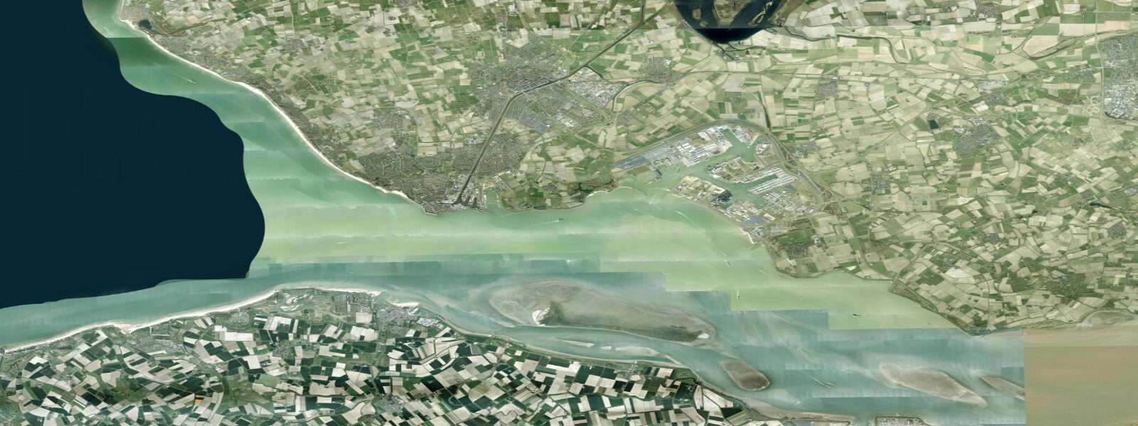
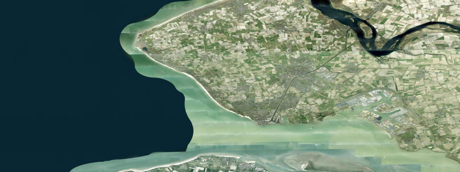
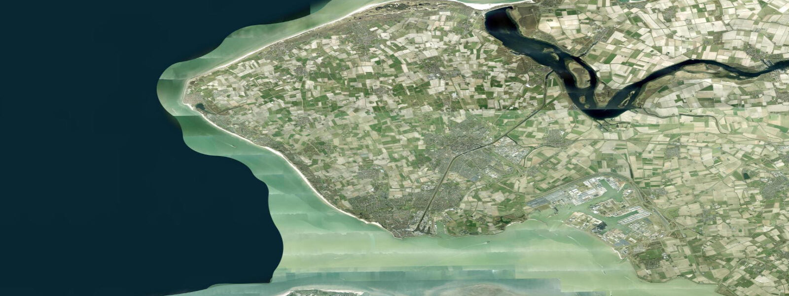
Vlissingen (Flushing in English) sits at the mouth of the Western Scheldt (Westerschelde), the deepwater estuary that carries some of the world's heaviest maritime traffic to and from the port of Antwerp, 80 km upstream. The town's waterfront — the Boulevards — looks directly north across the Scheldt approach and onto the North Sea. Container ships, bulkers, and tankers pass within a kilometre of the sea wall at all states of tide, 24 hours a day.
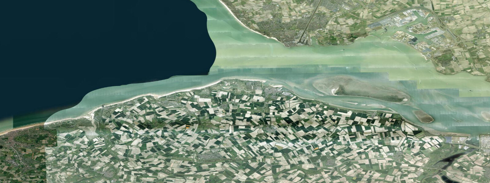
The mean tidal range at Vlissingen is approximately 3.8 m referenced to NAP (Normaal Amsterdams Peil, the Dutch vertical datum), measured at the Rijkswaterstaat tide gauge that has operated here since the 19th century. Spring tides reach around 4.5 m; neap tides around 3.0 m. These are large, macrotidal ranges. The flood tide runs 5–6 hours; the ebb runs slightly longer and at higher velocity due to the estuary geometry. Tidal current speeds in the Westerschelde main channel reach 3–4 knots on spring tides — among the strongest in the Dutch waters.
For the sea wall and beach at Vlissingen, the tidal range means significant exposure variation. At low water, a wide sandy foreshore is exposed along the Boulevard; at high water on spring tides, waves reach the sea wall directly. The beach is most practical in the 2–3 hours around high tide. The famous North Sea surf spot at the Boulevard works best on incoming swell from the northwest combined with a rising tide over the sand ridge; the shallow bottom accelerates wave energy as depth decreases.
Rijkswaterstaat maintains the official tide gauge network for the Netherlands and publishes real-time water level data online (waterinfo.rws.nl) along with official tide tables. This is the authoritative source for any navigation or planning in the Westerschelde. Open-Meteo Marine model uncertainty (±45 min, ±0.2–0.3 m) is small relative to the 3.8 m mean range — predictions here are directionally useful — but official Rijkswaterstaat gauge data should always be used for shipping, docking, and engineering decisions.
Tide questions about Vlissingen
Quick answers to the most common questions about tide times, range, and water access at Vlissingen.
What is the tidal range at Vlissingen?
Mean tidal range at Vlissingen is approximately 3.8 m (NAP datum), measured at the Rijkswaterstaat tide gauge at the mouth of the Westerschelde. Spring tidal range reaches around 4.5 m; neap range around 3.0 m. These are large, macrotidal values — among the highest in Dutch waters. Rijkswaterstaat publishes official tide tables and real-time gauge data at waterinfo.rws.nl. Tide predictions on this site use Open-Meteo Marine models (±45 min, ±0.2–0.3 m); the large range means model error is proportionally less significant here than at microtidal locations.
How strong are the tidal currents in the Westerschelde?
Tidal currents in the Westerschelde main channel at Vlissingen reach 3–4 knots on spring tides — well into the range where small craft must account for tidal set in cross-channel passages. The ebb current runs slightly stronger and longer than the flood because the estuary shape accelerates outflow. The Westerschelde is also the main shipping channel to Antwerp, with continuous commercial traffic at all states of tide; any small-craft navigation must factor both the current and the vessel traffic separation scheme.
Is the beach at Vlissingen usable for swimming and surfing?
The Boulevard beach at Vlissingen is usable but macrotidal conditions dictate timing. At low tide on spring tides, the water recedes 200–300 m from the sea wall across exposed sand. High tide brings water directly to the wall, reducing the beach to a narrow strip or eliminating it. Swimming and beach use is most comfortable in the 2–3 hours around high water. For surfing, the Boulevard receives North Sea swell from the northwest; the best conditions combine a clean northwest groundswell with a rising tide over the sand bottom. Water temperature peaks around 18–19 °C in August.
What is the significance of Vlissingen and the Westerschelde for shipping?
The Westerschelde is the only navigable deepwater approach to Antwerp, one of Europe's largest container ports. All vessels bound for or departing Antwerp must transit the Westerschelde, which is maintained at around 16 m depth by continuous dredging. Vlissingen is the seaward gateway: large container ships, LNG tankers, and bulk carriers pass the town's waterfront continuously. The Zeeland Refinery (one of the Netherlands' largest) and a large chemical cluster operate adjacent to the estuary. Rijkswaterstaat controls dredging, buoyage, and traffic management for the channel.
Are these tide predictions suitable for navigation in the Westerschelde?
These predictions are for general information only and are not a substitute for official navigation data. For navigation in the Westerschelde — a vessel traffic separation scheme area with 3–4 knot tidal currents and continuous commercial shipping — use official Rijkswaterstaat tide tables and real-time gauge data from waterinfo.rws.nl. Obtain current charts (UKHO or NLHO), follow the traffic separation scheme regulations, monitor VHF channel 67 (Westerschelde Traffic), and ensure your vessel has appropriate current charts and up-to-date notices to mariners.
8-day tide table — Vlissingen
Heights relative to MSL. Predictions: Open-Meteo Marine (MeteoFrance SMOC, 0.08° grid) — heights relative to MSL (not chart datum / LAT). Model-derived.
| Day | Type | Time | Height |
|---|---|---|---|
| Sun 21 Jun | Low | 02:00 | -2.0m |
| High | 07:16 | 1.3m | |
| Low | 13:45 | -1.6m | |
| High | 19:24 | 1.1m | |
| Mon 22 Jun | Low | 02:03 | -2.3m |
| High | 08:23 | 1.0m | |
| Tue 23 Jun | Low | 02:50 | -2.2m |
| High | 09:34 | 1.0m | |
| Low | 15:17 | -1.7m | |
| High | 21:53 | 0.9m | |
| Wed 24 Jun | Low | 03:37 | -1.9m |
| High | 10:48 | 1.3m | |
| Low | 16:12 | -1.5m | |
| High | 22:57 | 0.9m | |
| Thu 25 Jun | Low | 04:32 | -1.9m |
| High | 11:43 | 1.0m | |
| Low | 17:02 | -1.8m | |
| Fri 26 Jun | High | 00:05 | 0.9m |
| Low | 05:24 | -1.9m | |
| High | 12:40 | 1.0m | |
| Low | 17:52 | -1.8m | |
| Sat 27 Jun | High | 00:57 | 1.1m |
| Low | 06:15 | -1.7m | |
| High | 13:28 | 1.3m | |
| Low | 18:43 | -1.5m | |
| Sun 28 Jun | High | 01:00 | 1.2m |