Hillsborough, Carriacou tide times
Hillsborough, Carriacou tide forecast — heights relative to MSL.
Today's tide times for Hillsborough, Carriacou
Tide times at Hillsborough, Carriacou on Saturday, 27 June 2026: first low tide at 08:10am, first high tide at 03:45pm, second low tide at 06:45pm. Sunrise 05:43am, sunset 06:34pm.
Tide chart for Hillsborough, Carriacou
24-hour cosine-interpolated curve around the present moment. Heights relative to MSL. Predictions: Predictions: Open-Meteo Marine (MeteoFrance SMOC, 0.08° grid).
Sun, moon and conditions on Sat 27 Jun
Snapshot at build time — refreshes daily. Sea state from Open-Meteo Marine.
Highs and lows next 7 days
Every predicted high and low for the next week, with the daily tidal coefficient (0–120; higher = bigger swing, > 95 means stronger currents).
Other spots nearby
The three closest curated TideTurtle locations to Hillsborough, Carriacou, measured by great-circle distance.
Today's solunar windows
Solunar tradition: major periods are the ≈3h windows around moon transit and opposition; minor are ≈2h around moonrise and moonset. Pair with the local tide stage and wind for the best read.
Cycle dates near Hillsborough, Carriacou
Next spring tide on Mon 29 Jun (range 0.6m). Next neap on Sat 27 Jun.
Spring tides cluster around new and full moons (biggest swings). Neap tides land on quarter moons (smallest swings). See the spring tide and neap tide glossary entries for the why.
About tides at Hillsborough, Carriacou
A short guide to the coastline at Hillsborough, Carriacou — geography, sea state, and what the tide is actually doing under your feet.
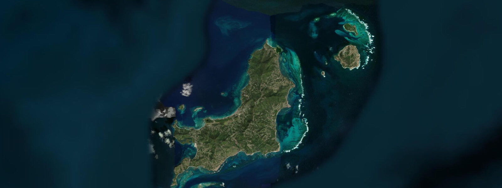
Hillsborough is the main town on Carriacou, the largest of the Grenadine islands within Grenada's territory, sitting 27 km north-northeast of Grenada main island. The town occupies a gently shelving bay on the island's west coast, facing the Grenadines channel toward Union Island (St. Vincent) to the north and sheltered from the dominant northeast trades by Carriacou's ridge. The ferry from Grenada docks at the Hillsborough jetty; the same jetty serves the inter-Grenadines trade that has defined this corridor since the pre-motorised era.
Carriacou is quieter, less developed, and more self-contained than Grenada main island in a way that is apparent immediately on arrival. The population is around 8,000; the economy is fishing, subsistence agriculture, and small-scale tourism. The boatbuilding tradition at Windward village on the northeast coast — where wooden sloops have been constructed by hand using techniques derived from Scottish settlers who arrived in the 17th century — is one of the most unusual cultural survivals in the Caribbean. The Carriacou Regatta in late July–early August, now in its sixth decade, is the island's major annual event: traditional wooden sloops, canots (small open racing boats), and modern dinghies race in the channel south of the island.
The tidal regime at Hillsborough is Caribbean microtidal: mixed semidiurnal, spring range 0.3–0.4 m. The Grenadines channel between Carriacou and Union Island has a moderate tidal current — 0.5–1.0 knots on spring tides — that runs broadly north-south through the channel. Sailing and motorboating in the channel, which is the standard transit route for the regional sailing circuit between Grenada and the Grenadines/St. Vincent, is not significantly affected by tidal state. The wind is the dominant variable.
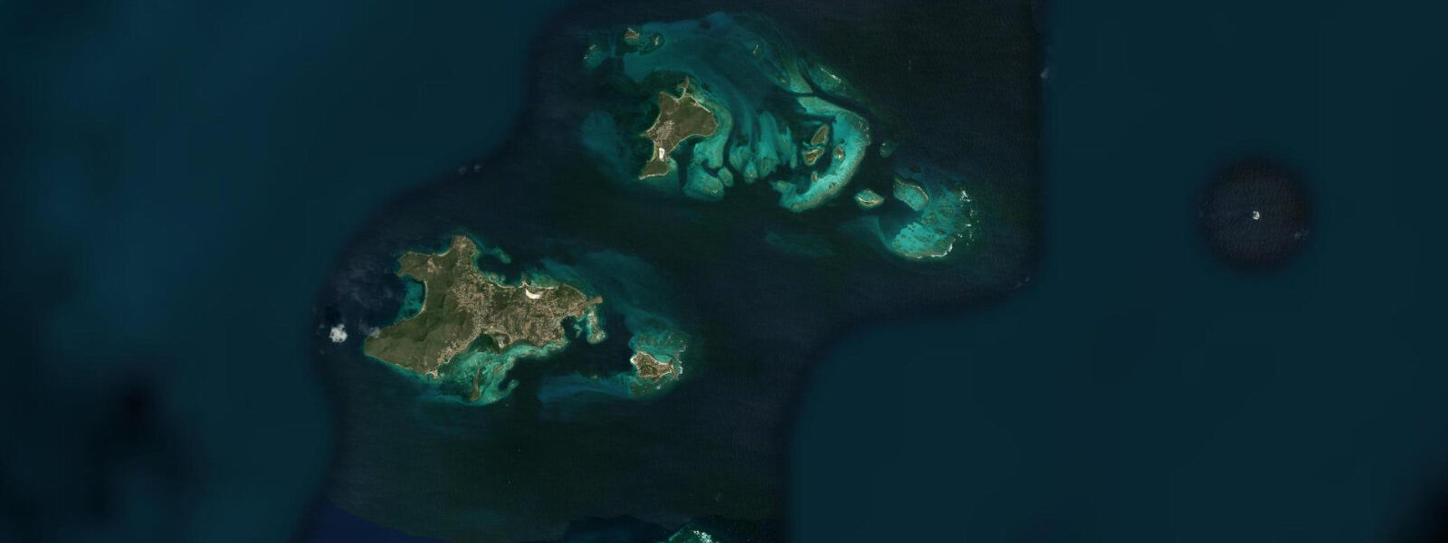
Snorkelling around Hillsborough bay accesses the reef patches on the bay's southern and northern headlands. The Sandy Island (Carriacou) marine protected area, a small uninhabited cay 2 km northwest of Hillsborough, is the premier snorkel destination — ringed by a shallow reef in 1–4 m, with high fish density and hawksbill turtles feeding on the sandy approaches. Water transport from the Hillsborough jetty to Sandy Island takes 15 minutes by water taxi. The reef is best visited on the flood tide with calm sea conditions; the exposed northern exposure of the cay means swell from the northeast can make the water murky after sustained trade-wind days.
Anglers in Hillsborough work the bay edges and the channel between Carriacou and Petit Martinique (the small island 5 km to the northeast) for kingfish, carite, snapper, and flyingfish. The Grenadines channel current concentrates fish on the ebb at the headlands on both sides. Local pirogues fish the channel; visitors can arrange day charters through the Hillsborough jetty.
The Carriacou Museum on Patterson Street, immediately behind the main square, documents the island's history — the African origins of the population, the Scottish boatbuilders at Windward, the sugar plantation era, and the Carriacou Big Drum ceremony that survives as a living tradition of African spiritual practice adapted to the island's history. The museum is small but the context it provides for understanding why Carriacou has the character it does is worth the 45-minute visit before exploring the island further.
For beach families, Paradise Beach (1.5 km north of Hillsborough along the coast road) is the island's best swimming beach — shallow, calm, backed by palms, with the Saline Island and Frigate Island visible offshore. At low tide the shallow sand shelf extends 30–40 m from the waterline; children wade and play in water that rarely exceeds knee depth until 20 m from the beach edge. The calm and shallow character persists at all tide stages given the microtidal range.
All tide predictions for Hillsborough, Carriacou come from the Open-Meteo Marine gridded model. Timing accuracy is ±45 minutes; height accuracy is ±0.3 m above Chart Datum.
Tide questions about Hillsborough, Carriacou
Quick answers to the most common questions about tide times, range, and water access at Hillsborough, Carriacou.
How do I get to Carriacou from Grenada?
The Osprey high-speed ferry runs twice daily from the Carenage quay in St. George's to the Hillsborough jetty, taking approximately 90 minutes. Schedules are timed for morning and afternoon departures in both directions; advance booking is recommended, particularly around the Carriacou Regatta in late July–early August. Small aircraft also fly Grenada to Lauriston Airport on Carriacou in 20 minutes via SVG Air or Trans Island Air, with multiple daily departures. The sea crossing passes through the Grenadines channel, which can be rough in the November–April northeast swell season.
What is Sandy Island, Carriacou, and is it worth the water taxi trip?
Sandy Island is a small uninhabited cay 2 km northwest of Hillsborough, protected as a marine reserve, with a fringing reef in 1–4 m surrounding a white sand beach. The reef has high fish density and hawksbill turtles reliably present, and the water clarity on calm days reaches 15–20 m. Water taxis from the Hillsborough jetty charge a fixed return rate; the crossing takes 15 minutes. The cay is best visited on mornings after settled conditions — northeast trade wind days stir the sand on the exposed northern side and reduce visibility. It is the best snorkelling within immediate reach of Hillsborough.
What is the Carriacou Regatta?
The Carriacou Regatta is an annual sailing event held in late July–early August, one of the oldest traditional boat races in the Caribbean at over 60 years continuous running. The racing features traditional wooden sloops (including hand-built vessels from Windward village), canots (small open racing boats traditionally made from gommier wood), and modern sailing dinghies in separate classes. The regatta is as much a community festival as a sailing event — live music, food stalls, and Big Drum ceremony performances run alongside the racing. The Grenadines channel south of Hillsborough is the race course. Accommodation books out early for the regatta weekend.
What is the traditional boatbuilding at Windward, Carriacou?
Windward village on Carriacou's northeast coast has maintained a wooden boatbuilding tradition descended from Scottish craftsmen who arrived in the 17th century and adapted their techniques to tropical hardwoods — primarily gommier (mountain gum). Sloops of 30–60 feet are still built in the village by hand, using adze and plane, without the use of blueprints or computer design. The boats serve as working vessels in the Grenadines trade. Visitors can watch the construction in progress — the boatyard at Windward is open and the builders welcome observers, though the work schedule is their own. It is a 20-minute drive from Hillsborough on the coastal road.
Is there a tidal current in the Grenadines channel near Carriacou?
The Grenadines channel between Carriacou and Union Island carries a tidal current of 0.5–1.0 knots on spring tides, running broadly north on the flood and south on the ebb. For the regional sailing circuit transiting between Grenada and the Grenadines, this current is a minor factor compared to the 15–25 knot northeast trades that dominate November through April. Passage planning focuses on wind angle and sea state rather than tidal current. Small-boat operators and kayakers crossing the channel should be aware of the combined current and wind-driven chop, particularly on strong-trade days.
7-day tide table — Hillsborough, Carriacou
Heights relative to MSL. Predictions: Open-Meteo Marine (MeteoFrance SMOC, 0.08° grid) — heights relative to MSL (not chart datum / LAT). Model-derived.
| Day | Type | Time | Height |
|---|---|---|---|
| Sat 27 Jun | Low | 08:10 | -0.1m |
| High | 15:45 | 0.2m | |
| Low | 18:45 | 0.1m | |
| Sun 28 Jun | High | 00:50 | 0.4m |
| Low | 19:10 | 0.1m | |
| Mon 29 Jun | High | 01:42 | 0.4m |
| Low | 09:15 | -0.1m | |
| High | 16:50 | 0.2m | |
| Low | 20:00 | 0.2m | |
| Tue 30 Jun | High | 02:06 | 0.4m |
| Low | 09:50 | -0.1m | |
| High | 17:00 | 0.2m | |
| Wed 01 Jul | Low | 21:10 | 0.1m |
| Thu 02 Jul | High | 03:15 | 0.4m |
| Low | 10:50 | -0.1m | |
| Fri 03 Jul | High | 03:54 | 0.4m |
| Low | 11:18 | -0.1m | |
| High | 18:10 | 0.3m |