Tobago Cays, Grenadines tide times
Tobago Cays, Grenadines tide forecast — heights relative to MSL.
Today's tide times for Tobago Cays, Grenadines
Tide times at Tobago Cays, Grenadines on Saturday, 4 July 2026: first high tide at 04:50am, first low tide at 11:45am. Sunrise 05:44am, sunset 06:35pm.
Tide chart for Tobago Cays, Grenadines
24-hour cosine-interpolated curve around the present moment. Heights relative to MSL. Predictions: Predictions: Open-Meteo Marine (MeteoFrance SMOC, 0.08° grid).
Sun, moon and conditions on Sat 04 Jul
Snapshot at build time — refreshes daily. Sea state from Open-Meteo Marine.
Highs and lows next 7 days
Every predicted high and low for the next week, with the daily tidal coefficient (0–120; higher = bigger swing, > 95 means stronger currents).
Other spots nearby
The three closest curated TideTurtle locations to Tobago Cays, Grenadines, measured by great-circle distance.
Today's solunar windows
Solunar tradition: major periods are the ≈3h windows around moon transit and opposition; minor are ≈2h around moonrise and moonset. Pair with the local tide stage and wind for the best read.
Cycle dates near Tobago Cays, Grenadines
Last spring tide on Fri 03 Jul (range 0.4m). Next spring tide on Thu 09 Jul (range 0.5m). Next neap on Sun 05 Jul.
Spring tides cluster around new and full moons (biggest swings). Neap tides land on quarter moons (smallest swings). See the spring tide and neap tide glossary entries for the why.
About tides at Tobago Cays, Grenadines
A short guide to the coastline at Tobago Cays, Grenadines — geography, sea state, and what the tide is actually doing under your feet.
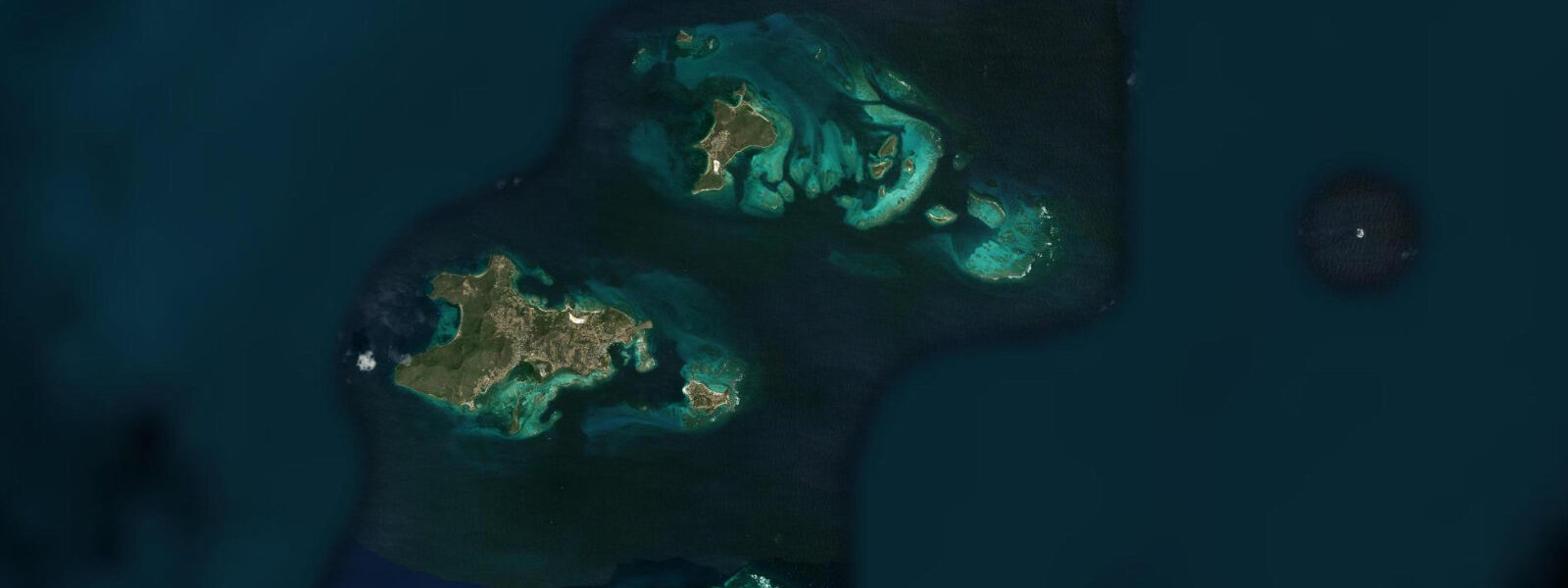
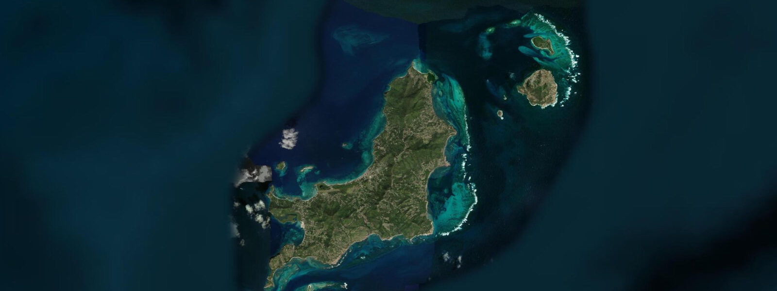
The Tobago Cays are a group of five uninhabited islands — Petit Bateau, Petit Tabac, Baradal, Jamesby, and Petit Rameau — enclosed within the Horseshoe Reef, a continuous barrier reef that curves around the eastern side of the group and breaks the Atlantic swell into the turquoise lagoon inside. The cays sit in the southern Grenadines, within the Tobago Cays Marine Park, approximately 45 kilometres south of Bequia. Access is by boat only; no regular ferry serves the cays directly. Day-charter boats from Union Island (the closest inhabited island, 10 kilometres south) and from Bequia, Saint Vincent, and the other Grenadines run regular trips.
The tidal regime at the Tobago Cays is Caribbean mixed semidiurnal, spring range 0.3 to 0.4 metres — at the minimal end of the Caribbean microtidal spectrum. The Horseshoe Reef partially dampens the tidal signal inside the lagoon. Two unequal high tides and two unequal low tides per day. The tide is essentially irrelevant for snorkelling and swimming planning inside the lagoon; water depth changes by 0.3 metres or less. The tidal current through the passages between the cays is more relevant — the channels between Petit Bateau and Petit Tabac, and between Petit Tabac and Baradal, run with the tide, and the direction change at the turn produces brief slack-water windows that are the best conditions for drifting through the channels with a mask.
The marine park is the best-known snorkelling and diving destination in the Grenadines. The interior lagoon has exceptional water clarity, typically 20 to 30 metres horizontal visibility in normal conditions. Hawksbill turtles are resident in the lagoon and feed on the sea grass beds immediately around the cays; snorkellers encounter them with high reliability in the morning before the day-charter boats arrive. The sea grass on the lagoon floor between the cays at Baradal is a designated turtle sanctuary; anchoring in the sea grass is prohibited. Green turtles also use the cays; both species nest on the beaches.
The Horseshoe Reef itself — accessible by swimming from the inner lagoon at the reef's west face or by boat to the break zone on the Atlantic side — has the most dramatic coral architecture in the southern Grenadines. Large elk and staghorn coral formations on the reef crest, massive brain corals on the slopes below, and high fish diversity in the fish-rich upwelling zone where the Atlantic meets the reef face. Nurse sharks rest under the reef overhangs in the afternoon.
Anchoring in the Tobago Cays Marine Park requires a permit purchased from park rangers who patrol the cays. Day visitors and charter boats typically anchor in the designated zones off Petit Bateau and Petit Tabac. Overnight anchoring is permitted in the designated zones; the park rangers collect fees from visiting vessels. No waste may be discharged in the park; all rubbish must be removed by visiting boats.
Tide predictions for the Tobago Cays come from Open-Meteo Marine, a global gridded ocean model. Accuracy is typically within plus or minus 45 minutes on timing and 0.2 to 0.3 metres on height.
The management of the Tobago Cays Marine Park has improved significantly since its formal establishment in 2006. The permit system, the ranger patrol, and the waste management requirements have reduced the anchor damage and the plastic accumulation that characterised the anchorage in earlier decades. The coral condition in the protected zones has measurably improved compared to 2005 survey baselines. The challenge is enforcement consistency: the ranger patrol has limited resources, and the number of vessels anchoring simultaneously can exceed the patrol capacity on busy days in the main December through April season.
Tide questions about Tobago Cays, Grenadines
Quick answers to the most common questions about tide times, range, and water access at Tobago Cays, Grenadines.
What is the tide range at the Tobago Cays?
The Tobago Cays are at the minimal end of Caribbean microtidal — spring range 0.3 to 0.4 metres, mixed semidiurnal. The Horseshoe Reef partially shelters the lagoon from the open ocean tidal signal. At this range the tide has no practical effect on snorkelling or swimming inside the lagoon; water depth changes by less than half a metre. The tidal current through the passages between the cays is the more relevant variable: the turn of the tide produces a brief slack window that is the best condition for drifting the channels. Tide predictions come from Open-Meteo Marine — accuracy within plus or minus 45 minutes on timing and 0.2 to 0.3 metres on height.
How do I get to the Tobago Cays?
The Tobago Cays are accessible by boat only. Day-charter boats from Union Island (10 km south) run the most frequent service — hourly departures from the Union Island waterfront through the morning, reaching the Cays in 30 to 40 minutes by fast motorboat or 1 to 2 hours by sailing yacht. Day charters from Bequia, Mustique, Canouan, and Mayreau also run regularly. Most visitors from Saint Vincent take the MV ferry south to Union Island and then a day boat to the Cays. Liveaboard sailing yachts anchor directly in the Park; the overnight anchor fee is paid to park rangers who patrol the anchorage.
Can I see sea turtles at the Tobago Cays?
Yes, with high reliability in the morning. Hawksbill turtles are resident in the lagoon year-round, feeding on the sea grass beds between the cays and on the reef. Snorkelling in the morning before the day-charter boats arrive — ideally before 09:00 — consistently produces turtle encounters, often at arm's reach in shallow water. Green turtles are also present, though less reliably. The sea grass at Baradal is a designated turtle sanctuary within the marine park; approaching turtles is permitted but contact is prohibited. Both species nest on the beaches during the June through August season; night walking on beaches during nesting season requires a park ranger accompaniment.
What are the rules for visiting the Tobago Cays Marine Park?
All visiting vessels must purchase a park permit from a ranger on arrival or in advance from the Union Island port authority. Anchoring in sea grass is prohibited — designated anchor zones are marked; GPS coordinates are available from the Union Island tourism office. No fishing is permitted within the park boundaries. No waste may be discharged; all rubbish — including grey water from the galley — must be retained until outside the park. Single-use plastics (bags, bottles) are banned from the park. Rangers patrol daily and are empowered to issue fines. Spearfishing is strictly prohibited.
Is the Horseshoe Reef snorkelling or diving?
Both, depending on depth preference. The inner reef crest on the lagoon-facing west side starts at 1 to 3 metres and has significant staghorn and elkhorn coral architecture accessible to snorkellers. The outer Atlantic face of the reef and the reef wall on the northeast side are dive territory, from 6 metres to deeper sections with large coral formations, overhangs with nurse sharks, and the fish diversity driven by the Atlantic upwelling at the reef face. Dive boats from Union Island and from charter yachts anchor outside the reef for the wall dive. The interior lagoon reef is the snorkelling site; swim out from the anchorage toward the reef crest, visible as the colour change in the water from turquoise to white foam on the swell.
7-day tide table — Tobago Cays, Grenadines
Heights relative to MSL. Predictions: Open-Meteo Marine (MeteoFrance SMOC, 0.08° grid) — heights relative to MSL (not chart datum / LAT). Model-derived.
| Day | Type | Time | Height |
|---|---|---|---|
| Sat 04 Jul | High | 04:50 | 0.4m |
| Low | 11:45 | -0.1m | |
| Sun 05 Jul | High | 18:50 | 0.3m |
| Mon 06 Jul | Low | 00:50 | 0.1m |
| High | 06:10 | 0.3m | |
| Low | 12:50 | 0.0m | |
| Tue 07 Jul | High | 20:10 | 0.3m |
| Wed 08 Jul | Low | 14:00 | 0.1m |
| High | 21:00 | 0.4m | |
| Thu 09 Jul | Low | 04:50 | -0.0m |
| High | 21:45 | 0.4m | |
| Fri 10 Jul | Low | 06:00 | -0.1m |
| High | 19:00 | 0.2m |